Ticker for March 29, 2018
MESONET TICKER ... MESONET TICKER ... MESONET TICKER ... MESONET TICKER ...
March 29, 2018 March 29, 2018 March 29, 2018 March 29, 2018
Stupid Balrogs
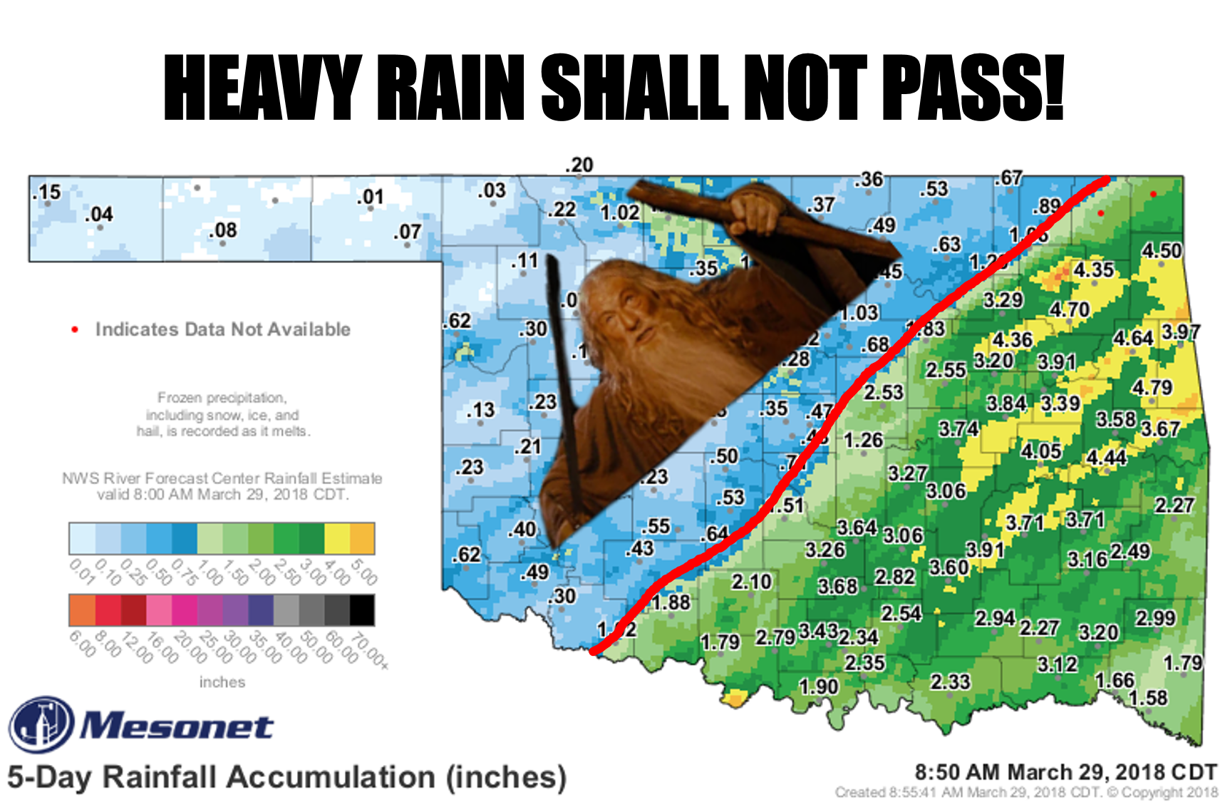
A "Lord of the Rings" reference?
GROANNNNNNNN!
But it does seem as if there is some sort of mystical force keeping these storm
systems from dumping significant rain across the northwestern half of the state.
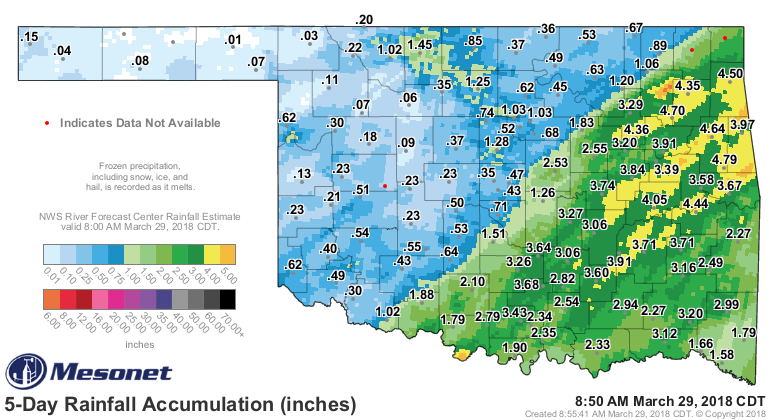
Here's a look at that 5-day rain map without our friend Dumbledore (come on,
what's the difference?). We do see spots of greater than an inch to the northwest
of that demarcation line, including in the worst drought hit areas in north
central Oklahoma, which came with the final exit of the upper-level storm
system last night.
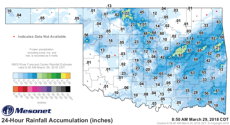
However, any possible improvements for the Drought Monitor's purposes will
be considered next week. As it is, this is the map we're left with this week,
and for the northwestern half (again), it ain't good.
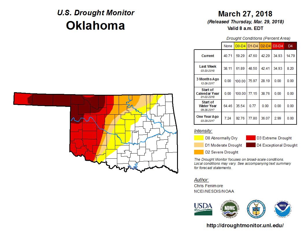
The fortunes of the two halves of the state are linked to the heavy rains of the
last 60 days across the southeast, and the lack thereof across the northwest.

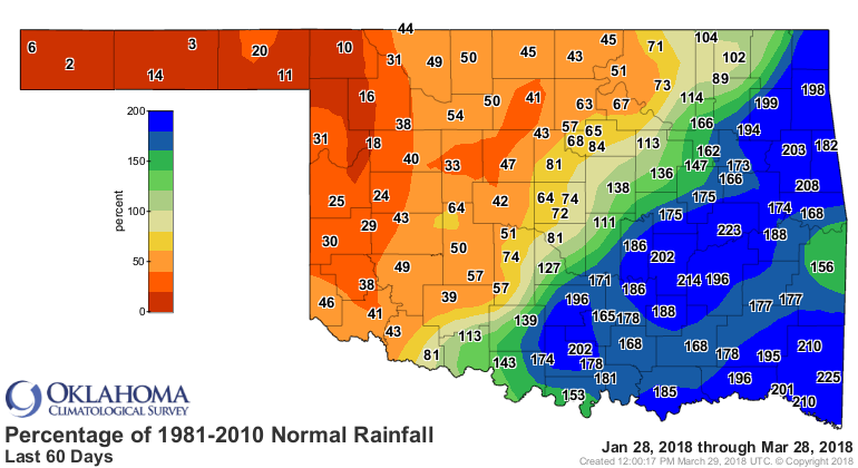
And those differences are evident on the 2-month Drought Monitor change map.

Our next rain chances come with a storm system just in time for Easter, which
will also come with a nice (not really) cold front. Western Oklahoma still
gets Gandalfed.

Maybe next week? Don't tell Mother Nature, though, or it'll jinx it.
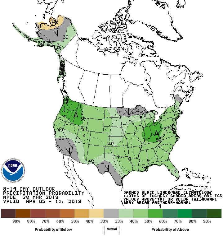
Keep it secret. Keep it safe.
Gary McManus
State Climatologist
Oklahoma Mesonet
Oklahoma Climatological Survey
(405) 325-2253
gmcmanus@mesonet.org
March 29 in Mesonet History
| Record | Value | Station | Year |
|---|---|---|---|
| Maximum Temperature | 94°F | HOLL | 2022 |
| Minimum Temperature | 16°F | BOIS | 2009 |
| Maximum Rainfall | 2.93 inches | WATO | 2007 |
Mesonet records begin in 1994.
Search by Date
If you're a bit off, don't worry, because just like horseshoes, “almost” counts on the Ticker website!