Ticker for March 26, 2018
MESONET TICKER ... MESONET TICKER ... MESONET TICKER ... MESONET TICKER ...
March 26, 2018 March 26, 2018 March 26, 2018 March 26, 2018
Swing and a miss!
It's the classic setup we've been begging for to cure our drought woes...a
slow-moving (or cut-off) upper-level low pressure system hanging out to our
west and pumping moisture up from the Gulf of Mexico on strong southerly winds.
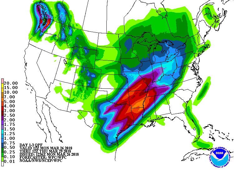
Then send out a fewer smaller waves to kick several rounds of showers and
storms. The only trouble is, as has happened for pretty much the last 6 months
straight, western Oklahoma will miss out on the bulk of the moisture. See the
3-day precip forecast as we start with a couple of waves kicking out through
the larger flow, then the upper-level low itself moving through on Wednesday.
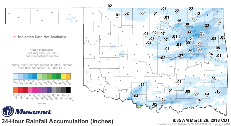
The show actually started last night with a few severe storms down across far
southern Oklahoma. Some golf ball size hail was reported, but most of the heavy
rains stayed to the south of the Red River. There was also a bit of shower
activity to the northeast to whet their whistle for more to come.
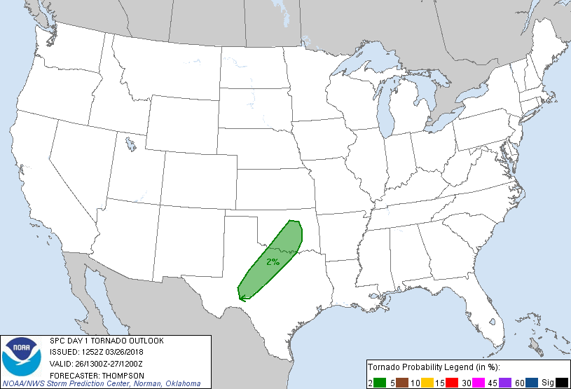
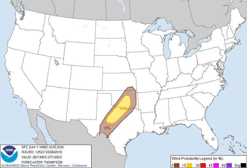
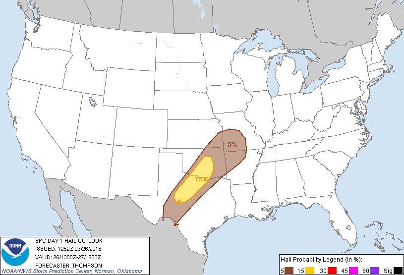
There will be a severe threat later today across the I44 corridor to the
southeast, but the threat of high-end severe weather is low at this time. Can't
hurt to stay abreast of the situation, however. Tornado threat is low across
SW OK, but not zero.

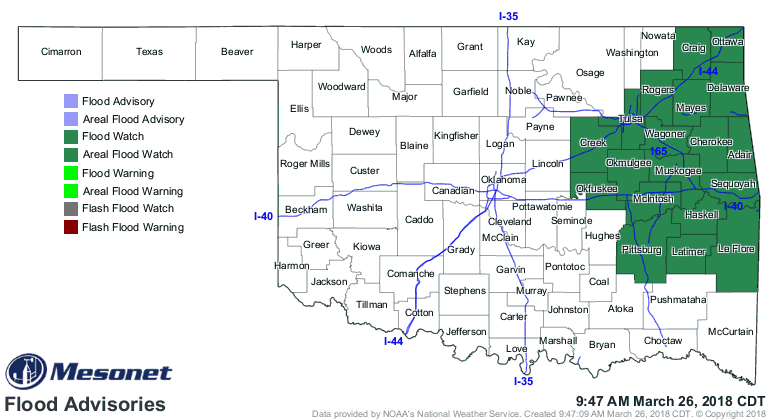
The severe threat pushes farther to the southeast tomorrow and Wednesday, but
an area of heavy rain should set up over eastern OK tomorrow, hence the
issuance of a flash flood watch. This could expand as the rain starts falling.
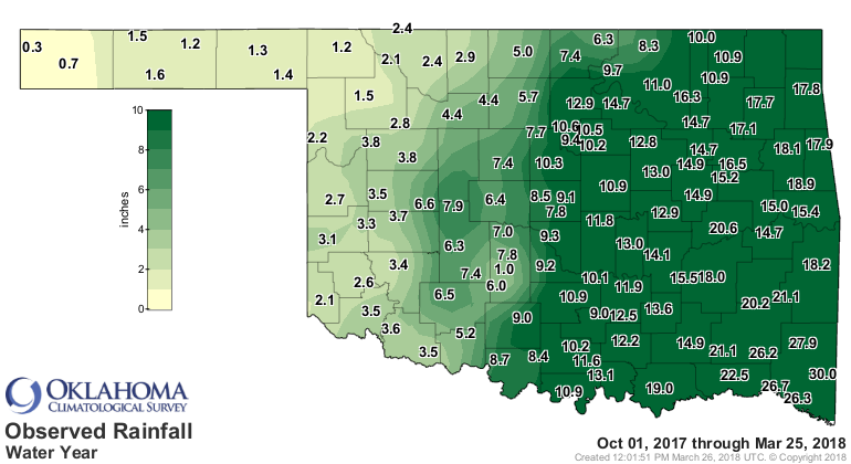
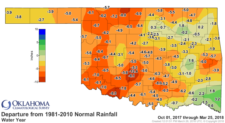
For western OK, especially the far northwest and the Panhandle, it's the same
ol' same ol'. We're now approaching 6 months (6 MONTHS!!!) without significant
rainfall in most areas. Kenton and Boise City have had less than an inch of
rain in that time frame.
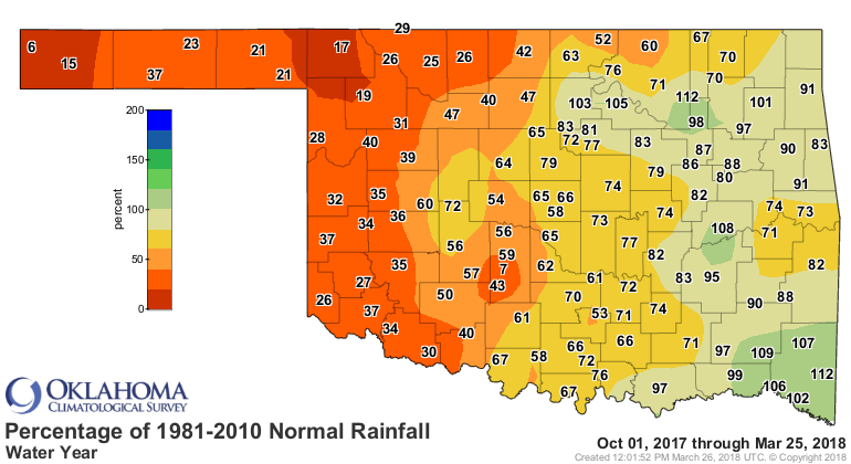
Another possible storm for Easter weekend, but it appears that one will be
working with less moisture. We need to wring everything we can out of this
one, just shift it northwest about 100 miles!
Stranger things have happened?
Gary McManus
State Climatologist
Oklahoma Mesonet
Oklahoma Climatological Survey
(405) 325-2253
gmcmanus@mesonet.org
March 26 in Mesonet History
| Record | Value | Station | Year |
|---|---|---|---|
| Maximum Temperature | 100°F | HOLL | 2020 |
| Minimum Temperature | 11°F | BOIS | 2024 |
| Maximum Rainfall | 2.35″ | BYAR | 2018 |
Mesonet records begin in 1994.
Search by Date
If you're a bit off, don't worry, because just like horseshoes, “almost” counts on the Ticker website!