Ticker for March 22, 2018
MESONET TICKER ... MESONET TICKER ... MESONET TICKER ... MESONET TICKER ...
March 22, 2018 March 22, 2018 March 22, 2018 March 22, 2018
Droughtface
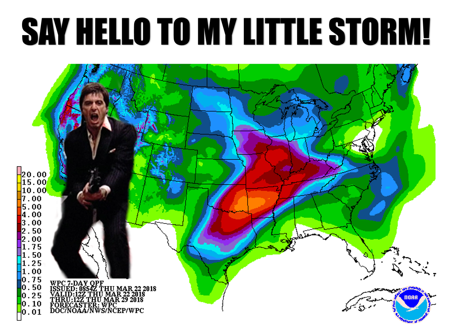
I don't know what Mother Nature is snorting. Tree pollen if she's like me.
That's about as wild as I get, and I don't do it for fun. But the drought
is about to *possibly* take another big blow coming up this weekend into next
week. The only question is, will northwestern Oklahoma be in the line of fire?
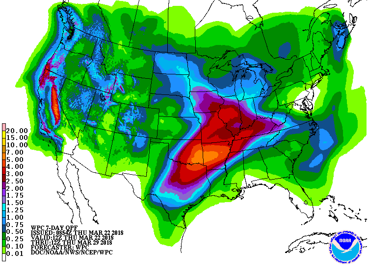
That looks very similar to the pattern we saw that last week of February when
a series of storm systems ended the drought across eastern Oklahoma. The biggest
difference with the current unsettled weather pattern is there won't be any
frigid air with these bouts of moisture, so no snow days. There will be a good
chance of storms, as is customary with springtime moisture in Oklahoma. A big
upper-level low pressure system should dive into the Desert Southwest and hang
around for a few days, sending out smaller impulses over the weekend and into
the middle of next week. That will provide several chances for rain and storms,
with flooding and severe weather being possible. Here's an explanation from
some folks that actually know what they're talking about, the NWS forecast office
in Tulsa.

"A frontal boundary forecast to move into the region Saturday.
This frontal boundary is forecast to stall Saturday night and
lift back northward Sunday with an additional cold front looking
to slowly move across the region during the first half of next
week. The result will be continued thunderstorm chances developing
Saturday night and increasing Sunday through mid next week over
Eastern Oklahoma and Northwest. This will create the potential
for multiple rounds of heavy rainfall with increasing flash flood
concerns to be possible. Uncertainties continue with exact amounts
and locations of the heavy rainfall as well as the potential for
severe weather over the weekend and into next week."
Yes, still lots of uncertainties. What we really need is for that heavy rain to
shift farther to the northwest where the drought continues intensifying, as
shown by today's new U.S. Drought Monitor.
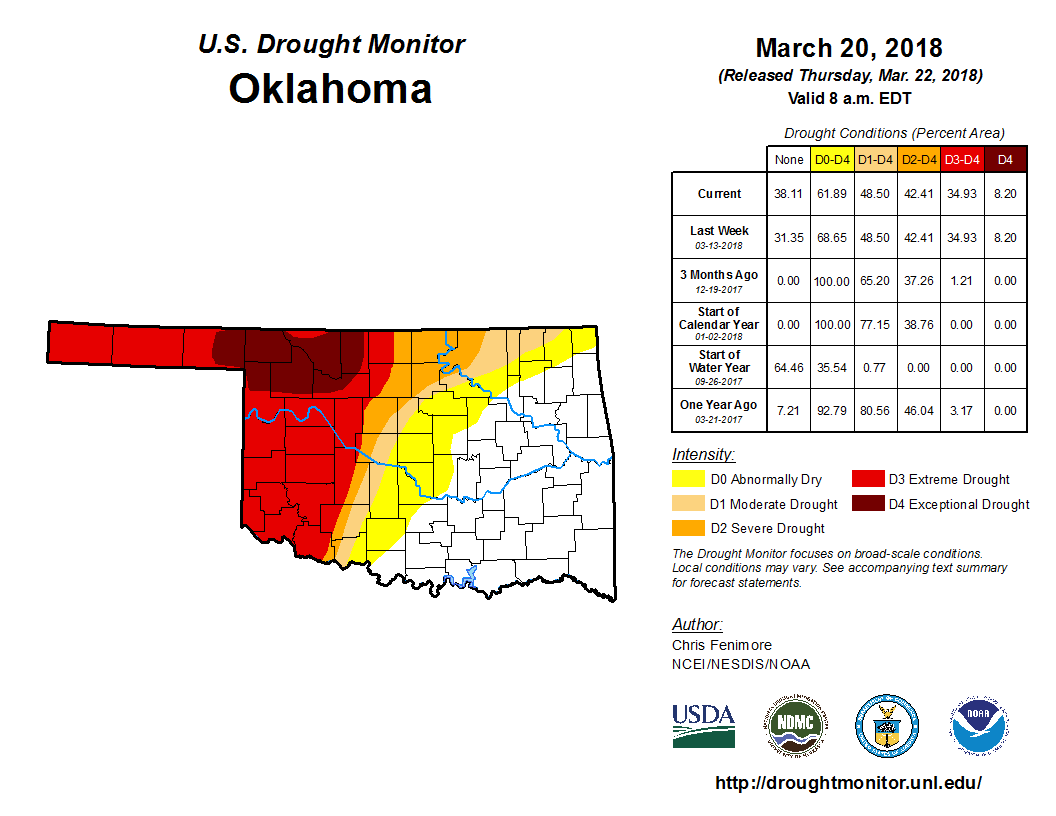
Last weekend's rains whittled away more of that drought across central and south
central Oklahoma, but we still have that blob of severe/extreme/exceptional
drought across the NW half of the state where the deficits increase daily.
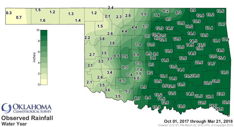

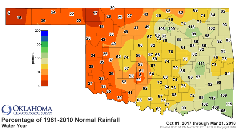
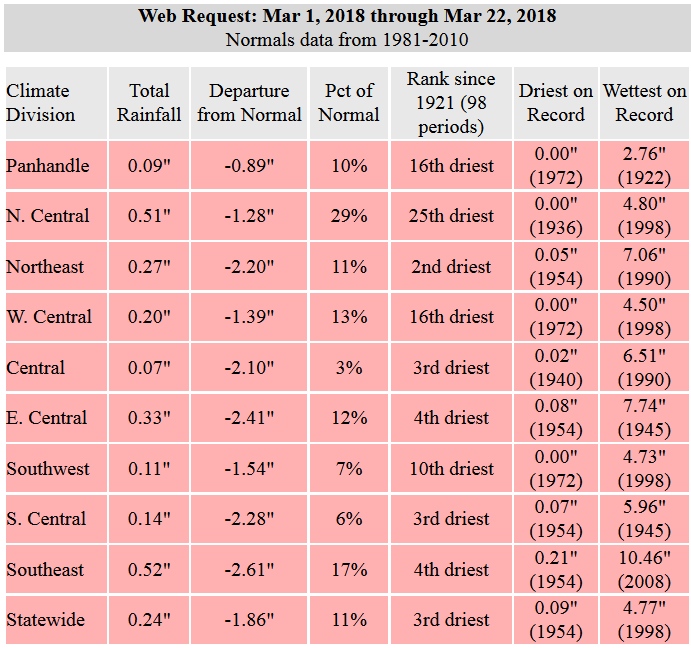
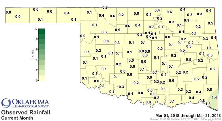
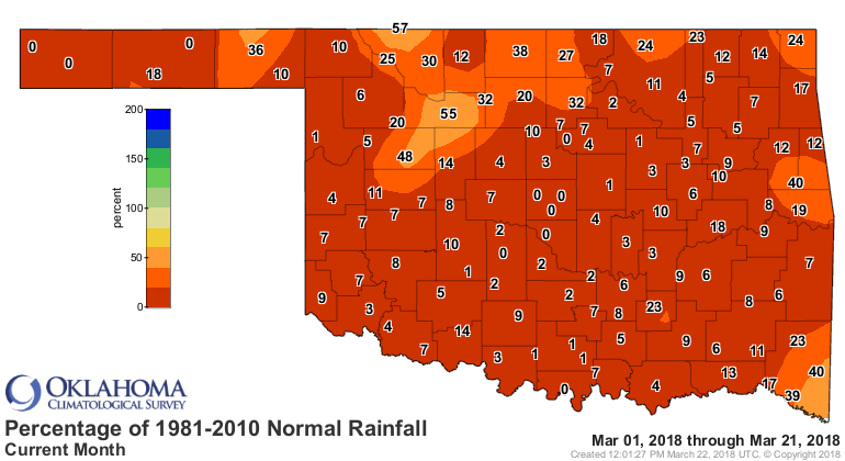
And if we're not careful, we're going to end up with one of our driest Marches
on record. This weekend's rain should take care of this problem, we hope.
Through today, we're dealing with the 3rd driest March 1-22 since at least
1921.

Until we do get some moisture, and then some green up of our dead/dormant
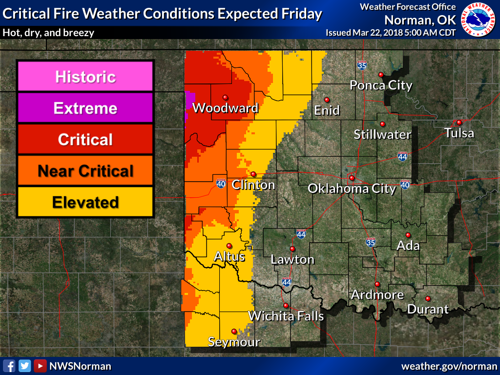
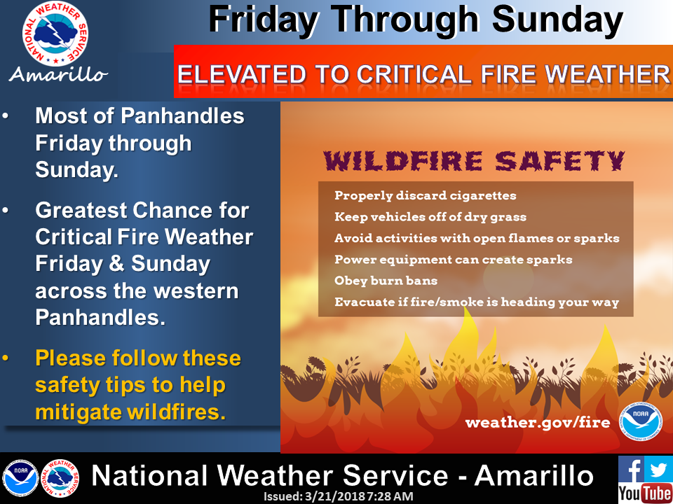
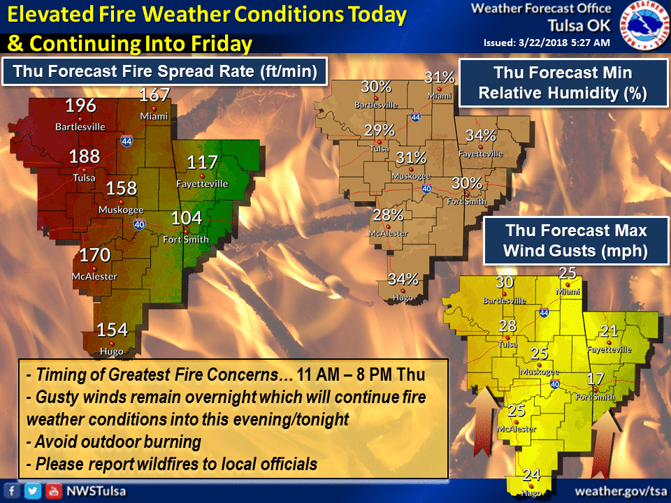
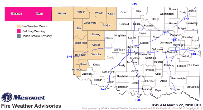
vegetation, we're going to be stuck with fire danger, so today and tomorrow
look particularly critical across western Oklahoma.
In this state, you gotta take the fire first. Then when you get the fire, you
get the storms. Then when you get the storms, then you get the rain.
Gary McManus
State Climatologist
Oklahoma Mesonet
Oklahoma Climatological Survey
(405) 325-2253
gmcmanus@mesonet.org
March 22 in Mesonet History
| Record | Value | Station | Year |
|---|---|---|---|
| Maximum Temperature | 92°F | WALT | 2011 |
| Minimum Temperature | 12°F | MEDF | 2002 |
| Maximum Rainfall | 3.70 inches | PUTN | 2007 |
Mesonet records begin in 1994.
Search by Date
If you're a bit off, don't worry, because just like horseshoes, “almost” counts on the Ticker website!