Ticker for March 15, 2018
MESONET TICKER ... MESONET TICKER ... MESONET TICKER ... MESONET TICKER ...
March 15, 2018 March 15, 2018 March 15, 2018 March 15, 2018
'twas but a spark...
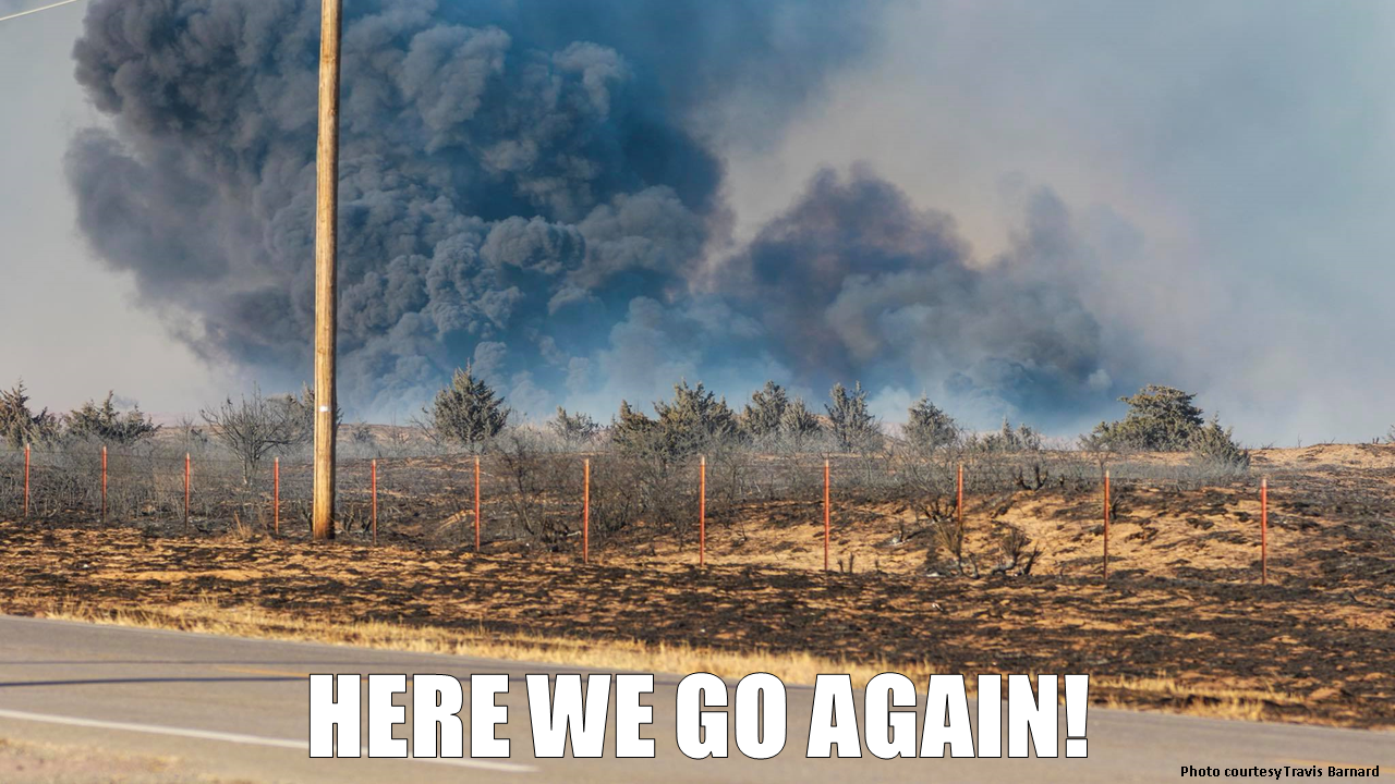
That fire north of Woodward was but one of many across the state yesterday, and
conditions look even worse over the next several days. What's scary is that
yesterday was probably the least worst (say what?) of the upcoming fire days.
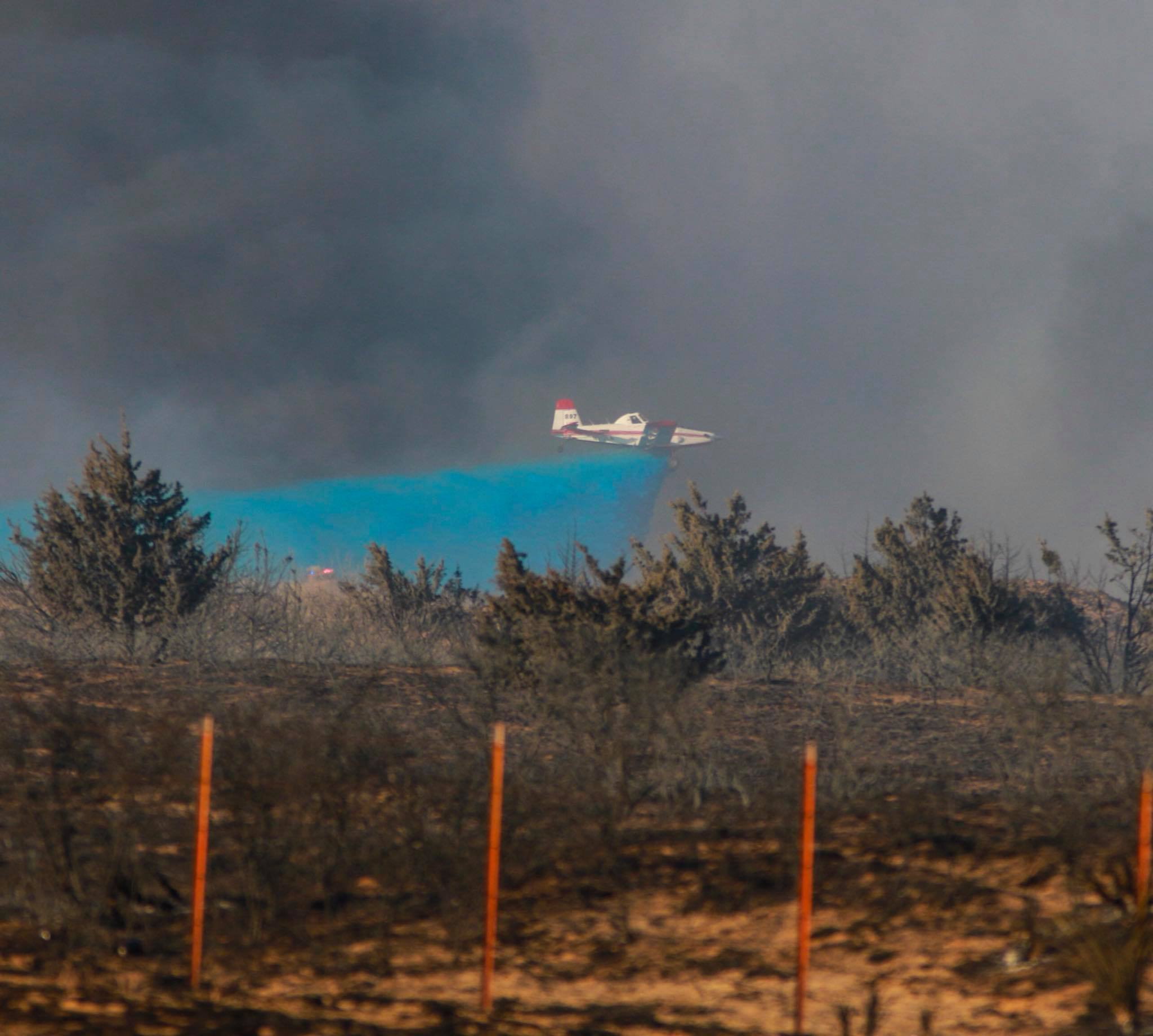
Tomorrow is supposed to be exceptionally bad. So expect more pics like this, taken
by Travis Barnard, of that fire 7 miles north of Woodward.
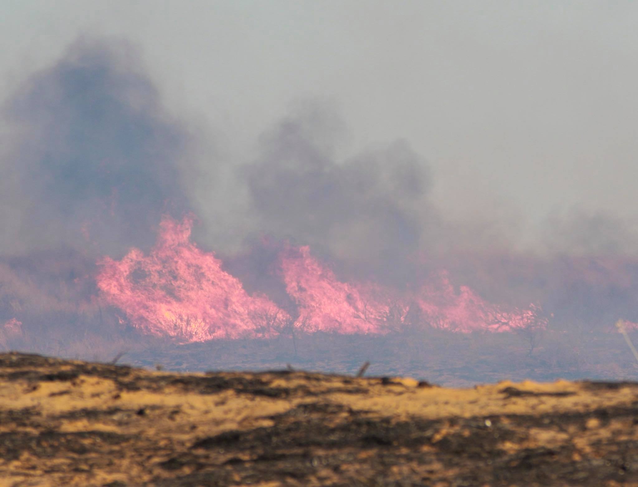
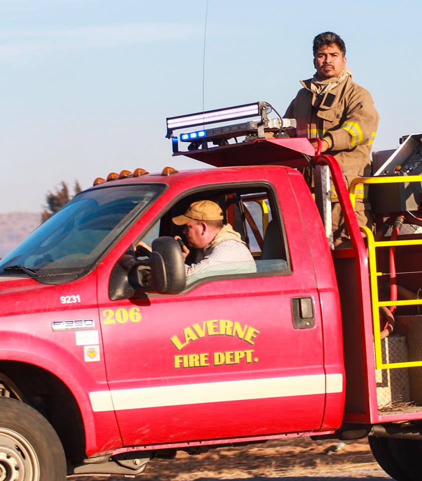


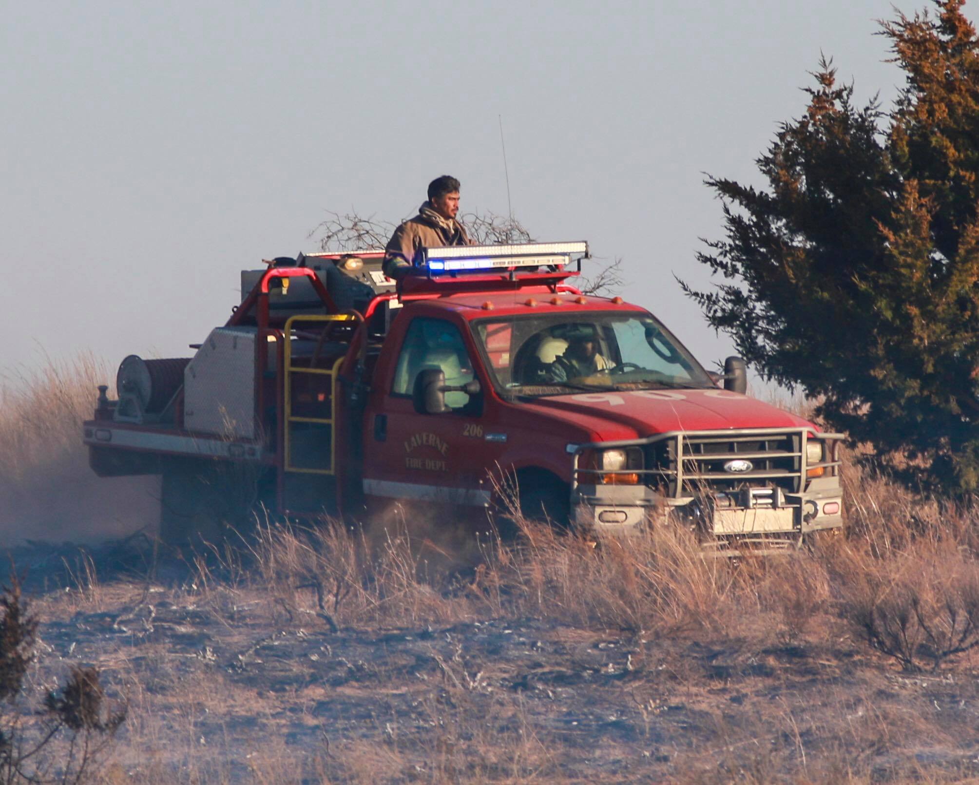
Or like these pictures of the Cimarron Fire, taken by Kayla Williams of the
Buffalo Weekly News, 16 miles east of Buffalo along the Cimarron River.
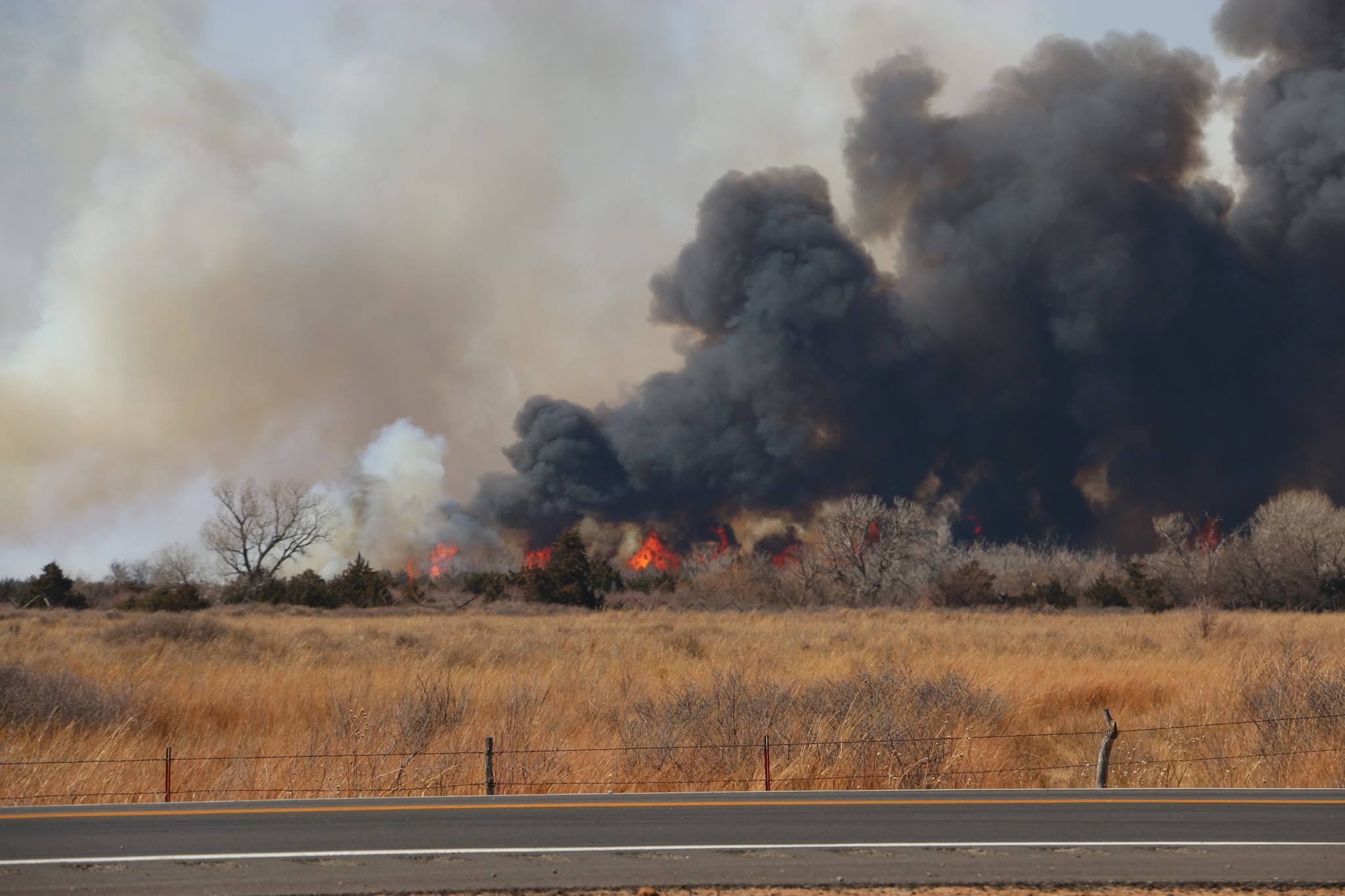
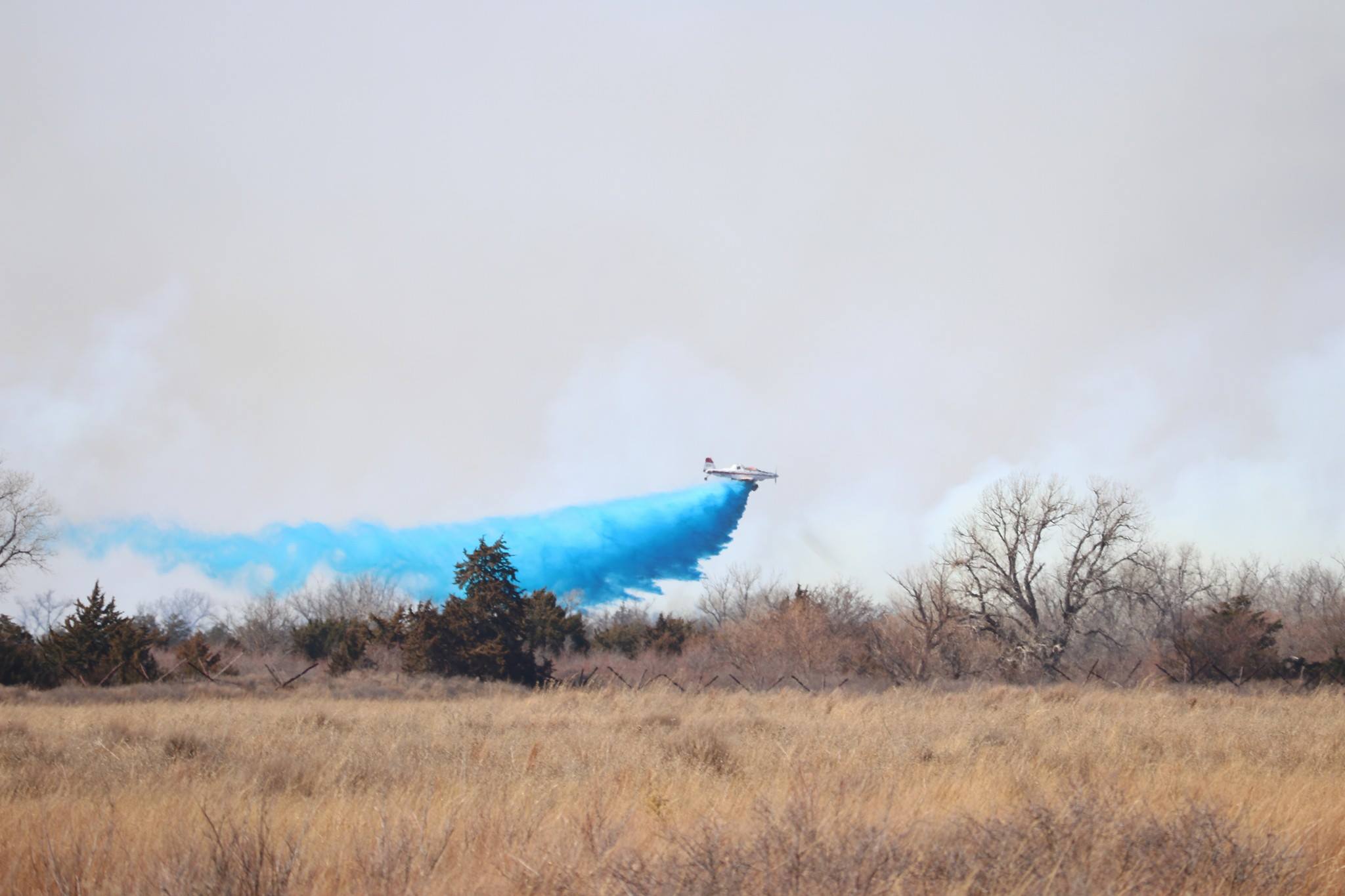
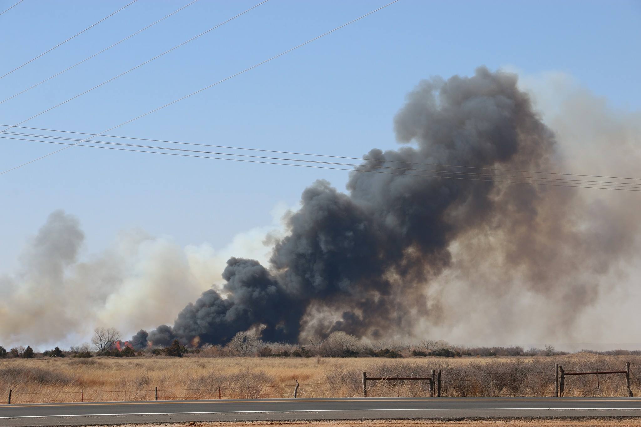
Eye candy type pics for sure, but dangerous as any other hazard in Oklahoma.
And those fire department pics, the guys on the front lines...those are
volunteers putting themselves in harms way, saving property and lives. Needless
to say we need to be careful about sparking any fires ourselves, given that
there are so many other ways fires can start somewhat beyond our control (e.g.,
pump batteries, sparks from highline wires blowing in the wind, lightning
from dry thunderstorms, etc.). In fact, I wish it were severe storms we were
worried about today, because at least those might come with rain.
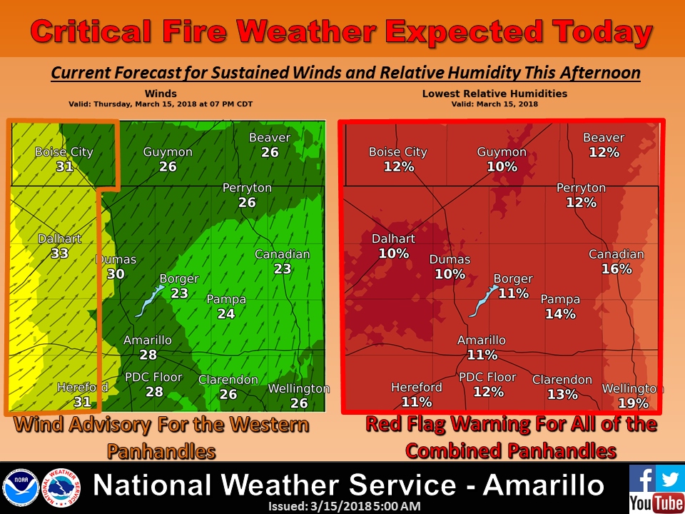
So we have a Red Flag Fire warning out across western Oklahoma today, with
much of the rest of the state under a fire weather watch for tomorrow. And
don't be surprised if that Red Flag Warning expands today.
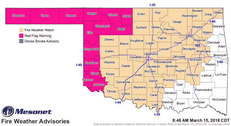
Here's how our state forestry department describes the setup.
Red Flag Warning in effect for today across the Oklahoma Panhandle,
northwest Oklahoma and western tier of counties beginning at 1:00 PM
and lasting into the late evening. Critical fire weather will occur
supporting rapid rates of fire spread and extreme fire behavior. The
next several days will present very-high to extreme fire danger indices
across much of Oklahoma. Given the composite fuel moisture values and
fire-effective weather pattern, fires are expected to exhibit both
problematic and extreme fire behavior with high potential to escape
initial attack efforts. Fire danger today will be highest in the
western third of Oklahoma, however building indices and ongoing fire
activity in the northern tier and some eastern counties points to the
state of the fire environment causing concerns for increased extended
attack fire activity.
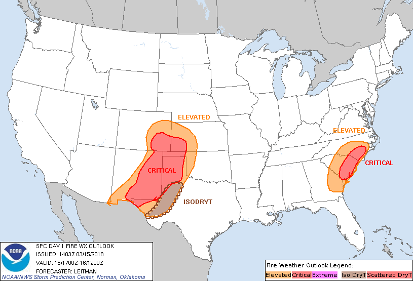
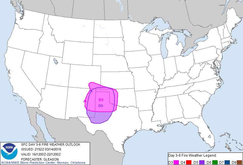
The Storm Prediction Center sees it like this:

And our NWS offices see it like this:
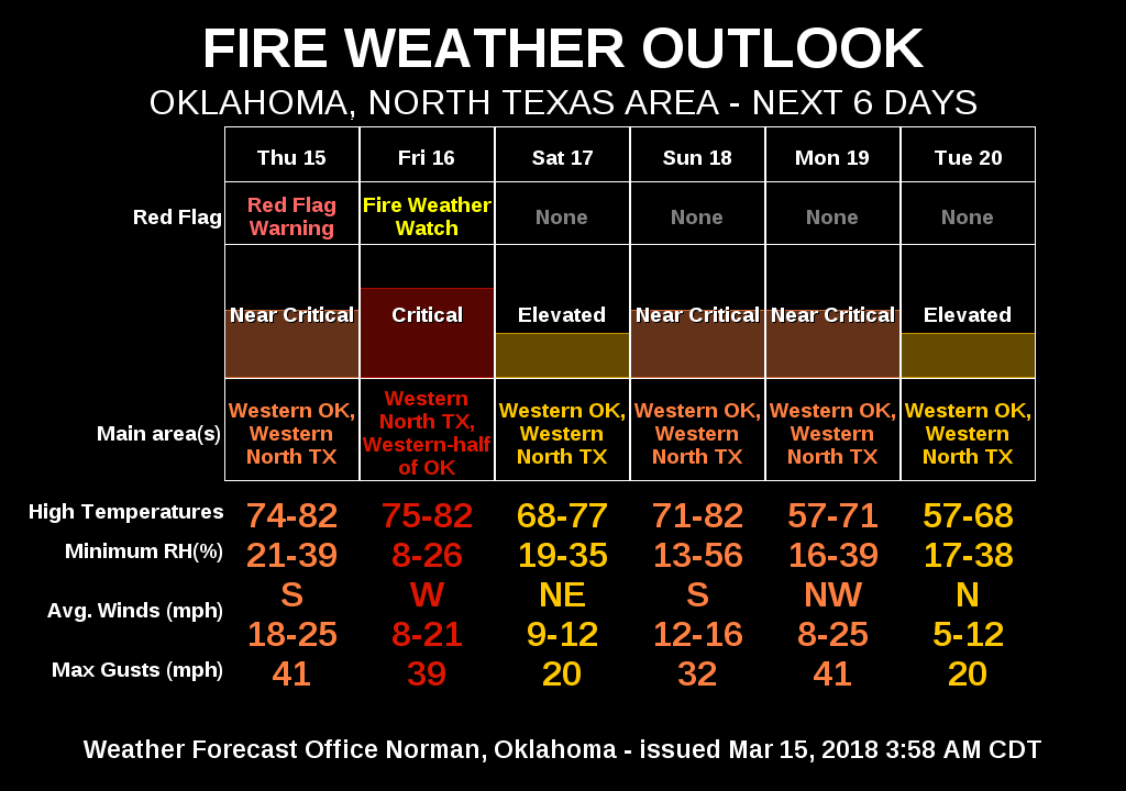
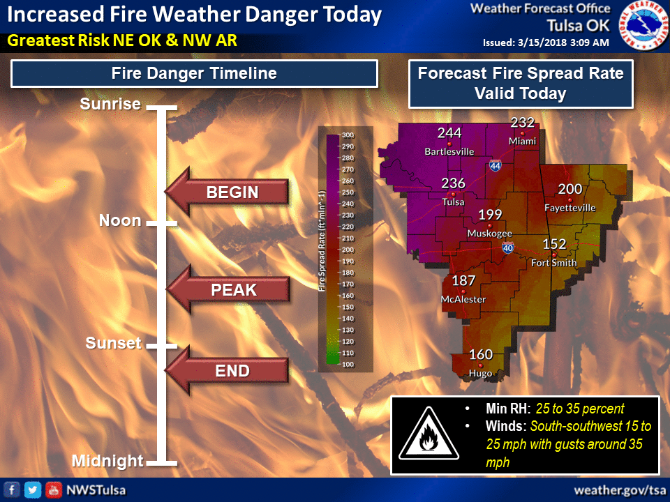
We've talked about this before, but that's never stopped us from being
redundant and repeating ourselves over and over (see what we did there? see
what we did there?). This lovely fire danger is not just due to the weather
that's occurring now. It actually has its roots going back to events well over
a year ago. Let's start with the significant ice storm that struck northwest
OK last January.
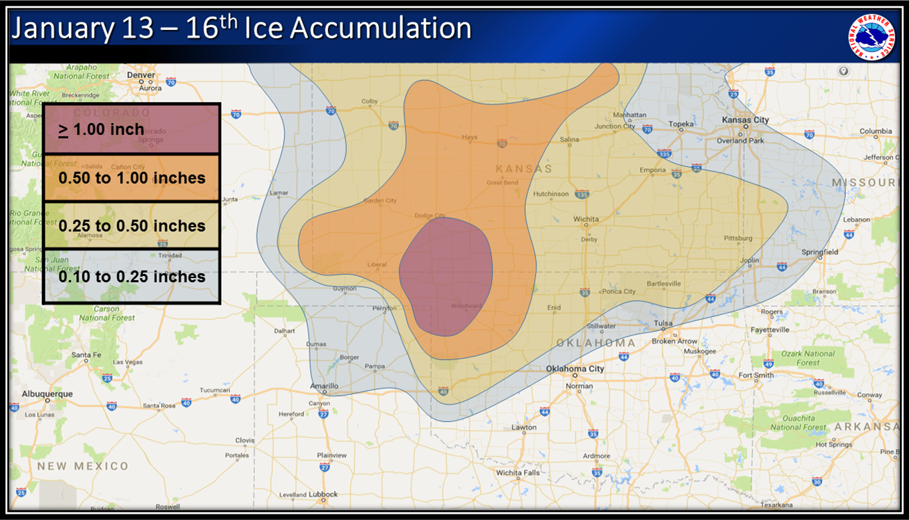
That left lots of trees and other debris on the ground, providing some of those
larger fuel sources. Those larger fuel sources have been cured by the last 6
months of drought. Mother Nature's firewood. Now add onto that the west spring
mild summer (especially August, which was one of the coolest/wettest on record).
Normally our summer (again, especially August) has its own fire season and takes
care of some of that fuel. Instead, what we have is an abundance of vegetative
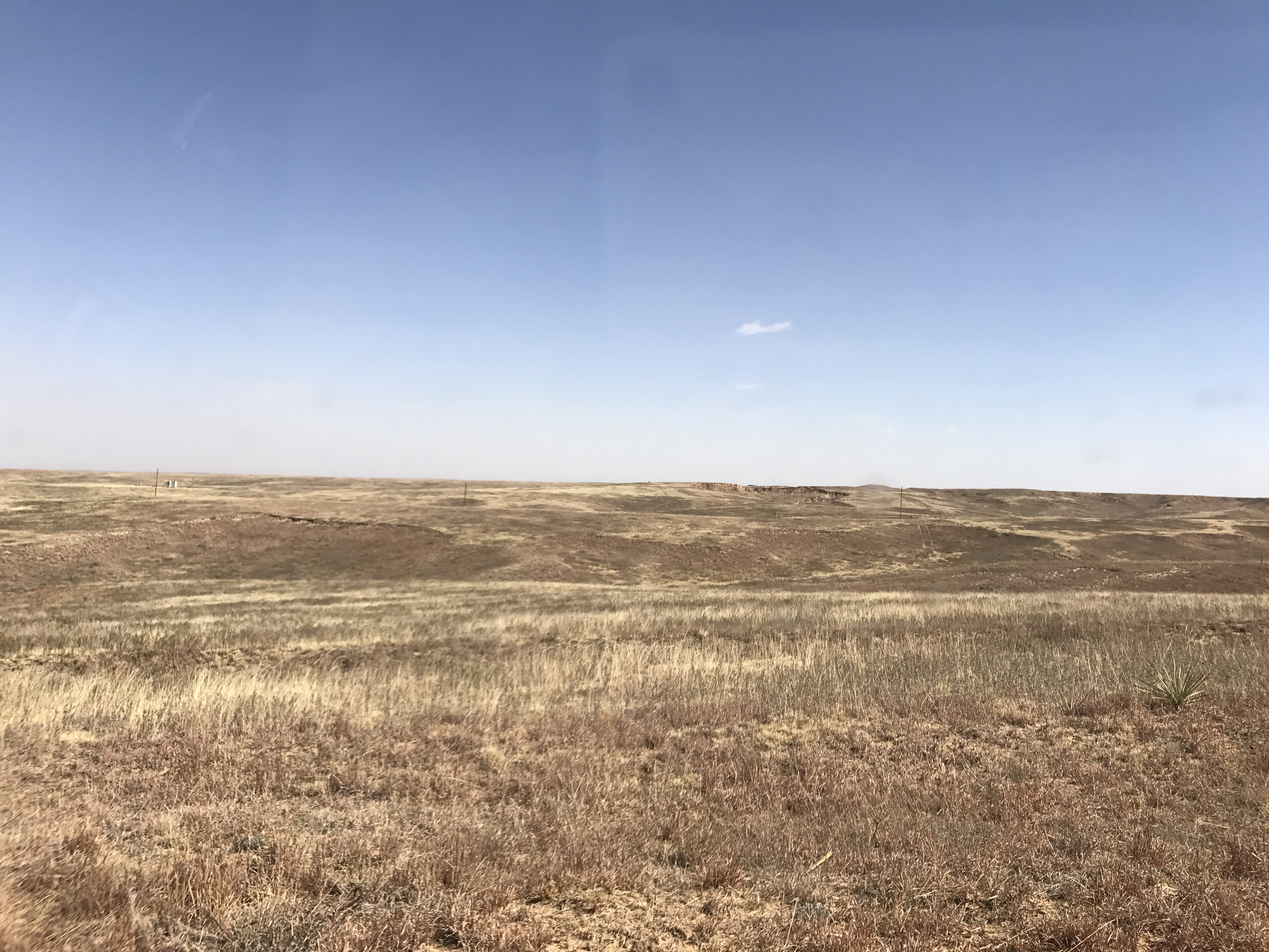
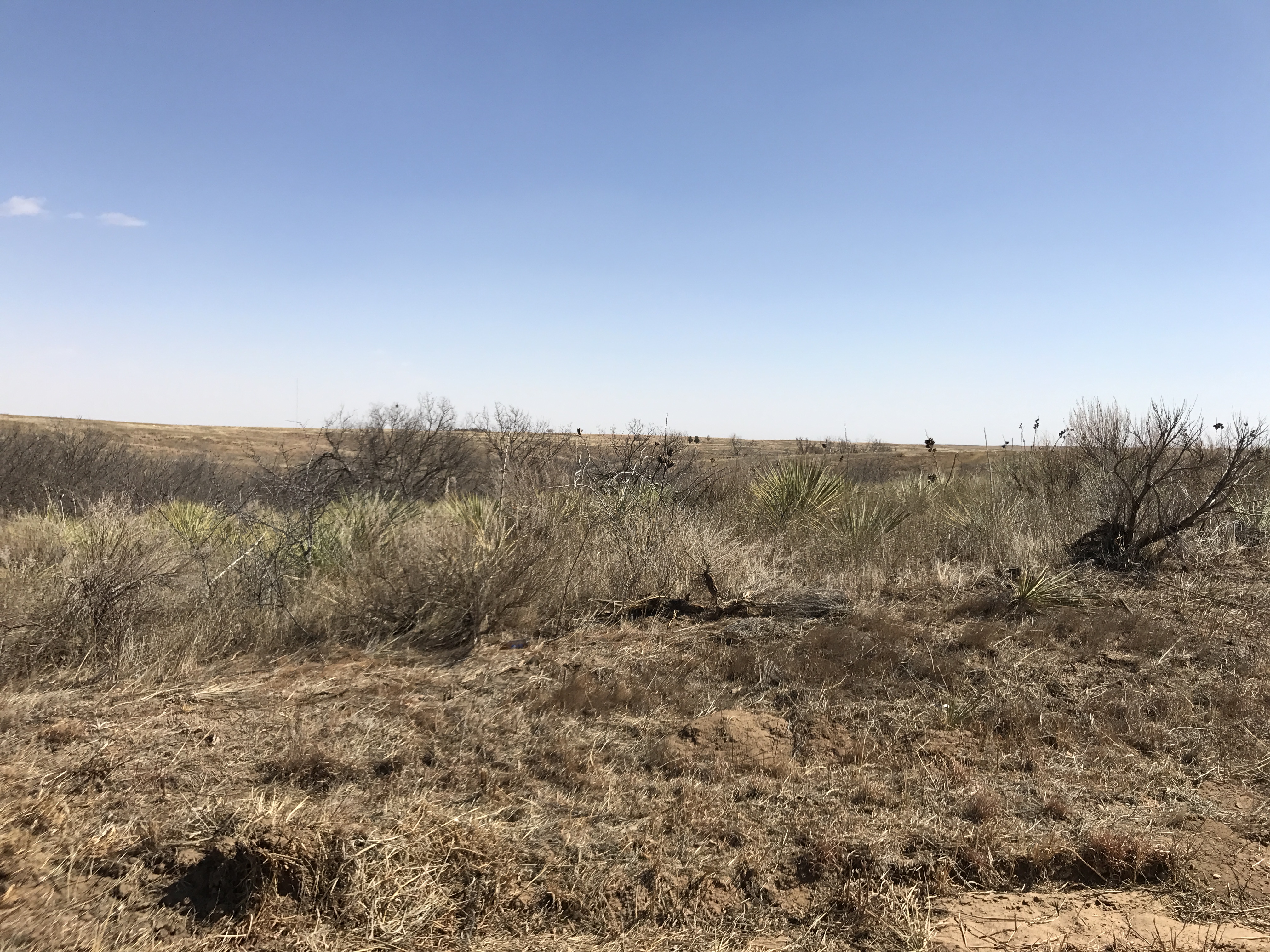
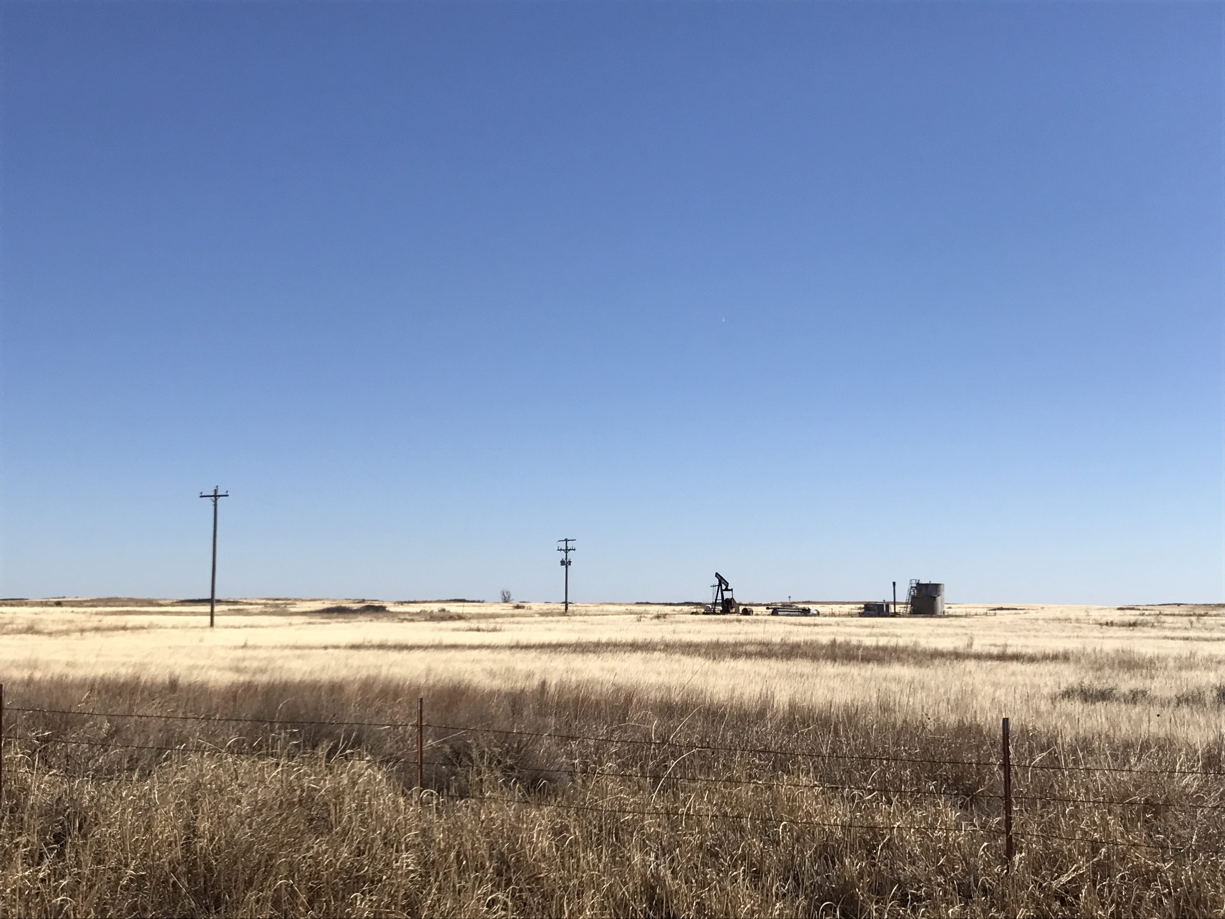
overgrowth, dead and dormant, just waiting for a spark. Much of western OK is
a sea of switch grass, dried out cedar trees and yucca plants, again waiting for
some type of spark. This is evident in some of these pictures taken by our
Assistant State Climatologist Monica Mattox last week in Beaver County.
That brings us today to our current drought situation, dealing with dry
conditions stretching back nearly 6 months. As noted previously, that drought
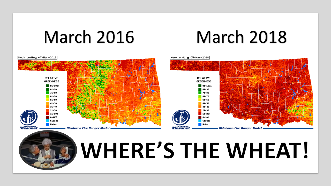
has cured those larger fuels, leaving them easily ignitable. It's devastated the
winter wheat crop, an important firefighting tool in rural areas that can act
as fire breaks. Normally that wheat would be a lush green right now, and a
flame retardant.
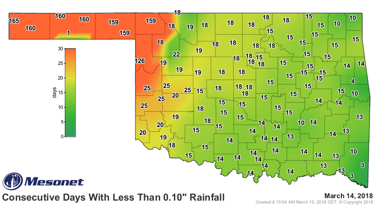
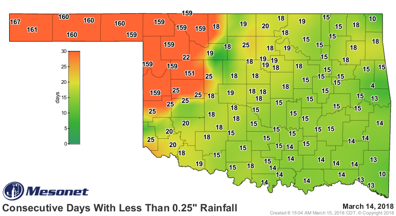
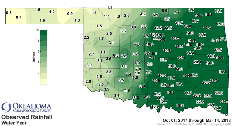
These rainfall maps are old hat by now, but here they are again showing just
how dry the state is, especially across western OK.


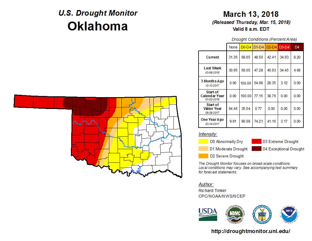
And drought continues to expand, with exceptional drought (the worst category)
spreading across far northwestern Oklahoma, nearly doubling in size in one
week.
How long is this danged Ticker going to be? Wait, did I type that out loud?
Onward we go!
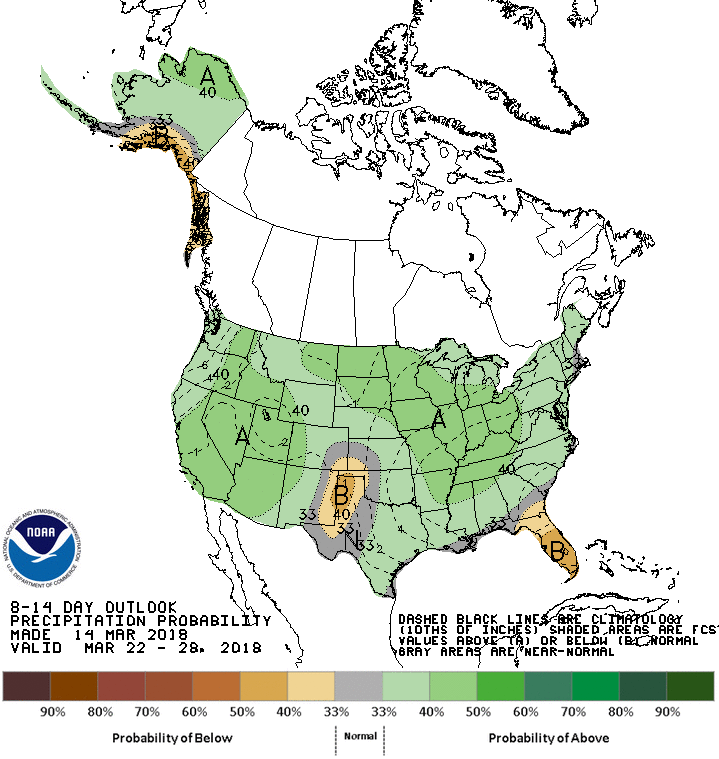
Chances for significant precip in the next 7 days across far NW OK? Not good.
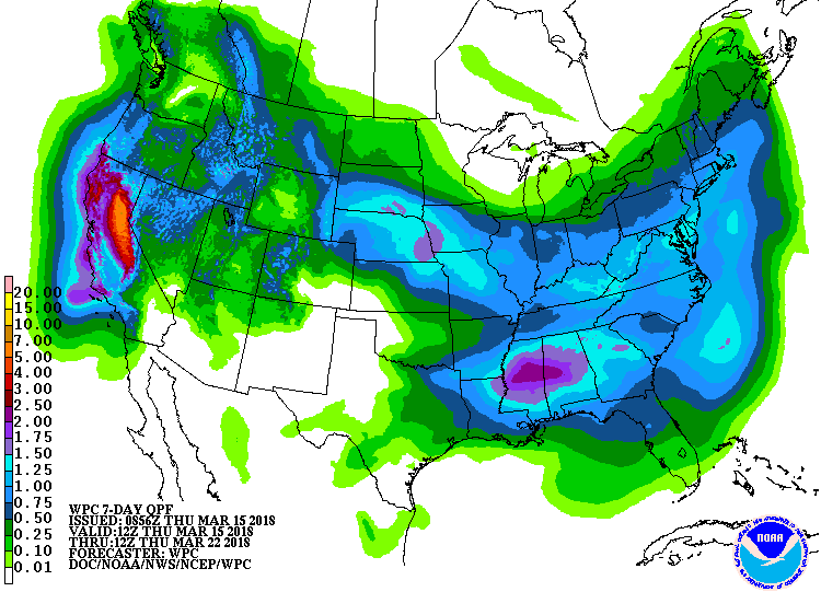
How about through the end of the month? Not too good either. And when you look
at this, feel free to say to yourself "Really?!?".
Let's go farther out. The latest CPC outlooks for April show increased odds
of above normal temps (not helpful) across all of Oklahoma. The same precip
outlook punts, so no help there.
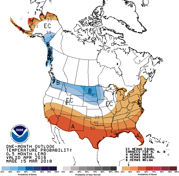
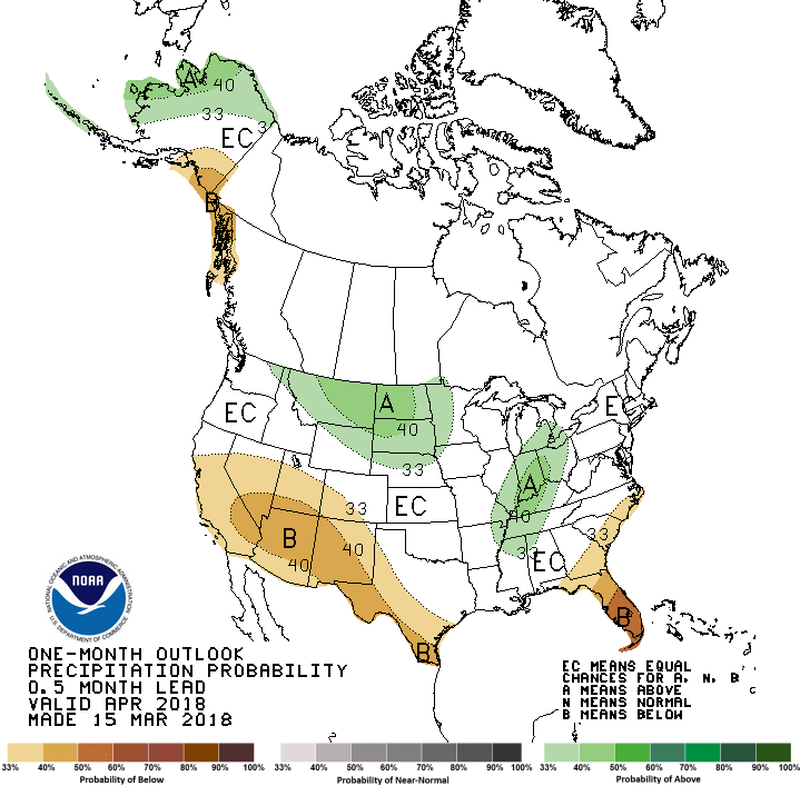
A warmer than normal April would mean more evaporation, but if it can rain, that
could aid in green up, which would aid in fire danger reduction (i.e., green
stuff doesn't burn as readily).
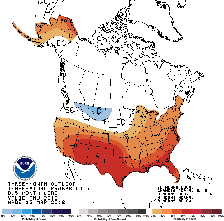
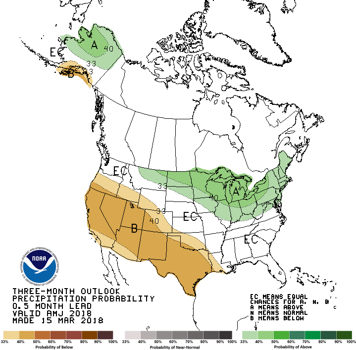
The April-June CPC outlooks aren't much better, with a very strong signal for
above normal temperatures through that period, and a somewhat weaker signal
across western OK for below normal precip.
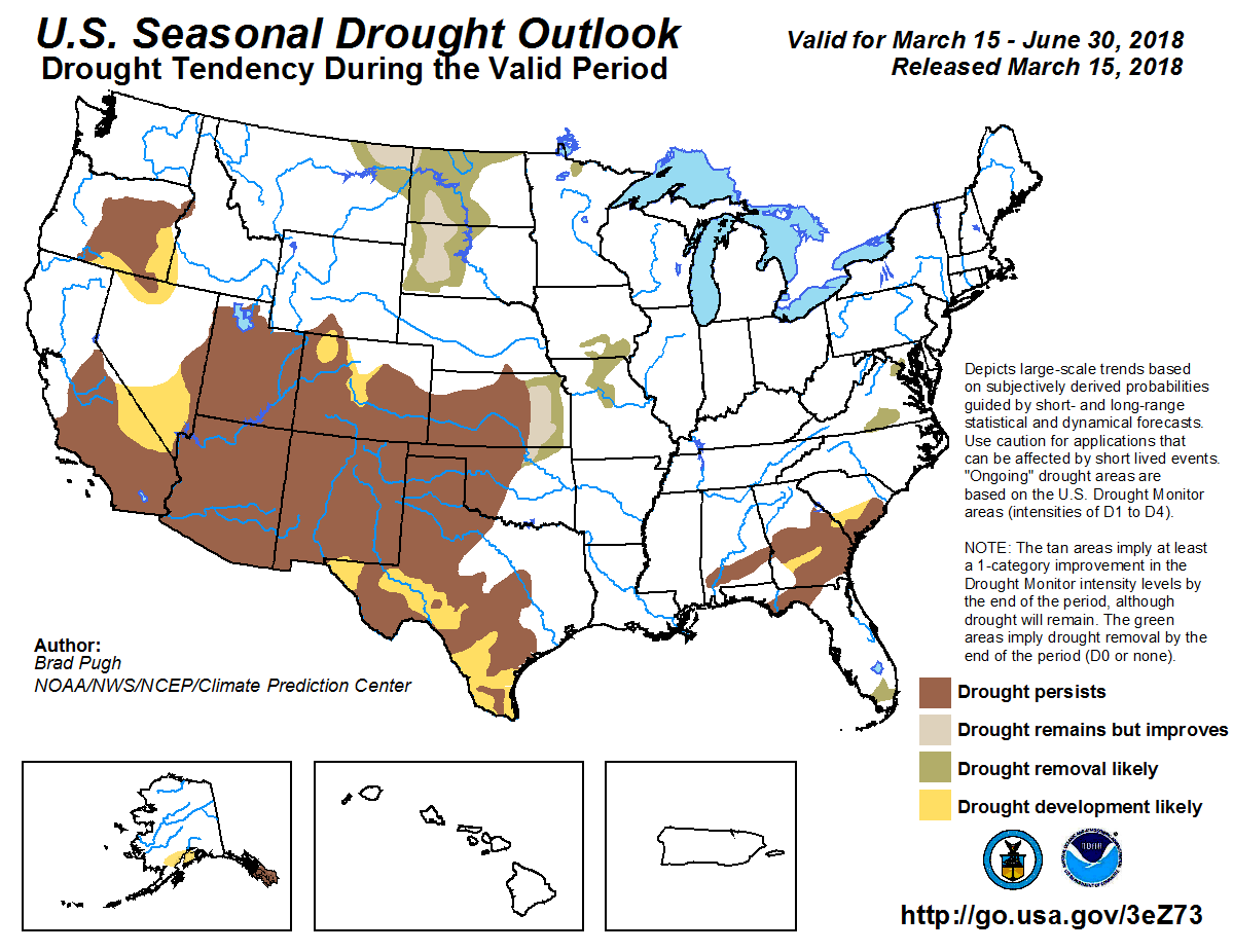
All in all, that leaves us with a nasty looking seasonal drought outlook, with
the drought expected to at least persist and possibly intensify across the
western half of the state.
That's it. I'm done. Now we sit back and watch the radars for smoke plumes,
satellites for hot spots, and hope it's a boring day.
Gary McManus
State Climatologist
Oklahoma Mesonet
Oklahoma Climatological Survey
(405) 325-2253
gmcmanus@mesonet.org
March 15 in Mesonet History
| Record | Value | Station | Year |
|---|---|---|---|
| Maximum Temperature | 88°F | ALV2 | 2013 |
| Minimum Temperature | 14°F | SLAP | 1997 |
| Maximum Rainfall | 3.96 inches | WILB | 2014 |
Mesonet records begin in 1994.
Search by Date
If you're a bit off, don't worry, because just like horseshoes, “almost” counts on the Ticker website!