Ticker for March 13, 2018
MESONET TICKER ... MESONET TICKER ... MESONET TICKER ... MESONET TICKER ...
March 13, 2018 March 13, 2018 March 13, 2018 March 13, 2018
Anatomy of a drought
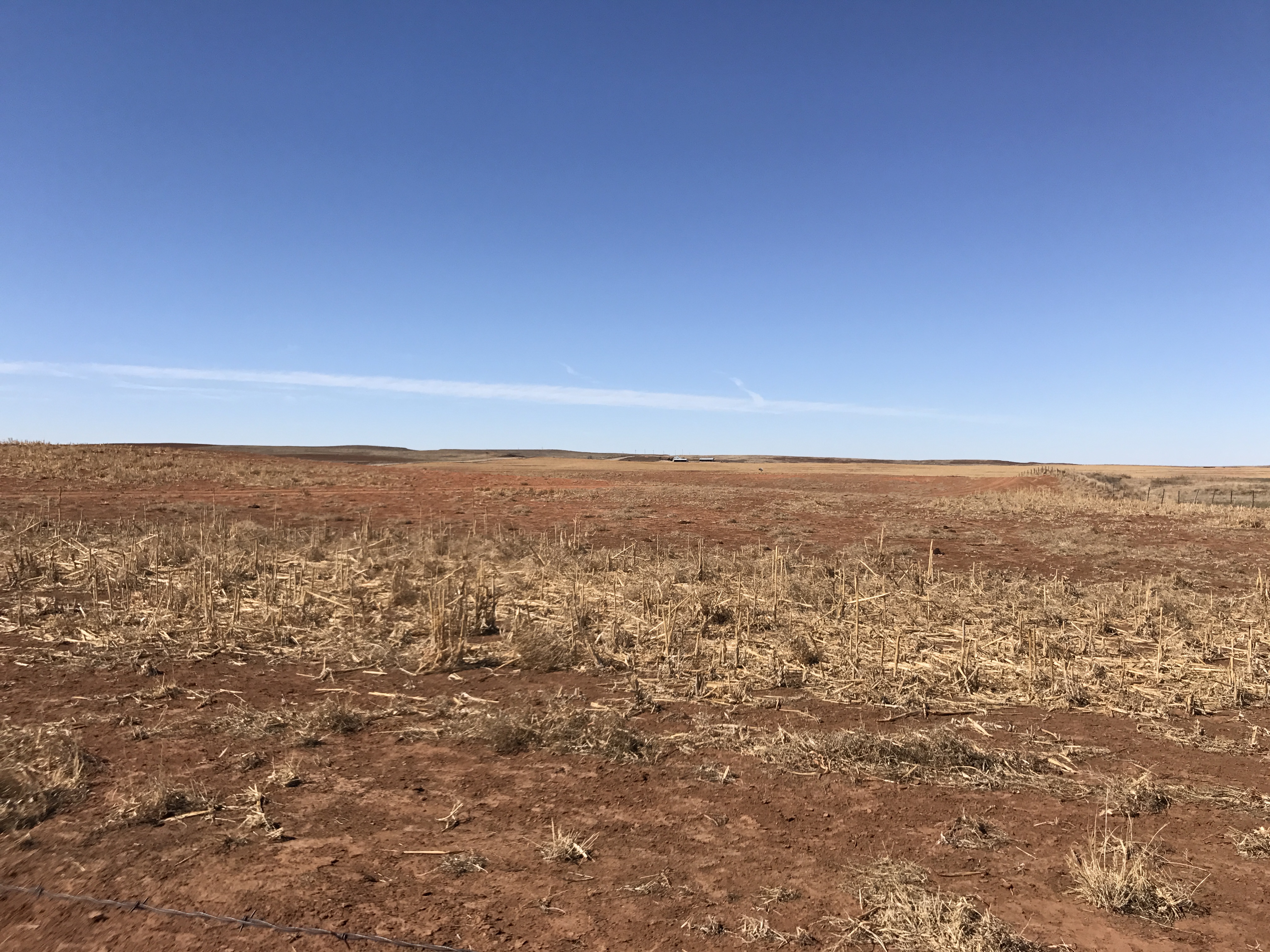
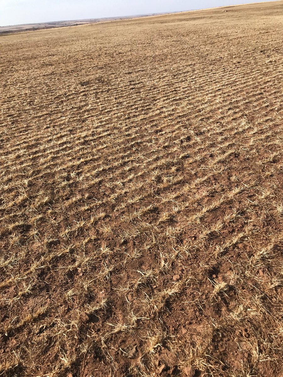
This picture, taken of a wheat (or in this case, a not-wheat) field near Buffalo
by our Assistant State Climatologist Monica Mattox, tells it all. And the tell
is not good. And it's the same story all across western Oklahoma, at least in
a general sense, whether it be near Forgan
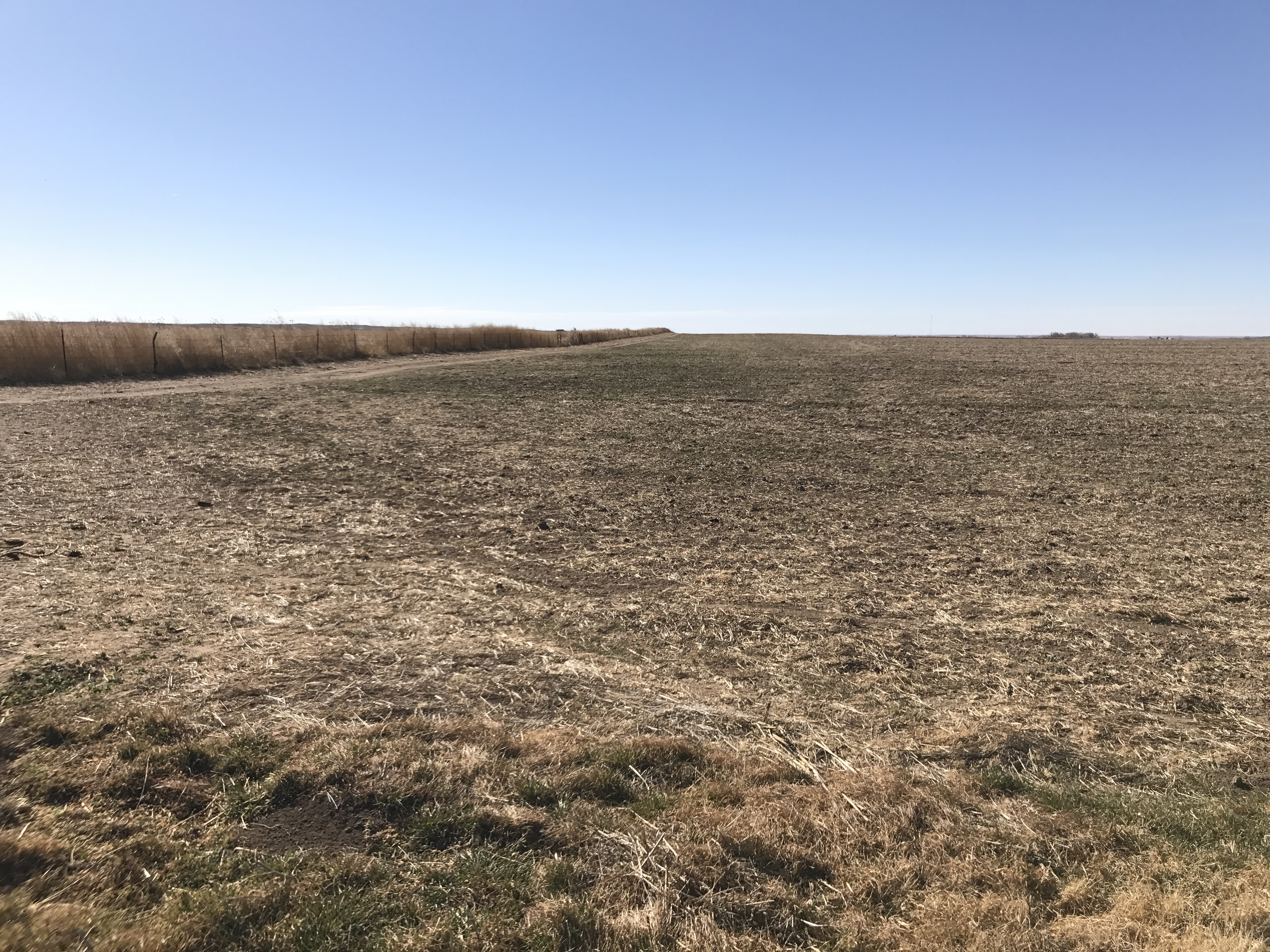
or Gate (yes, these are actual towns...my old stomping grounds!)
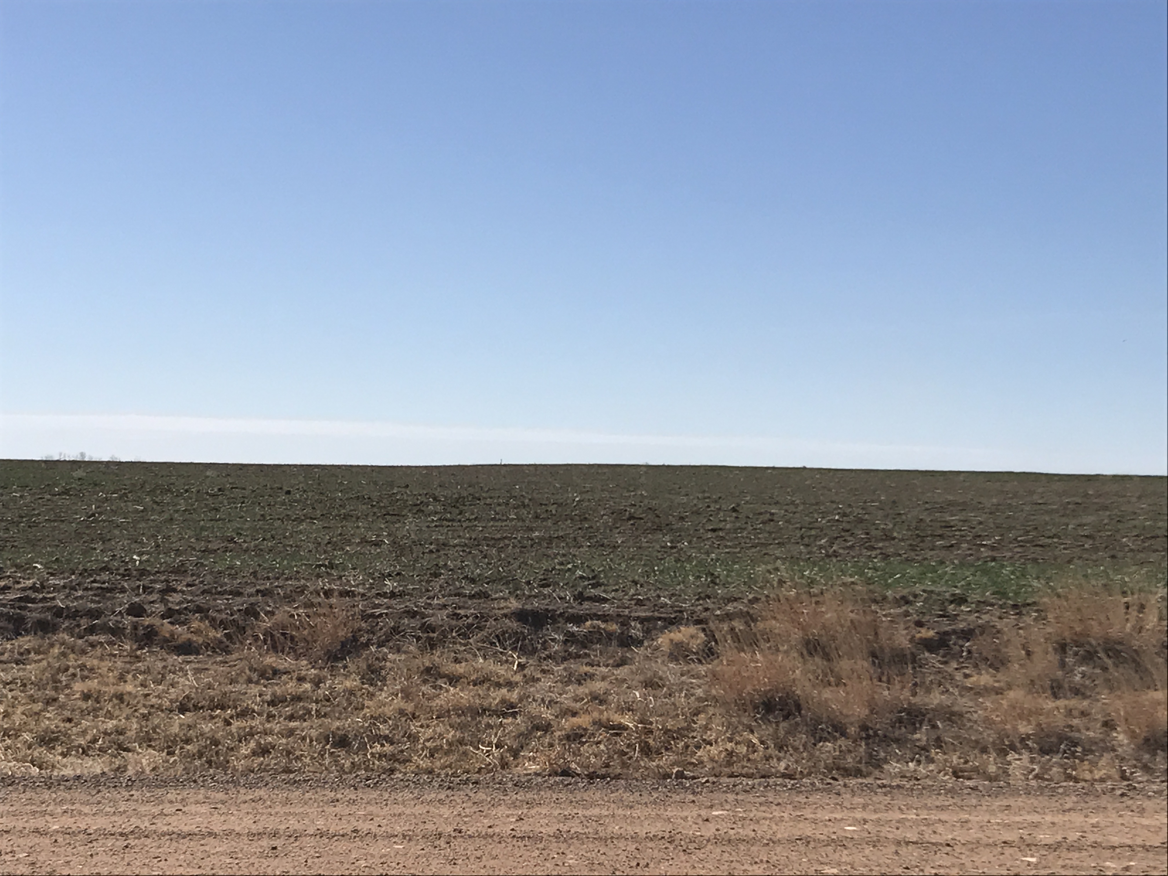
or Knowles
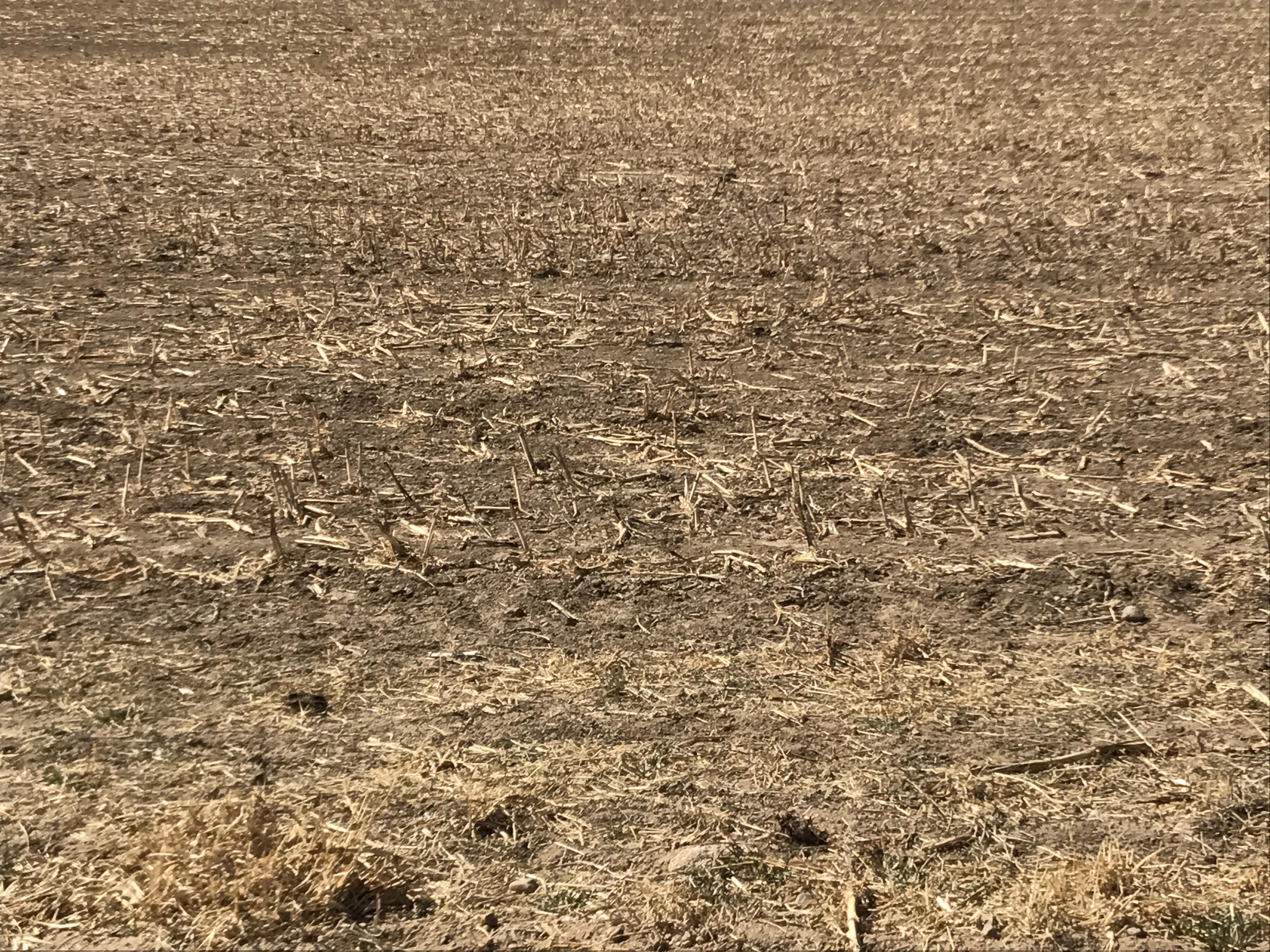
or...well, you getting the picture? You should be because I just bombarded you
with them. And lest you think I'm all about the Panhandle (well, I guess I am),
here's another "bad" wheat field pic from near Butler, taken by Lane Broadbent.
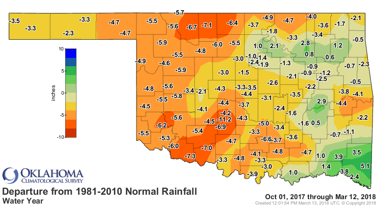
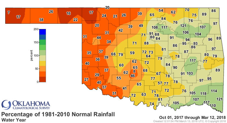
The statistics are worn out by now, but these maps again tell the story of the
current drought, which began in earnest in early October. A LONG time ago! Check
out the water year (Oct. 1-Sept. 31) thus far.
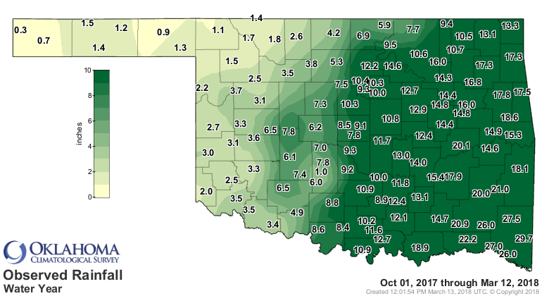
Wow, that doesn't look so bad, right? Lots of nice green on that map.
Well, wrong.
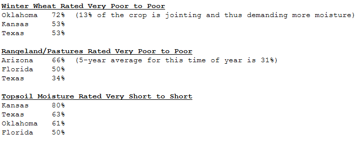
The wheat crop is in bad shape, that's not a shock. The USDA's National Ag
Statistics Service have 72% of OK wheat in "poor to very poor" condition, but
at least there's misery in numbers? Sorry Kansas and Texas.
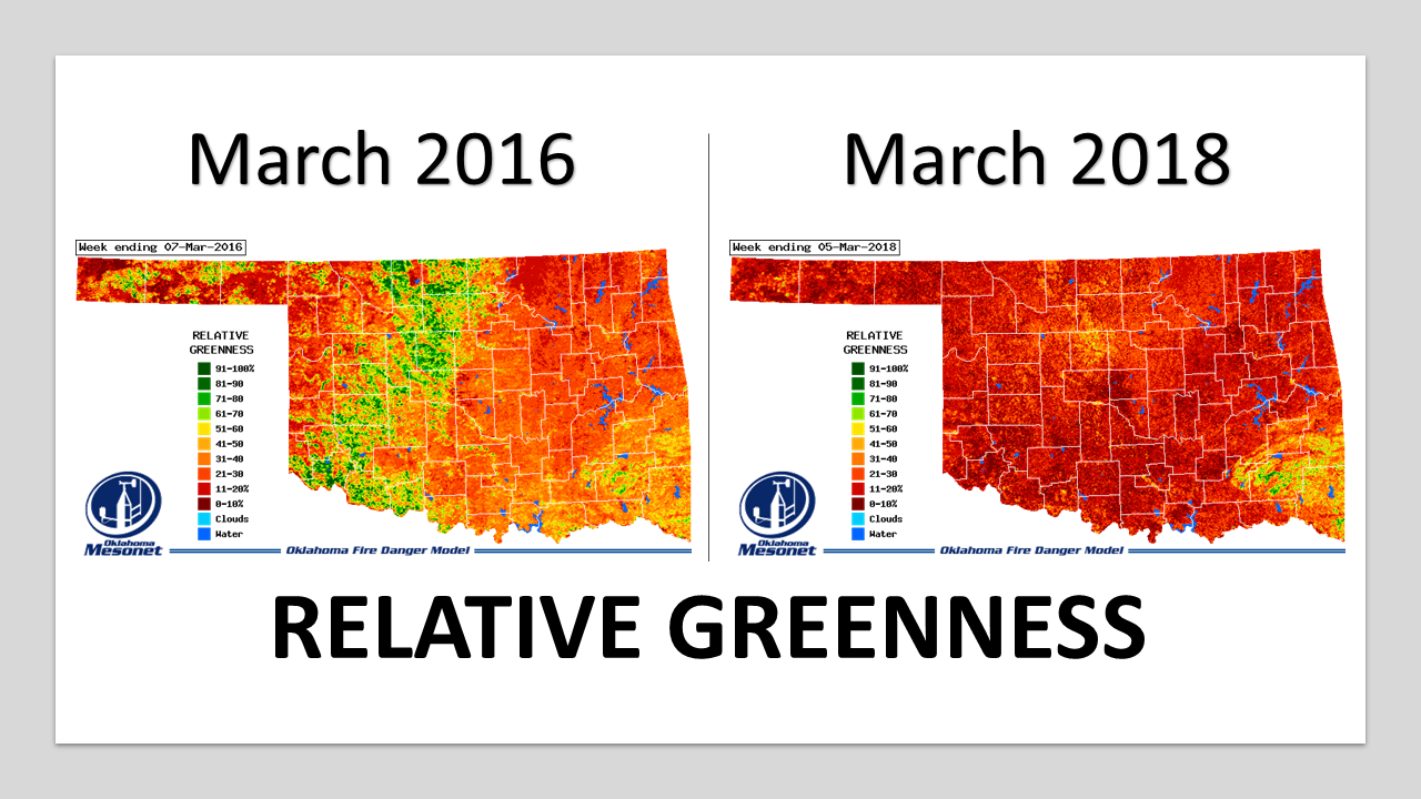
Now this really becomes apparent when looking at the relative greenness maps
from the Mesonet's OK-FIRE program. Notice the "normal" appearance of Oklahoma's
wheat belt across western through north central OK in March 2016, vs. this
March? This is the time of year when you'd expect lush green wheat surrounded
by dead/dormant pasture/rangeland/native vegetation.
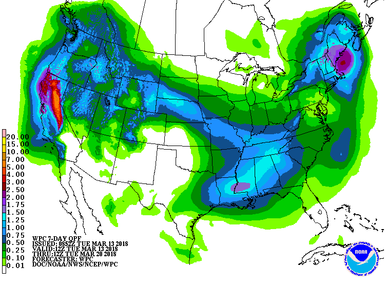
The only thing that's gonna help is rain. Next 7 days? Nope.
And it's not looking too promising after that either.
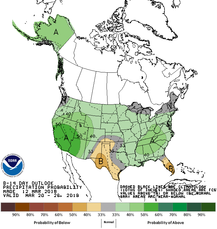
Ooh, it's tantalizingly close, however! Maybe that's hope in and of itself? A
wobble here, a wobble there, and voil?...rain?
Gary McManus
State Climatologist
Oklahoma Mesonet
Oklahoma Climatological Survey
(405) 325-2253
gmcmanus@mesonet.org
March 13 in Mesonet History
| Record | Value | Station | Year |
|---|---|---|---|
| Maximum Temperature | 92°F | ALTU | 2002 |
| Minimum Temperature | 14°F | KENT | 2006 |
| Maximum Rainfall | 3.50 inches | LANE | 1995 |
Mesonet records begin in 1994.
Search by Date
If you're a bit off, don't worry, because just like horseshoes, “almost” counts on the Ticker website!