Ticker for March 8, 2018
MESONET TICKER ... MESONET TICKER ... MESONET TICKER ... MESONET TICKER ...
March 8, 2018 March 8, 2018 March 8, 2018 March 8, 2018
Exceptional?
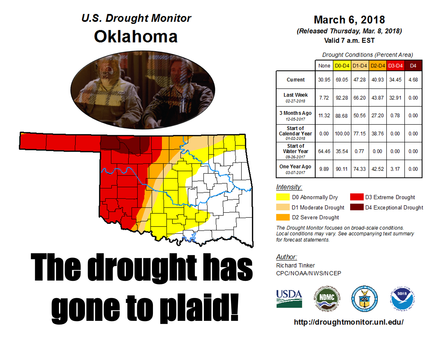
For the first time since May 5, 2015, the U.S. Drought Monitor has "Exceptional"
drought in Oklahoma. Now it's just a blob up in NW OK, a mere 5 percent of the
state, but it's there for good reason. Now I don't know why it's called
"Exceptional." That's like saying I'm "exceptionally" bald. The words just don't
go together. "Extreme," "Severe" and "Moderate?" Those are easy to understand.
And only 47% of the state is still in drought, but where it IS in drought, it's
REALLY in drought. Here's an unblemished map for a better look. Of that 47%,
only 6% would be the mildest intensity of "moderate."
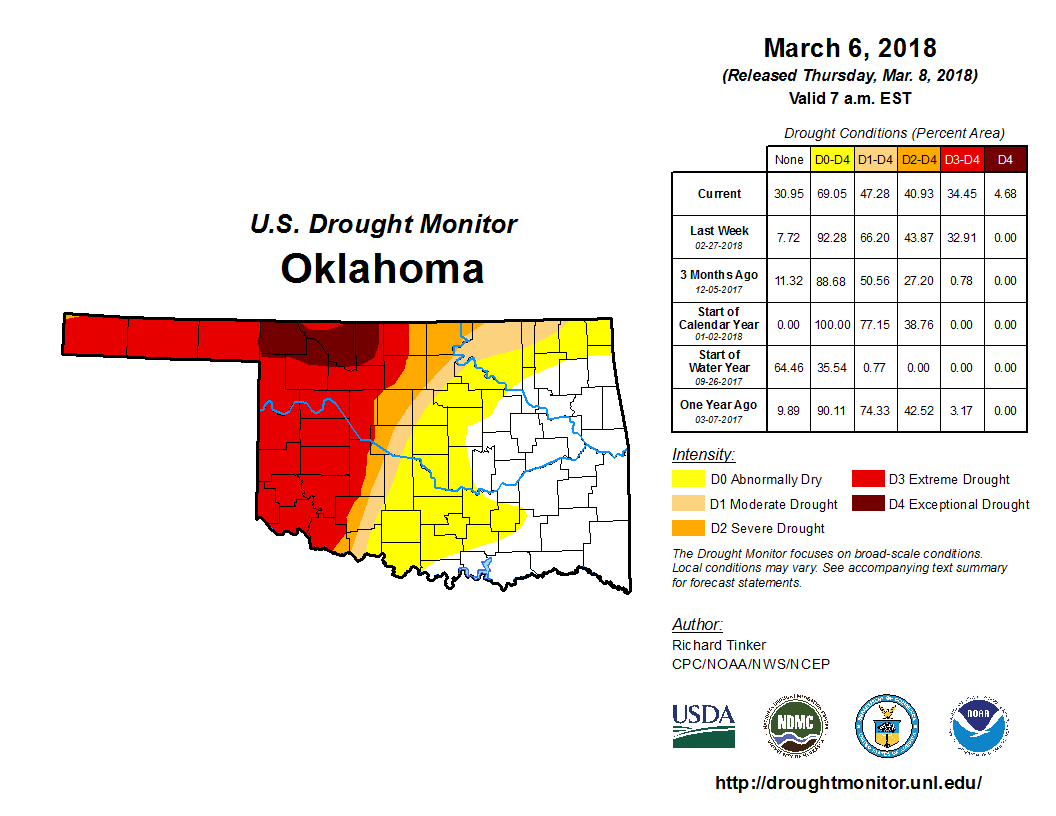
Exceptional is the highest of the Drought Monitor's intensities,
and it doesn't happen very often. We saw more improvements across eastern
Oklahoma, but western Oklahoma just isn't getting the moisture to even
forestall drought intensification. We've now gone 159 (counting today) days
without at least a tenth of an inch of rain across the western Panhandle, to
152 days in Harper County. It's just as bad or worse for the quarter-inch stat.
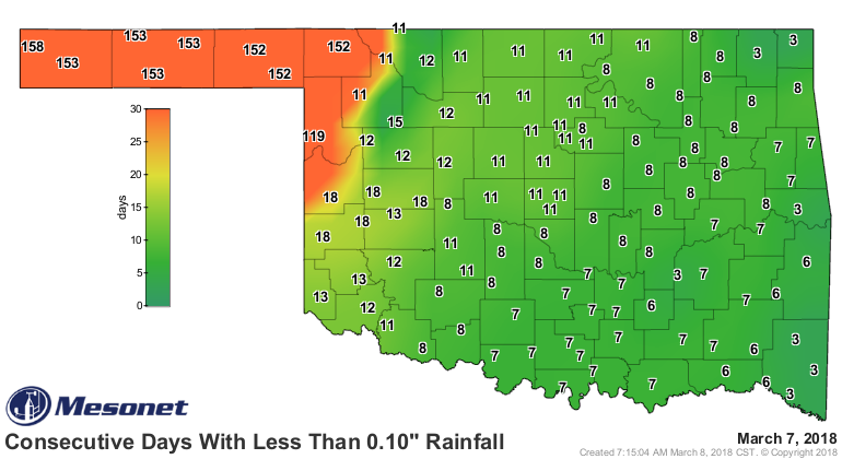
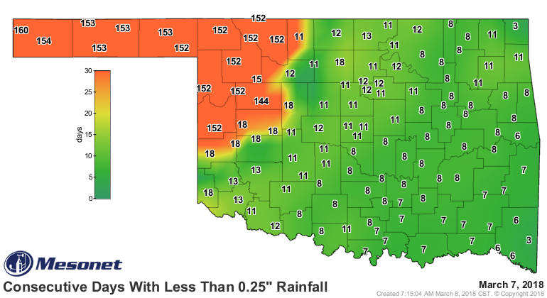
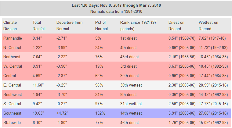
It gets uglier. Check out the disparity between west and east on the 120-day
maps.
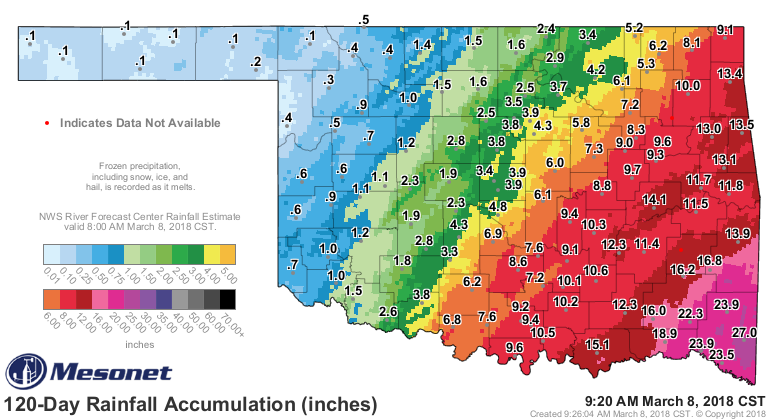
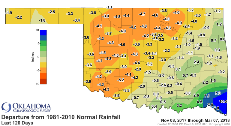
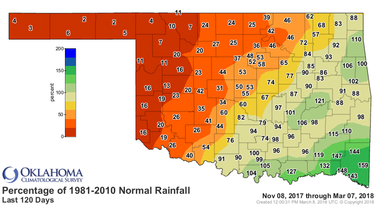
Easily the driest such period on record.
Pictures are worth 1,000 words, as they say (they also say pictures are worth
one of my words). Check out these wheat pics from Beaver County in the
Panhandle. Should be a lush green about a foot high right now, with no dirt
showing.
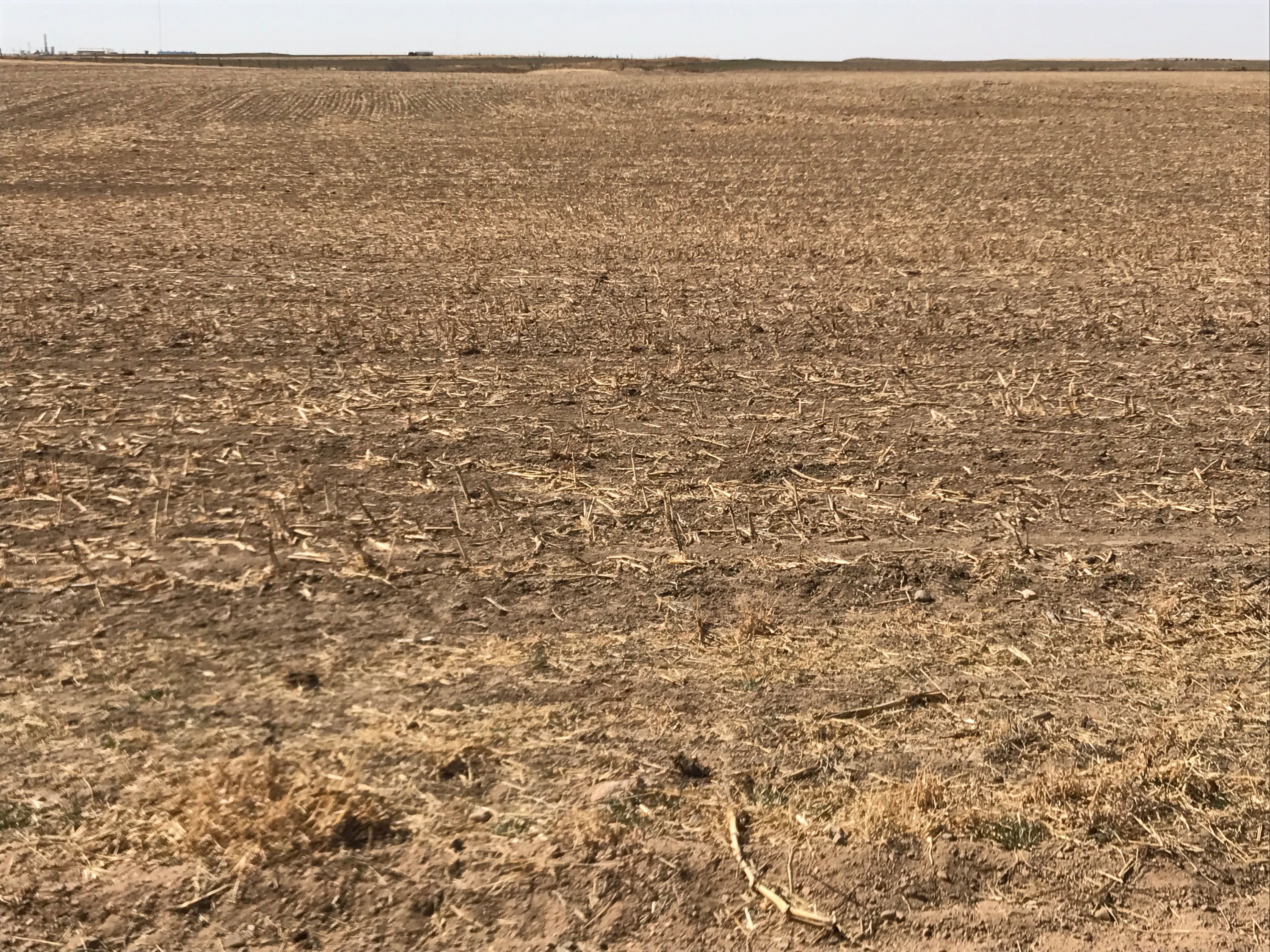
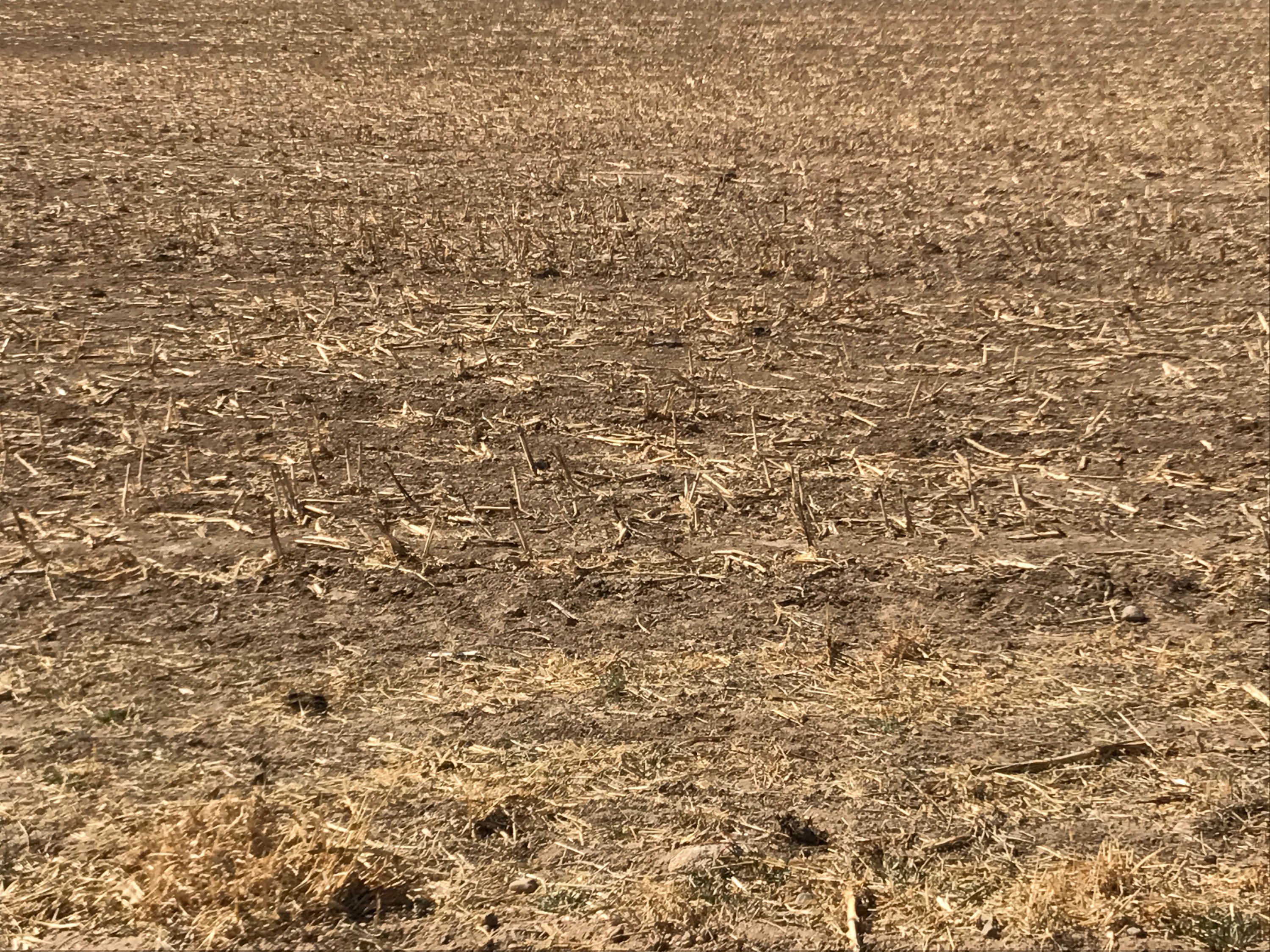
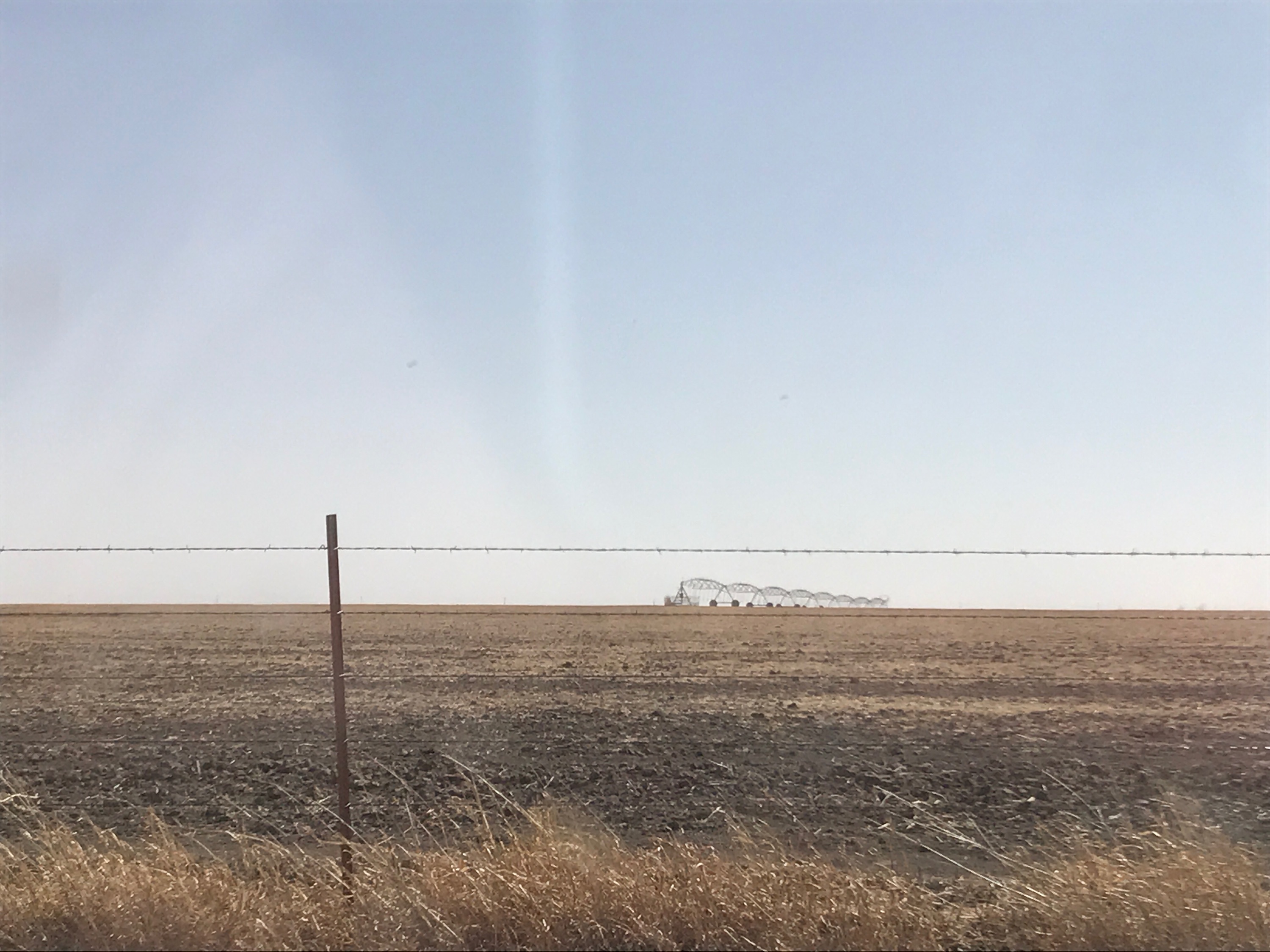
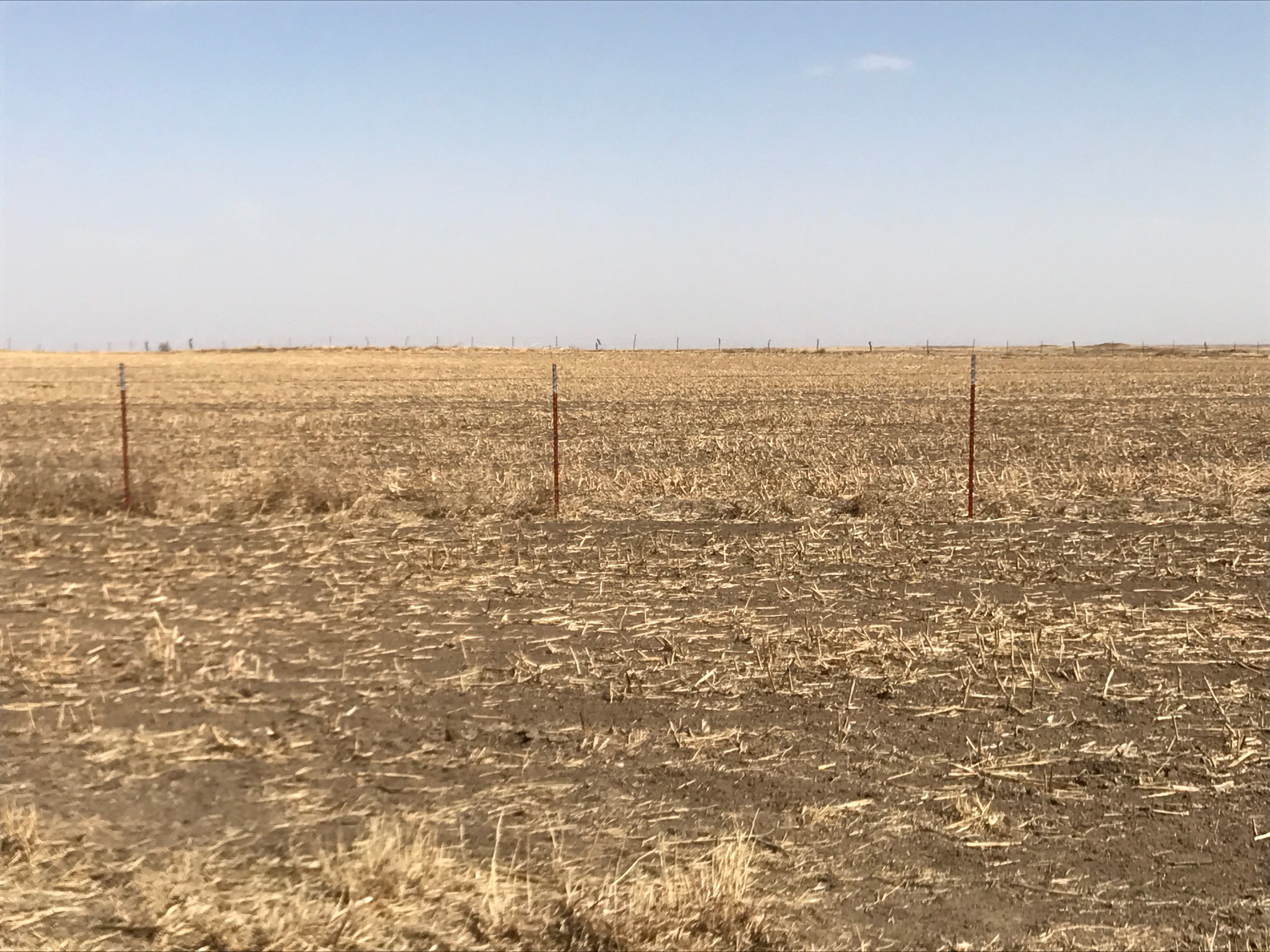
Ugh. Fail! And the ramifications of that dead wheat go beyond just the loss of
the crop for sale. If cattle were expected to graze on that over the winter,
that's another fail, so a double whammy on Oklahoma's agricultural economy.
So when's it going to rain out west? Next 7 days? Doubtful.
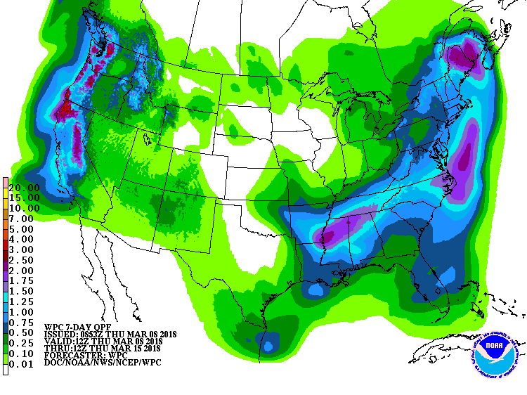
How about in the next couple of weeks or so? Not looking good.
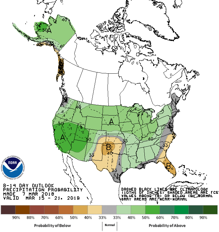
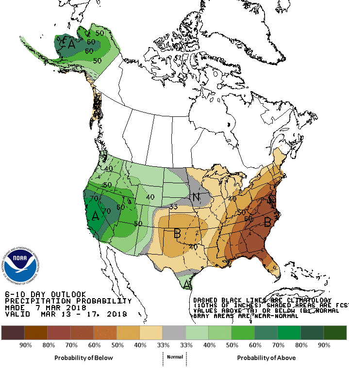
Through the end of March? It's not my fault!
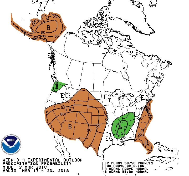
That's what it looks like now, of course. Our next big storm could pop up on
the 7-10 day horizon anytime now. The only problem is to get it to rain in
western OK instead of only in eastern OK.
Gary McManus
State Climatologist
Oklahoma Mesonet
Oklahoma Climatological Survey
(405) 325-2253
gmcmanus@mesonet.org
March 8 in Mesonet History
| Record | Value | Station | Year |
|---|---|---|---|
| Maximum Temperature | 84°F | HOLL | 2002 |
| Minimum Temperature | 7°F | SEIL | 2008 |
| Maximum Rainfall | 3.01″ | BESS | 2016 |
Mesonet records begin in 1994.
Search by Date
If you're a bit off, don't worry, because just like horseshoes, “almost” counts on the Ticker website!