Ticker for February 28, 2018
MESONET TICKER ... MESONET TICKER ... MESONET TICKER ... MESONET TICKER ...
February 28, 2018 February 28, 2018 February 28, 2018 February 28, 2018
Not so-Happy Days
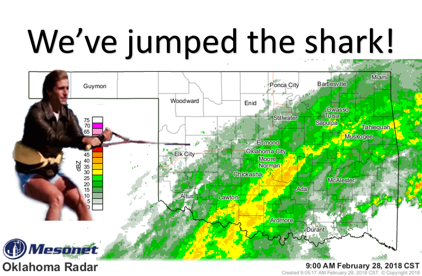
Yes kids, this is what us older folks used to watch on TV...a 5'6" punk named
Fonzie that could start a jukebox (that's another story) by hitting it once
on the side, AND jump sharks on vacation in Hawaii. And now you know how the
term "jumped the shark" came to be. And that's exactly what has happened with
Mother Nature as we watch yet another round of rain miss western Oklahoma as the
rain totals, light as they may be to the east, just tease those folks. Another
5 hundredths is nothing to somebody down south, but it would at least settle
the dust to the west.
So what's in store from here? Well, a nice day today with temperatures in the 70s
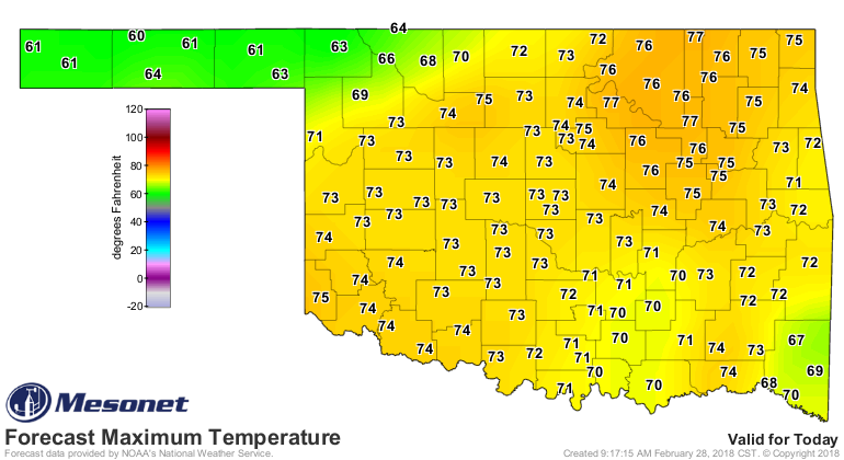
and another dry cold front for the northwest with possible storms in the
southeast. In fact, that front has already entered northwestern OK.
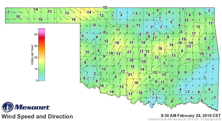

There is a chance for a bit of severe weather with those storms later today
as the front approaches, but those should be confined to far southeastern
Oklahoma.

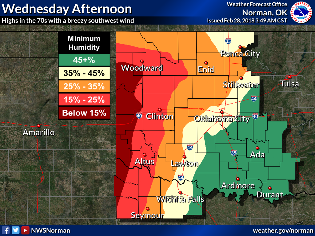
Meanwhile, western Oklahoma gets yet ANOTHER day of fire danger.
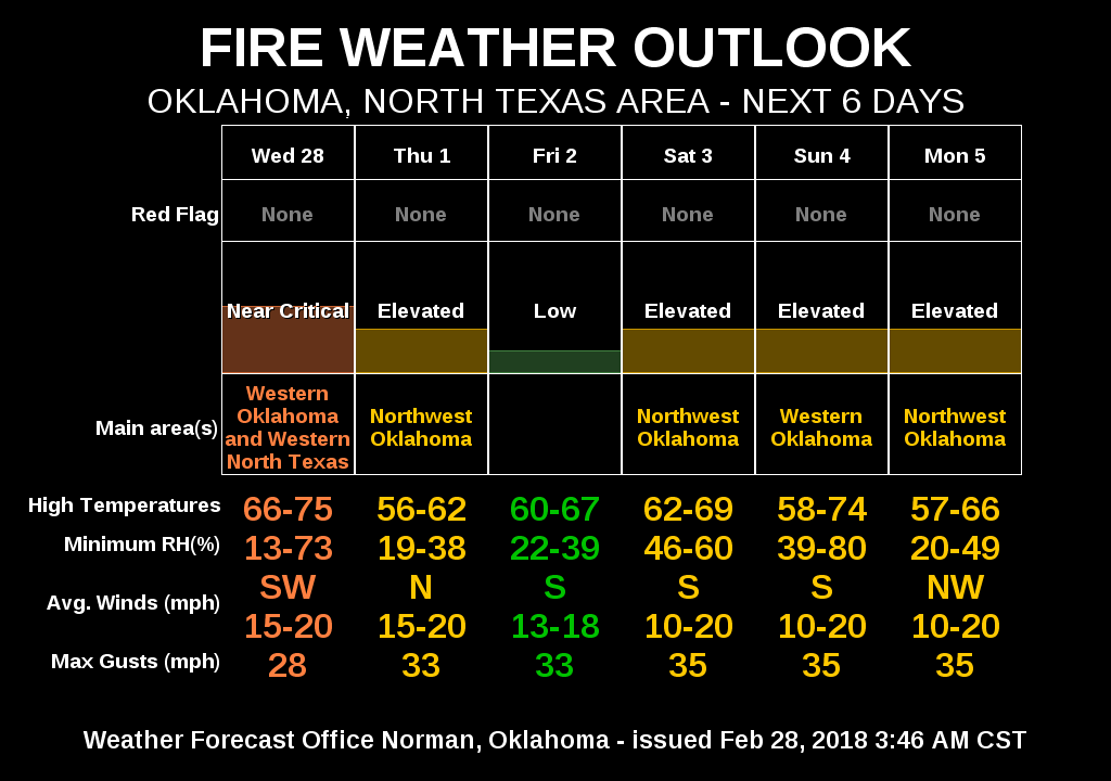
February...parts of SE OK have their wettest on record, northwest has their
driest. Jumped the shark indeed.
HEYYYYYYYYYY!!!
Gary McManus
State Climatologist
Oklahoma Mesonet
Oklahoma Climatological Survey
(405) 325-2253
gmcmanus@mesonet.org
February 28 in Mesonet History
| Record | Value | Station | Year |
|---|---|---|---|
| Maximum Temperature | 90°F | HOLL | 2006 |
| Minimum Temperature | 7°F | BEAV | 2019 |
| Maximum Rainfall | 3.70″ | BROK | 2018 |
Mesonet records begin in 1994.
Search by Date
If you're a bit off, don't worry, because just like horseshoes, “almost” counts on the Ticker website!