Ticker for February 26, 2018
MESONET TICKER ... MESONET TICKER ... MESONET TICKER ... MESONET TICKER ...
February 26, 2018 February 26, 2018 February 26, 2018 February 26, 2018
Venti, but non-Grande
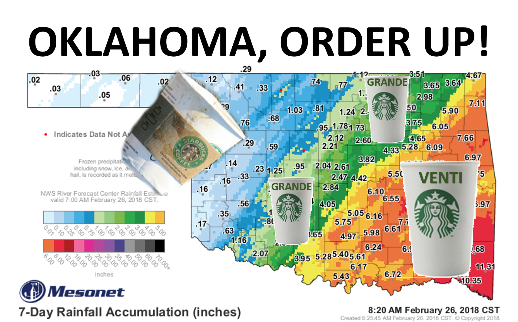
I don't drink coffee (I pretty much stick to a diet of pickle juice and canned
ham), so I'm not sure of the proper ordering technique at Starbuck's. That's
opposed to Braum's, where I can order a hot fudge sundae AND grab a loaf of bread
and gallon of milk without a hitch. Now let me show you a graphic of the actual
rainfall, or in some cases melted ice, that we've received in the last week.
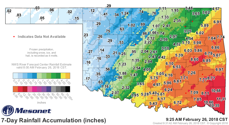
ZOUNDS! 11+ inches down in the SE. Fantastic. Drought ender.
But then again...
ZOUNDS! Two-hundredths of an inch in the Panhandle. Not good.
So these maps look much better for most, but still terrible for some.

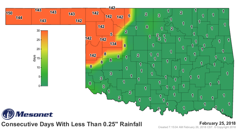
We even managed to end some historic moisture-free streaks for Woodward and
Hooker. The streak ends of 136 days at Hooker when their ice melted and 0.06"
entered their water budget. Woodward lasted 133 days, garnering a whopping
0.29 inches. Sorry to say, but for Hooker that streak may have ended, but it
didn't REALLY end. Six hundredths isn't going to do squat for their water woes.
Laverne broke their streak at 134 with 0.15 inches, which probably evaporated
as fast as it fell.
The 120-day rainfall maps show the same mixed bag:

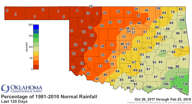

So you can see we have changed the drought story across eastern Oklahoma,
especially across far SE OK. But drought continues in full force across the
NW quarter-to-half of the state, albeit with increased improvements as you go
southeast. Another clue, in addition to the lessening of the oranges and
reds on that pct of normal map would be the burn ban map. Looks strangely
similar to the rainfall map.
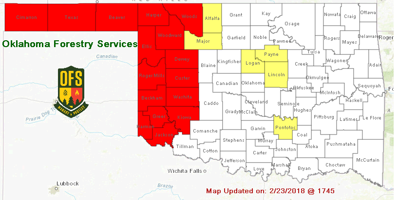
Remember that the red counties are under the Governor's burn ban while the
yellow counties are those under a County Commissioner's burn ban. Some of those
may drop off as those bodies meet. But the western quarter of the state is
still solidly in the burn ban regime because their wildfire conditions will
continue to be elevated/critical as we go forward. Two things will change that...
rainfall and the spring green up.
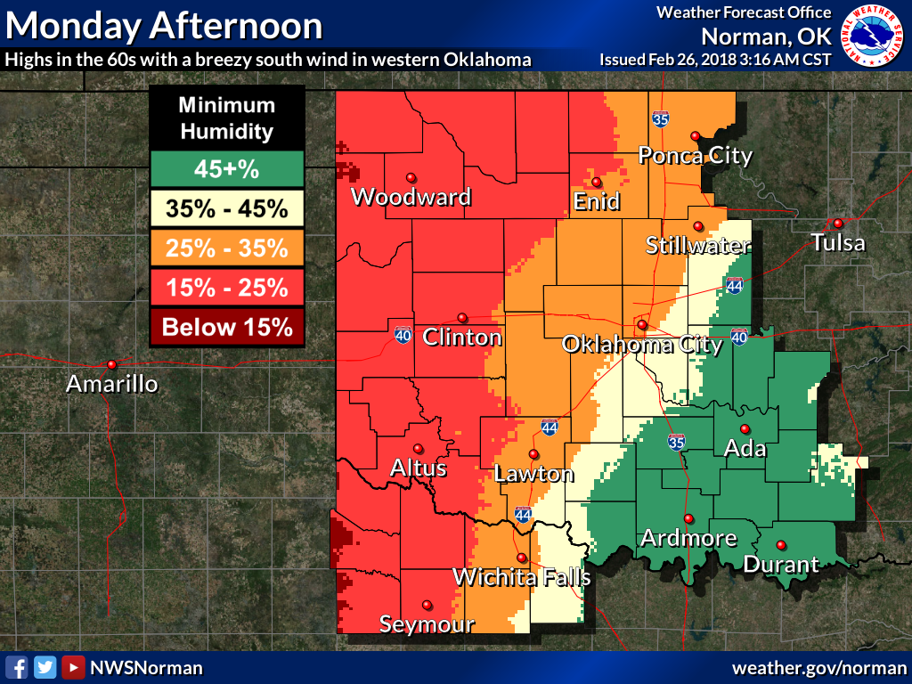
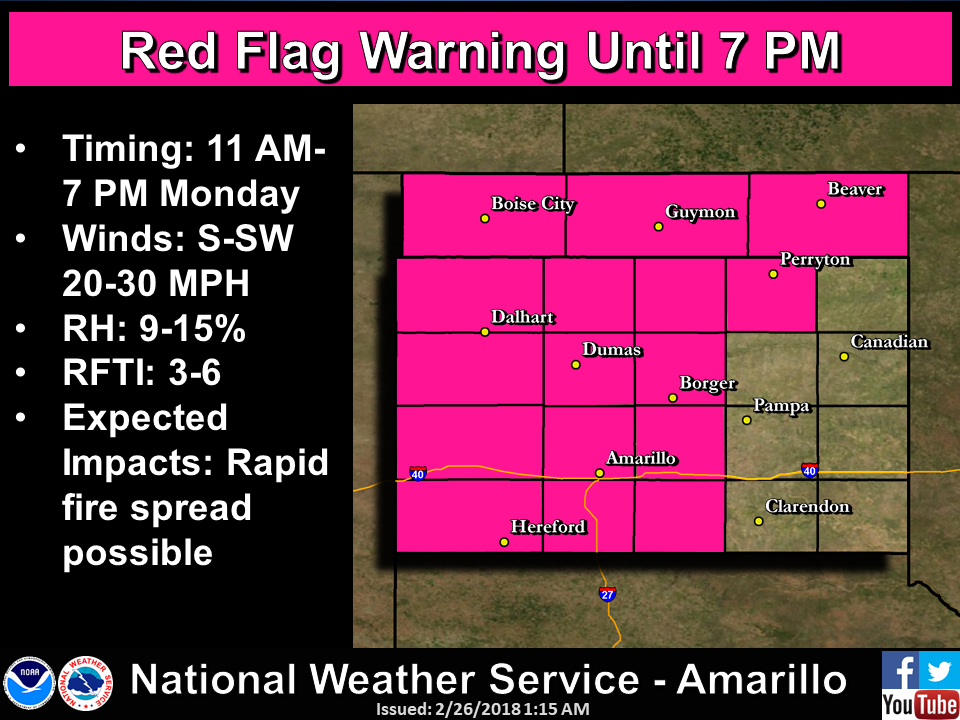
So here comes the fire danger once again!
And here comes the "sorry western Oklahoma" rain chances for tomorrow and
Wednesday."
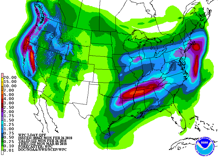
Drought removal/intensification shall continue, it appears.
Gary McManus
State Climatologist
Oklahoma Mesonet
Oklahoma Climatological Survey
(405) 325-2253
gmcmanus@mesonet.org
February 26 in Mesonet History
| Record | Value | Station | Year |
|---|---|---|---|
| Maximum Temperature | 93°F | MANG | 2024 |
| Minimum Temperature | 0°F | BOIS | 2002 |
| Maximum Rainfall | 1.61 inches | NOWA | 1997 |
Mesonet records begin in 1994.
Search by Date
If you're a bit off, don't worry, because just like horseshoes, “almost” counts on the Ticker website!