Ticker for February 20, 2018
MESONET TICKER ... MESONET TICKER ... MESONET TICKER ... MESONET TICKER ...
February 20, 2018 February 20, 2018 February 20, 2018 February 20, 2018
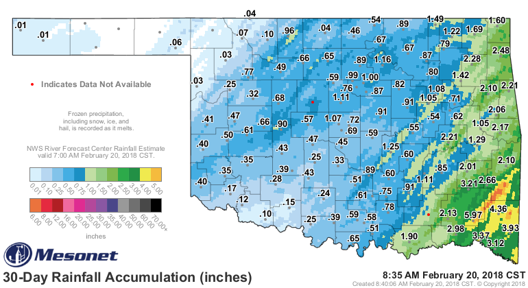
Glory Glory Hallelujah!

That sure do look purty, don't it (that's Okie for "That sure does look pretty,
does it not)? We could go with the rain gauge half empty version, which is "NW OK
still missing out," but we're hoping they'll get some eventually. So we're going
with the rain gauge half full version of RAIN, GLORIOUS RAIN! It's still not a
drought-buster in any part of the state...yet.
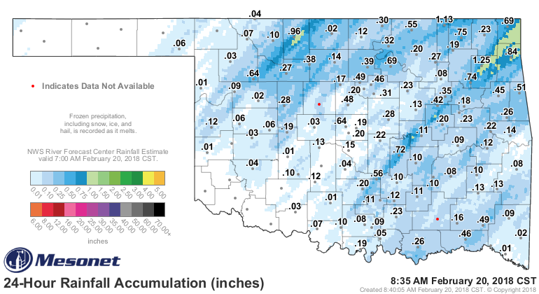
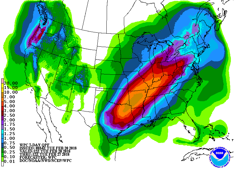
But it could get there.
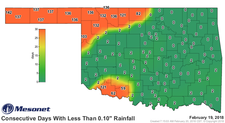
So we're still dealing with long-term consecutive day periods without significant
rainfall across the NW and far SW. Woodward and Hooker have still gone 132
consecutive days without a drop of moisture. Surely that will change soon.
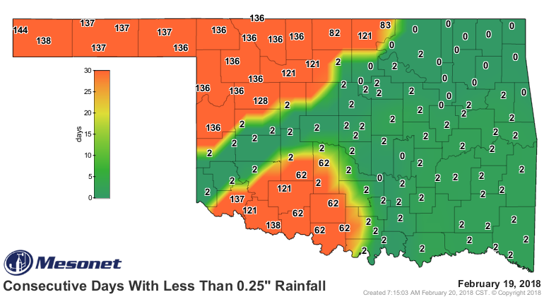
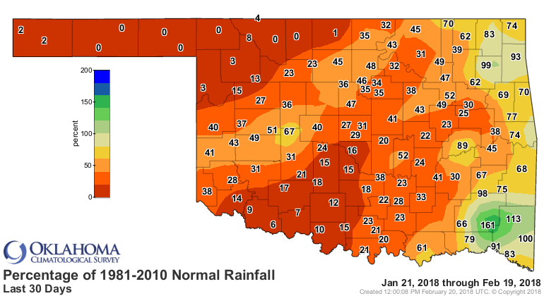
However, we have had some chinks show up in this drought's armor. The deep
reds and oranges of the significant deficits over 30 days are starting to fade
in places.
Okay, but here's another problem. That freezing line has plunged south, as far
as I44.
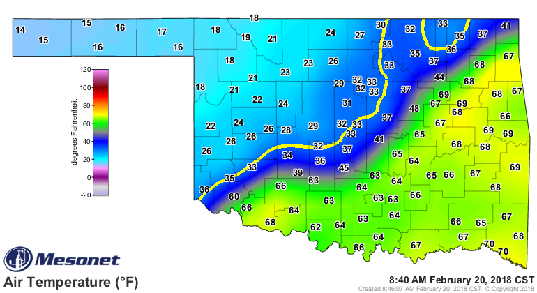
Okay, precip falling...temperatures below freezing. It doesn't take a
State Climatologist to figure out we're in trouble. No, seriously, I couldn't
figure it out, so I turned to the NWS and sure enough, we now have winter
weather advisories out for much of northern and central Oklahoma.
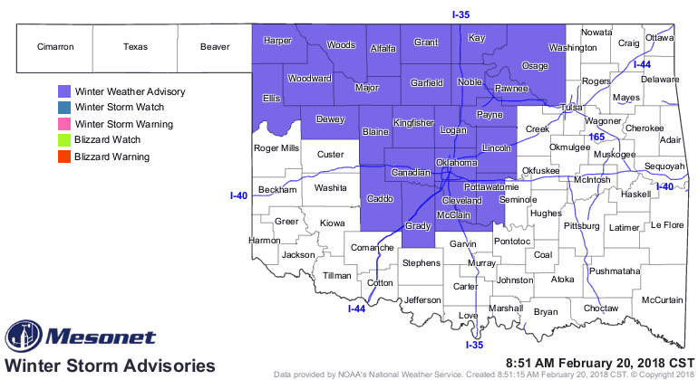
That runs until noon in the far NW and 5pm farther to the south, so you'll
need to slow down and travel safely. Those bridges and overpasses are going
to get dangerous.
To complete the storm's sundry impacts, we have a flood watch across far
eastern Oklahoma, with flood warnings already in place.
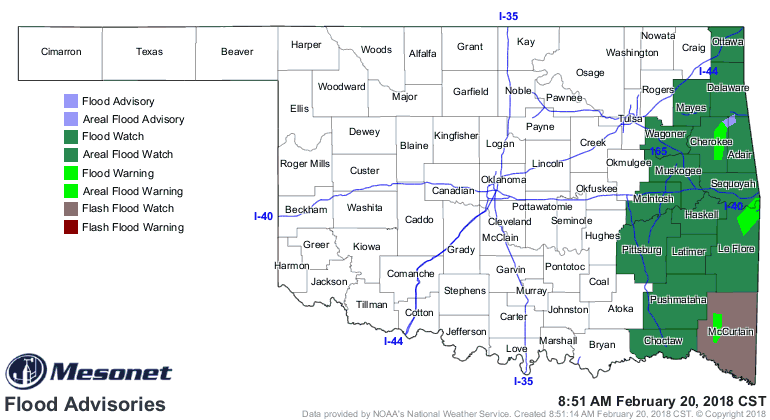
So let's keep it up, Mother Nature. We do need a push back to the NW, but
again, we'll take it!
Gary McManus
State Climatologist
Oklahoma Mesonet
Oklahoma Climatological Survey
(405) 325-2253
gmcmanus@mesonet.org
February 20 in Mesonet History
| Record | Value | Station | Year |
|---|---|---|---|
| Maximum Temperature | 86°F | ALTU | 2016 |
| Minimum Temperature | -7°F | FORA | 2025 |
| Maximum Rainfall | 4.01 inches | SALL | 1997 |
Mesonet records begin in 1994.
Search by Date
If you're a bit off, don't worry, because just like horseshoes, “almost” counts on the Ticker website!