Ticker for February 14, 2018
MESONET TICKER ... MESONET TICKER ... MESONET TICKER ... MESONET TICKER ...
February 14, 2018 February 14, 2018 February 14, 2018 February 14, 2018
Like a rolling stone
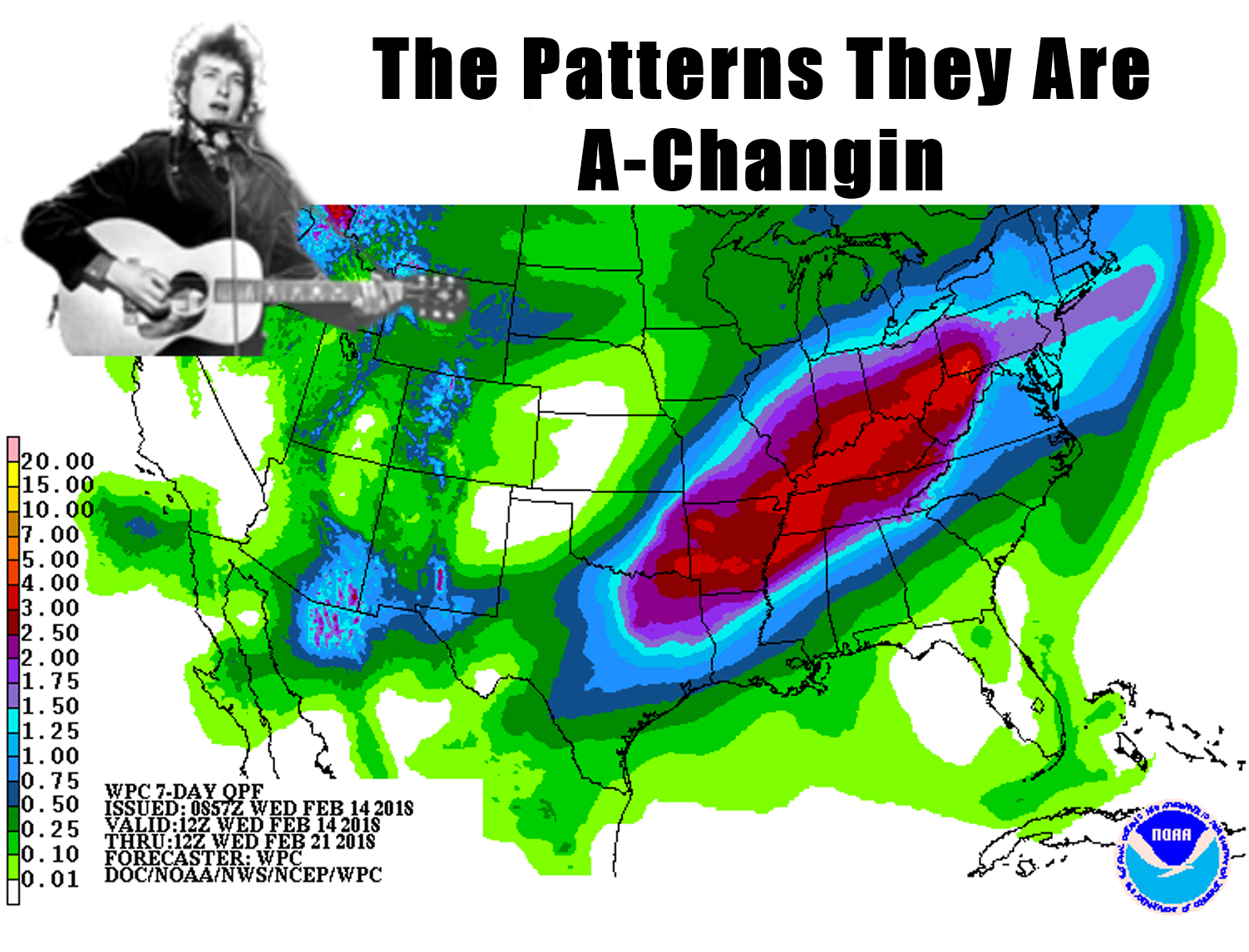
Bob Dylan (Nobel Prize winner, remember!) wouldn't lie, would he? Well, sort of.
The pattern does appear to be changing somewhat as we switch from this incessant
upper-level northwesterly flow and its fast-moving dry cold fronts. That is
already being reflected in the low clouds and fog as moisture starts to move up
from the south into Oklahoma.
The problem, as you can see in the 7-day precip forecast being serenaded by Mr.
Dylan, is that there is still a doughnut hole of dryness across northwestern
Oklahoma. I'm not sure when that's going to change. It might be awhile.
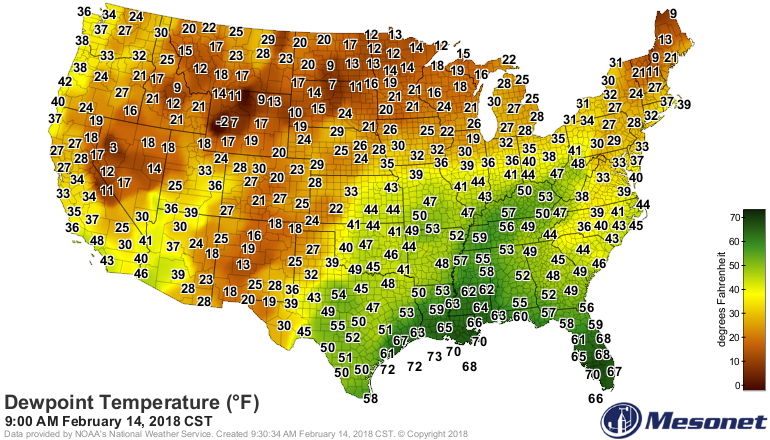
However, if we can get drought alleviated across the southeastern half of the
state, then we can concentrate all fire power on those star destroyers! Wait,
Admiral Ackbar flashback...then we can concentrate all our resources on
northwestern Oklahoma. That's not a fix, but a smaller percentage of the state
to worry about, at least.
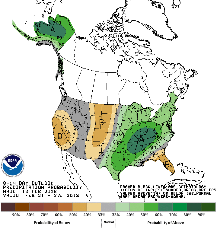
A lot of our hopes are riding on a storm system early next week. Unfortunately,
it's still a ways out and as we've seen lately, it's not set in stone just
yet. I'm still waiting for the 7-day precip forecasts to start pushing
everything to the southeast. A bit of drought PTSD, I think. However, the fire
danger and damage to wheat will continue. Expect near record temperatures
today and tomorrow (yay?), and also near-critical fire danger (boo!).
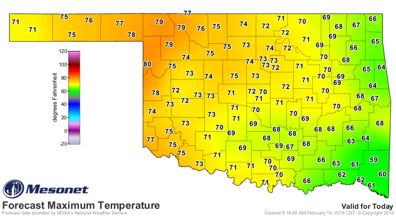
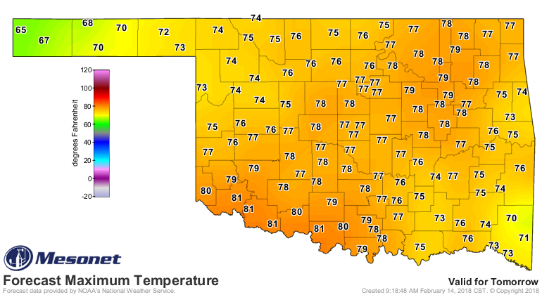
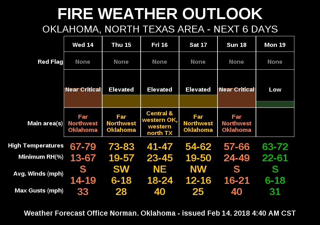
So the wheat (what's left) is going to be thirsty. The fuels are dry as kindling.
The evaporation will go up the next couple of days, with more days coming soon
as we approach spring. Perfect time for a pattern change. Now we just need
to get northwestern OK into the act!
Gary McManus
State Climatologist
Oklahoma Mesonet
Oklahoma Climatological Survey
(405) 325-2253
gmcmanus@mesonet.org
February 14 in Mesonet History
| Record | Value | Station | Year |
|---|---|---|---|
| Maximum Temperature | 84°F | FREE | 2018 |
| Minimum Temperature | -18°F | KENT | 2021 |
| Maximum Rainfall | 3.30 inches | MTHE | 2017 |
Mesonet records begin in 1994.
Search by Date
If you're a bit off, don't worry, because just like horseshoes, “almost” counts on the Ticker website!