Ticker for January 10, 2018
MESONET TICKER ... MESONET TICKER ... MESONET TICKER ... MESONET TICKER ...
January 10, 2018 January 10, 2018 January 10, 2018 January 10, 2018
Coldtergeist
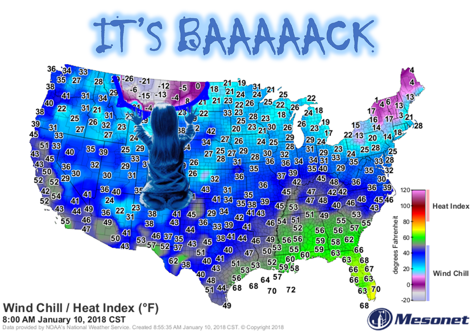
Yeah, be afraid. Be very afraid. That blob of frigid air you see up along the
Canadian border, just starting to ooze its way down south, will soon be in the
state. And winter, and I'm talking REAL winter, will be back. Nice little run
we had there. Normal-to-above normal temps. Break out your longjohns, jims,
jerrys, jans and any other "J" named clothing you can find.
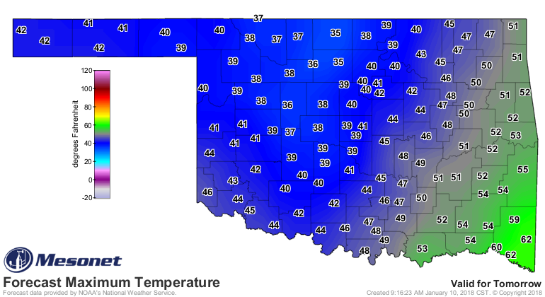
We're going to get the first shot of cold air early tomorrow and through the day
from due north, then that blob of cold air will pull away for a day or so, then
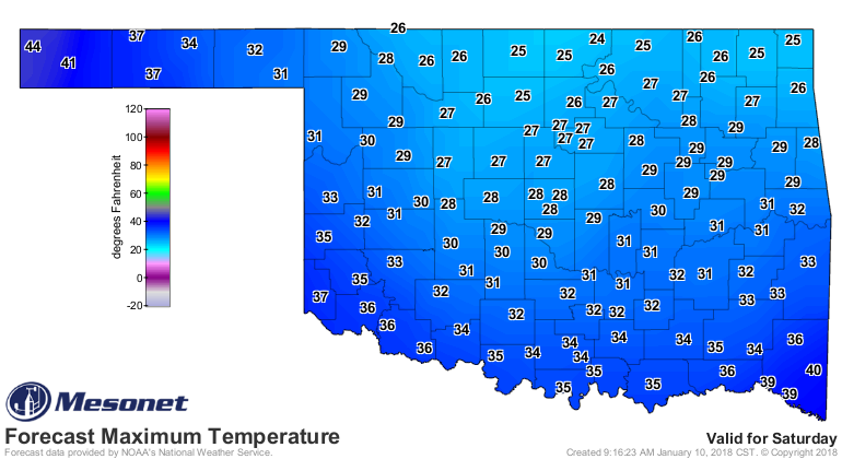
we get to do the whole thing over again this weekend in the form of a backdoor
cold front (from the NE).
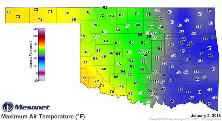
So less of this (sorry eastern Oklahoma, you got hosed by clouds, while western
OK had sun and strong southerly winds)

and more of this
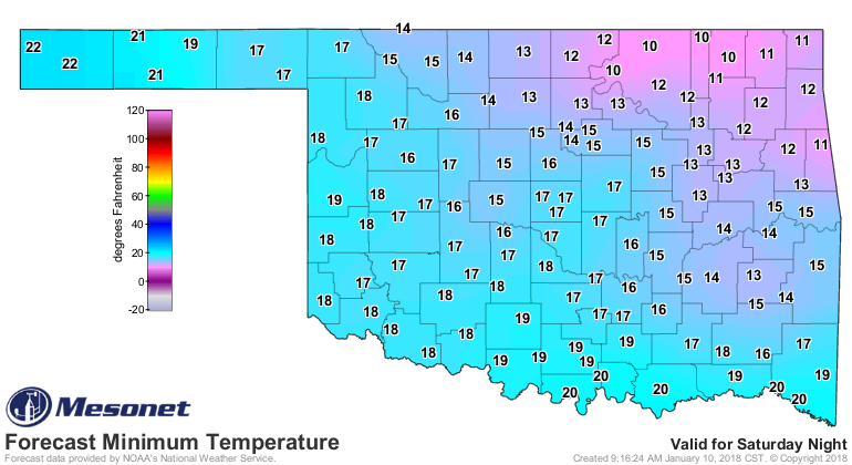
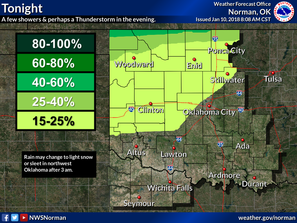
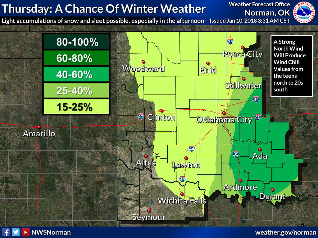
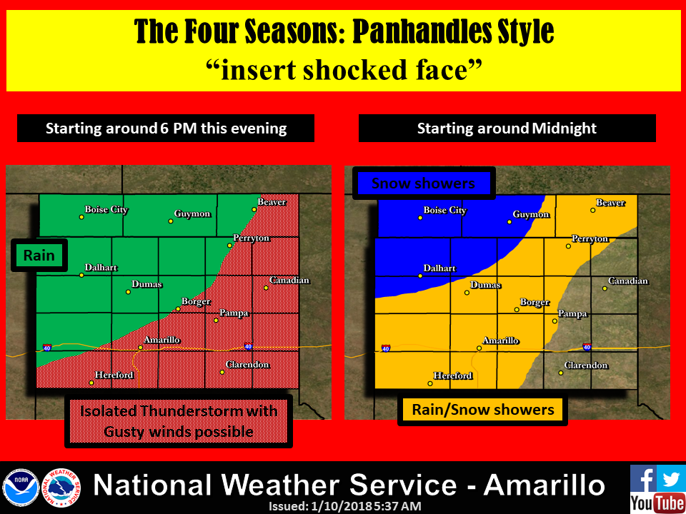
There might be a bit of snow and ice behind the front, perhaps a bit of light
rain ahead of the front. Nothing major on either side, but as we know, a little
bit of ice goes a long way if you're out driving in it. Here are a few tidbits
from our NWS friends detailing some of our precip chances.
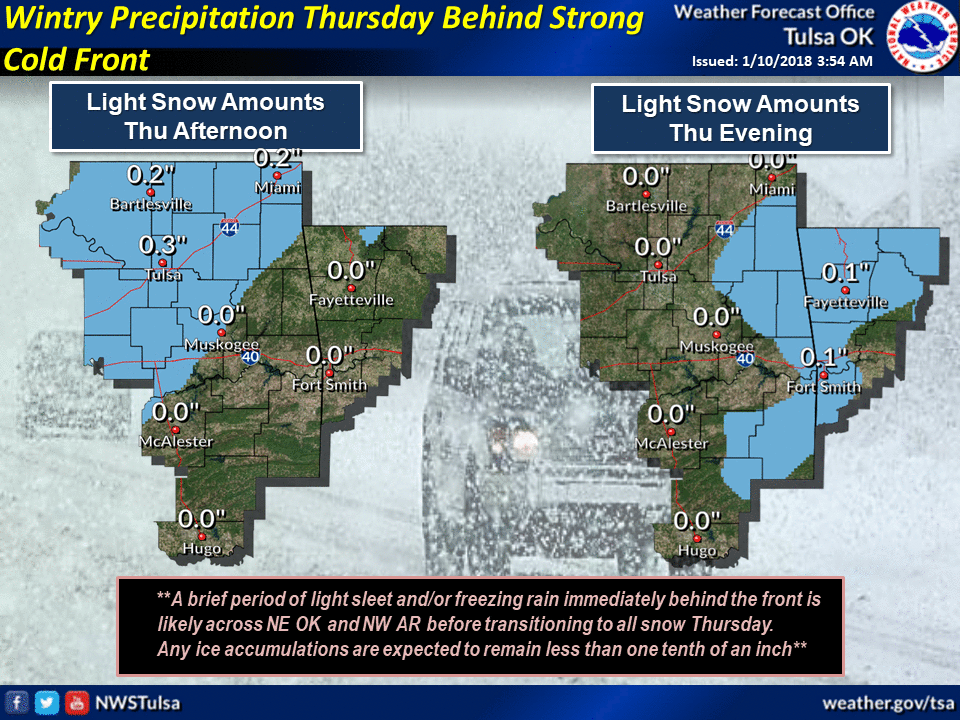
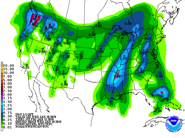
Maybe a tenth to a quarter of an inch up north? They'll take it, trust me!
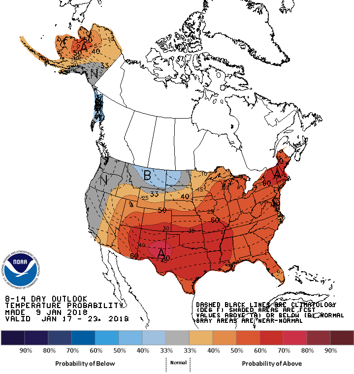
But remember, this is Oklahoma where the winters are fleeting even if it's
sleeting.
So be afraid, but never fear.
What?
Gary McManus
State Climatologist
Oklahoma Mesonet
Oklahoma Climatological Survey
(405) 325-2253
gmcmanus@mesonet.org
January 10 in Mesonet History
| Record | Value | Station | Year |
|---|---|---|---|
| Maximum Temperature | 84°F | BURN | 2023 |
| Minimum Temperature | -6°F | VINI | 2010 |
| Maximum Rainfall | 4.31″ | MADI | 2020 |
Mesonet records begin in 1994.
Search by Date
If you're a bit off, don't worry, because just like horseshoes, “almost” counts on the Ticker website!