Ticker for January 8, 2018
MESONET TICKER ... MESONET TICKER ... MESONET TICKER ... MESONET TICKER ...
January 8, 2018 January 8, 2018 January 8, 2018 January 8, 2018
Happy Drought Day
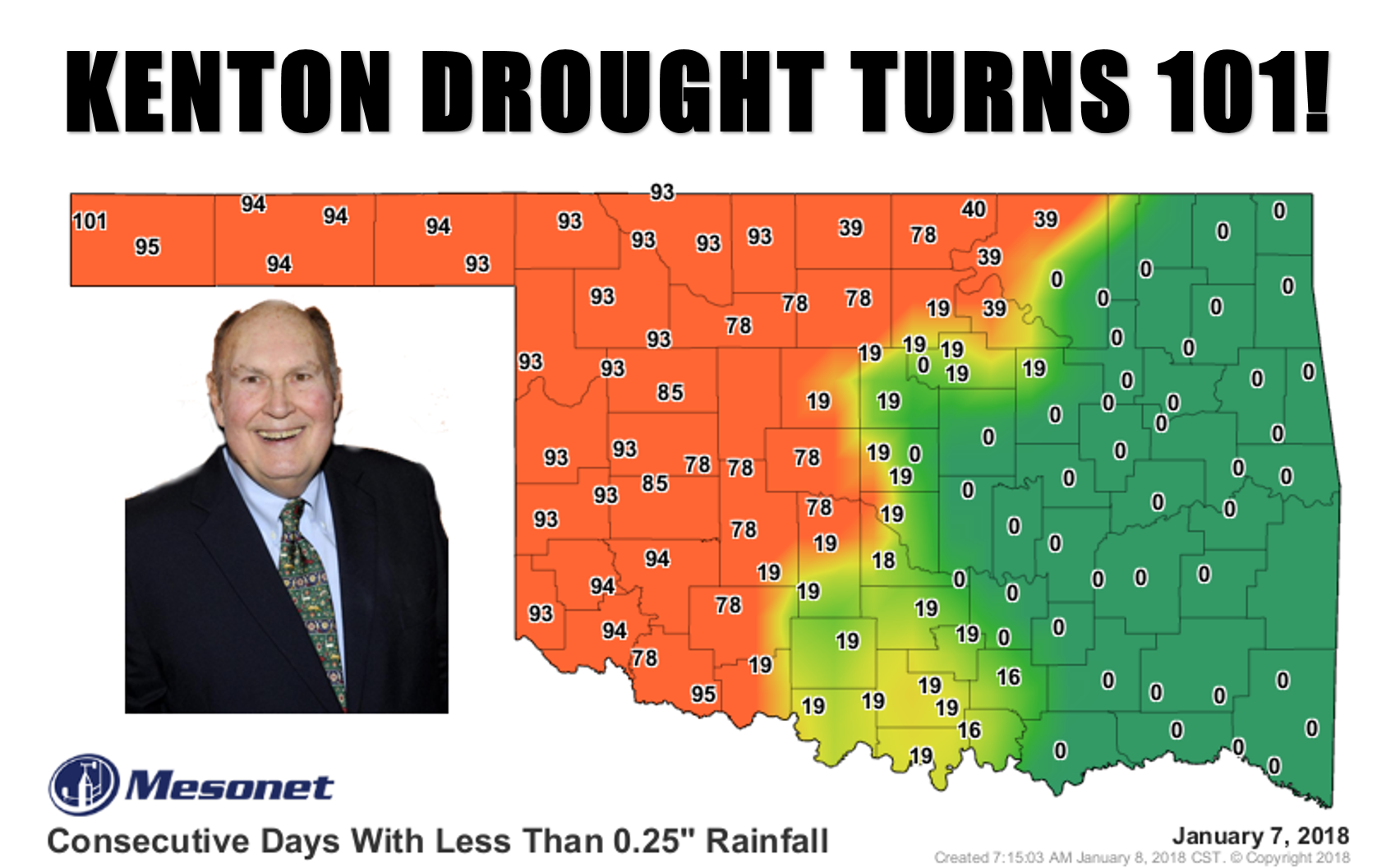
That's Willard Scott, kids. You see, he used to...ahh, never mind. If you're not
already halfway on your way to what he used to congratulate folks for, you
needn't worry. But here's a secret. That graphic only goes through yesterday, so
Kenton's streak of days without at least a quarter inch of rainfall turns 102
today. But here's ANOTHER secret. The drought is longer than that at some places
And here's yet ANOTHER secret.
Sorry, but that's secret. I'm no rat.
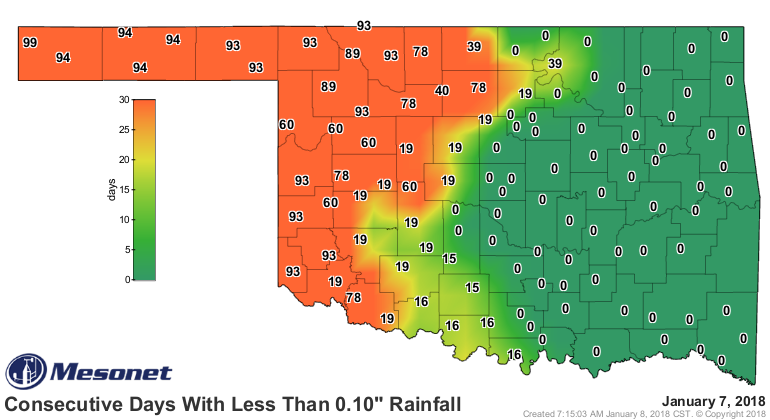
For Kenton, and NW OK, the moisture-less streak continues. Even the days without
at least a tenth of an inch map looks pretty scary.
There was another modicum of moisture across eastern OK, but the western half was
left wanting yet again.
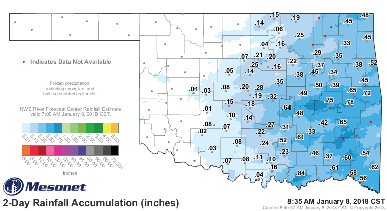
Very sad. And the 90-day rainfall maps and stats are very troubling.
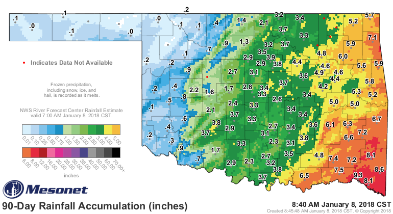
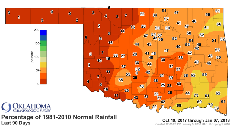
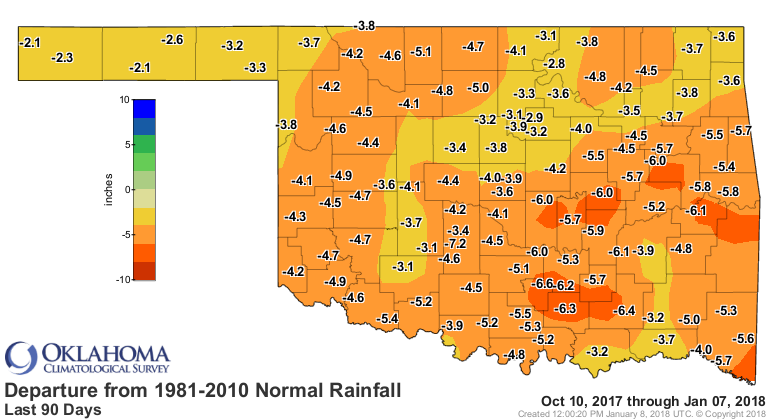
Moisture deficits over the last 90 days range from over 6 inches in the east
to 2-3 inches in the west. Compared to normal, however, that amounts 50-60 pct
of normal in the east and less than 10 pct of normal in the west. For places
like Beaver, which hasn't had a single drop of moisture in 94 days as of today,
that's ZERO percent of normal. Those deficits add up.
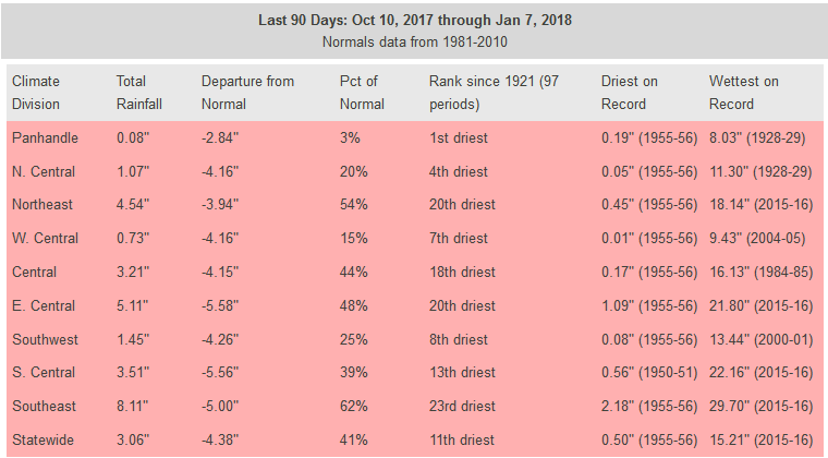
For the state as whole, that last 90 days have been the 11th driest since at
least 1921 with a statewide average of 3.06", 4.38" below normal. For The
Panhandle (and Harper and Ellis counties), it is THE driest last 90 days with
an average of...0.08"??? 3 pct of normal???
Yikes.
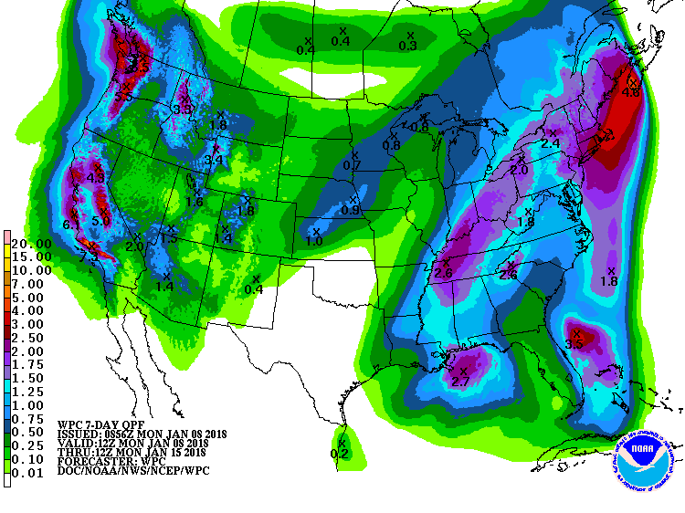
Hope for the future? Well, not really in the short term. There is a bit of
moisture showing up across the far western Panhandle on the 7-day precip
forecast, but that's iffy at best.
Longer term? No. Unless you're hoping for "Normal" amounts of precip, which for
this period pretty much means diddly.
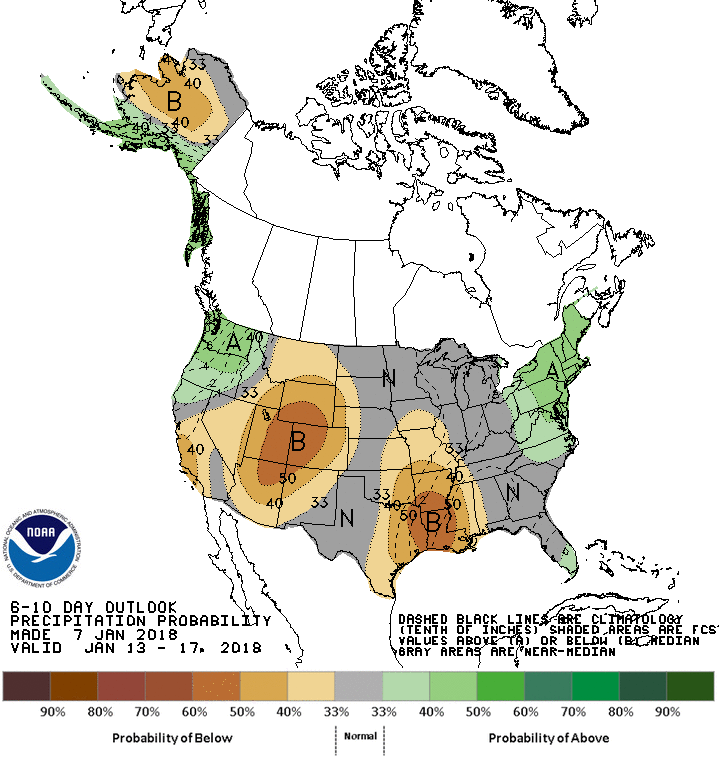
Go even farther out and you see a return to the dreaded ridging that left us
high and dry for so long (BOO!!), and warmer than normal (YAYYYY!!!).

Well there you have it. We're breaking birthdays left and right across western
Oklahoma. And not the good kind.
Gary McManus
State Climatologist
Oklahoma Mesonet
Oklahoma Climatological Survey
(405) 325-2253
gmcmanus@mesonet.org
January 8 in Mesonet History
| Record | Value | Station | Year |
|---|---|---|---|
| Maximum Temperature | 79°F | CAMA | 2002 |
| Minimum Temperature | -6°F | GOOD | 2010 |
| Maximum Rainfall | 1.43 inches | CLOU | 2024 |
Mesonet records begin in 1994.
Search by Date
If you're a bit off, don't worry, because just like horseshoes, “almost” counts on the Ticker website!