Ticker for January 11, 2018
MESONET TICKER ... MESONET TICKER ... MESONET TICKER ... MESONET TICKER ...
January 11, 2018 January 11, 2018 January 11, 2018 January 11, 2018
Winter fights back!
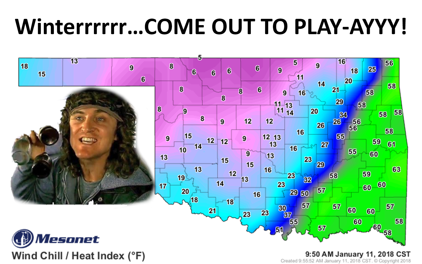
Once a cult classic, winter has gone mainstream this year. Cult classics are a bit
strange or unfamiliar, but you're fascinated by it. You were okay with it
the first time, but not something you want to see over and over. Maybe once a
year. Nobody puts a cult classic on replay. It becomes mainstream. At least sorta
different than what we're used to over the last few winters. So after our 3rd or
4th mainstream, it would appear as if Mother Nature is going for the big money
of sequels rather than small independent seasons.
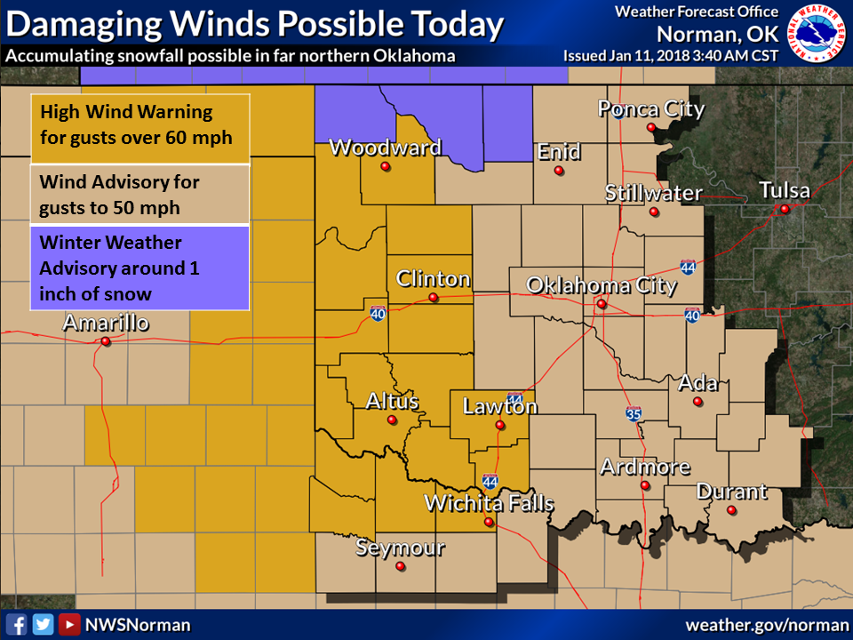
We have ridiculous amounts of wind today behind this front, with gusts in the 30-
40 mph range, but easily hitting the 50s out west. And there are several wind
advisories out with cautionary tales of damage being possible from those stronger
gusts (woe be to those power lines that accumulate anything frozen!).


There will also be some frozen precip to contend with, but the biggest concern
will be those bridges and underpasses (and underpants, if you drive too fast in
the snow today). But, with any snow or other types of frozen precip, the winds
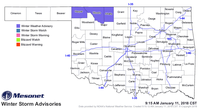
will reduce visibility while it's falling. A Winter Weather Advisory is still
in effect for NW OK, and you should stay up with the latest advisories in case
those are extended south and east.
"...Snow and blowing snow expected throughout the morning...
A potent storm system will result in very strong north winds and
snow through late this morning. Visibilities could drop below one
half mile at times, making travel extremely difficult. Snow
accumulation on roadways will also result in slippery road
conditions. Travel will be extremely difficult for high profile
vehicles."
Here's a bit more about the wintry weather from our friends at the NWS. The
images are a bit dated, to be sure to check in with them from time to time.
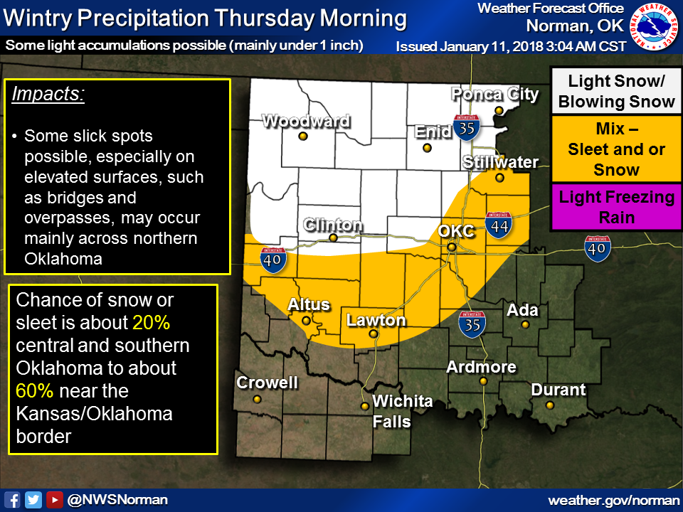
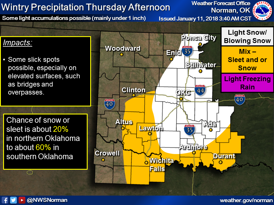
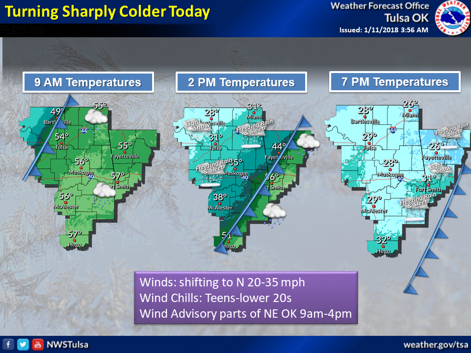
We're not talking a snowstorm here, but just enough to make your life a bit
more difficult.
On top of all that, we have drought continuing to plague the state, and the
situation has worsened across much western and northern Oklahoma. The newest
Drought Monitor map shows Extreme (D3) drought now in the far NW, just a few
weeks after it was removed in the SE. And the Severe (D2) drought/Moderate (D1)
drought surrounding that area has also increased.
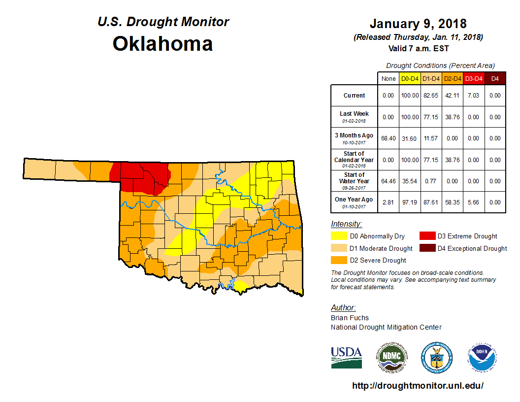
We're back with 7% of the state in Extreme drought, 42% in at least Severe
drought, and 83% in some sort of drought. The remaining 17% is "Abnormally Dry"
and in danger of headed towards drought if significant moisture is not
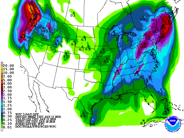
soon realized. But if you're looking for a 7-day drought-busting forecast, this
ain't it.
What can I say, we're going to have to battle our way through winter to spring
it would appear.
Gary McManus
State Climatologist
Oklahoma Mesonet
Oklahoma Climatological Survey
(405) 325-2253
gmcmanus@mesonet.org
January 11 in Mesonet History
| Record | Value | Station | Year |
|---|---|---|---|
| Maximum Temperature | 85°F | BURN | 2023 |
| Minimum Temperature | -8°F | HOOK | 2011 |
| Maximum Rainfall | 2.07″ | BBOW | 1998 |
Mesonet records begin in 1994.
Search by Date
If you're a bit off, don't worry, because just like horseshoes, “almost” counts on the Ticker website!