Ticker for November 22, 2017
MESONET TICKER ... MESONET TICKER ... MESONET TICKER ... MESONET TICKER ...
November 22, 2017 November 22, 2017 November 22, 2017 November 22, 2017
Plains, Trains and Drought
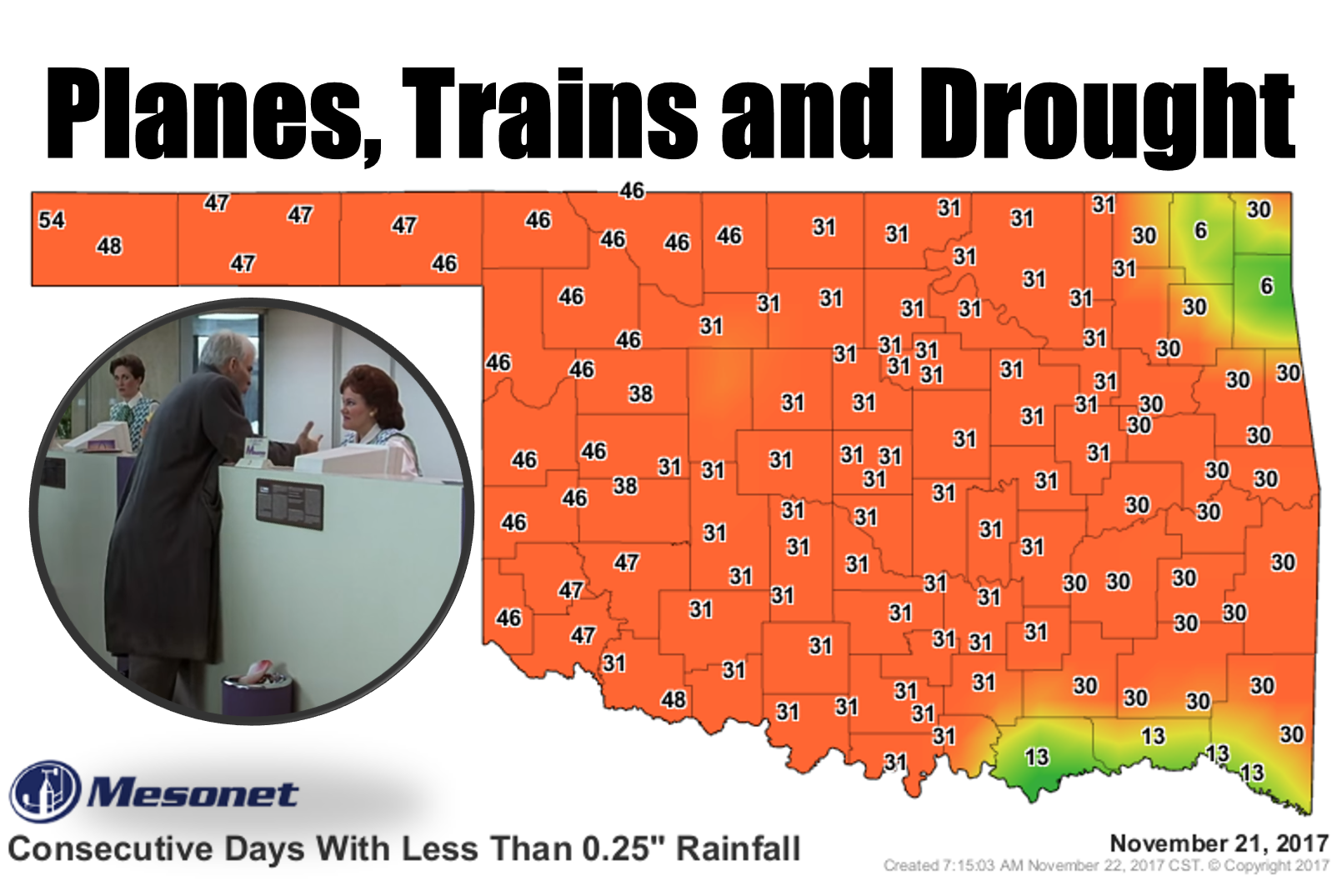
Merry Christmas! Why am I skipping Thanksgiving cheer this year? Because
apparently that's the next time that crab apple named Mother Nature is going to
let it rain again. Oh, it won't be that bad. We'll get moisture again. The only
problem is that it's bad NOW. So it's obviously going to get worse before it
gets better. We've already seen an uptick in fires across the state, and reports
of stressed winter wheat are also pouring in (as well as some of those other
fall/winter crops). The newest Drought Monitor map shows the continuing
intensification of drought across Oklahoma.
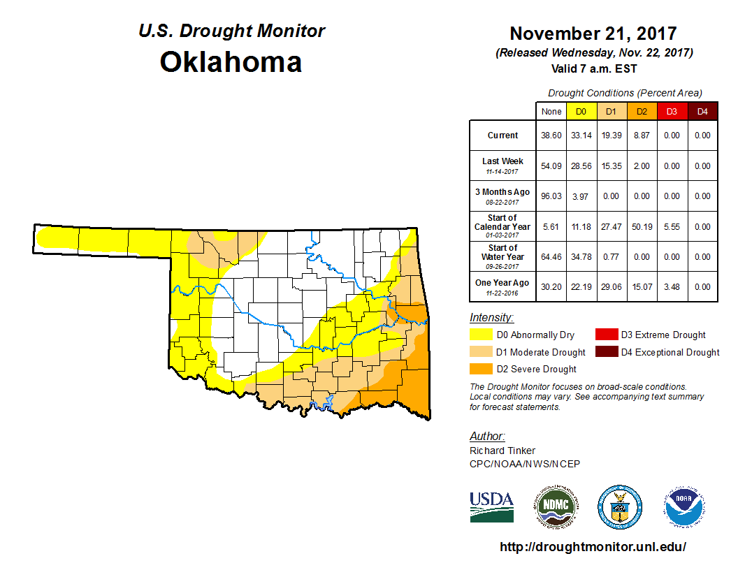
Getting ugly, eh? We now have SEVERE drought (D2) creeping up from the southeast
as well as moderate drought. Then we have the abnormally dry conditions (in this
case, a precursor to drought development) barging its way into the Panhandle
and far western Oklahoma. The rainfall maps tell the story. We're bone dry out
to a month, and in some areas its worse than that as we go out to 60, 90, 120+
days. Today I'll concentrate on the 30-day monstrosities, and a few others that
will chap your lips.
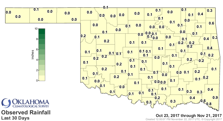

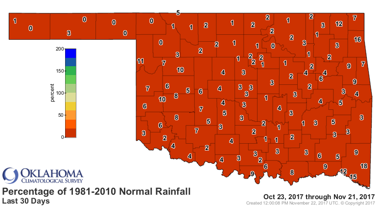
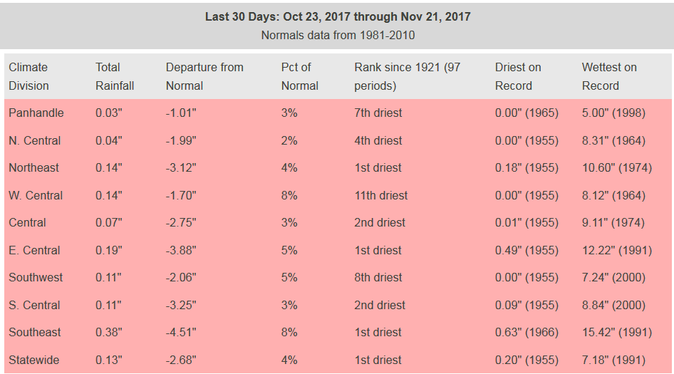
You're reading that right. The last 30 days are THE driest on record since at
least 1921. That encompasses Oct. 23-Nov. 21. For the month thus far, we are at
a statewide average of 0.12 inches. The driest November on record is 0.13 inches
set back in 1949. Can we get a hundredth of an inch in the next 8 days. Looking
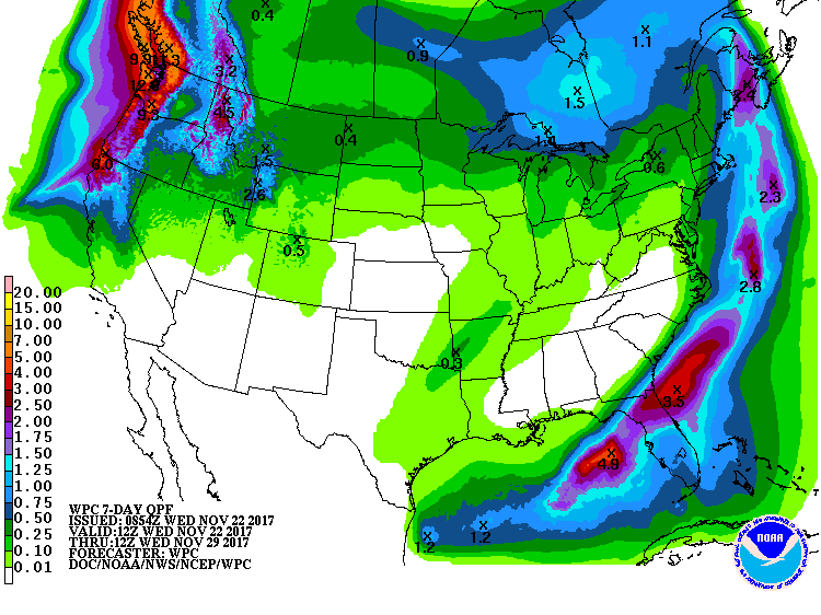
kind of iffy. We may break that record. The 7-day rainfall forecast is as dry
as your mother-in-law's turkey across most of the state. Our only hope so far
is a swath of moisture interacting with a frontal passage at the end of this
period down in the far SE.
Which is also reflected in CPC's Nov. 29-Dec. 5 precip outlook.
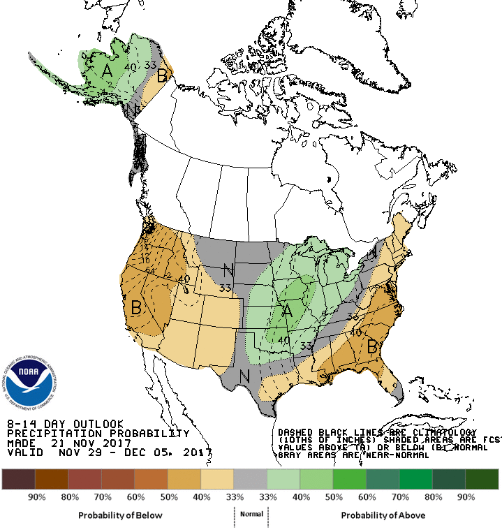
So it's dry, probably going to get drier, and it definitely looks warmer than
normal more often than not over the next couple of weeks.
Hey, be thankful. That first map could be of wind gusts!
Happy Thanksgiving to you and yours.
Gary McManus
State Climatologist
Oklahoma Mesonet
Oklahoma Climatological Survey
(405) 325-2253
gmcmanus@mesonet.org
November 22 in Mesonet History
| Record | Value | Station | Year |
|---|---|---|---|
| Maximum Temperature | 87°F | HOOK | 1998 |
| Minimum Temperature | 12°F | HOOK | 2007 |
| Maximum Rainfall | 4.22″ | KETC | 2014 |
Mesonet records begin in 1994.
Search by Date
If you're a bit off, don't worry, because just like horseshoes, “almost” counts on the Ticker website!