Ticker for November 16, 2017
MESONET TICKER ... MESONET TICKER ... MESONET TICKER ... MESONET TICKER ...
November 16, 2017 November 16, 2017 November 16, 2017 November 16, 2017
48 Days Later
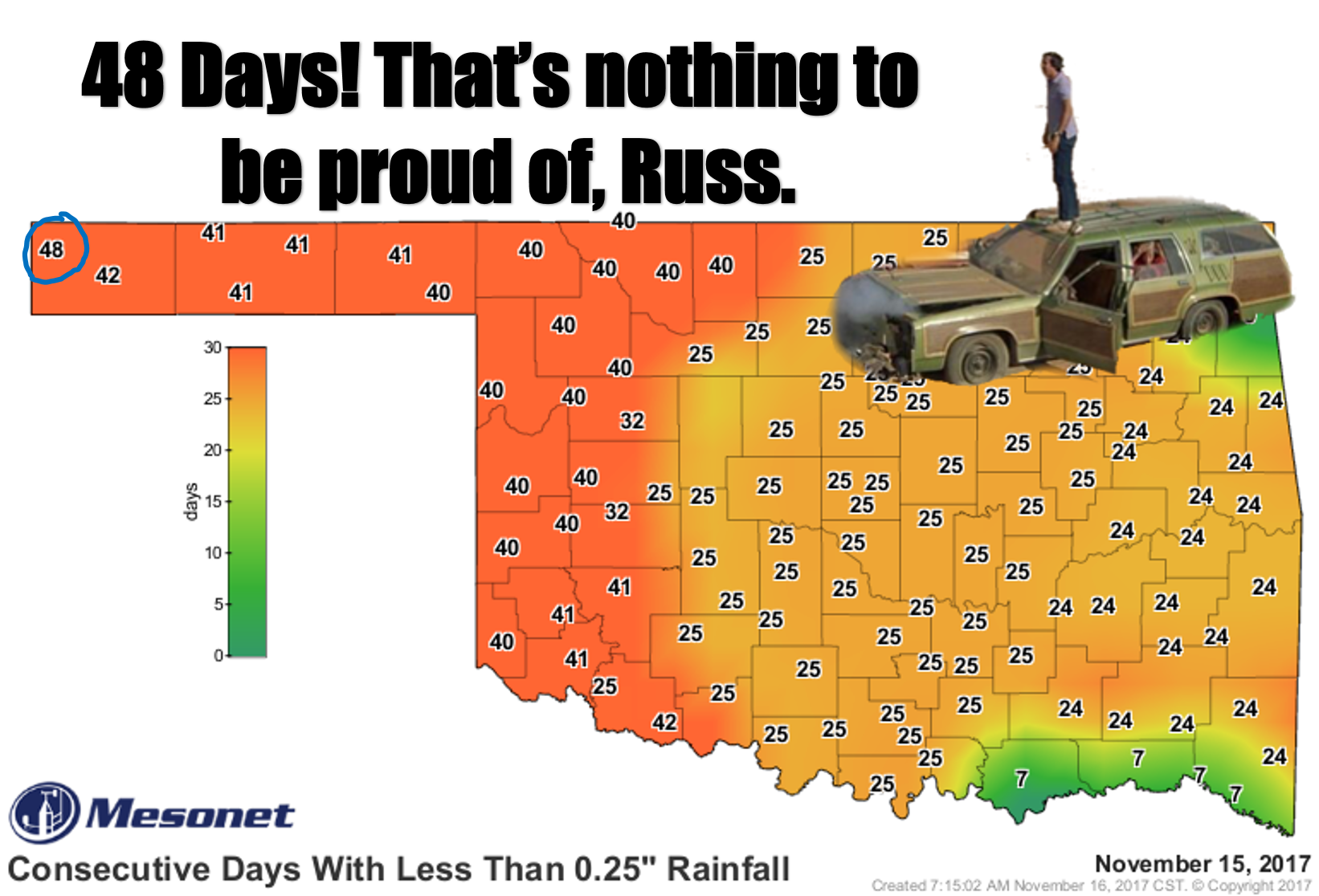
It was actually 50 yards that Clark Griswald was secretly proud of, but the
analogy works. It has now been 48 days (make that 49 after today...coming up on
50) since the western OK Panhandle has seen at least a quarter-inch of rain in
a single day. Now to be a bit more precise, the offending station at Kenton has
had 0.21 inches over that 48 day period spread out a day here and a day there.
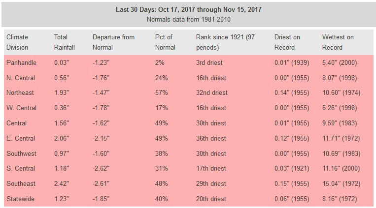
If you look at the statistics and maps over the last 30 days, it's pretty
horrifying.
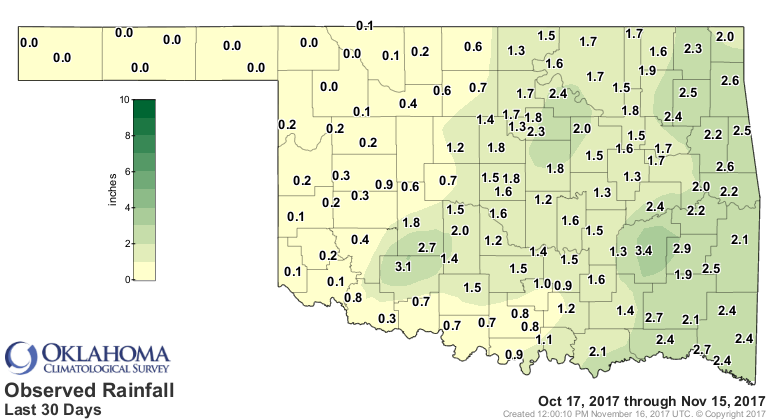
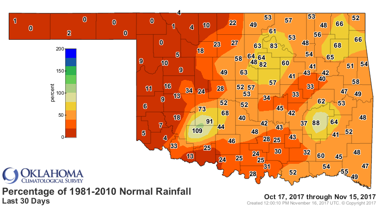
That's a lot of zeroes out that way, and in all, the 3rd driest last 30 days on
record for that section of the state.
And things aren't too much better if you go back a month and a half to the
beginning of October.
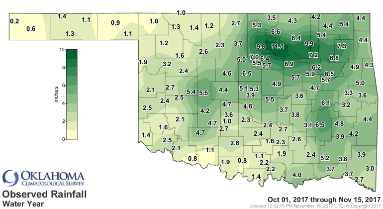
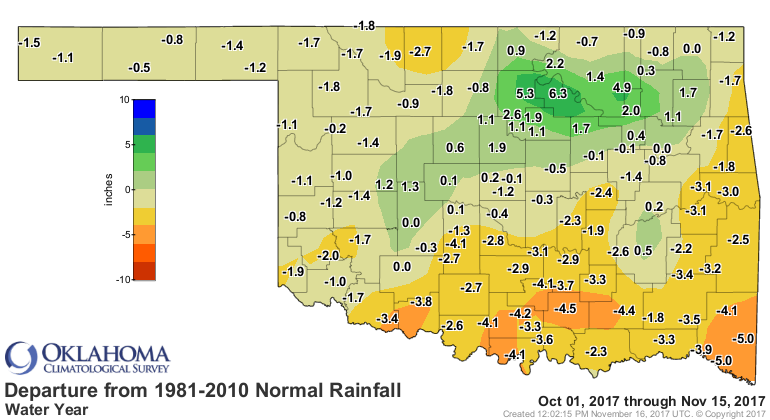
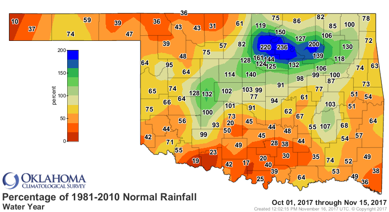
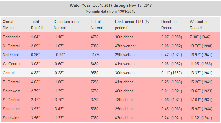
The message here is that it is drying out across Oklahoma. We're lucky that
we've seen our first killing frost over much of the state and our vegetation
has started to go dormant or dead. The trouble out west is the fact that winter
wheat is still SOMEWHAT actively growing and needs a drink of water. So for all
the reasons given above, as well as some not-quite-alarming-but-bad-enough
reports from the field out that way, we asked for an expansion of both moderate
drought (D1) and Abnormally Dry conditions (D0) across much of western and
southern Oklahoma on the latest Drought Monitor map.
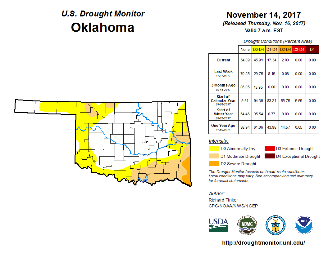
That is a rather rapid jump from 8% of the state in at least D1 drought a week
ago (2% two weeks ago) to 17%. And 2% of that 17% is Severe Drought (D2) down in
far SE OK. Now much like my scalp, I've always been fairly transparent with you
folks on the Drought Monitor process, so for those in the far western Panhandle
where it's been close to 50 days with decent moisture...I did ask for D0 in that
area but didn't receive it, despite some negative reports from the field. We
realize that it is the dry season out that way (and everywhere else), but there
is as noted earlier a crop that needs moisture, and there are also
growing fire danger concerns which are at least partially impacted by drought
conditions in the cool season.
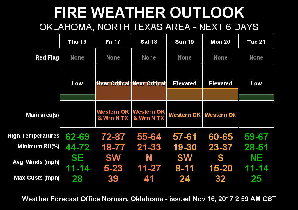
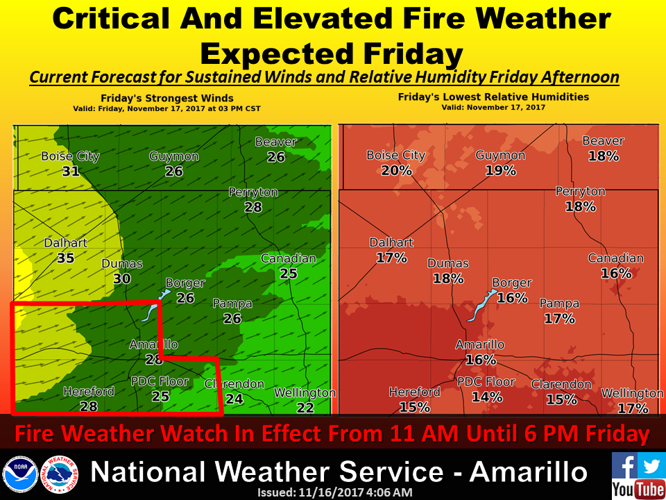
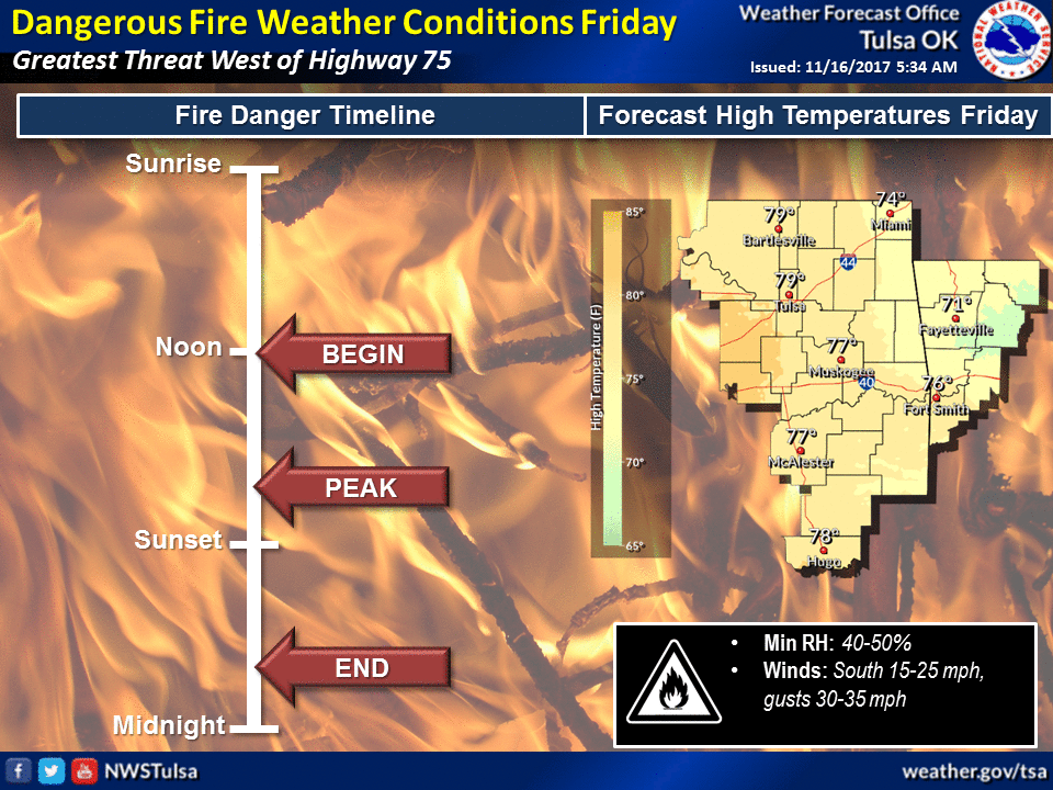
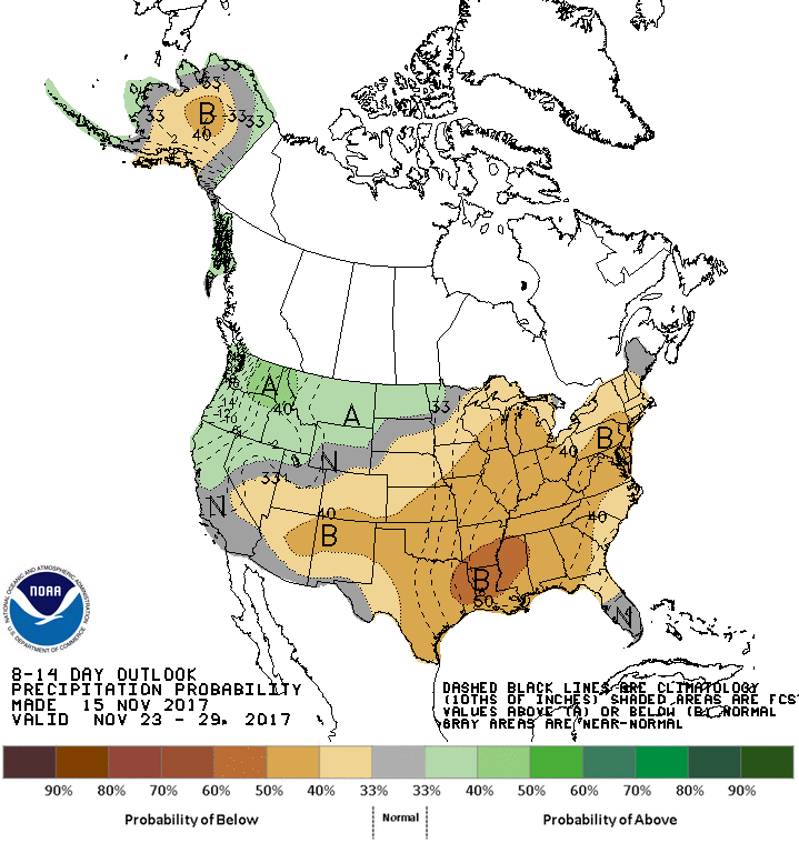
Unfortunately, the chances for precip are bleak at best for at least the next
7 days, and possibly the next two weeks.

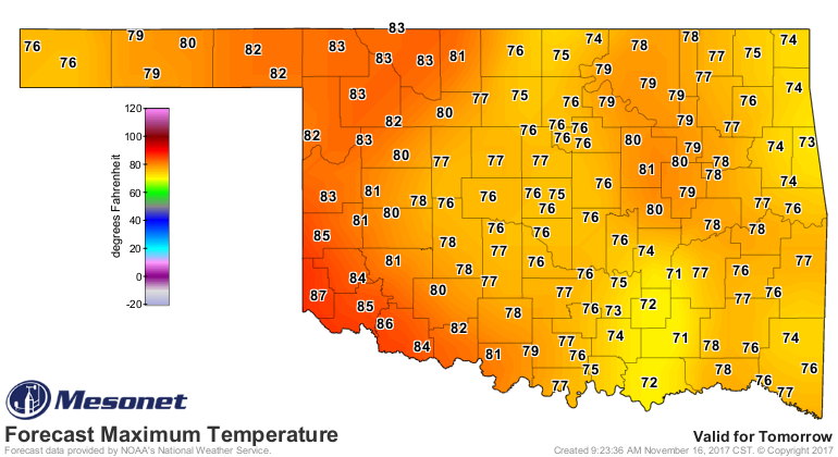
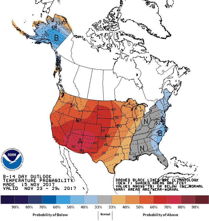
Another complicating factor is the return of warm weather, which along with the
wind and low RHs will continue to leech more moisture than normal for this
time of year.
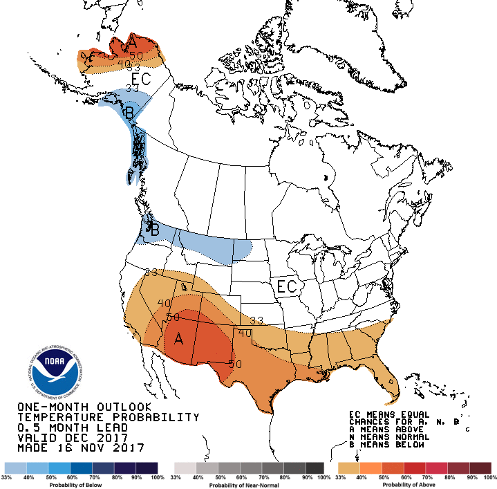
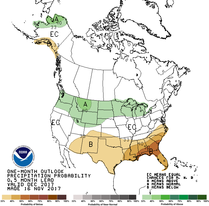
The December outlooks released today don't exactly spell drought relief either,
but remember what we've cautioned before...extreme weather events CAN AND WILL
happen even during longer periods of dry, boring weather.
And the updated winter (Dec-Feb) outlook still favors warmer and drier than
normal weather as well (same warning of extreme events applies).
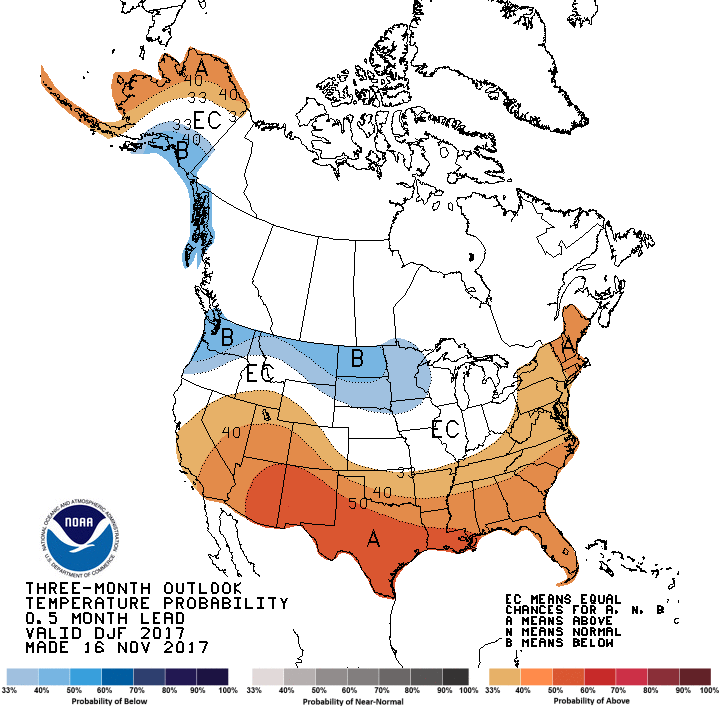
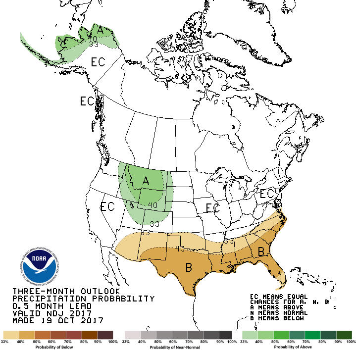
Those December and Dec-Feb outlooks reflect the La Nina currently coalescing
in the equatorial pacific, which enhanced our odds of a drier and warmer than
normal cool season.
So the takeaways, at least from me. I'm worried about the winter wheat crop
out west. It needs a drink of water. I'm worried about the upcoming fire season,
or at least those days when the proper conditions for extreme fire danger arise.
Lots of vegetation from out mild winter and extremely wet August are just
waiting for a spark.
And finally, how long can it be dry during "the dry season" in the western
Panhandle before it's actually abnormally dry? We're coming up on 50 days.
60? 75?
The solution is simple...let's get some rain and snow in here and solve the
problem before we find out.
Gary McManus
State Climatologist
Oklahoma Mesonet
Oklahoma Climatological Survey
(405) 325-2253
gmcmanus@mesonet.org
November 16 in Mesonet History
| Record | Value | Station | Year |
|---|---|---|---|
| Maximum Temperature | 90°F | BUFF | 2016 |
| Minimum Temperature | 7°F | KENT | 1997 |
| Maximum Rainfall | 3.72″ | PAWN | 1996 |
Mesonet records begin in 1994.
Search by Date
If you're a bit off, don't worry, because just like horseshoes, “almost” counts on the Ticker website!