Ticker for October 10, 2017
MESONET TICKER ... MESONET TICKER ... MESONET TICKER ... MESONET TICKER ...
October 10, 2017 October 10, 2017 October 10, 2017 October 10, 2017
Froze-lahoma

Well, we flirted with it several times, but it's finally happened. Oklahoma has
done froze over. Those wind chills in the Panhandle NEED TO STAY IN THE PANHANDLE!
And remember, those are wind chills, so they're the impact of the wind along with
the temperatures on your body. The actual air temperatures aren't too different,
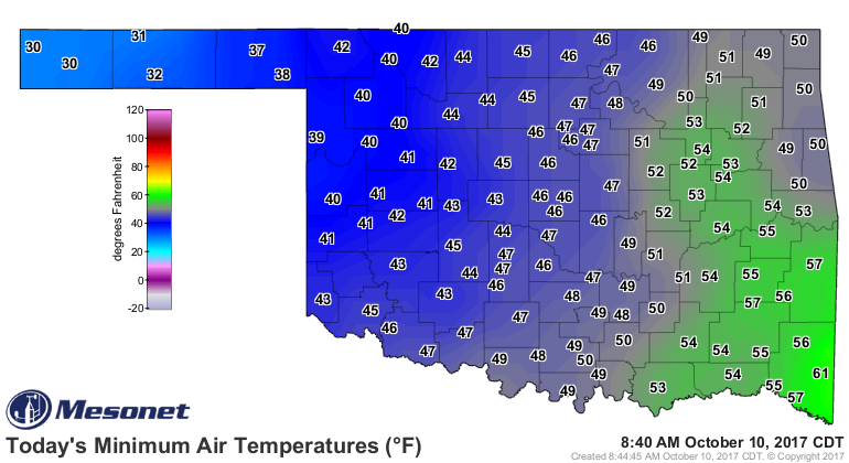
however, and the Mesonet low temperature map shows the season's first freeze
struck all the way into the heart of the state as far east as Goodwell (okay, the
heart of the Panhandle, which really is the heart of the state...sorry down-
staters!).
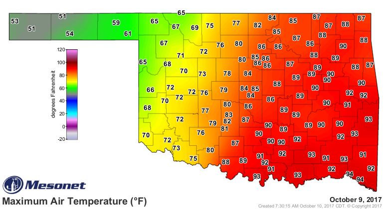
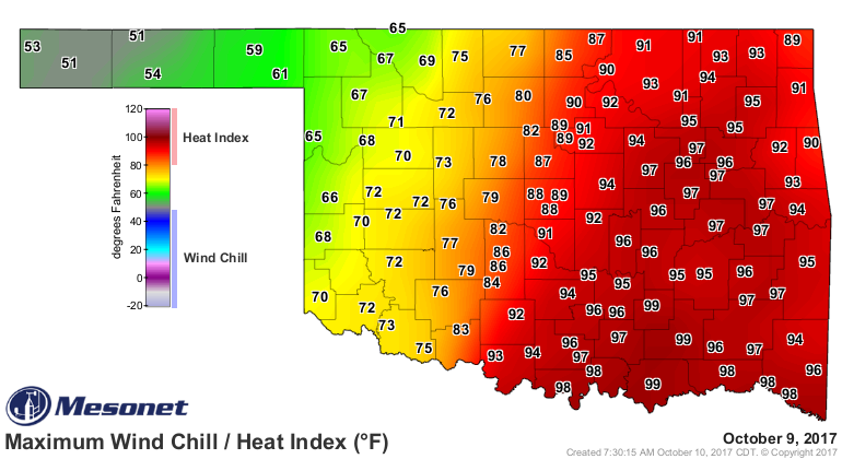
This is all thanks to yesterday's front which brought maniacally mangled high
temperature and heat index maps as it moved through.
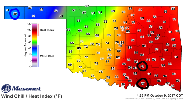
And you may have seen this map from yesterday on our Facebook page from 4:25pm
where it felt as cold as 29 degrees at Boise City in the Panhandle and as hot
as 97 degrees from Durant and Centrahoma in the southeast!
It also brought rain and storms to eastern Oklahoma, although the rain didn't
amount to too much, and the severe weather stayed to a minimum.
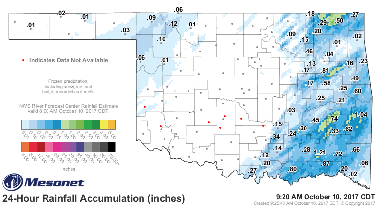
Well, after that burst of excitement we're back on the roller coaster headed
up, ready for the next plunge sometime around Sunday or so.
Our friends at the NWS give us a good overview of the coming week into the
weekend.
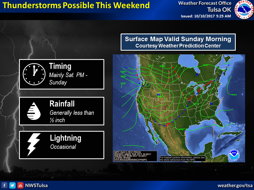

So that front will be a bit less exciting it would appear, and it does look warm
after that.
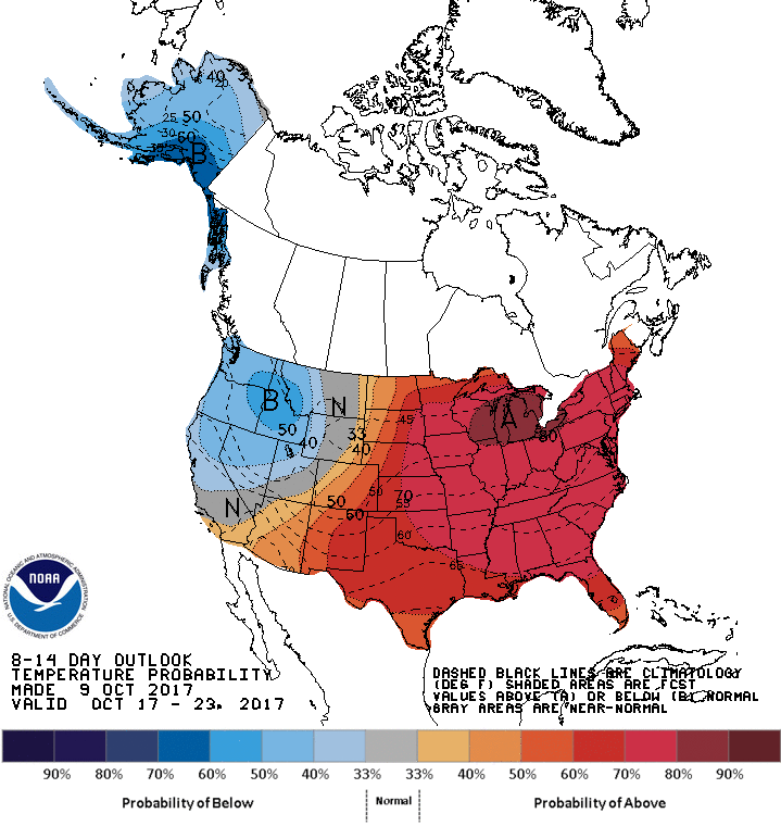
Goodness!
Gary McManus
State Climatologist
Oklahoma Mesonet
Oklahoma Climatological Survey
(405) 325-2253
gmcmanus@mesonet.org
October 10 in Mesonet History
| Record | Value | Station | Year |
|---|---|---|---|
| Maximum Temperature | 97°F | GRA2 | 2024 |
| Minimum Temperature | 21°F | BRIS | 2000 |
| Maximum Rainfall | 4.52 inches | ANTL | 2004 |
Mesonet records begin in 1994.
Search by Date
If you're a bit off, don't worry, because just like horseshoes, “almost” counts on the Ticker website!