Ticker for October 9, 2017
MESONET TICKER ... MESONET TICKER ... MESONET TICKER ... MESONET TICKER ...
October 9, 2017 October 9, 2017 October 9, 2017 October 9, 2017
I'm blue, how 'bout you?
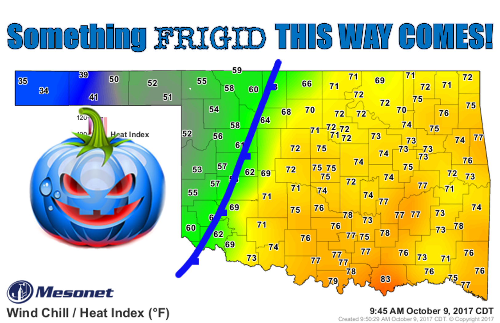
Yeah, prepare to freeze your pumpkins off. And I know this isn't a winter blast,
but it IS the coldest air of the season thus far, and before we're done we'll
see temperatures a good 20-30 degrees cooler than where they've been, patchy
areas of frost, and wind chills up in the northwest below the GEEZ IT'S COLD line.
You can see the progress of the front in the wind field, as well as that colder
air that is filtering in much farther behind it.
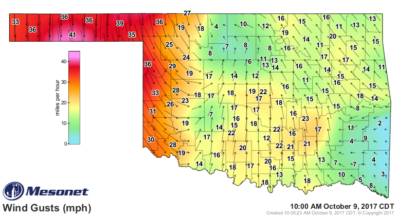
Those winds gusting to over 40 mph behind the front (it's sort of a complicated
setup, with a surface low/front/dryline situation going on) will push east just
a bit, but the worst should stay to the west. HOWEVER, the worst of the weather
itself will probably be farther to the east as storms are expected to go up
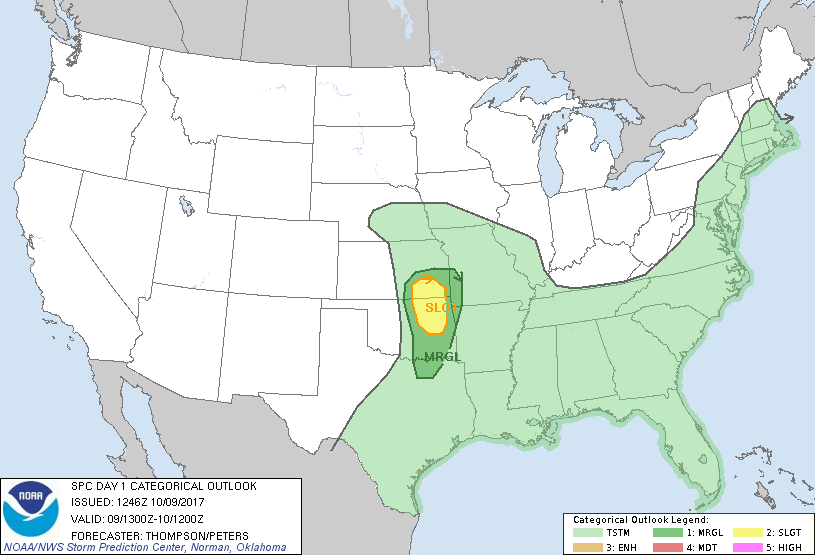
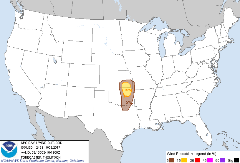
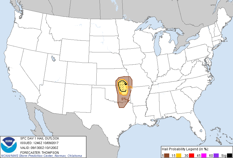
on the dryline/front as it approaches I-35. SPC's day-1 outlook sees a slight
chance for severe weather in that area, with large hail being the primary threat.
However, ALL modes of severe weather are possible.
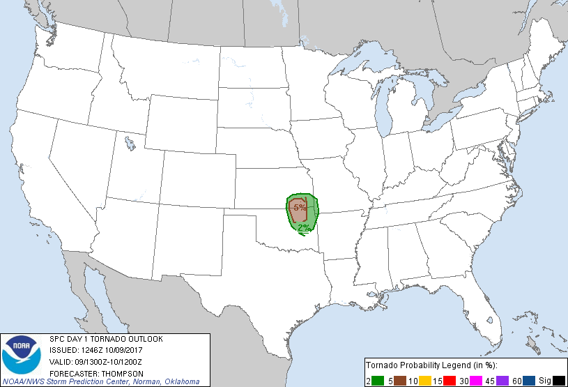
As is always the case in these situations, the current forecast can and probably
will change as the mesoscale features unfold later today and things come into
focus a bit more. All areas close to I-35, if not farther west, should be
prepared for severe weather today.
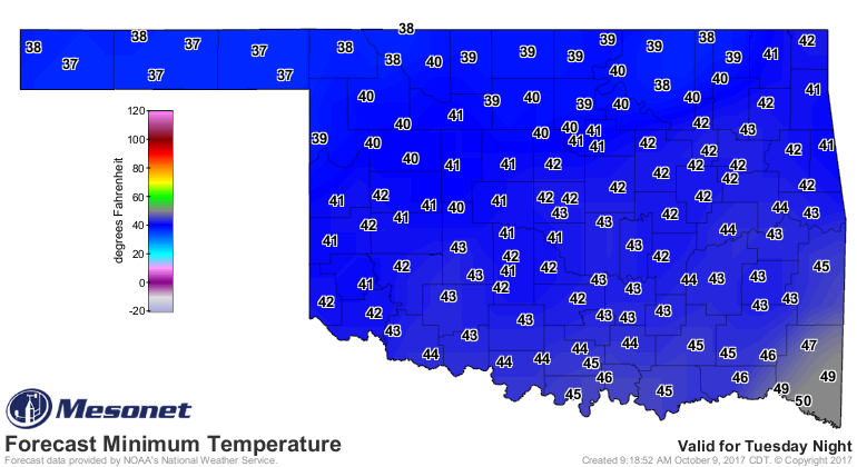
Now, back to the BRRR! How does this low temperature map look to ya?
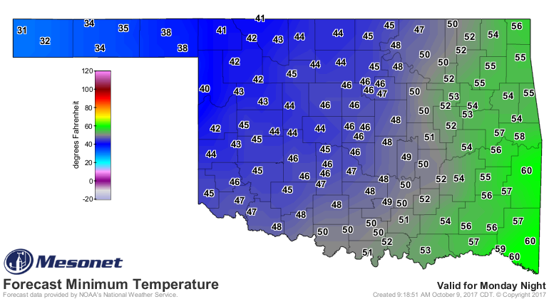
Yes, those are freezing temps (the temperatures themselves aren't freezing...
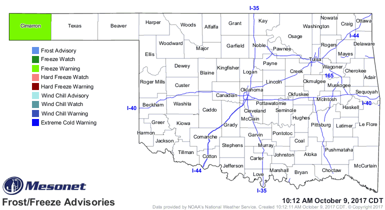
they're just a measurement of YOU freezing) in the Panhandle. Thus, there is a
freeze warning for Cimarron County for tonight.
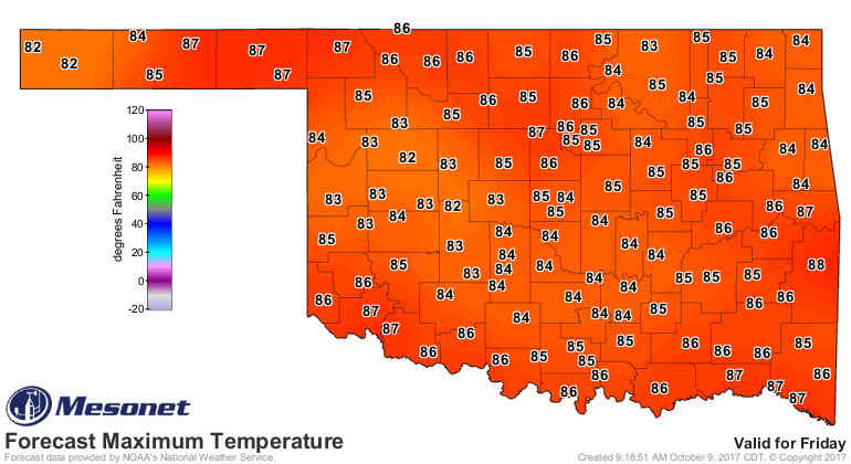
For the rest of us, chilly weather (chili weather, perhaps??) for the next
few days before another nice warm up for the weekend.
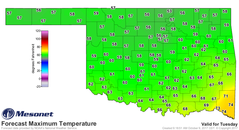
All in all, right in line with the average date of the first fall freeze.
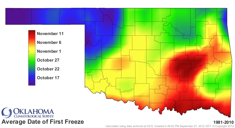
Just don't be shocked if you wake up to frost in low-lying areas tomorrow.
High-lying areas...you'll be cold too.
Gary McManus
State Climatologist
Oklahoma Mesonet
Oklahoma Climatological Survey
(405) 325-2253
gmcmanus@mesonet.org
October 9 in Mesonet History
| Record | Value | Station | Year |
|---|---|---|---|
| Maximum Temperature | 102°F | FREE | 2021 |
| Minimum Temperature | 16°F | ELRE | 2000 |
| Maximum Rainfall | 4.15 inches | WAUR | 1997 |
Mesonet records begin in 1994.
Search by Date
If you're a bit off, don't worry, because just like horseshoes, “almost” counts on the Ticker website!