Ticker for October 12, 2017
MESONET TICKER ... MESONET TICKER ... MESONET TICKER ... MESONET TICKER ...
October 12, 2017 October 12, 2017 October 12, 2017 October 12, 2017
The Drought Monitor giveth
And the Drought Monitor taketh away.
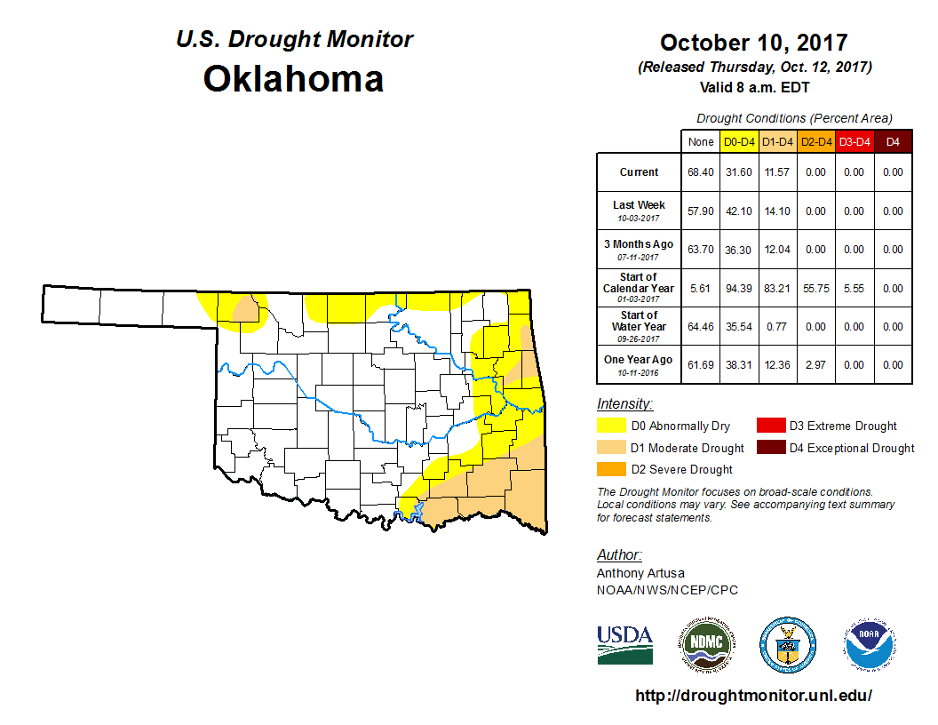
You can see that we did have substantial improvement over NE and NC Oklahoma
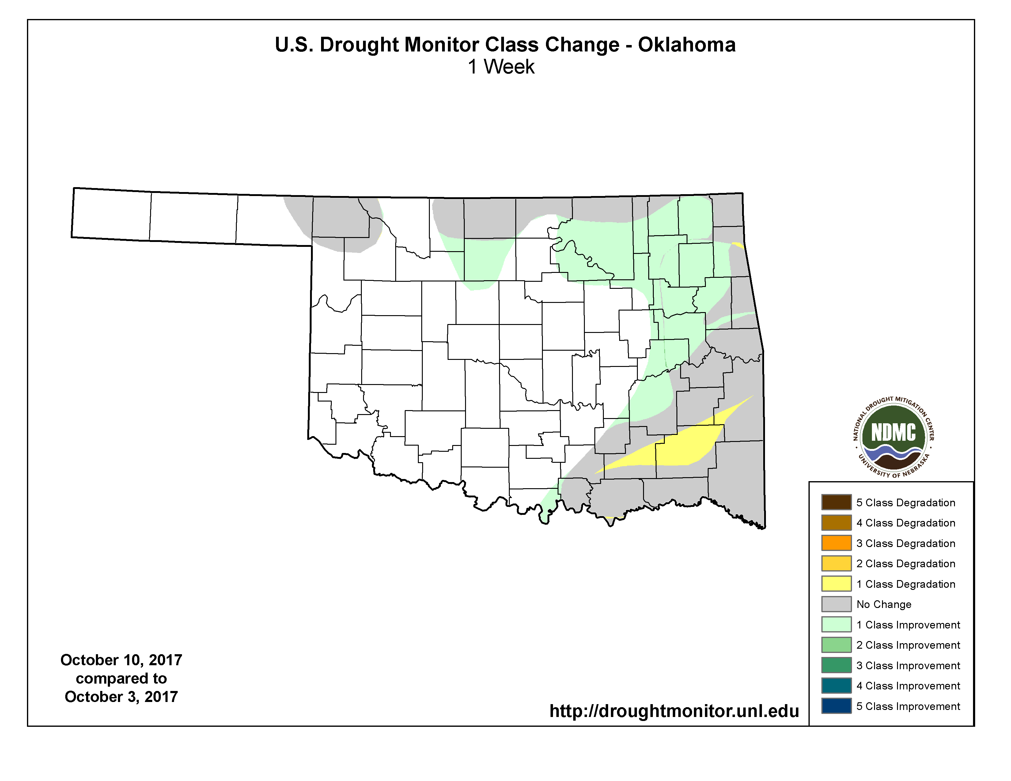
thanks to those generous-to-overwhelming rains in that region, and that's better
reflected here in the 1-week Drought Monitor change map.
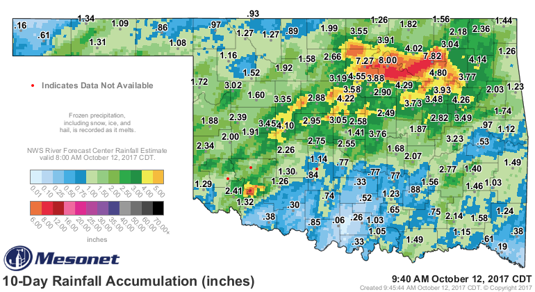
You'd think after all that rain had drought would have been completely wiped out.
The truth of the matter is that most of the heavy rains fell in areas where no
drought or abnormally dry conditions existed in the first place.
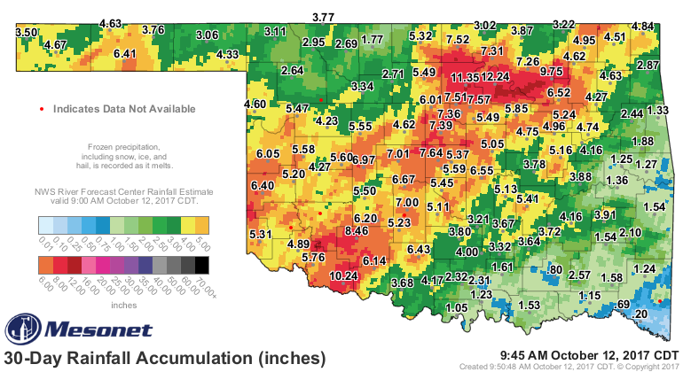
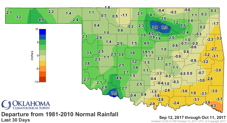
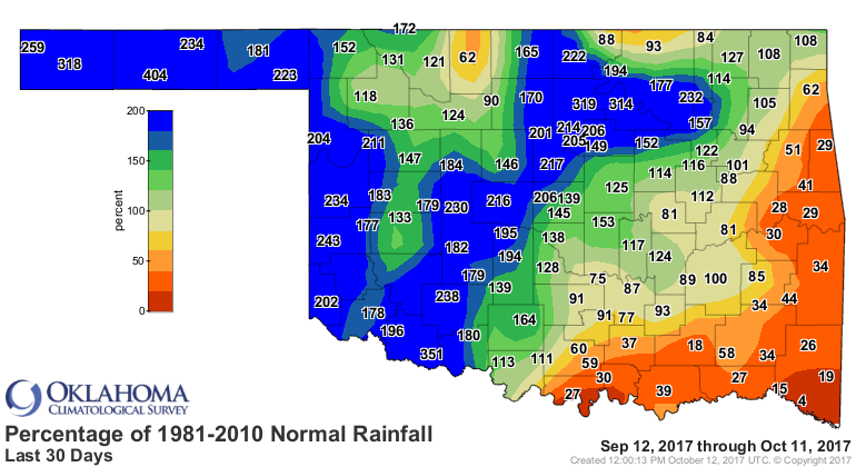
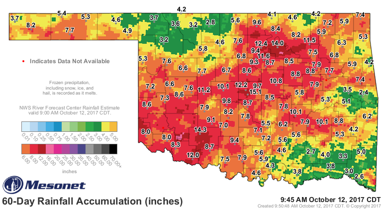
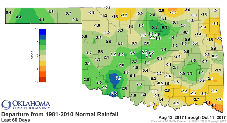
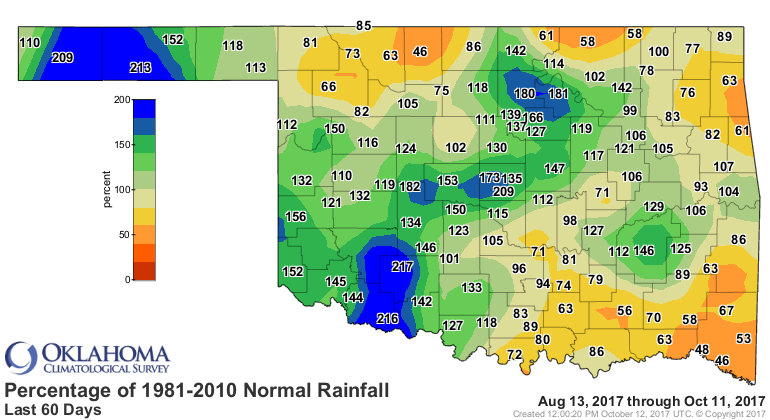
And the reason those dry conditions are still in place, and as you saw on the
change map, even expanding down in the far SE, is better explained by the
30-day and 60-day rainfall maps. Lots of unwanted colors and negative numbers
on those maps.
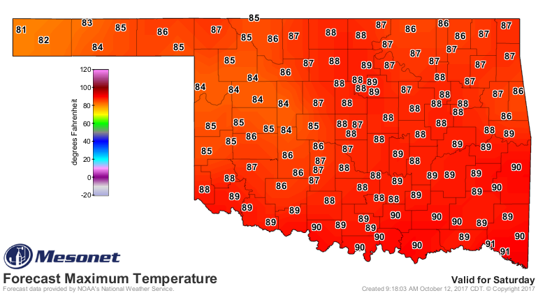
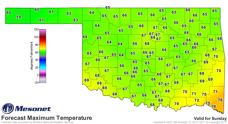
Now we're gonna warm up for a few days, then have a front on Saturday into
Sunday that gives us a chance of rain, then we're probably going to warm up
as we get further into next week.

Unfortunately, the rain doesn't look like it's going to have much impact on the
dry conditions to the southeast, but maybe that will change as we get closer.
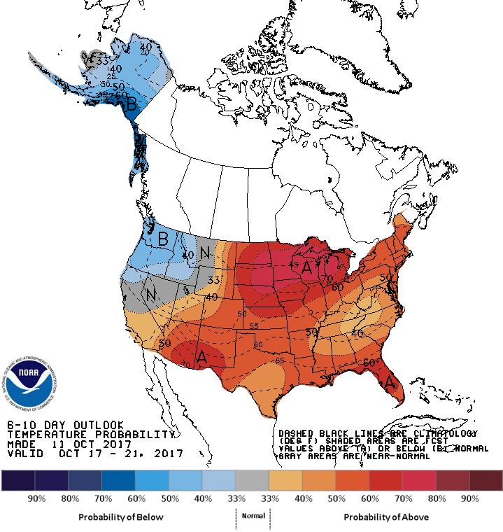
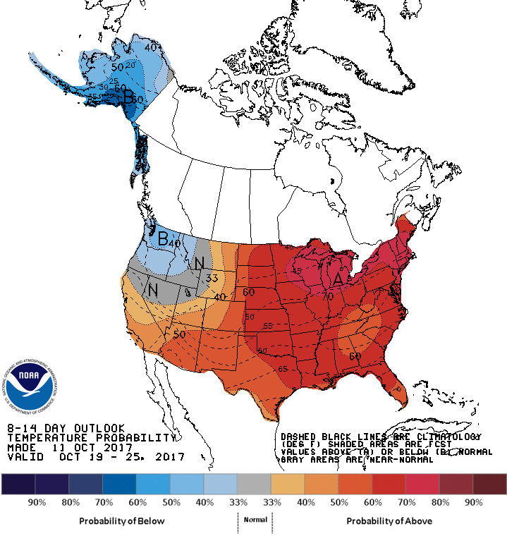
Our next big front just isn't showing up just yet, but that drastic change in
the forecast is often just around the corner! Stay tuned.
Gary McManus
State Climatologist
Oklahoma Mesonet
Oklahoma Climatological Survey
(405) 325-2253
gmcmanus@mesonet.org
October 12 in Mesonet History
| Record | Value | Station | Year |
|---|---|---|---|
| Maximum Temperature | 99°F | MANG | 2024 |
| Minimum Temperature | 23°F | EVAX | 2019 |
| Maximum Rainfall | 2.92 inches | MIAM | 2016 |
Mesonet records begin in 1994.
Search by Date
If you're a bit off, don't worry, because just like horseshoes, “almost” counts on the Ticker website!