Ticker for October 5, 2017
MESONET TICKER ... MESONET TICKER ... MESONET TICKER ... MESONET TICKER ...
October 5, 2017    October 5, 2017    October 5, 2017    October 5, 2017


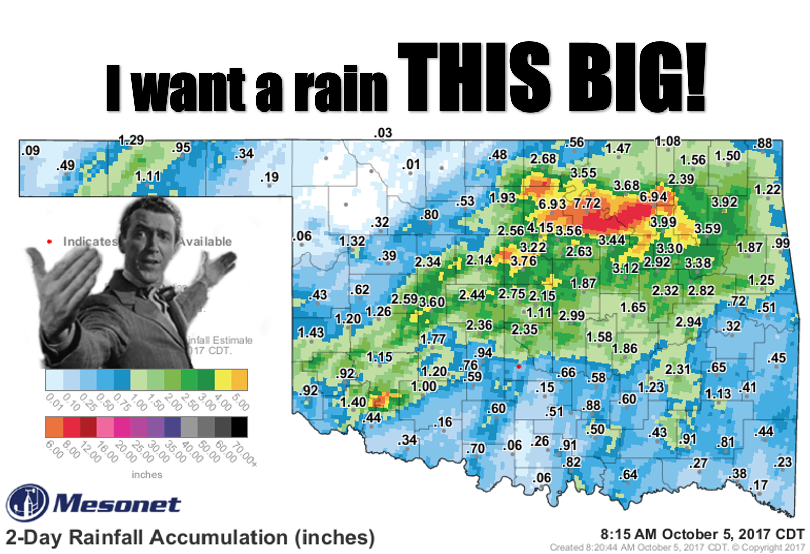
That rain was THIS BIG


Be careful what you ask for, Jimmy. You wanted a rain that big, well, you got it.
Okay, technically Pawnee and Osage (and the surrounding areas) got it, but it
was a bit more than was asked for. Obviously lots of flooding and other bad
things that go with that much rain in a short period of time. Pawnee led the
Mesonet with 7.72 inches of rain, with Red Rock and Skiatook close behind, but
obviously the hefty rain totals between Mesonet sites were more widespread, if
not larger. One CoCoRaHS (Community Collaborative Rain, Hail and Snow Network)
from near Glencoe in Noble County measured 9.5 inches. AND, not to be outdone,
there was another small area of very heavy rainfall in southern Kiowa County
in SW OK.

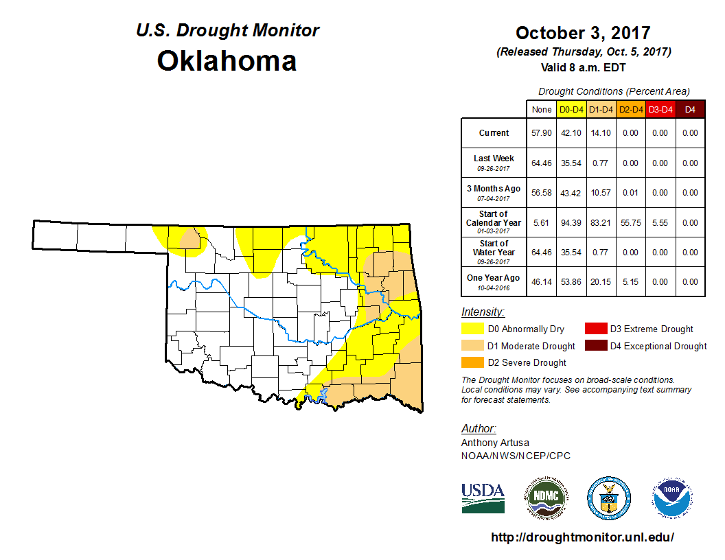
So for Drought Monitor purposes, we see some areas that are going to get lots of
color erased from the new map that came out this morning, and other areas that
still need lots of help.


Please remember that while this map came out today, the cutoff for any precip to
be considered was Tuesday, Oct. 3, at 7 a.m. (to allow the national author
ample time to consider reports coming in from across the entire country).

So the good news is a lot of that mess of new D0 (Abnormally Dry) and D1
(Moderate Drought) from up in north central over to east central OK will be
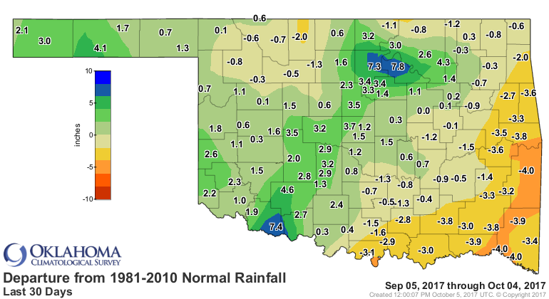
upgraded, but the far southeast is still needing rain. This shows up pretty well
on the 30 day departure from- and percent of-normal rainfall maps from the
Mesonet.


The problem areas show up pretty readily as you look at that pct of normal
map...just look for the reds and oranges (sorry Bedlam fans!).

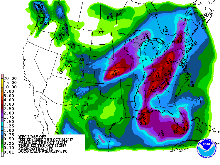
Looking ahead, we see SOME more chances for rain, mostly with cold fronts
Friday and then again early next week. But nothing to alleviate the dryness
down in the SE corner of the state.


There might be a spot of severe weather on Friday, so that needs to be
watched.


As advertised before, the front early next week is the first REAL fall cold
front of the season. The turn-on-the-heater-for-the-first-time-since-March-and-
smell-that-weird-smell type of front.

Hopefully that weird smell is dust burning. Call your local repairman if it is
too funky.

Gary McManus
State Climatologist
Oklahoma Mesonet
Oklahoma Climatological Survey
(405) 325-2253
gmcmanus@mesonet.org
October 5 in Mesonet History
| Record | Value | Station | Year |
|---|---|---|---|
| Maximum Temperature | 96°F | HOOK | 2018 |
| Minimum Temperature | 31°F | KENT | 2016 |
| Maximum Rainfall | 5.92 inches | PRYO | 1998 |
Mesonet records begin in 1994.
Search by Date
If you're a bit off, don't worry, because just like horseshoes, “almost” counts on the Ticker website!