Ticker for October 4, 2017
MESONET TICKER ... MESONET TICKER ... MESONET TICKER ... MESONET TICKER ...
October 4, 2017 October 4, 2017 October 4, 2017 October 4, 2017
Come again another day
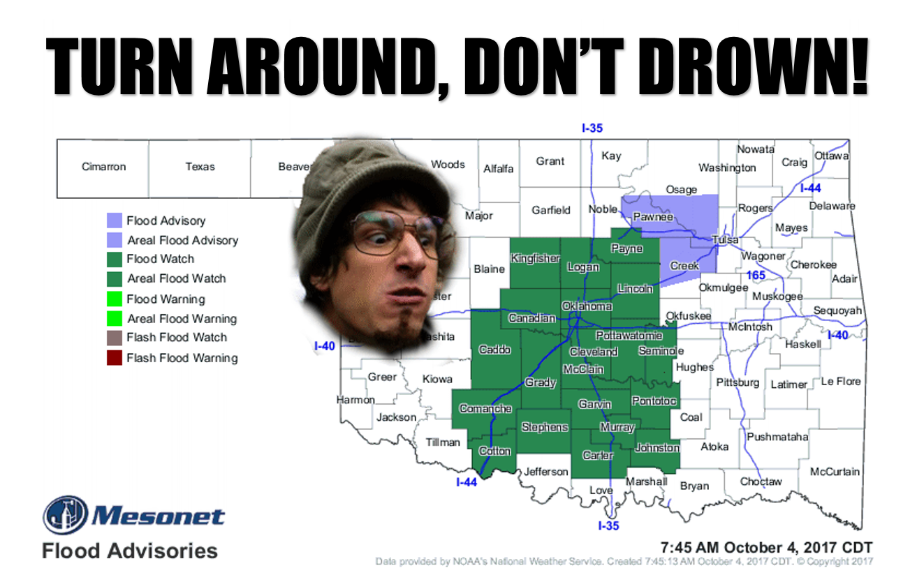
Rain IS here today, and it WILL come another day, or two, and I did call that
graphic "duh," because flash flooding deaths are almost entirely preventable, and
"turn around don't drown" is a good phrase to remember if you think your car or
truck can get through that water flowing over the road at an unknown depth, and
yes, I will eventually end this sentence with a period, and I think I will do that
now.
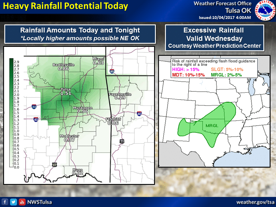
So the rain is here already
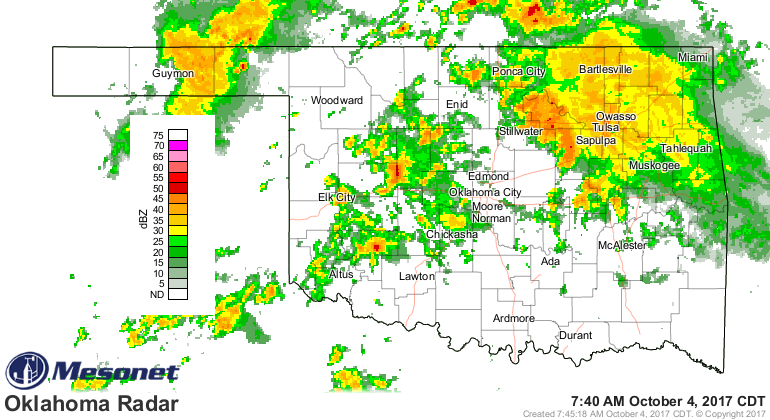
and it would appear the I44 corridor is the focus for said rain, from 1-3 inches
with higher amounts locally.
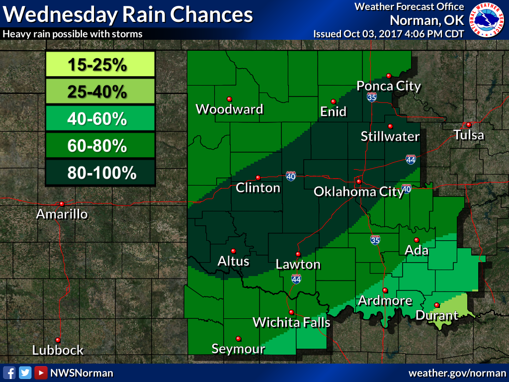
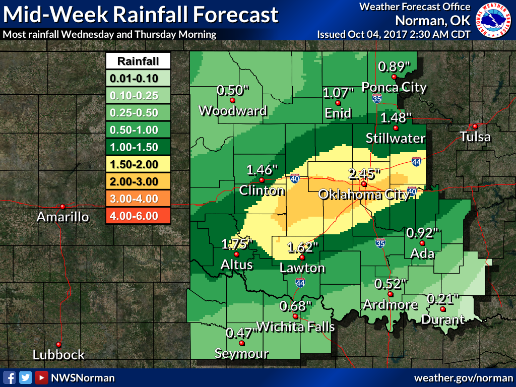
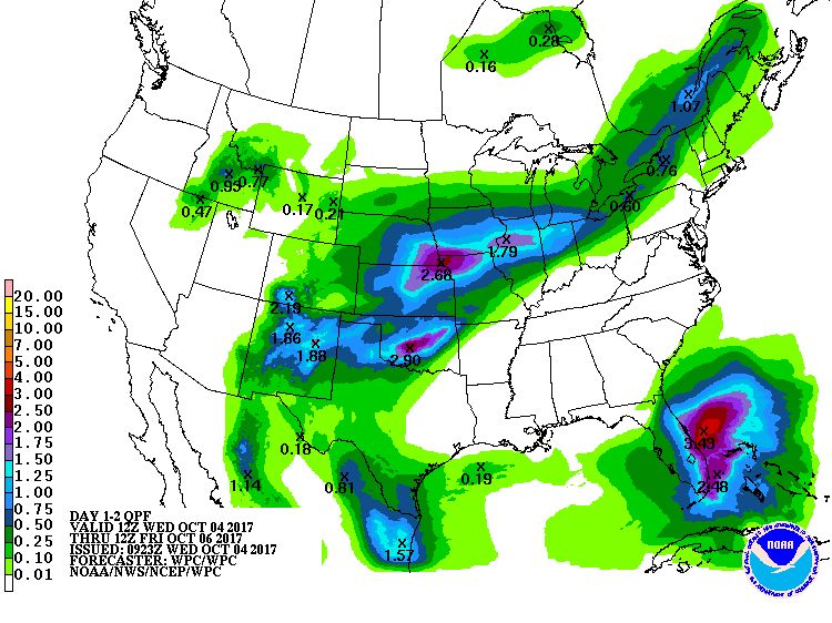
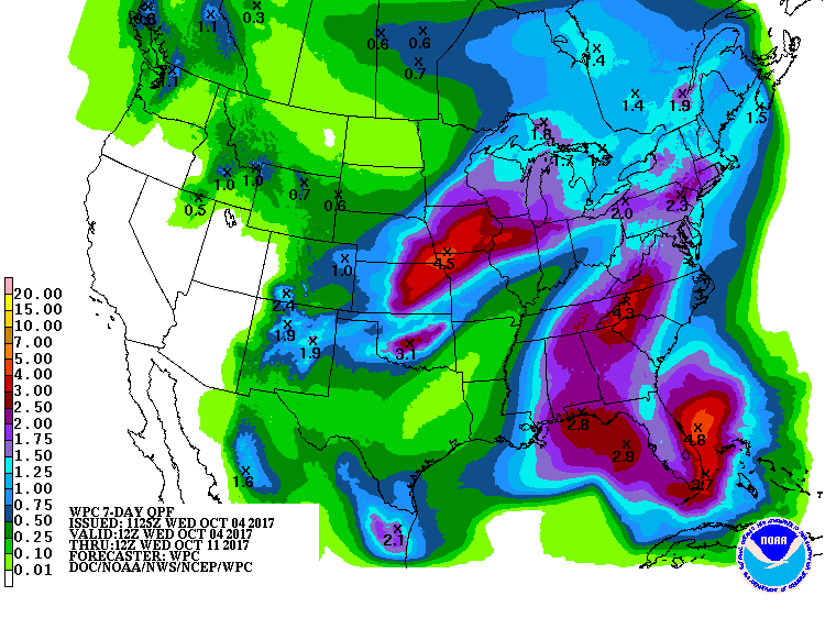
And here's the overall pic for this storm system, and then the longer view out
to 7 days for more rain chances coming Friday and Saturday.
I would tell Mother Nature to "BRING IT!" but that never turns out well. Of
course, some of it has already been broughten (new word, call Merriam Webster).
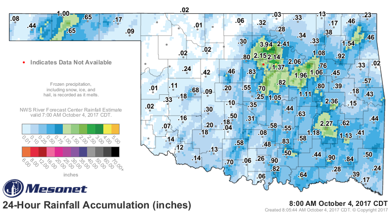
It's a start! And it's also why there is already a flood advisory for parts of
Osage, Creek, Pawnee and Tulsa counties, and that flood watch for much of
central Oklahoma.
It's pretty simple. Turn around, don't drown. Turn around and go to Braum's
and get a nice ice cream cone, chocolate chip, instead.
Gary McManus
State Climatologist
Oklahoma Mesonet
Oklahoma Climatological Survey
(405) 325-2253
gmcmanus@mesonet.org
October 4 in Mesonet History
| Record | Value | Station | Year |
|---|---|---|---|
| Maximum Temperature | 99°F | WALT | 2000 |
| Minimum Temperature | 29°F | OILT | 2010 |
| Maximum Rainfall | 7.72 inches | PAWN | 2017 |
Mesonet records begin in 1994.
Search by Date
If you're a bit off, don't worry, because just like horseshoes, “almost” counts on the Ticker website!