Ticker for October 2, 2017
MESONET TICKER ... MESONET TICKER ... MESONET TICKER ... MESONET TICKER ...
October 2, 2017 October 2, 2017 October 2, 2017 October 2, 2017
Southeast OK dries out!
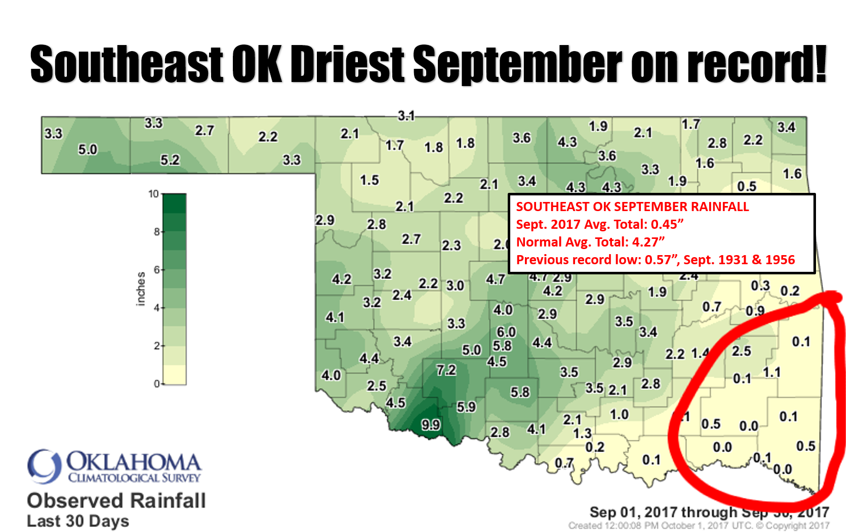
Southeastern Oklahoma just experienced its driest September on record, dating
all the way back to when records began in 1895. You can see the pertinent maps
in the summary below, but there were two Mesonet stations, Cloudy and Hugo, that
received NO rainfall during the month. WOW! For southeastern Oklahoma, that's
significant.
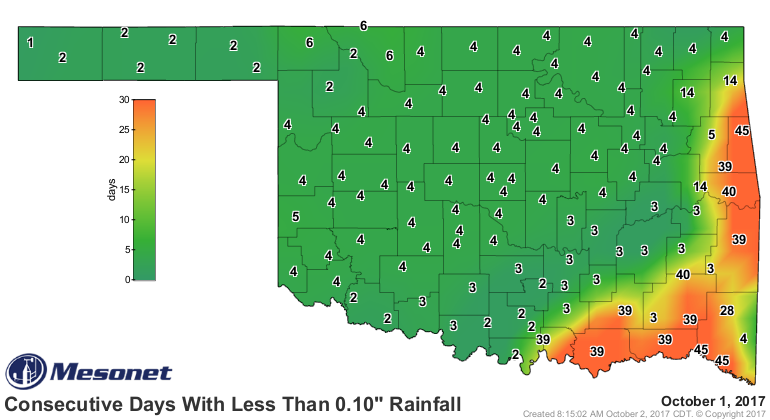
And the dry weather actually extends a bit farther back than that.

Rain chances are definitely on the rise later this week and again on the weekend.
But once again, southeastern OK seems to be out of luck for the best moisture.
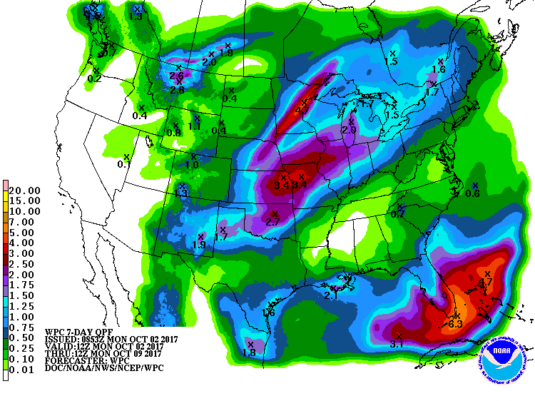
Not exactly zero, but not the 2-4 inches the rest of the state appears set for.
As we know, though, these forecasts can and WILL change. Here's rooting for
not only SE but also much of eastern OK to get a good soaking.
Now, your September summary.
------------------------------------------------------------------------------
Hot and dry weather dominated Oklahoma?s weather headlines for much of
September, a drastic change from the extraordinarily mild and wet August the
state had just experienced. Many wondered if fall?s premiere would wait until
October, but those fears were soon alleviated with the arrival of a strong
storm system during the month?s final week. High temperatures in the 50s and
60s along with generous rainfall amounts of 2-4 inches provided a pleasant
burst of autumn for much of the state and a welcome bout of moisture for
Oklahoma?s wheat farmers. The gray, rainy weather managed to avoid southeastern
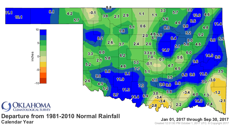
Oklahoma, leaving that area of the state stuck in summer mode for a bit longer. Eastern Oklahoma saw dry conditions expand through the end of the month as drought tried to mount a comeback.
According to preliminary data from the Oklahoma Mesonet, the statewide average
precipitation total was 2.60 inches, 0.93 inches below normal and the 50th
driest September since records began in 1895. The statewide average failed to
reflect the stark difference in rainfall amounts across the state, however.
Much of the eastern third fell 3-4 inches below normal. Southeastern Oklahoma
saw its driest September on record with an average of 0.45 inches, 3.82 inches
below normal. The previous record low total of 0.57 inches was set during the
significant drought years of 1931 and 1956. Parts of east central and south
central Oklahoma experienced similar deficits. The Panhandle averaged 3.34
inches, 1.52 inches above normal to rank as their 16th wettest September.
West central and southwestern Oklahoma also saw a significant moisture surplus.
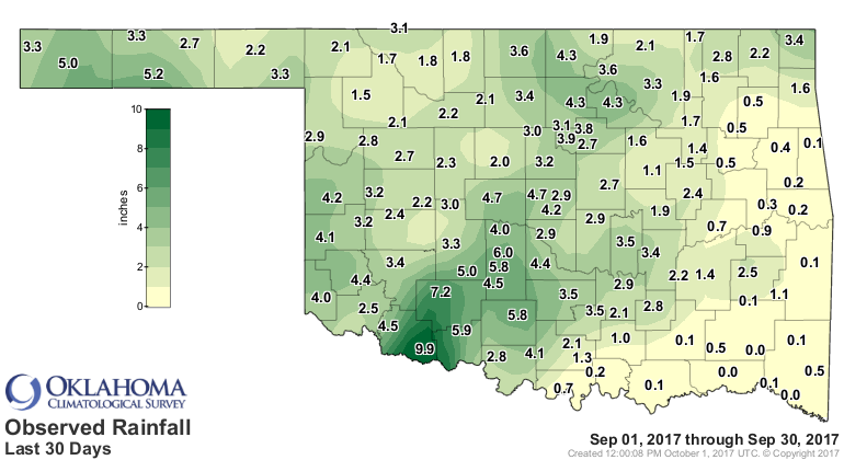
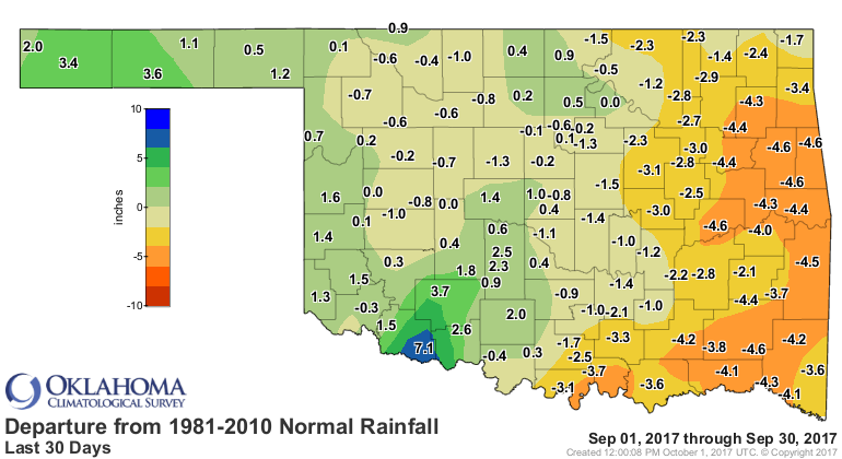
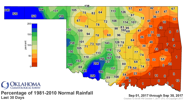
The Mesonet sites at Cloudy and Hugo reported no rainfall for the month, and
another six had a tenth of an inch or less. Grandfield recorded 9.87 inches to
lead the state, a whopping 7.1 inches above normal. Of the 121 Mesonet sites,
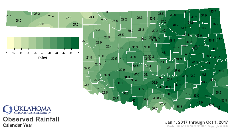
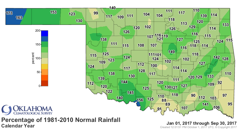
46 recorded at least 3 inches of moisture. The year through September remained
significantly wet with a statewide average of 33.52 inches, over 5 inches above
normal and the 13th wettest such period on record.
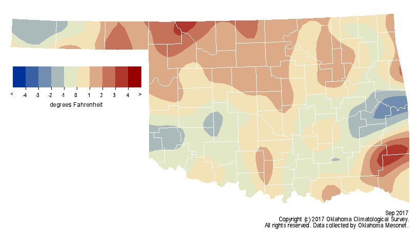
The state registered its last triple-digit temperature of September ? and
possibly the year ? on the 21st with Beaver, Buffalo and Cherokee hitting 100
degrees. The heat was not over yet, however. While the northwestern half of the
state cooled down a few days later with the arrival of the large storm system,
the rest of the state continued to bake. The heat index rose to as high as 97
degrees on the 27th in Idabel in the far southeast. During that same period,
highs across western Oklahoma were in the 50s and 60s. That final week?s brush
with milder air was enough to bring the September statewide average down to a
more respectable 72.9 degrees, 0.6 degrees above normal.

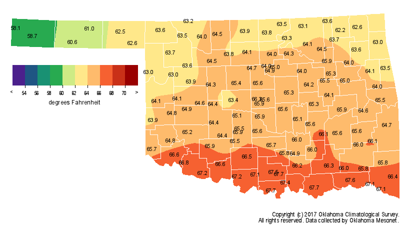
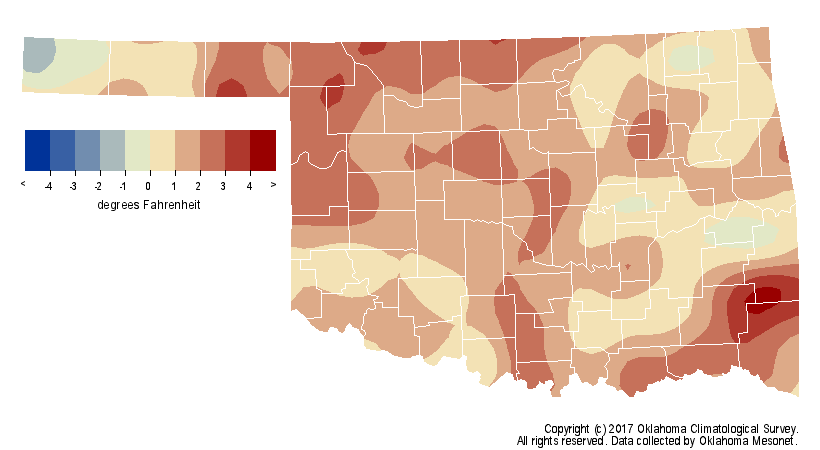
The month?s highest temperature of 101 degrees occurred at several sites on
two separate days. Triple-digit temperatures were uncommon, however. The 121
Mesonet sites reached 100 degrees a mere 10 times during September. The
January-September statewide average of 65.1 degrees was 1.7 degrees above
normal, the 16th warmest such period on record.
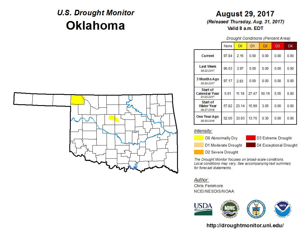
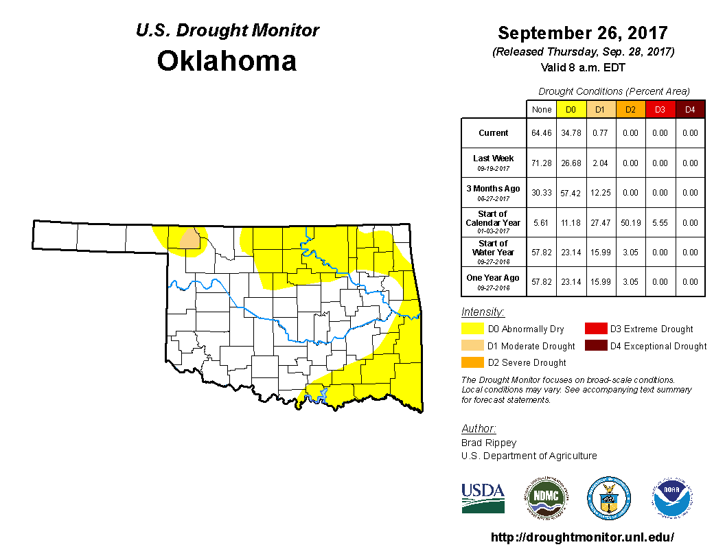
Oklahoma was drought free at the end of August, and only 2 percent of the state
was considered ?abnormally dry? by the U.S. Drought Monitor. While not a
drought designation, abnormally dry can indicate areas where drought
development is likely. The last Drought Monitor report listed 33 percent of the
state in abnormally dry conditions and a little less than 1 percent suffering
from moderate drought.
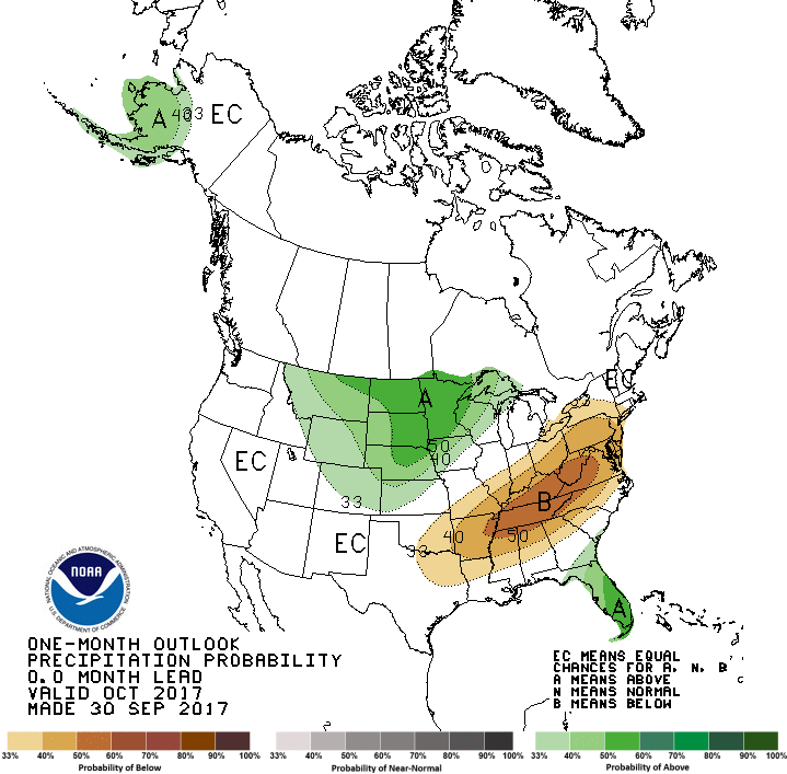
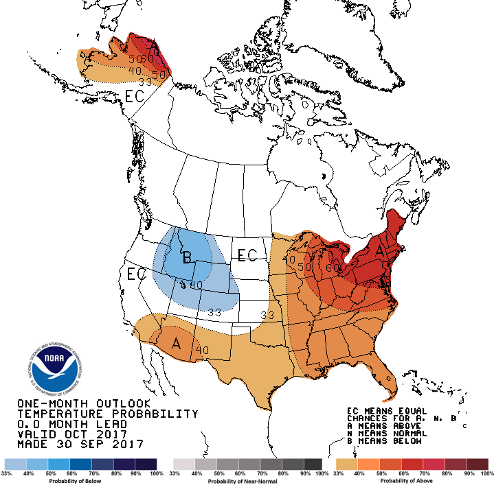
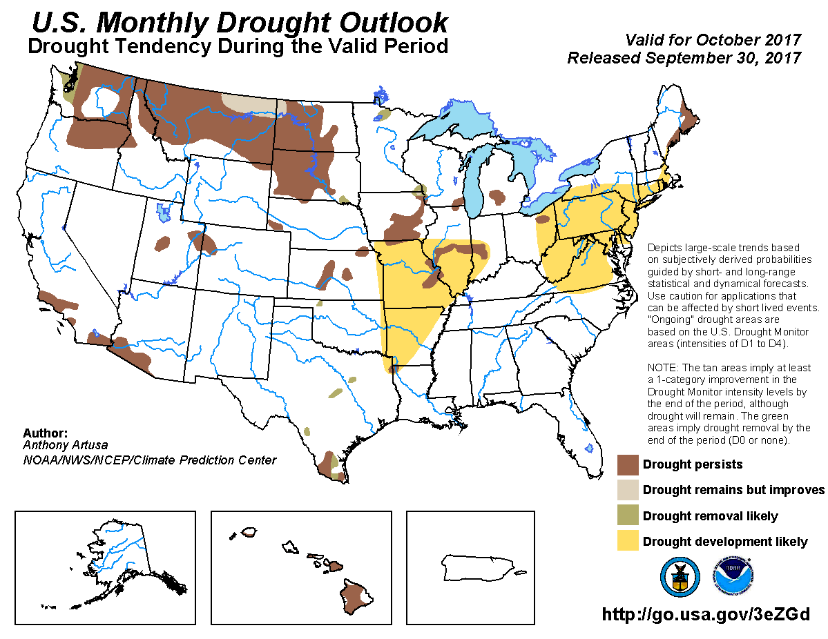
The Climate Prediction Center?s (CPC) October outlooks indicate increased odds
for below normal precipitation across the southeastern half of the state,
especially in far southeastern Oklahoma, and increased odds of above normal
temperatures over all but the northwestern quarter. Accordingly, CPC?s October
U.S. Drought Outlook sees drought development as likely across far eastern
Oklahoma.
Gary McManus
State Climatologist
Oklahoma Mesonet
Oklahoma Climatological Survey
(405) 325-2253
gmcmanus@mesonet.org
October 2 in Mesonet History
| Record | Value | Station | Year |
|---|---|---|---|
| Maximum Temperature | 103°F | TIPT | 2000 |
| Minimum Temperature | 28°F | BOIS | 2009 |
| Maximum Rainfall | 4.76 inches | CHER | 2002 |
Mesonet records begin in 1994.
Search by Date
If you're a bit off, don't worry, because just like horseshoes, “almost” counts on the Ticker website!