Ticker for September 28, 2017
MESONET TICKER ... MESONET TICKER ... MESONET TICKER ... MESONET TICKER ...
September 28, 2017 September 28, 2017 September 28, 2017 September 28, 2017
e-rain-ji
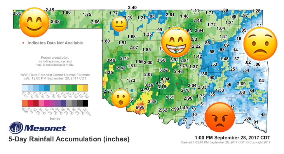
We're constantly trying to connect with the younger crowd here at the Ticker. Just
last year we changed our musical Tickers over from 8-track tape (LOOK IT UP,
KIDS) to cassettes, and we changed our Ticker videos from beta-max to VHS (LOOK
IT...oh, never mind, just enjoy being young). But the new thing is this emoji
stuff. I know this because my Mom uses them.
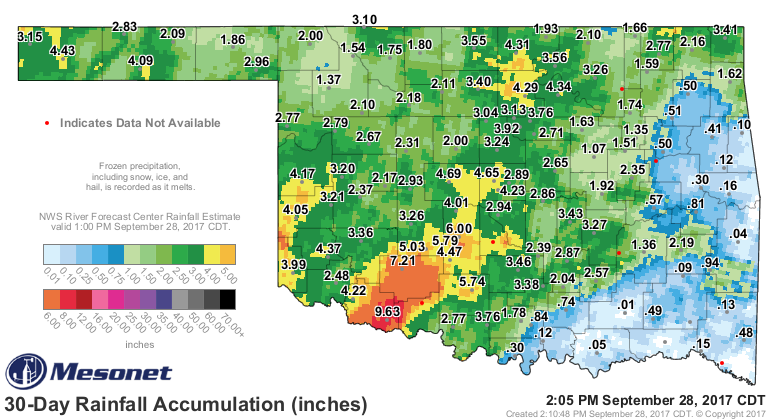
But yes, there are lots of happy folks across the state, some angry and sad peeps
in the east, and some water-logged southwestern Oklahomans. Oh yeah, and a few
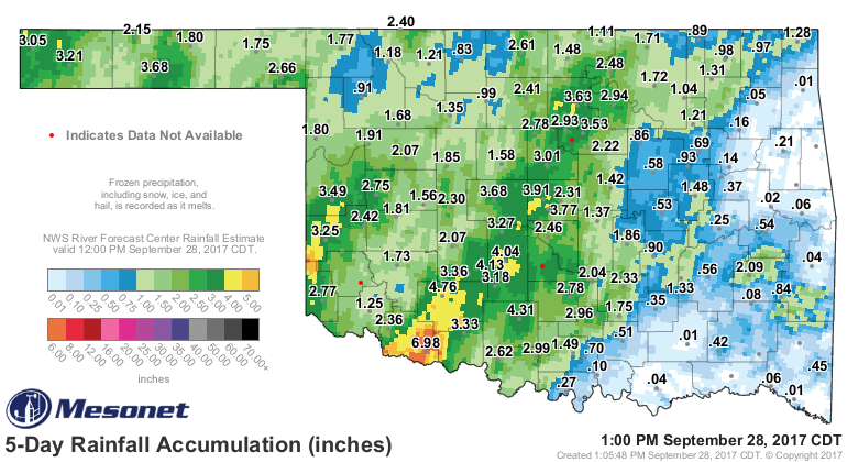
satisfied-but-not-quite-satisfied people in the northwest. Here's a clean 5-day
rain map to show you why.
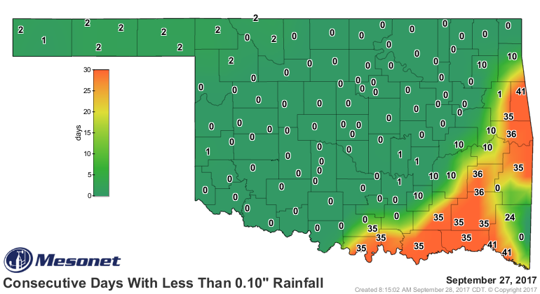
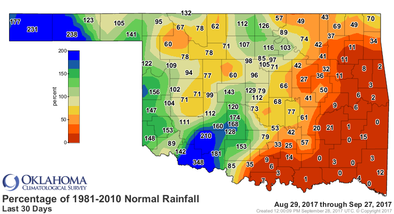
Heck, these "days without rainfall" maps show it about as good as any.
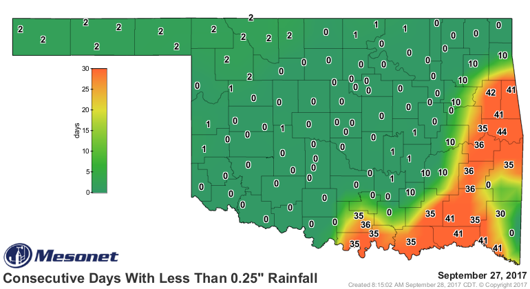
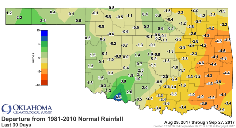
So you go back more than a month and the mounting deficits are evident.
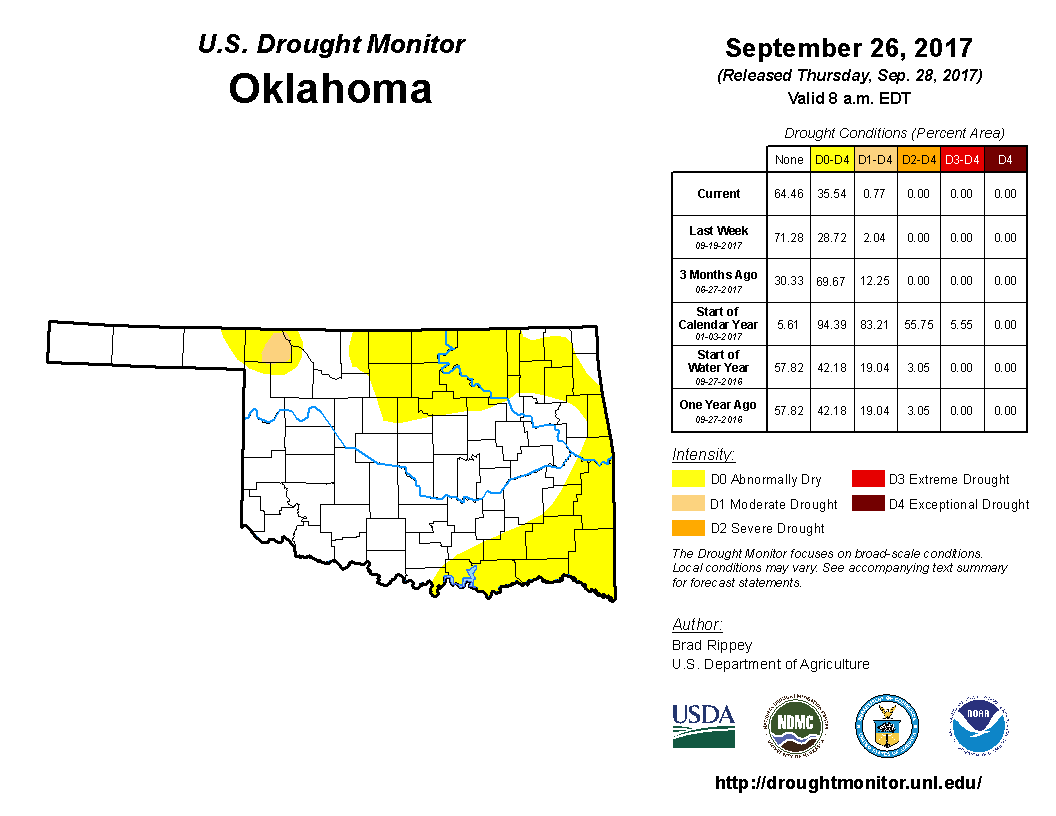
Thus, your improving-yet-deteriorating Drought Monitor map. More yellow in the
east, less in the west.
It's a dingy gray fall day across much of Oklahoma, and that's okay. Expect
clouds on and off for the next few days with showers, then we go back into the
frying pan, relatively speaking.
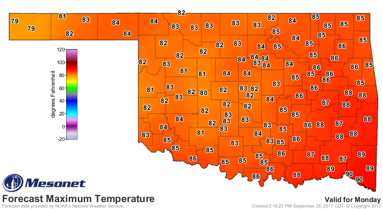
We start October on a warm note. It's usually downhill from there. Wait, is
there a "usual" for Oklahoma?
Not usually. ;)
Gary McManus
State Climatologist
Oklahoma Mesonet
Oklahoma Climatological Survey
(405) 325-2253
gmcmanus@mesonet.org
September 28 in Mesonet History
| Record | Value | Station | Year |
|---|---|---|---|
| Maximum Temperature | 100°F | WALT | 1998 |
| Minimum Temperature | 35°F | KENT | 2006 |
| Maximum Rainfall | 3.03 inches | SEIL | 2013 |
Mesonet records begin in 1994.
Search by Date
If you're a bit off, don't worry, because just like horseshoes, “almost” counts on the Ticker website!