Ticker for September 21, 2017
MESONET TICKER ... MESONET TICKER ... MESONET TICKER ... MESONET TICKER ...
September 21, 2017 September 21, 2017 September 21, 2017 September 21, 2017
Mighty Rain
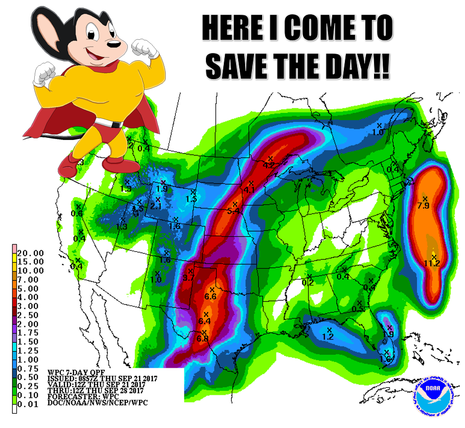
That 7-day rain forecast is gonna be suhhhh-weet! if it comes true. It's probably
a bit ambitious, but with drought and dry conditions persisting and even spreading
into the state from the north and southeast, it will be much needed. Check out
today's new U.S. Drought Monitor report for Oklahoma, as well as for the
surrounding region.
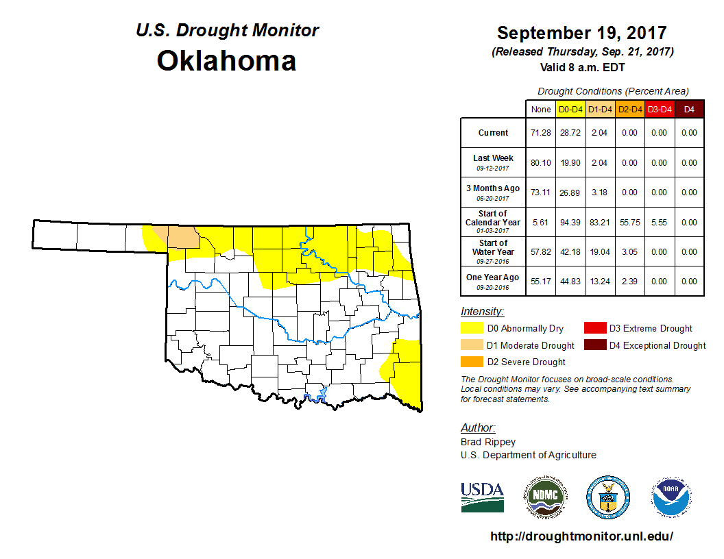
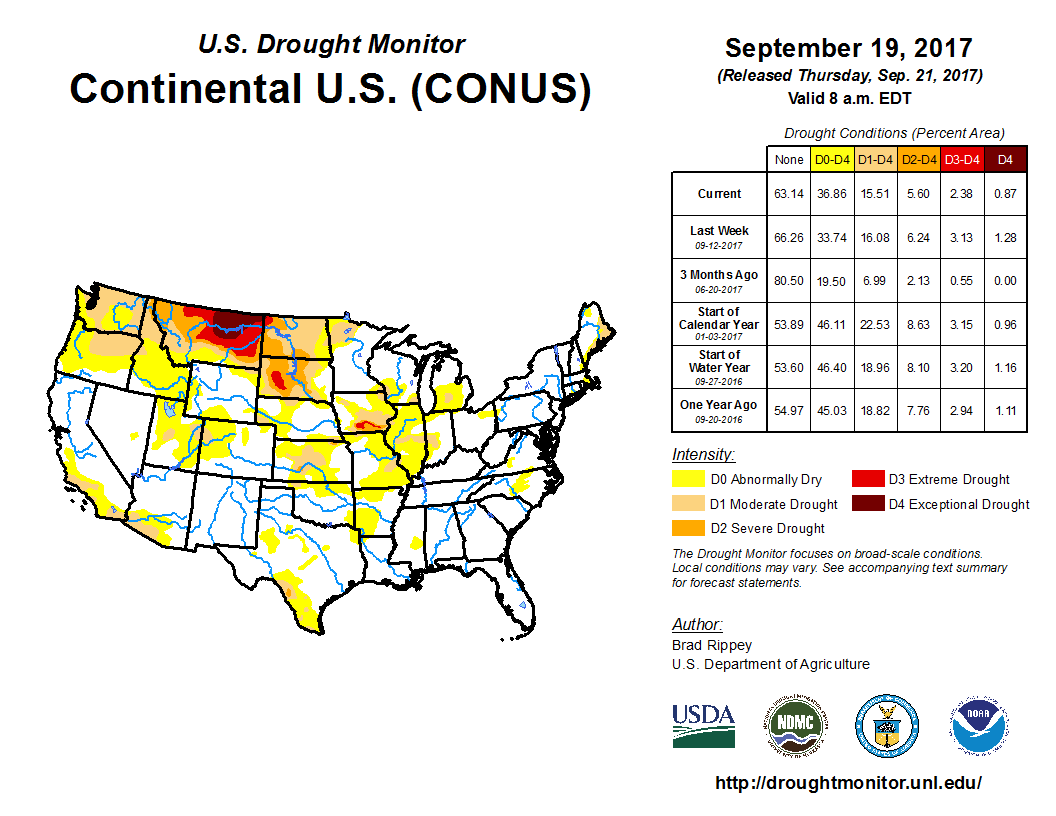
So still nothing *too bad* in our area, just a spot of moderate drought up in
Harper and Beaver counties, but that abnormally dry condition continues to spread
down from Kansas and up and over from the ArkLaTex region. The dryness in our
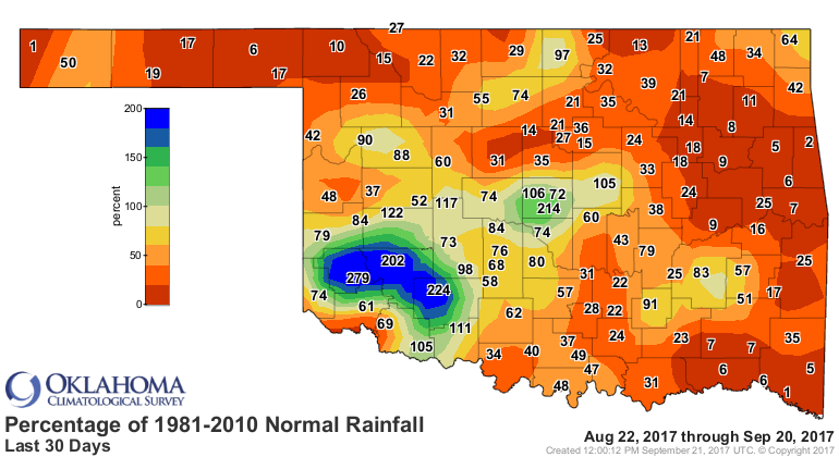
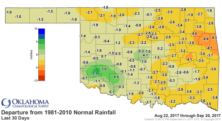
state is quite evident from the Mesonet rainfall maps, DESPITE the recent rains.
The totals look nice, but when compared to normal, not so nice.

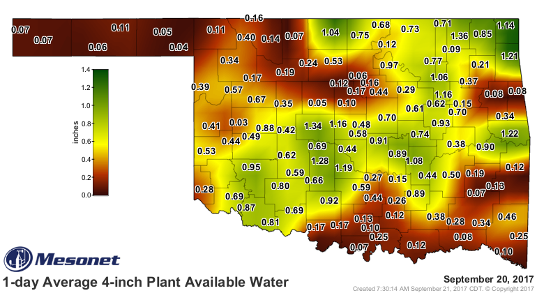
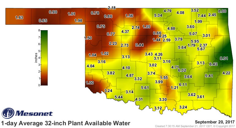
That dryness is beginning to impact those planting wheat as well, as both the
topsoil and subsoil moisture wicks away.
That's where our latest rain forecast comes in, with changes on the way starting
late in the weekend. A large upper-level trough will move east from the Western
U.S. and split off, leaving the Southern Plains with a lovely cut-off low
remaining out west. All that together means an express elevator to fall, for
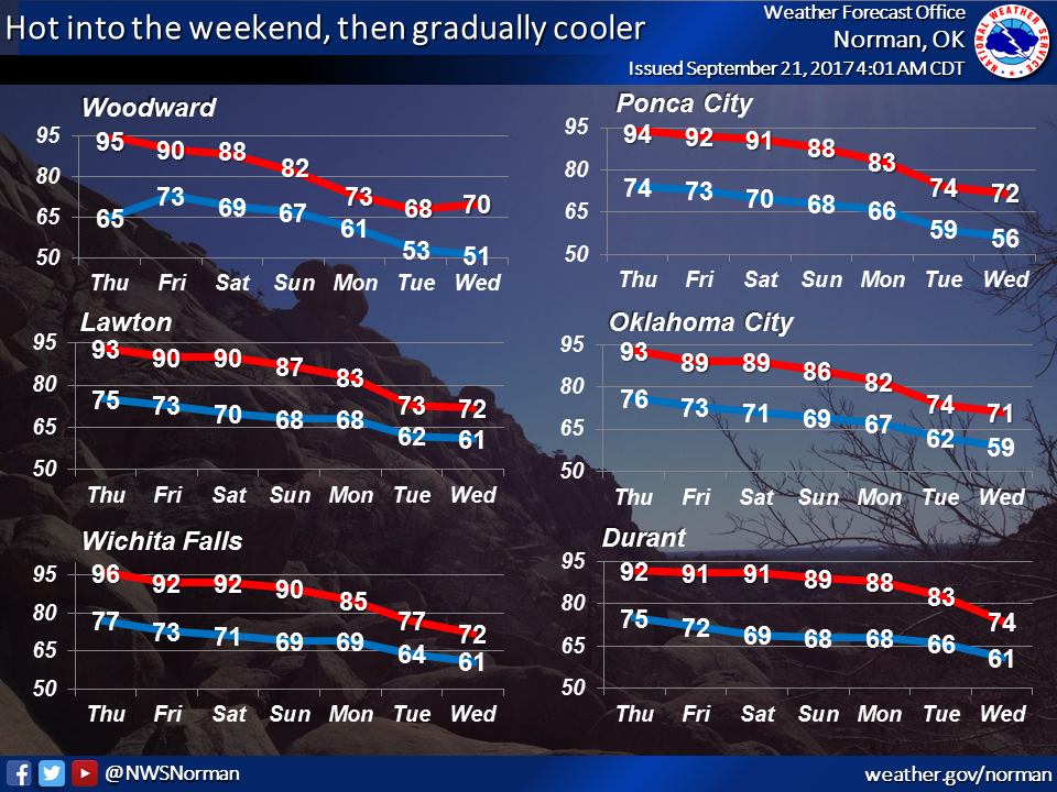
next week with lots of rain and cooler weather. Check out the 7-day temp forecast
from our friends at the Norman NWS office, for instance.
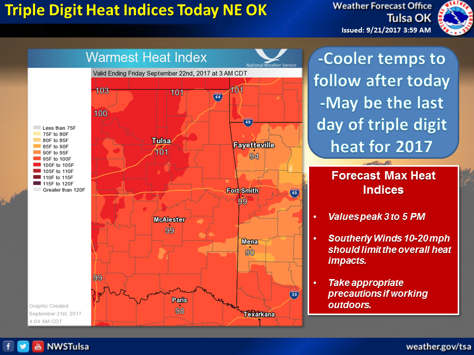
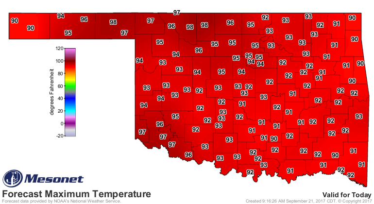
UNTIL THEN, however, summer will remain in place with a vengeance, complete with
fire danger and lots of suffocating heat. We will be close to triple-digits in
some places today...will it be the last of the 100s if so?
The mouse may roar...you just have to wait a bit.
Gary McManus
State Climatologist
Oklahoma Mesonet
Oklahoma Climatological Survey
(405) 325-2253
gmcmanus@mesonet.org
September 21 in Mesonet History
| Record | Value | Station | Year |
|---|---|---|---|
| Maximum Temperature | 103°F | WALT | 1998 |
| Minimum Temperature | 38°F | NOWA | 2000 |
| Maximum Rainfall | 14.20″ | FITT | 2018 |
Mesonet records begin in 1994.
Search by Date
If you're a bit off, don't worry, because just like horseshoes, “almost” counts on the Ticker website!