Ticker for September 25, 2017
MESONET TICKER ... MESONET TICKER ... MESONET TICKER ... MESONET TICKER ...
September 25, 2017 September 25, 2017 September 25, 2017 September 25, 2017
It ain't over
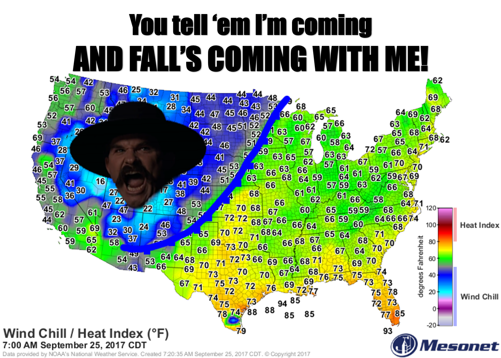
Wait, that's it, right? A powerful cold front, last week of September...that has
to end our flirtation with summer, correct? We've had highs in the 80s and 90s
most of the last two weeks, with more 90s than 80s. Our last triple-digit
temperature was 100 degrees at BUFFALO, THE BESTEST LITTLE HAMLET IN THIS STATE
OR ANY OTHER (note: it really is). Yesterday wasn't *too bad*...sort of a
transition period. Clouds and rain definitely helped in the west.
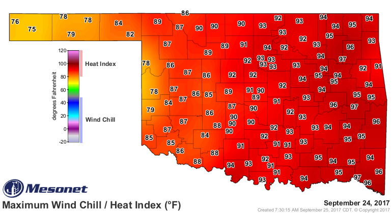
So how many times have we fallen for this? Oooh, a cold front, summer is over, no
more hot weather! Well I ain't falling for it this time. We'll cool down nicely
for a week or so, but I'm not willing to say we're done with hot weather, and that
goes for triple-digit temperatures as well. I mean, all we have to do is look back
to October 17 of LAST YEAR to understand why that's a fool's bet! In fact,
quoting the Ticker from October 16 last year, when we hit 10s at Slapout:
"100s in mid-October? VERY unusual. In fact, the 102 at the
Slapout Mesonet site yesterday was the highest temperature this
late in the year in state history, topping the previous 'highest
temperature this late in the year' of 101 degrees at Healdton back on
Oct. 17, 1972. Now if we can hit 102 degrees today, we'll advance that
record by one day AND top Oct. 17th's highest temp ever recorded."
And we did advance that record one more day when Buffalo (SEE!) hit 102.
So yes, we are going to get a nice blast of autumn, and it will probably last
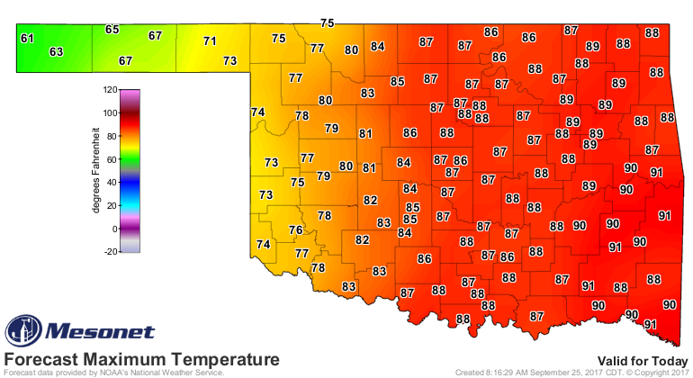
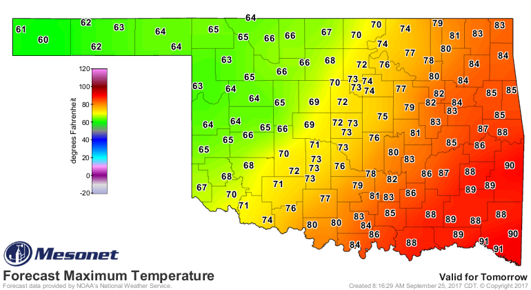
a week or so at least. This cold front will move SLOWLY through the state over
the next several days, as you can tell from the high temperature forecasts.
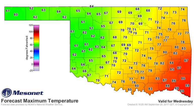

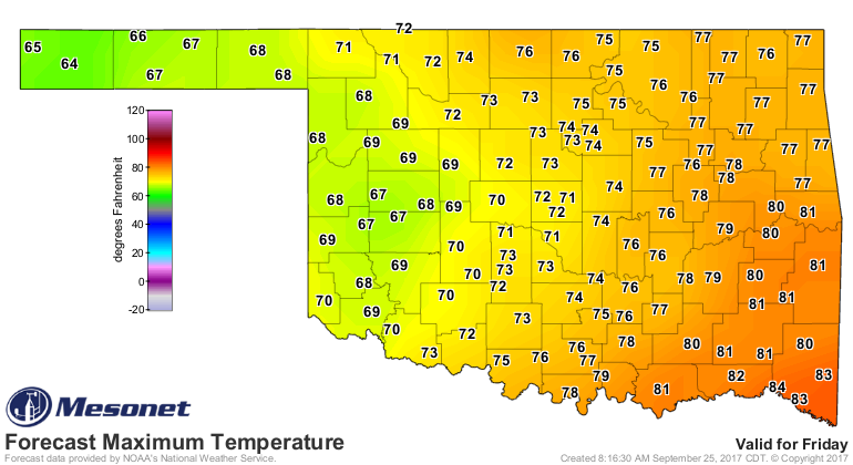
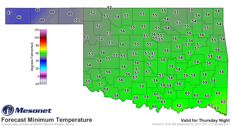
And we will see some very nice fall-like lows, such as on Friday morning.
Watch for showers and storms to hit western OK today, and then spread closer to
I-35 over the next day or two. The heaviest rain appears to remain out to the
west, but central OK will get some and eastern OK will probably get little.
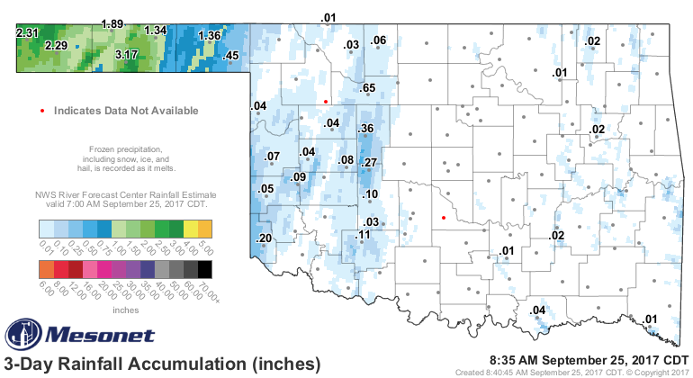
These amounts are overdone, no doubt

but far western OK and the Panhandle has already gotten quite a bit.
So to sum up, a burst of fall this week, some really nice temperatures and
rainfall in some places, but hot weather is probably not done for the year
just yet.
Enjoy the week!
Gary McManus
State Climatologist
Oklahoma Mesonet
Oklahoma Climatological Survey
(405) 325-2253
gmcmanus@mesonet.org
September 25 in Mesonet History
| Record | Value | Station | Year |
|---|---|---|---|
| Maximum Temperature | 102°F | SLAP | 2020 |
| Minimum Temperature | 29°F | BOIS | 2000 |
| Maximum Rainfall | 4.95″ | TISH | 2016 |
Mesonet records begin in 1994.
Search by Date
If you're a bit off, don't worry, because just like horseshoes, “almost” counts on the Ticker website!