Ticker for September 7, 2017
MESONET TICKER ... MESONET TICKER ... MESONET TICKER ... MESONET TICKER ...
September 7, 2017 September 7, 2017 September 7, 2017 September 7, 2017
IT is back
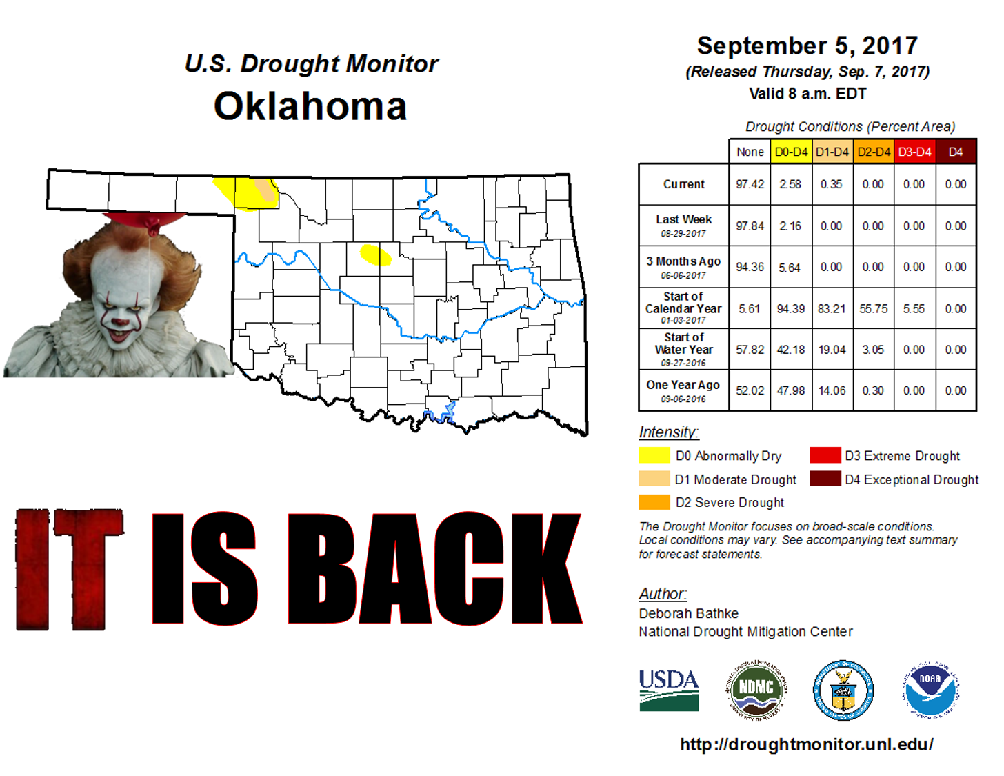
Hey, you think that clown is scary, you should see dry farm ponds!

Not, that's not THE famous little farm pond in Harper County, but scary, no?
Well, if you're trying to water cattle with that, you're pretty terrified.
Regardless, drought is back. Granted, it's a teeny tiny part of the state,
barely 0.3% of the state, but that's how it starts.

The thing is, there are plenty of deficits around the state on the rainfall maps,
from 30 days all the way out to 120 days, but that region in Harper County is the
one consistent area with a significant deficit throughout those periods.
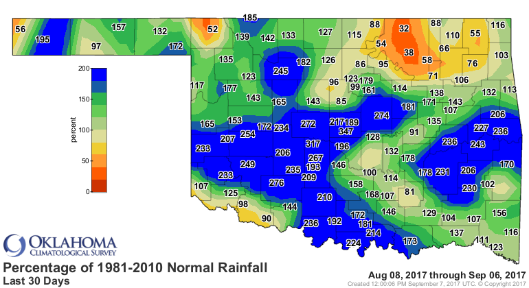
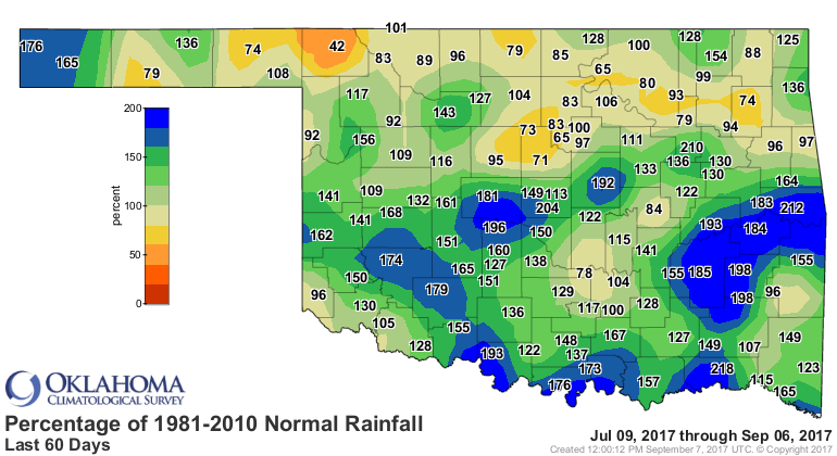

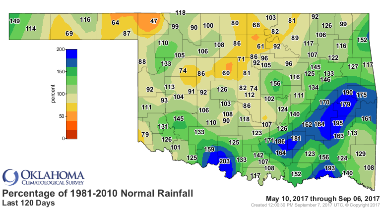
All those other major areas with deficits have had intervening periods of rain
that managed to tamp down on the drought impacts and thus eliminate the need
for drought depiction. Plus we've gotten lucky that over the last 2-3 weeks as
our unusual August rainy period wound down the unusually cool weather continued.
That also prevents drought from intensifying...or at least slows it down.
And cool we have been! Check out the lows from the last couple of days.


Uhhhh, lows in the lower 40s? I'm sorry (I really am!), but that's fall, not
summer. We may get warm again, and the forecast looks like we will get a bit
warmer
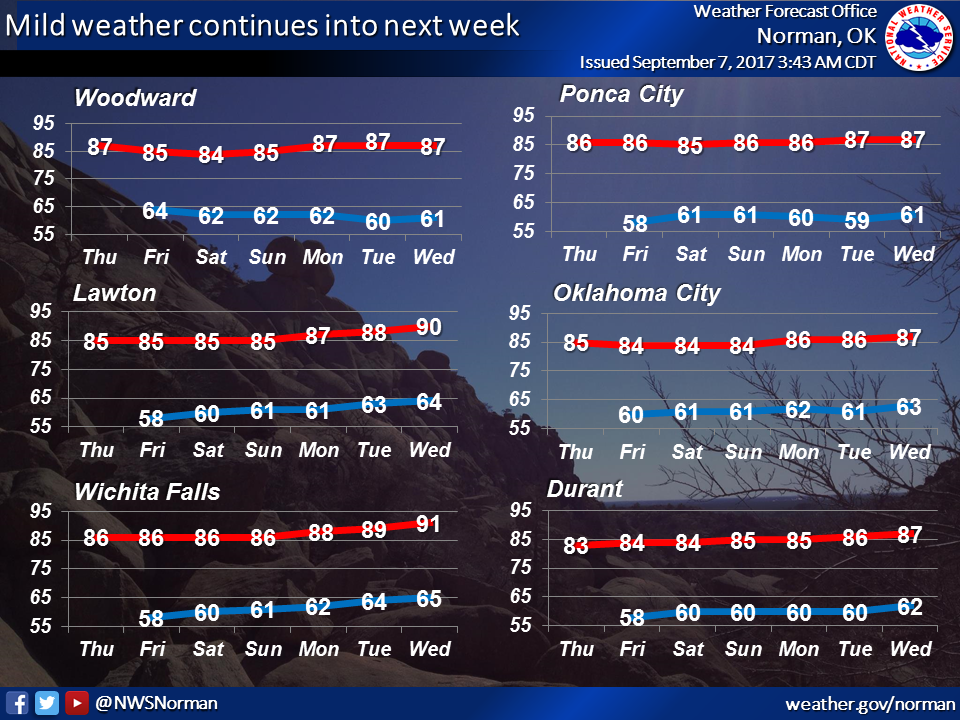
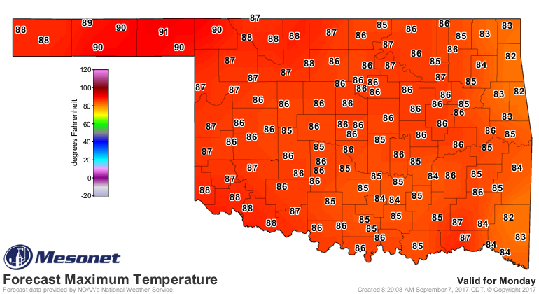
but those temps are still at or just a bit below normal for this part of the
calendar. And the rain doesn't look too fruitful either. Now as you look at
this 7-day rain forecast, your eyes are going to be drawn down to Florida and
the impacts from Hurricane Irma. Rightfully so. Our weather is infinitely more
boring than what they're facing.

And going farther out, prospects for significant moisture remain dim.
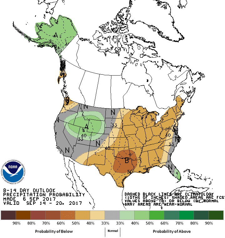
So might we see drought start to slowly creep back into the state? It's
a possibility. But will those drought impacts explode? Probably not, given the
lack of high temperature support. But, it bears watching.
By the way, they don't float up there in Harper County...too dry.
Gary McManus
State Climatologist
Oklahoma Mesonet
Oklahoma Climatological Survey
(405) 325-2253
gmcmanus@mesonet.org
September 7 in Mesonet History
| Record | Value | Station | Year |
|---|---|---|---|
| Maximum Temperature | 109°F | BURN | 2023 |
| Minimum Temperature | 39°F | BRIS | 2011 |
| Maximum Rainfall | 4.46 inches | BURB | 1995 |
Mesonet records begin in 1994.
Search by Date
If you're a bit off, don't worry, because just like horseshoes, “almost” counts on the Ticker website!