Ticker for September 5, 2017
MESONET TICKER ... MESONET TICKER ... MESONET TICKER ... MESONET TICKER ...
September 5, 2017 September 5, 2017 September 5, 2017 September 5, 2017
What a difference a front makes
We posted this yesterday on Facebook as the front approached...
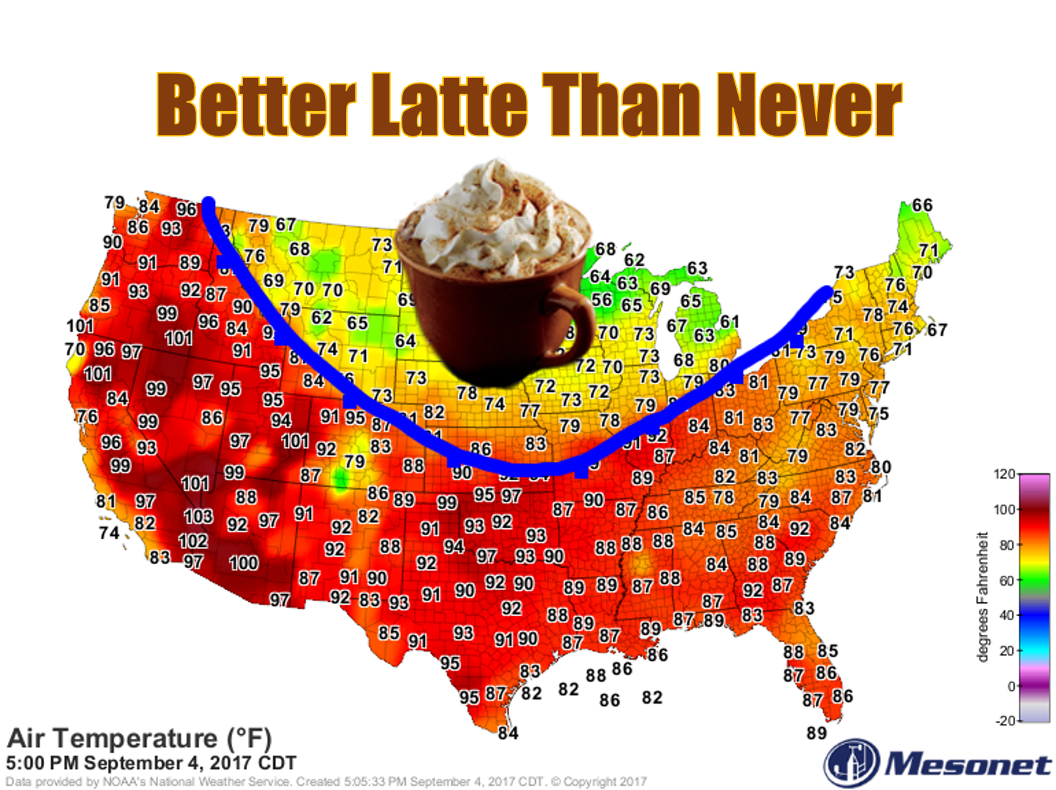
Yeah, a bit too early to call a wrap on summer, but most folks are ready to
pretend it's fall at least. Summer did raise up and make itself noticed over the
weekend with some toasty temperatures. We even saw triple-digits yesterday.
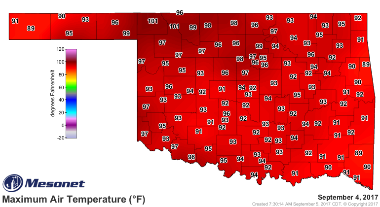
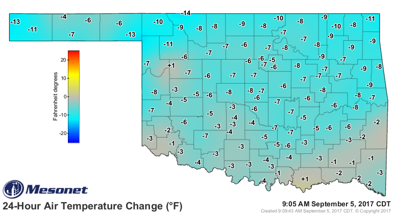
The front has definitely made a difference with current temperatures in the 60s
and 70s. No big whoop, right? Well the kicker is they ain't going up another 30
degrees like yesterday.
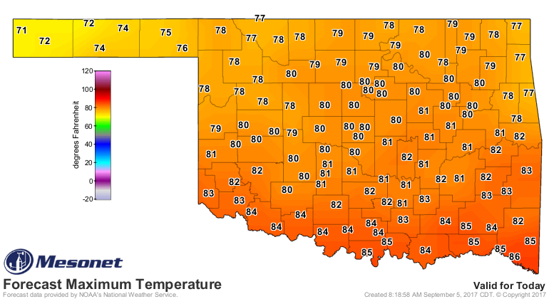
And the lows the next couple of days ARE going to be downright autumnal.
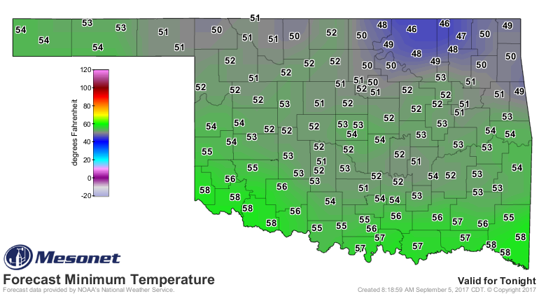
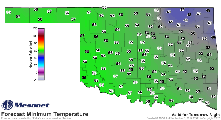
We're not going to see a similar warm up to this weekend in the coming week, at
least. All eyes turn to Hurricane Irma out in the Atlantic, as of now a
dangerous Cat-5 monster churning its way towards the US.
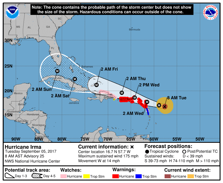
Too early to say if Oklahoma's weather will be impacted, but looks like somebody
is going to get walloped.
Gary McManus
State Climatologist
Oklahoma Mesonet
Oklahoma Climatological Survey
(405) 325-2253
gmcmanus@mesonet.org
September 5 in Mesonet History
| Record | Value | Station | Year |
|---|---|---|---|
| Maximum Temperature | 110°F | WALT | 1998 |
| Minimum Temperature | 43°F | BOIS | 2011 |
| Maximum Rainfall | 3.34″ | PERK | 2018 |
Mesonet records begin in 1994.
Search by Date
If you're a bit off, don't worry, because just like horseshoes, “almost” counts on the Ticker website!