Ticker for September 11, 2017
MESONET TICKER ... MESONET TICKER ... MESONET TICKER ... MESONET TICKER ...
September 11, 2017 September 11, 2017 September 11, 2017 September 11, 2017
Summer roars back!
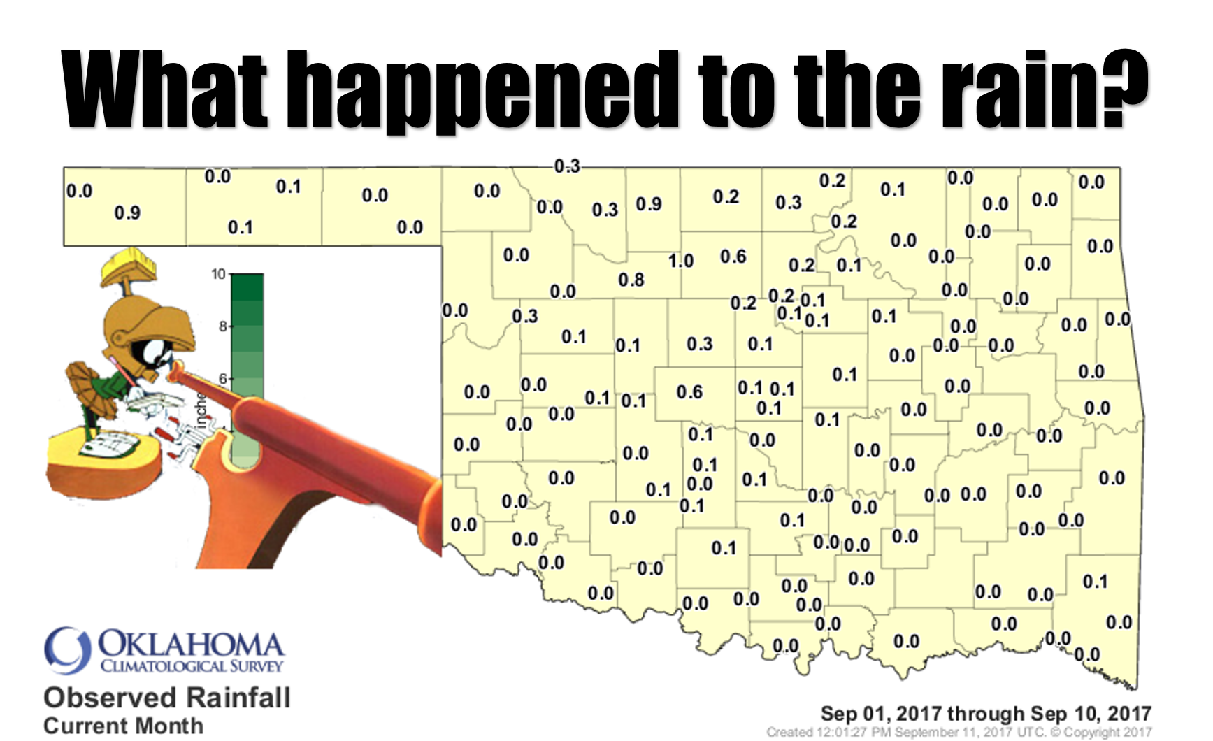
Remember way way WAY back in August when it rained? A lot? And we ended up with
the second wettest August on record, and also the sixth coolest? Ahhh, good times.
The rainfall for September thus far has been dry, to say the least.

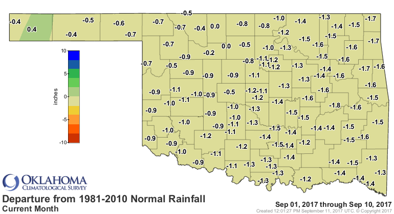
But despite August's reputation, the current dry spell actually started back on
Aug. 26, and the rainfall maps for the last 30 days are starting to show it,
especially across far northern Oklahoma.
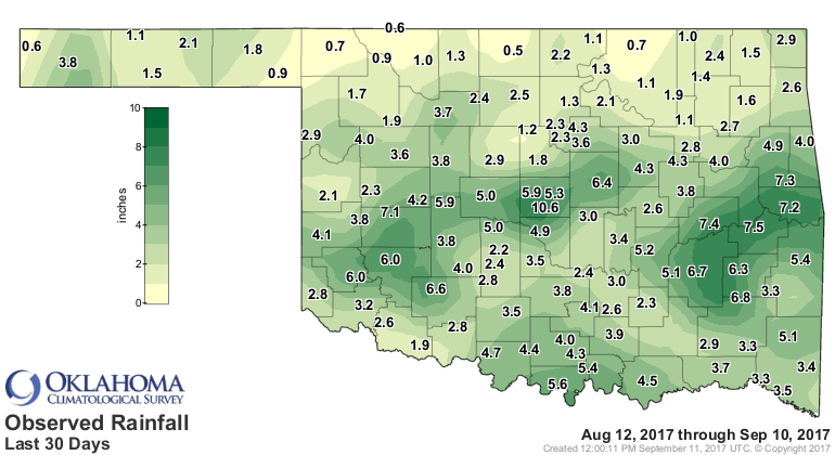
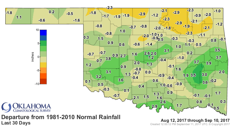
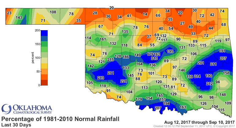
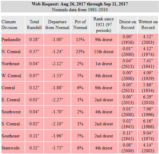
And if you look at the statistics since that Aug. 26 date, they're downright
pitiful. The driest such period since at least 1921 for northeastern Oklahoma!
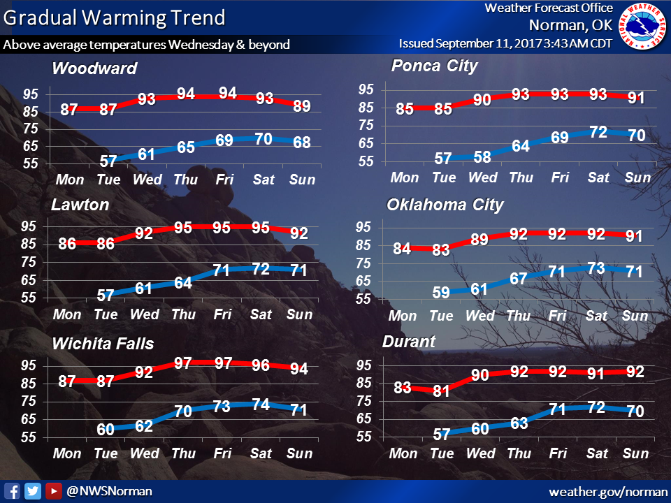
And don't look now, but summer is set to come roaring back this week. It was
inevitable, payback from Mother Nature for our August.
Friday will be indicative of the weather coming later this week.
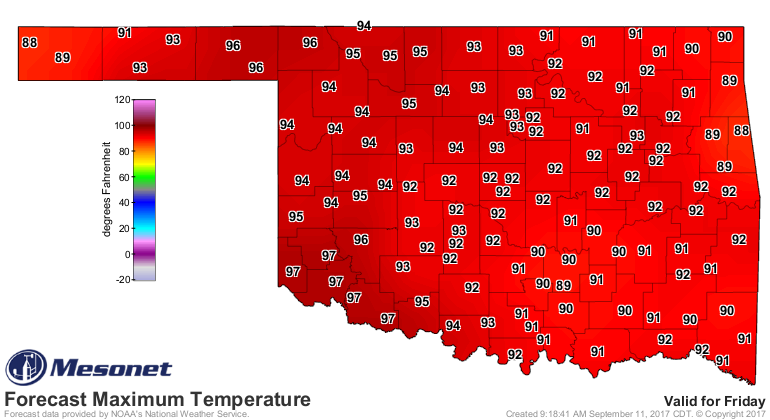
With a cold front coming in later this weekend, watch for lots of dry, windy
(and hot!) weather ahead of it...and you know what that means for those areas
drying out. No, not free ice cream cones...where's your head?
Wildfire danger.
Rainfall chances are not too good right now, at least for the next week.
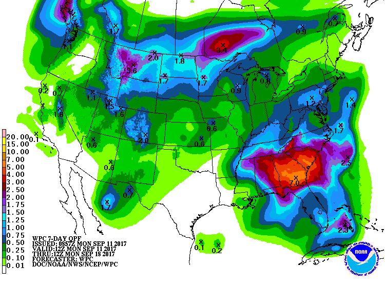
We'll see after that. How's that for a forecast?
Gary McManus
State Climatologist
Oklahoma Mesonet
Oklahoma Climatological Survey
(405) 325-2253
gmcmanus@mesonet.org
September 11 in Mesonet History
| Record | Value | Station | Year |
|---|---|---|---|
| Maximum Temperature | 109°F | FREE | 2000 |
| Minimum Temperature | 36°F | KENT | 2020 |
| Maximum Rainfall | 6.71 inches | PUTN | 2008 |
Mesonet records begin in 1994.
Search by Date
If you're a bit off, don't worry, because just like horseshoes, “almost” counts on the Ticker website!