Ticker for August 14, 2017
MESONET TICKER ... MESONET TICKER ... MESONET TICKER ... MESONET TICKER ...
August 14, 2017 August 14, 2017 August 14, 2017 August 14, 2017
Moving on up
August 2017 is zooming up the rankings, and with a statewide average of 4.4
inches ranks as the 19th wettest on record. However, this August is close on the
heels of 2003's 4.41 inches (probably pass that in a couple of hours), but still
a couple of inches behind the leader, 1915's 6.48 inches. Those records date back
to 1895. Here's a look at the rainfall thus far during August.
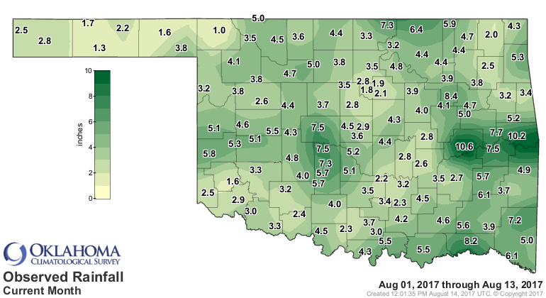
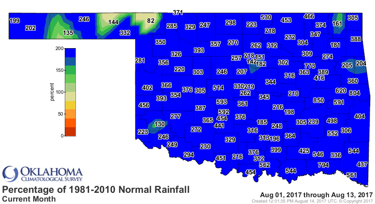
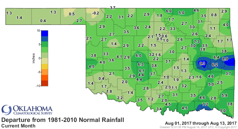
Some parts of the state are easily 4-8 inches above normal, and 2-4 inch surpluses
are common. Just to be different, Buffalo (the best spot not only in Oklahoma, but
the world) remains with a deficit of 0.2 inches for the month.
And remember, it's still raining!
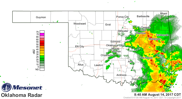
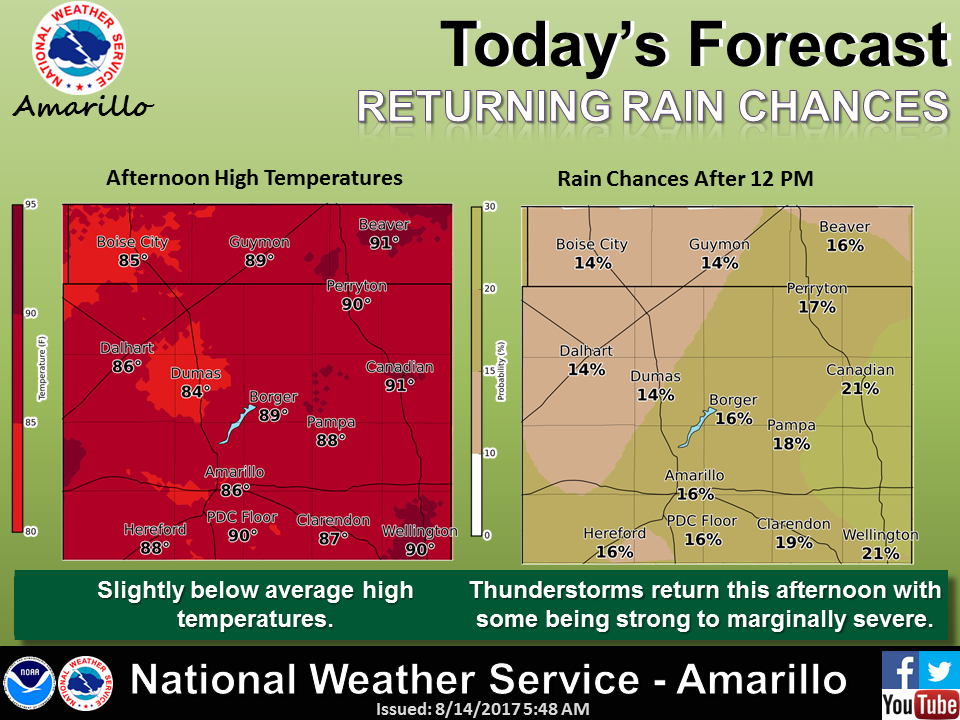
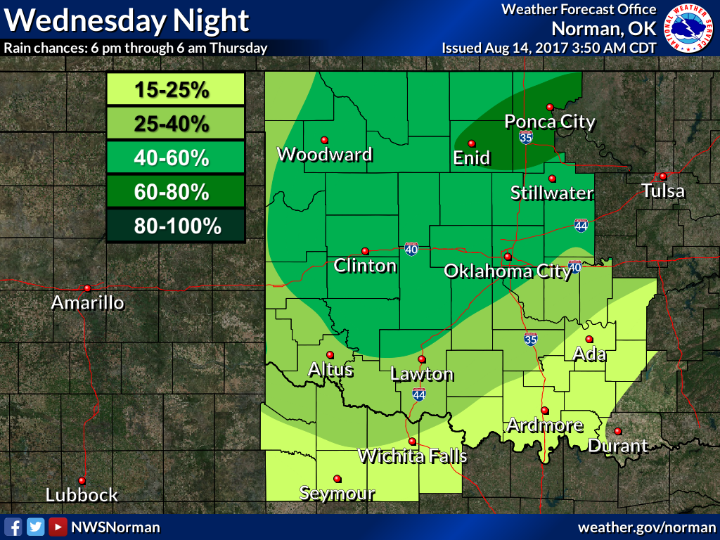
With more on the way! The NWS Amarillo and Tulsa offices preview the rest of
today, while Norman gives us a peak at Wednesday's storm.

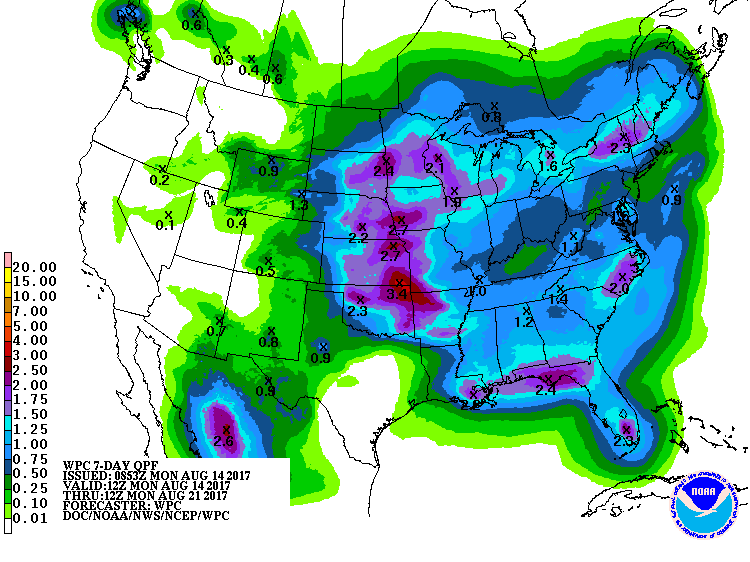
The 7-day rain forecast still shows substantial totals, especially across the
north and east, but remember some of that is what was forecast this morning.
1915...your ears should be burning (or full of water, I guess).
Gary McManus
State Climatologist
Oklahoma Mesonet
Oklahoma Climatological Survey
(405) 325-2253
gmcmanus@mesonet.org
August 14 in Mesonet History
| Record | Value | Station | Year |
|---|---|---|---|
| Maximum Temperature | 107°F | KIN2 | 2010 |
| Minimum Temperature | 50°F | WIST | 2004 |
| Maximum Rainfall | 5.37 inches | BOWL | 2005 |
Mesonet records begin in 1994.
Search by Date
If you're a bit off, don't worry, because just like horseshoes, “almost” counts on the Ticker website!