Ticker for July 17, 2017
MESONET TICKER ... MESONET TICKER ... MESONET TICKER ... MESONET TICKER ...
July 17, 2017 July 17, 2017 July 17, 2017 July 17, 2017
The long slog
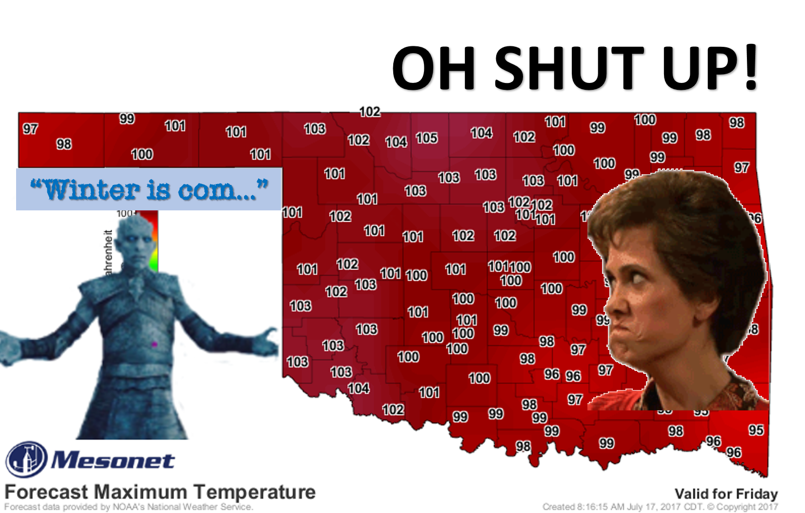
Oh we're in it now. We can only DREAM of winter now. We had a few days of showers,
storms, rain-cooled air, etc. Only a memory now. That Friday forecast above is
probably a bit on the conservative side, and definitely won't represent the misery
forecast for eastern Oklahoma as they add moisture to their heat. Some places
got blasted (KENTON WITH 4.69 INCHES??? YOU'RE SICK YOU'RE SICK!), others, not
so much. How the heck does Kenton get 4.69 inches anyway? I know July is their
"rainy" season (don't laugh, Idabel), but that's a bit extreme for those folks in
a MONTH, let alone a couple of days.
As for the rest of the week, well, the NWS folks are all full of good tidings
and cheer.
Prepare for heat advisories, especially across eastern Oklahoma.
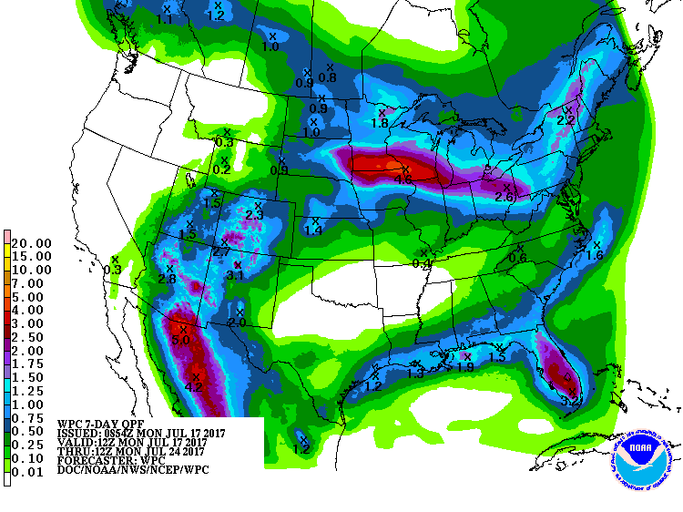
The dreaded heat dome signature is showing up in the 7-day precip forecast with
a big doughnut hole right over Oklahoma.
Some relief early next week is rumored. We don't like to gossip, but in this
case...
Hey, have you heard about the cold front for next week?
Gary McManus
State Climatologist
Oklahoma Mesonet
Oklahoma Climatological Survey
(405) 325-2253
gmcmanus@mesonet.org
July 17 in Mesonet History
| Record | Value | Station | Year |
|---|---|---|---|
| Maximum Temperature | 111°F | HOLL | 2022 |
| Minimum Temperature | 54°F | KENT | 2009 |
| Maximum Rainfall | 6.42 inches | BURB | 1997 |
Mesonet records begin in 1994.
Search by Date
If you're a bit off, don't worry, because just like horseshoes, “almost” counts on the Ticker website!