Ticker for July 13, 2017
MESONET TICKER ... MESONET TICKER ... MESONET TICKER ... MESONET TICKER ...
July 13, 2017 July 13, 2017 July 13, 2017 July 13, 2017
Give it back!
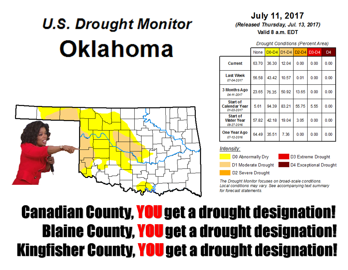
Sorry if I left your county out, but do you really want this present? And you
know those cars Oprah gave away came with a hefty tax bill, right? That's what
the old saying says, never look a gift horse in the mouth (or the other end,
for obvious reasons). Here's the unadulterated Drought Monitor report for your
perusal.
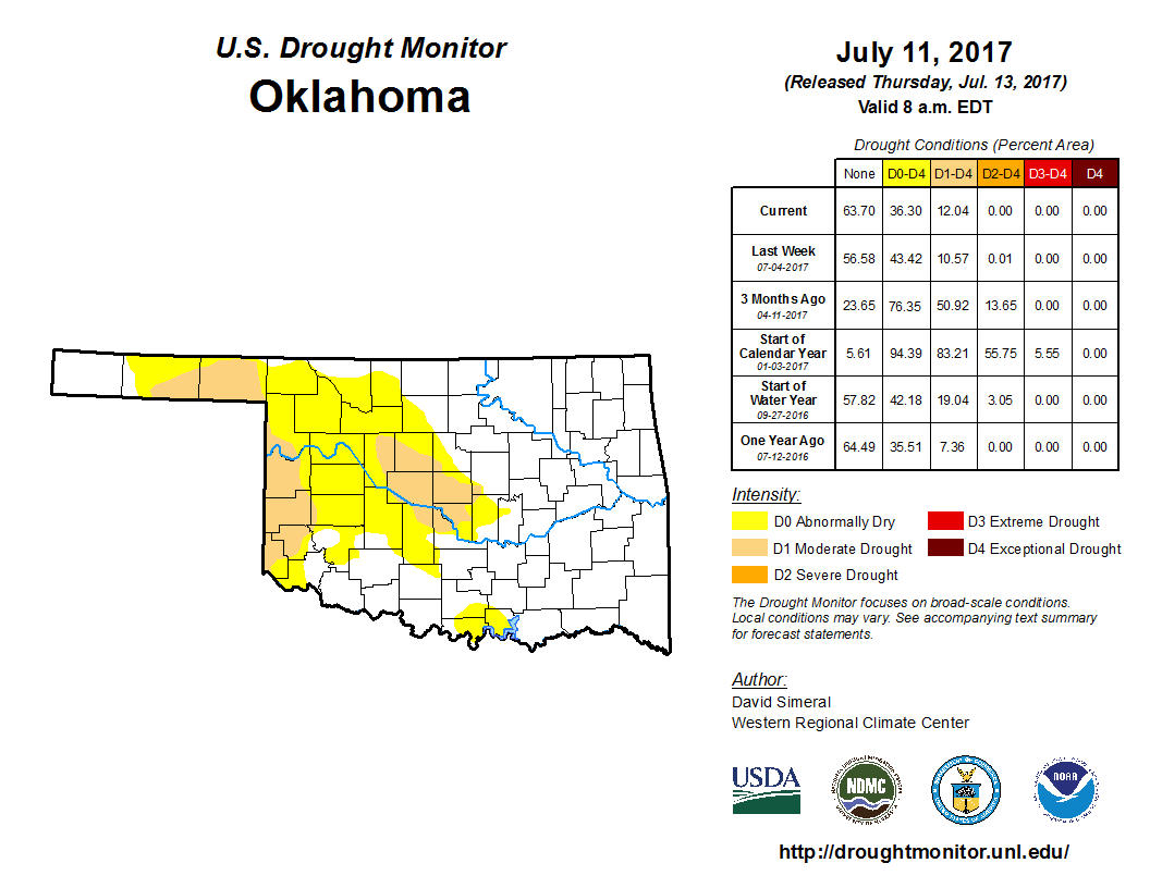
So we did have improvement across the SE, SC and NC parts of the state, but we
also saw deterioration out into Canadian, Blaine and Kingfisher counties, as well
as the central Panhandle. That's shown on this 1-week change in intensity map.
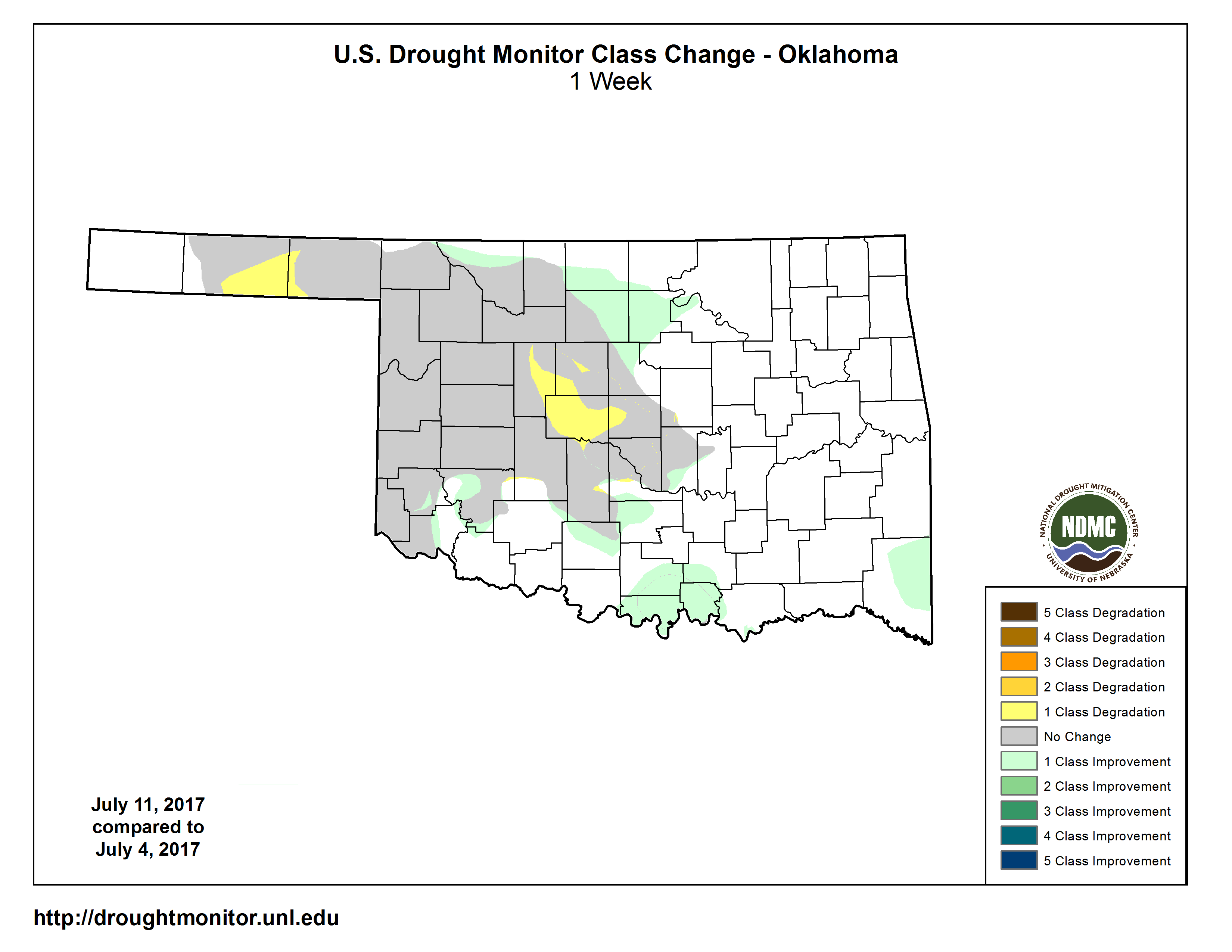
That expansion west in central OK came from a field report from a county-level
official. We love those ground truth reports like McAdams loves Gosling. That
allows us to confirm what we're seeing in the data, or in this case, see what
WASN'T spelled out in the data.
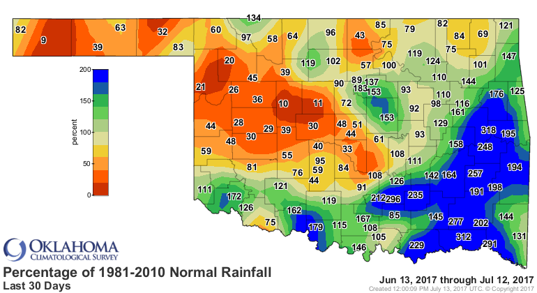
Let's go a bit further, out to 4 weeks.
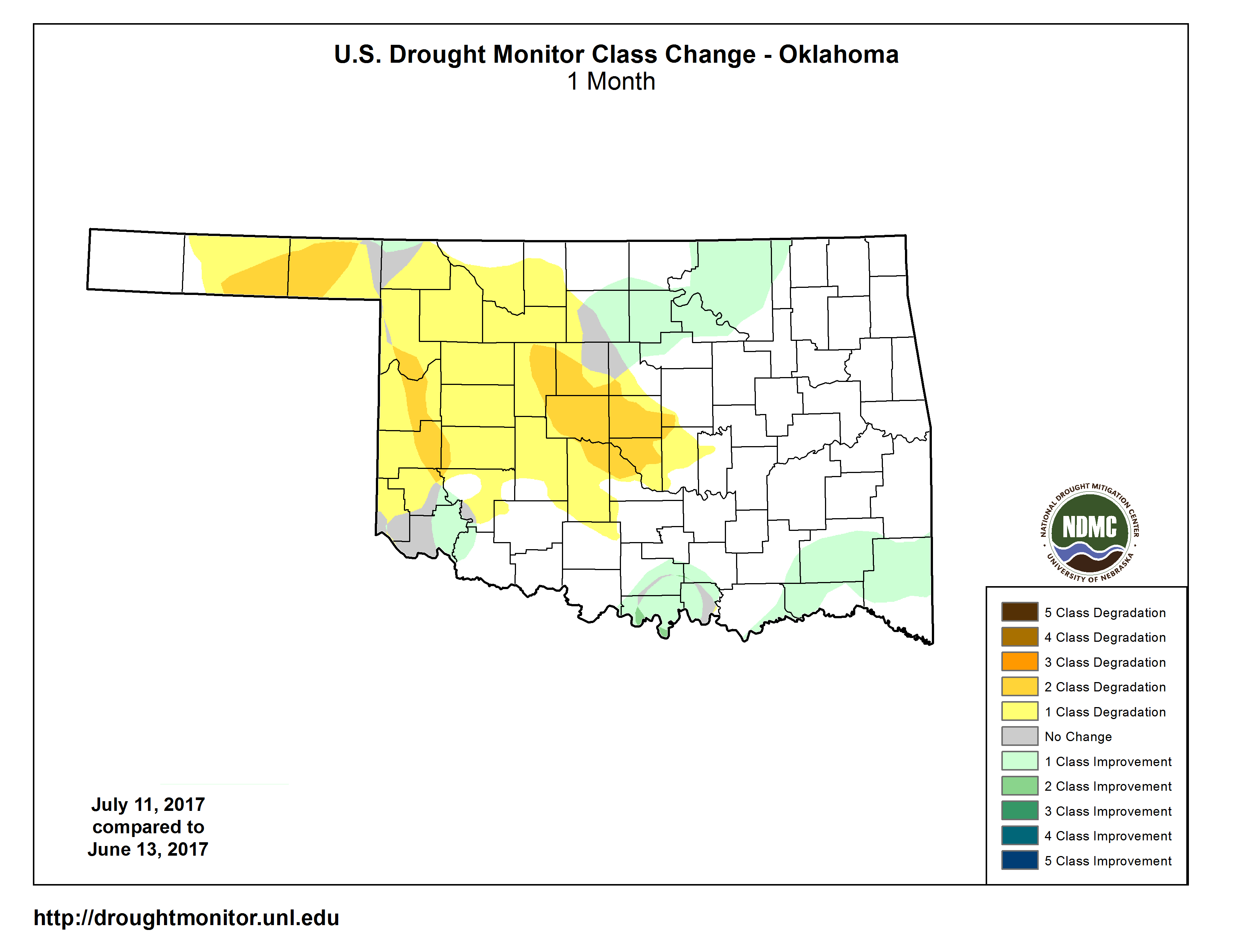
Here we see the impact of the flash drought across the western quarter of
Oklahoma, which not surprisingly matches up with the area of largest deficits
over that time frame.
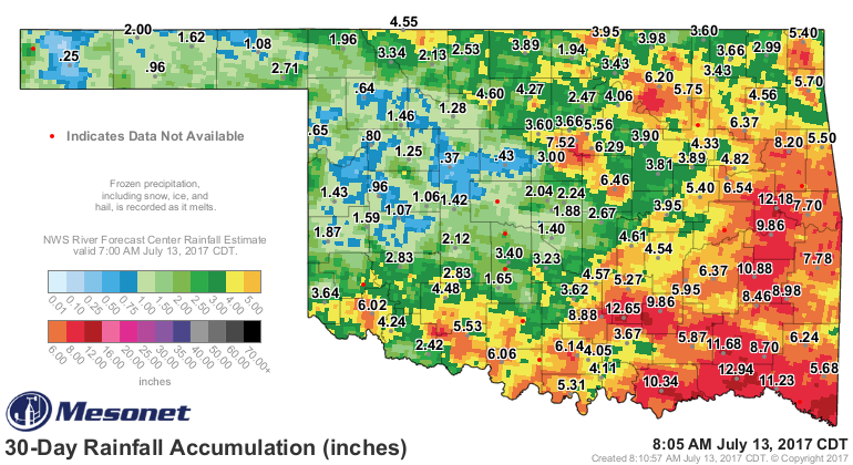
Lots of rain in lots of places that didn't need it as much as others, but they
needed it nonetheless. Areas that saw recent improvements are still in danger
of slipping back into the flash drought's grip because they still have
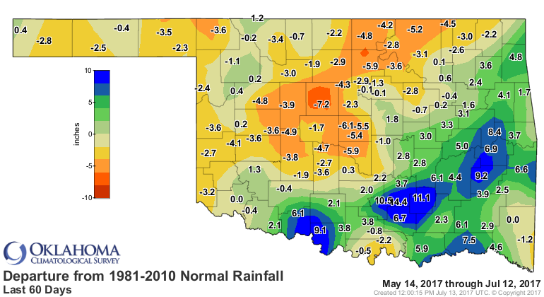
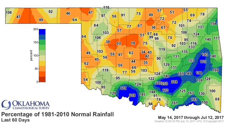
underlying deficits out past 30 days. Here's a look at the 60-day maps. Those
places in north central OK that were improved this week could easily slip back
into impact territory if they go without significant moisture in the face of
summer. And that's not to mention the worsening deficits across central OK. That
could lead to a jump from moderate to severe drought if we're not careful.
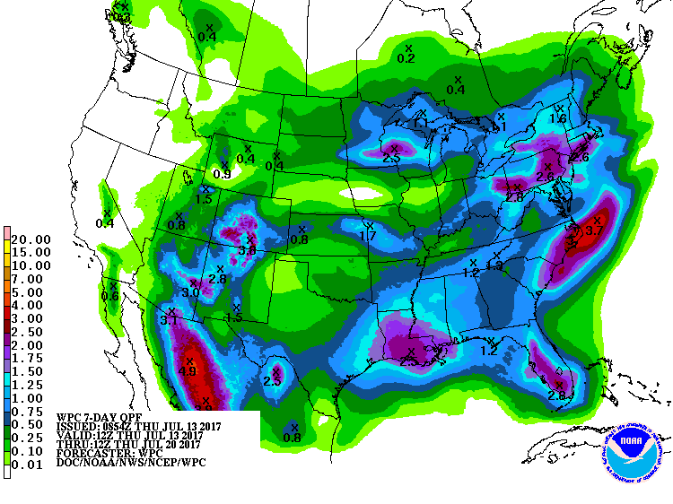
Well what about those prospects for rain here in the middle of summer? I'm
almost scared to look. Well, as it turns out, those chances are just what
you'd expect. Not much! At least for a good soaking rain. The best chances
appear to be in the far northwest tonight, a bit more coverage on Saturday.
But, not much in the way of moisture.
Past that, looks like next week will either be hot, or hotter. Ooh, the
excitement of summer!
Gary McManus
State Climatologist
Oklahoma Mesonet
Oklahoma Climatological Survey
(405) 325-2253
gmcmanus@mesonet.org
July 13 in Mesonet History
| Record | Value | Station | Year |
|---|---|---|---|
| Maximum Temperature | 109°F | LAHO | 2003 |
| Minimum Temperature | 52°F | BOIS | 2008 |
| Maximum Rainfall | 4.29 inches | CLAY | 2025 |
Mesonet records begin in 1994.
Search by Date
If you're a bit off, don't worry, because just like horseshoes, “almost” counts on the Ticker website!