Ticker for June 20, 2017
MESONET TICKER ... MESONET TICKER ... MESONET TICKER ... MESONET TICKER ...
June 20, 2017 June 20, 2017 June 20, 2017 June 20, 2017
Tropically depressed
With flash drought erupting in parts of the state, and summer having already
erupted a few times the past couple of weeks, some might think a good dose of
tropical moisture would be welcome? Well, it would and it wouldn't. For one thing,
even for those that need rain, tropical systems tend to bring a bit too much
rain in too quick of a time. And we do need rain, but perhaps we should rely on
a good old fashioned cold front, albeit a strong one for this time of the year,
for our precipitation.
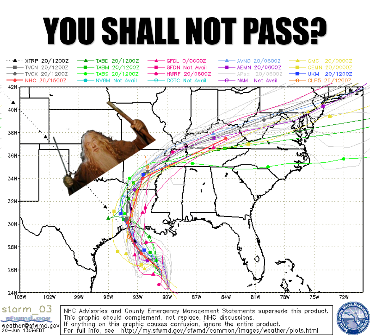
Case in point, I'm sure most of you know by now that tropical storm Cindy is
currently spinning in the Gulf of Mexico south of Louisiana.
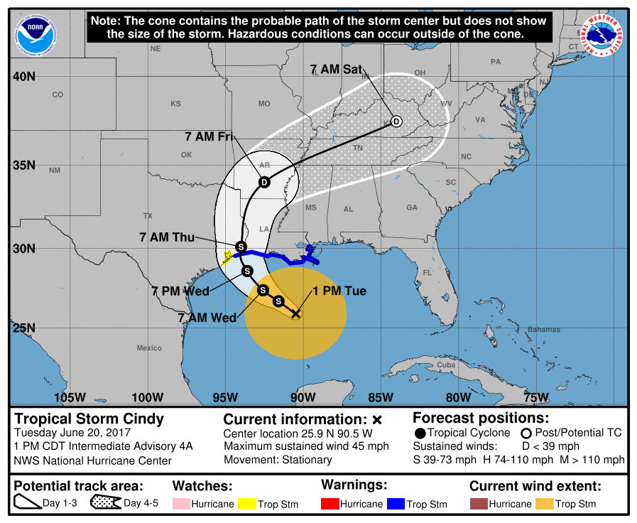
As you can see from that "forecast cone" from the National Hurricane Center, as
well as the first image I showed...a "spaghetti plot" of all the current model
output on Cindy's movements, it could be headed towards southeastern Oklahoma.
The forecast cone has it possibly clipping the far southeast, while the various
models from the spaghetti plot having the center of the system curving away
toward the northeast as it approaches Oklahoma. But remember, these systems'
impacts can be quite a bit larger than just where that center is located.
And to illustrate how impactful a tropical storm's precipitation footprint can
be, even if it is "just" a tropical depression as it is forecast to be as it
approaches our neck of the woods, check out the rainfall forecast.
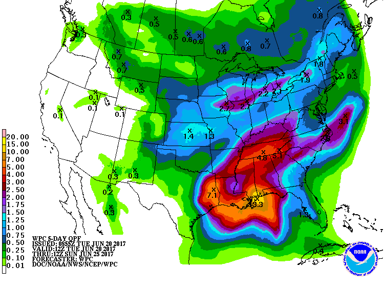
ZOUNDS! That's a lot of rainfall just to our southeast. Over 7 inches is
forecast, but as we've learned by now, it could be a lot more than that in
localized areas (and a lot less in others). We may dodge that bullet and keep
those flooding rains to the southeast, although that corner of our state might
see a bit of impact.
Still, we should see some rain going into and through the weekend, and
definitely some very un-summer like temperatures. How about highs in the 70s
on Sunday??
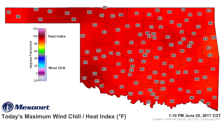
Besides, we're already feeling tropical anyway. But it ain't 112 degrees, at
least.
Gary McManus
State Climatologist
Oklahoma Mesonet
Oklahoma Climatological Survey
(405) 325-2253
gmcmanus@mesonet.org
June 20 in Mesonet History
| Record | Value | Station | Year |
|---|---|---|---|
| Maximum Temperature | 112°F | MANG | 1998 |
| Minimum Temperature | 52°F | KENT | 2000 |
| Maximum Rainfall | 4.32 inches | BOWL | 2007 |
Mesonet records begin in 1994.
Search by Date
If you're a bit off, don't worry, because just like horseshoes, “almost” counts on the Ticker website!