Ticker for May 25, 2017
MESONET TICKER ... MESONET TICKER ... MESONET TICKER ... MESONET TICKER ...
May 25, 2017 May 25, 2017 May 25, 2017 May 25, 2017
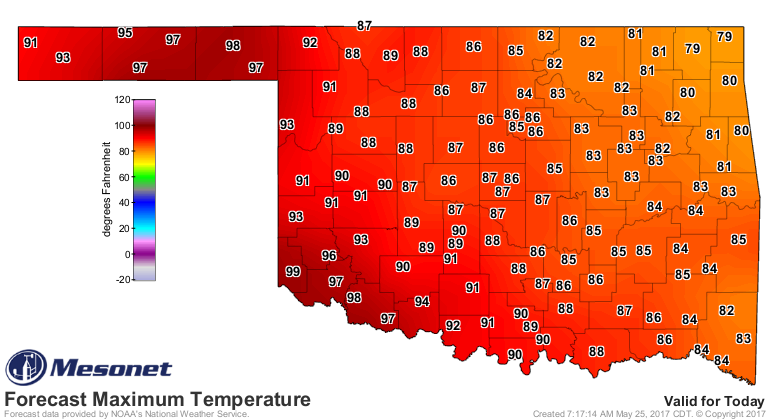
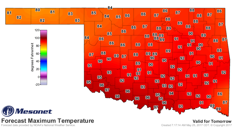
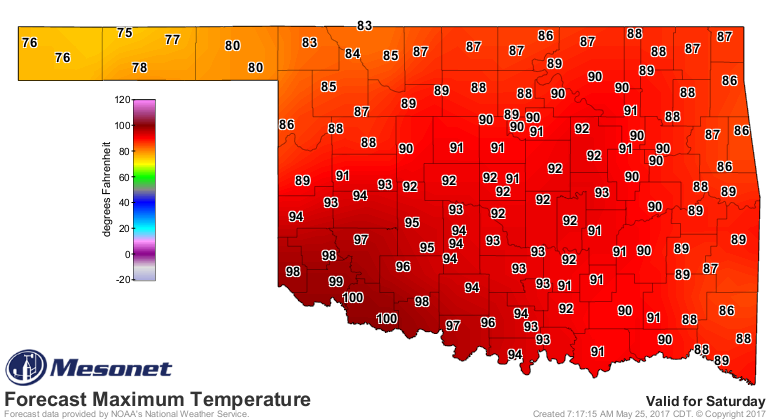
Fun in the 100s
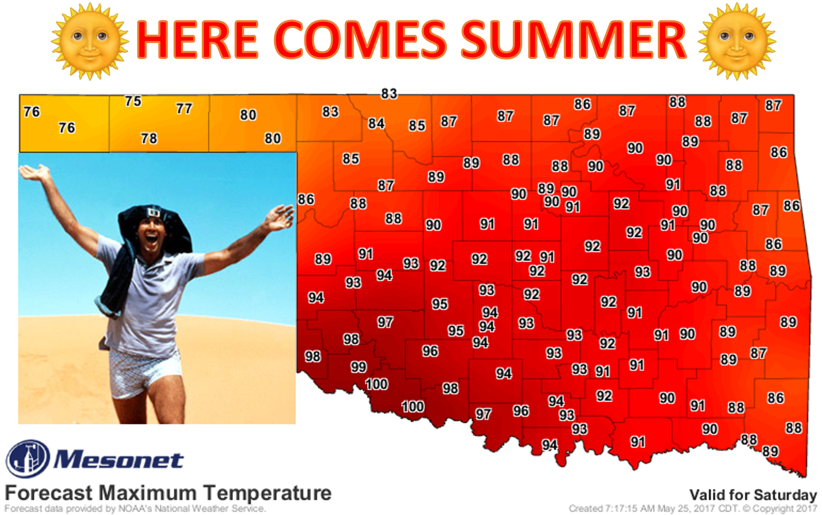
It was inevitable. Cold weather fans hate it. Hot chocolate lovers despise it.
Hot soup aficionados...well, just crank down the AC and go to town. Summer is
here, and just in time for the Memorial Day weekend. We will most likely see
our first triple-digit reading of the year sometime over the next three days.
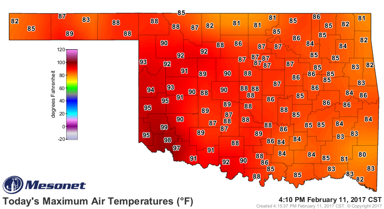
We almost got there over three months ago during winter, if you'll remember when
Mangum hit 99 degrees on February 11.
Starting today, the heat is cranking up and getting out of control!
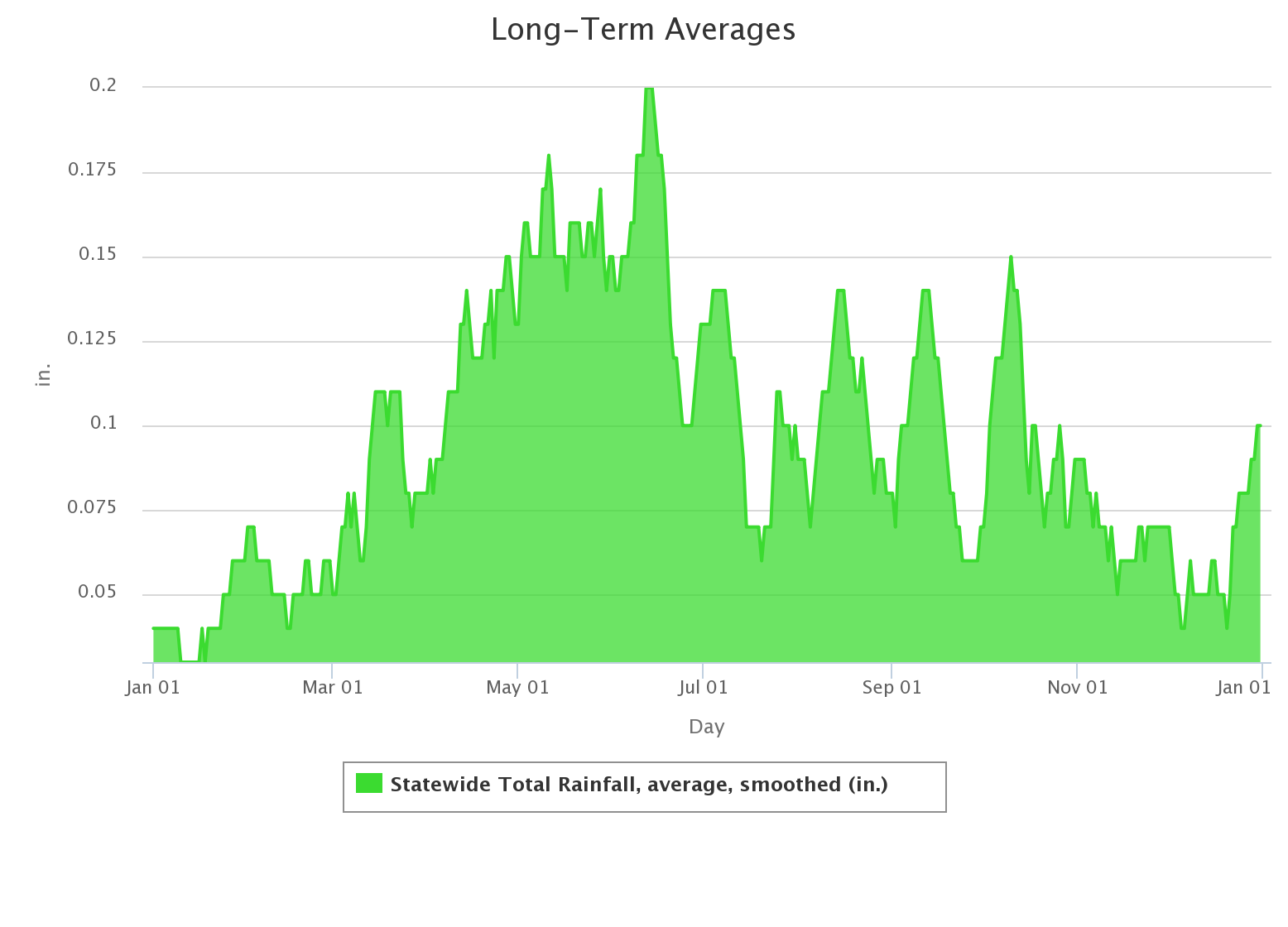
Summer will not persist, however. It's still gonna be June, the first couple of
weeks which represent the rainiest part of our calendar year for many areas.
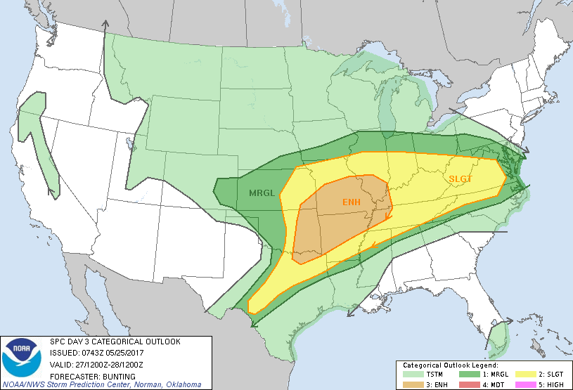
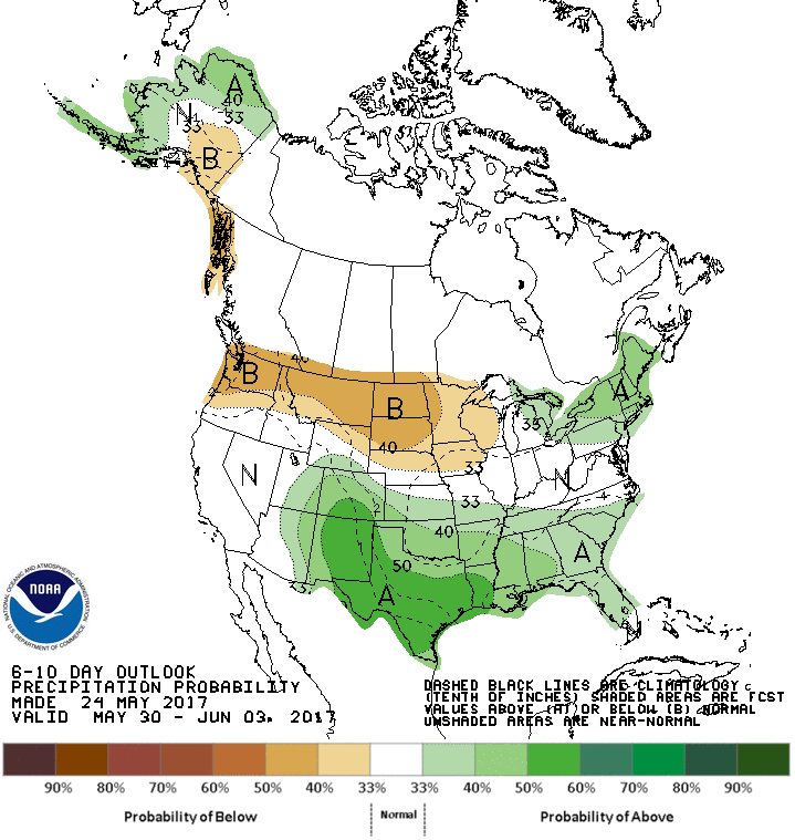
AND, there will be the chance of a storm system this weekend, with the chance of
some hefty rains across eastern Oklahoma

AND the chance of severe weather.
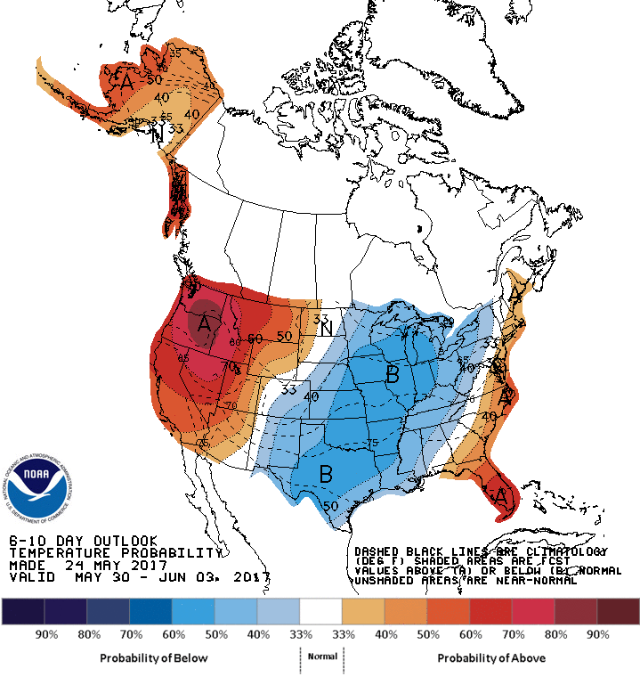
AND after that, a big storm system is shaping up for later that week into the
next.
The good news? For the third climatological summer (June 1-August 31) in a row,
we're entering the season with no drought in Oklahoma! Just a tad bit of
abnormally dry conditions across parts of southern OK.
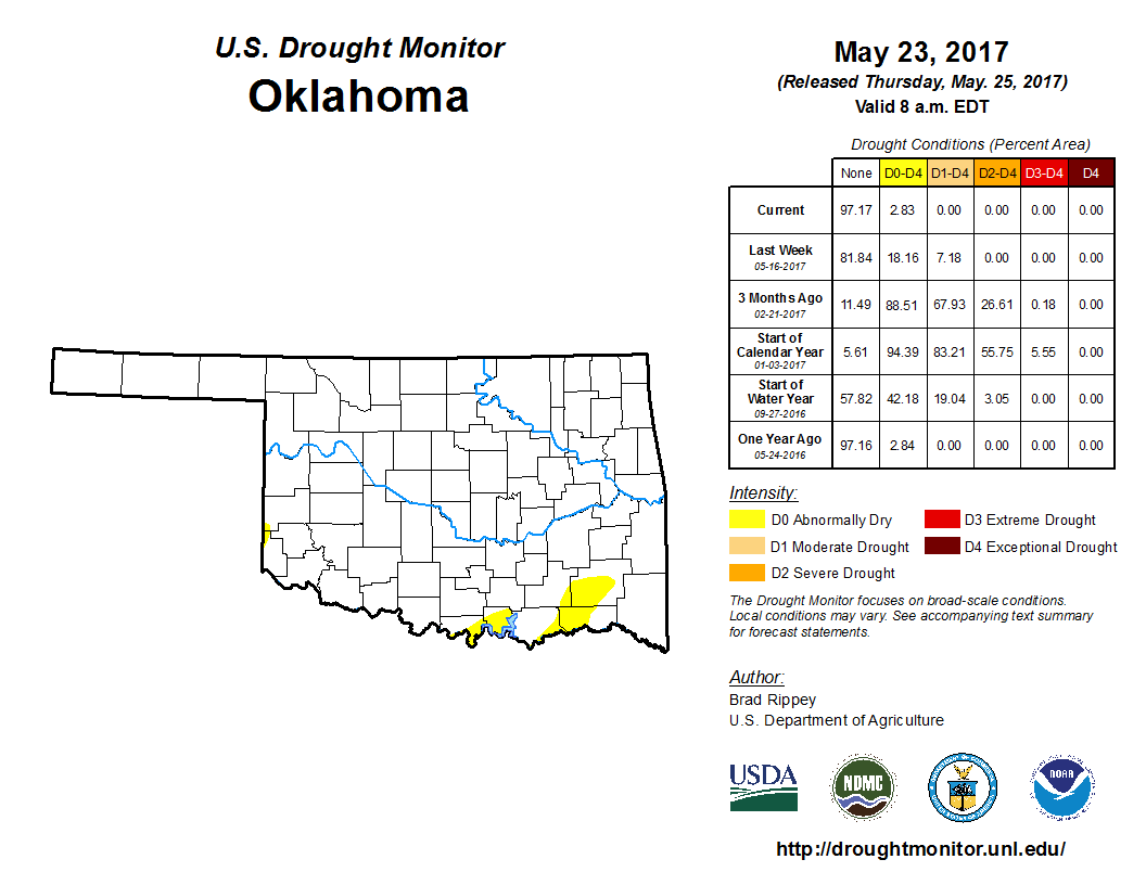
The bad news? Starting to get a bit concerned over building moisture deficits
across parts of the state.

Enjoy all that June has to offer...a bit for everybody!
Gary McManus
State Climatologist
Oklahoma Mesonet
Oklahoma Climatological Survey
(405) 325-2253
gmcmanus@mesonet.org
May 25 in Mesonet History
| Record | Value | Station | Year |
|---|---|---|---|
| Maximum Temperature | 103°F | BEAV | 2012 |
| Minimum Temperature | 33°F | KENT | 2002 |
| Maximum Rainfall | 4.74 inches | WILB | 2025 |
Mesonet records begin in 1994.
Search by Date
If you're a bit off, don't worry, because just like horseshoes, “almost” counts on the Ticker website!