Ticker for May 17, 2017
MESONET TICKER ... MESONET TICKER ... MESONET TICKER ... MESONET TICKER ...
May 17, 2017 May 17, 2017 May 17, 2017 May 17, 2017
A terrible price
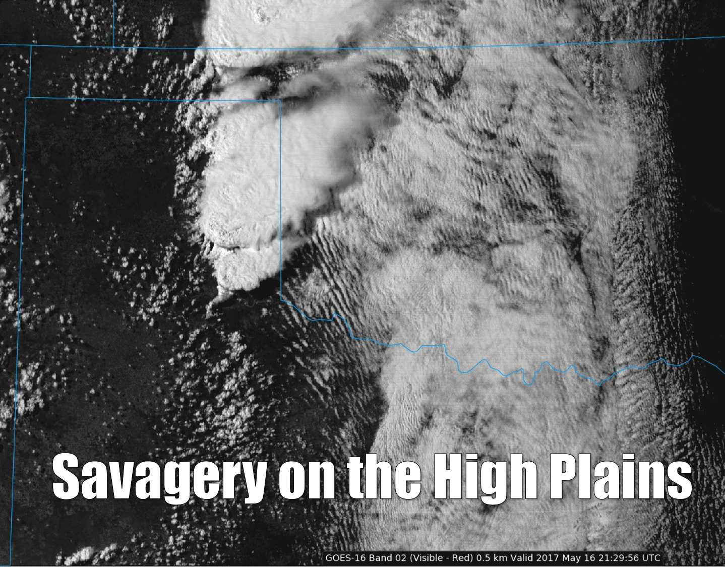
They don't look so bad from space, do they? They're actually quite breathtaking,
those puffs of condensed moisture, silent riders borne upwards by buoyant,
unstable air. Their results closer to the surface, however, are sometimes
devastating. That picture from the new GOES16 satellite, taken about 4:30pm
yesterday just as the storm were going tornadic in the Texas Panhandle, are now
less resplendent and more ominous -- made so by the terrible price western
Oklahoma paid with their passing.
Somewhere in the neighborhood of 10 tornadoes touched down in Oklahoma yesterday.
That number could go up or down based on NWS survey teams, of course, but their
impacts won't change. Several Oklahoma towns were pounded with hail to the size
of softballs (and possibly larger), severe winds and tornadoes.
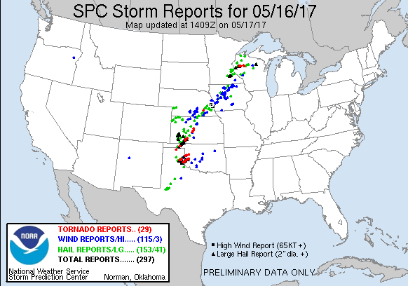
Numerous homes and other structures were damaged across western Oklahoma,
including 50-75 homes in Elk City, according to news reports. The worst impact
of all, however, occurred at the intersection of state highways 34 and 152 when
the significant tornado overtook a resident trying to get out of the way of
the storm.
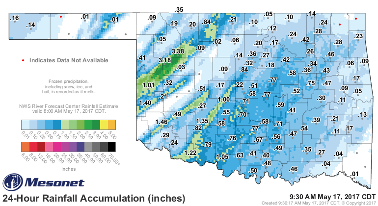
The good news is some decent rains fell across much of the state, although
too much fell with one of those supercells in Dewey County. Camargo registered
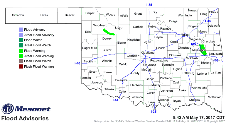
3.18 inches of rain, and Seiling led the Mesonet at 3.38 inches, prompting a
flood warning for the North Canadian River near Seiling.
The bad news? Looks like we get to do this all over again tomorrow and Friday.
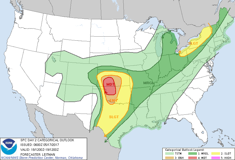
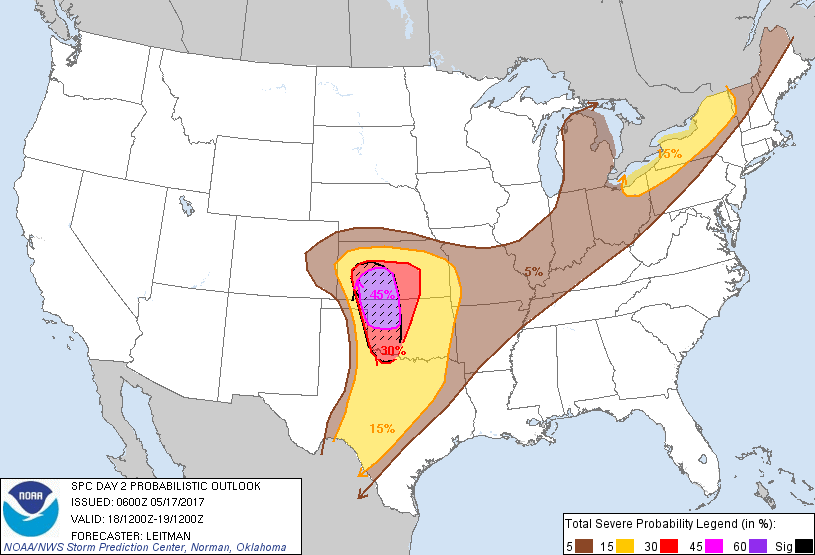
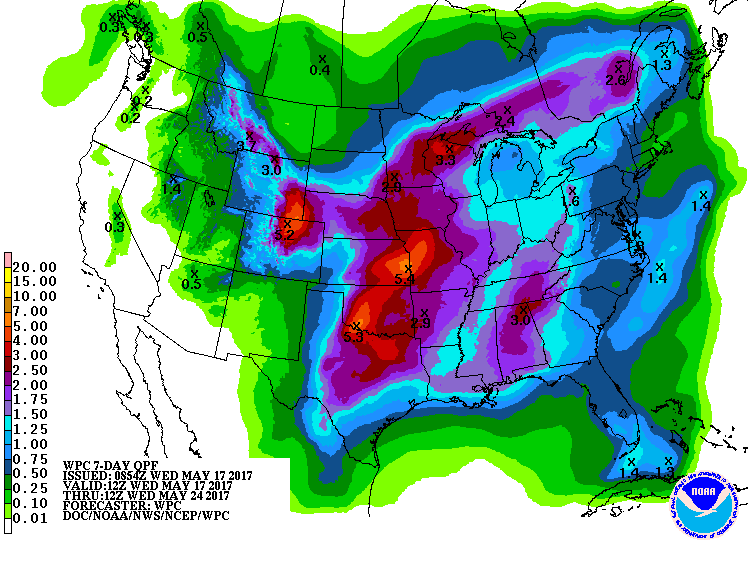
The rainfall from this next system looks tremendous(ly bad). Flooding will
again become a significant threat, especially on Friday.
Tornadoes are loathsome creatures. I would love for yesterday to have been the
last tornado day in the history of Oklahoma. Unfortunately, we know that's not
going to happen. Best we can do is stay prepared, and come together and recover
in the aftermath.
Gary McManus
State Climatologist
Oklahoma Mesonet
Oklahoma Climatological Survey
(405)325-2253
gmcmanus@mesonet.org
May 17 in Mesonet History
| Record | Value | Station | Year |
|---|---|---|---|
| Maximum Temperature | 101°F | HOLL | 2022 |
| Minimum Temperature | 37°F | CAMA | 2009 |
| Maximum Rainfall | 3.66″ | PORT | 2002 |
Mesonet records begin in 1994.
Search by Date
If you're a bit off, don't worry, because just like horseshoes, “almost” counts on the Ticker website!