Ticker for May 18, 2017
MESONET TICKER ... MESONET TICKER ... MESONET TICKER ... MESONET TICKER ...
May 18, 2017 May 18, 2017 May 18, 2017 May 18, 2017
Tornado Games
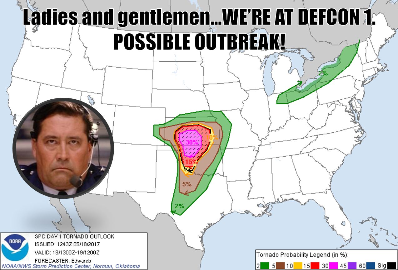
I wish it WAS a game, and I wish this was a DEF-BRAUMS map instead of a tornado
probability map. Unless you're living in a cave (and if you are living in a cave,
stay there), you now know our weather partners across the hall at the Storm
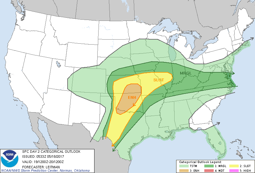
Prediction Center have issued a HIGH RISK for today, with associated MODERATE/
ENHANCED/SLIGHT/MARGINAL risk surrounding that area. See it here for yourself.
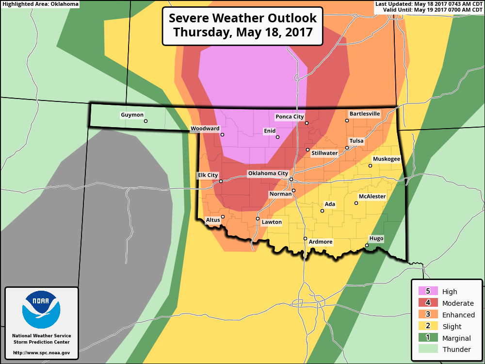
Some might accuse us of being overly dramatic, using the "outbreak" word. But,
that's sorta what the HIGH RISK category is for, as evidenced by SPC's own words.
" A Major Severe Weather Outbreak is Forecast Today and/or Tonight
An outbreak of severe thunderstorms with tornadoes, very large hail
and wind damage is expected to develop across parts of the southern
and central Plains from this afternoon into this evening and
overnight. Some strong, long-lived tornadoes are expected, along with
hail to near 4 inches in diameter, over parts of Kansas and Oklahoma.
Large hail, tornadoes and wind damage also will be possible outside
of these areas across parts of the southern and central Plains."
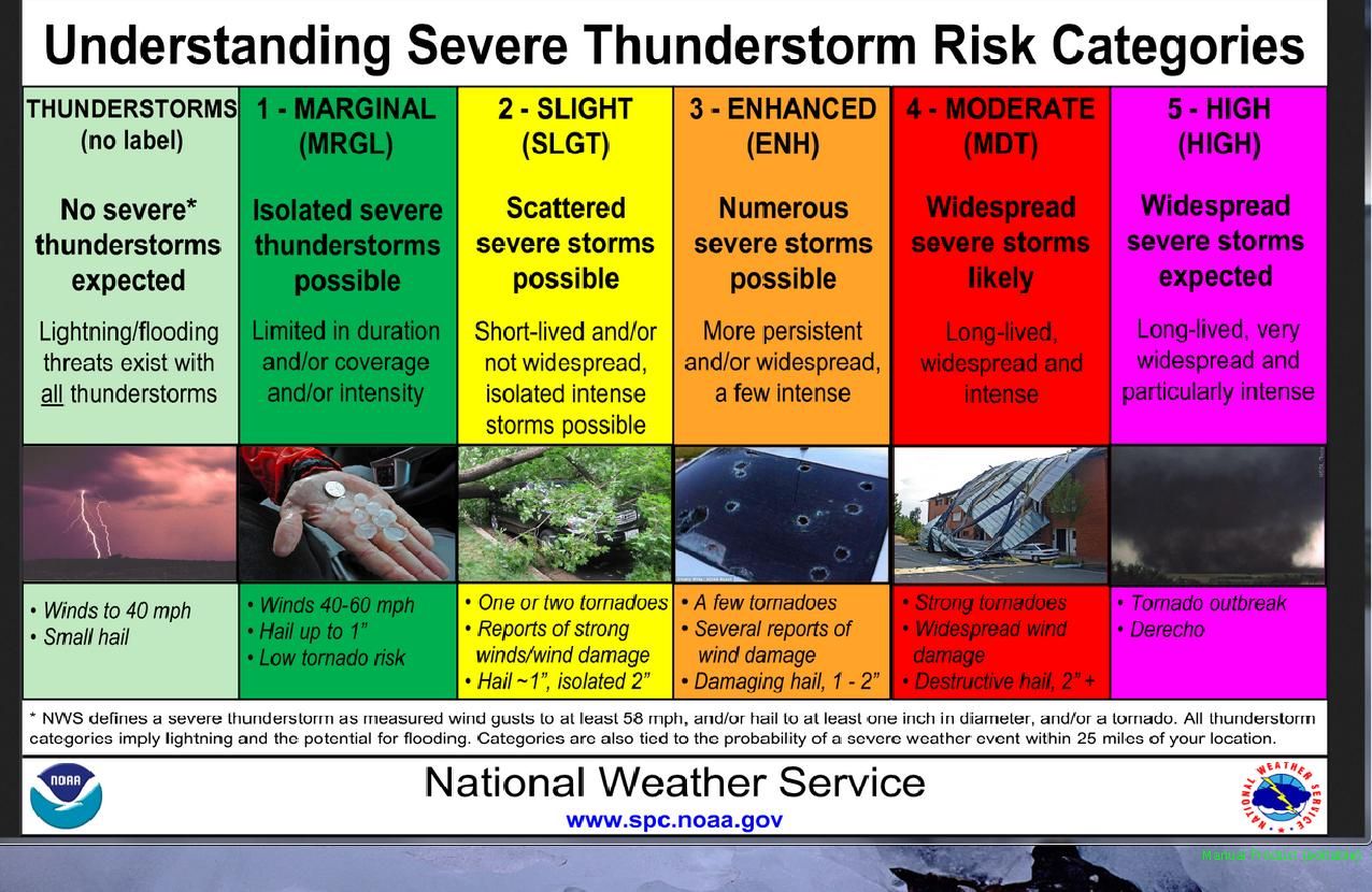
And the examples under the High Risk category says, well, "Tornado Outbreak."
That tornado outlook map above has 30% and 15% hatched areas coming down into
western Oklahoma, spreading to the east. Those indicate a 30/15% probability
of significant tornadoes (EF2-EF5) within 25 miles of a point. So any single
location is not guaranteed tornadoes, but that large area has a decent chance
of seeing tornadoes somewhere in it, relatively speaking. And as we saw from
Tuesday, the hail and high winds can be devastating as well. Those risks are
indicated thusly.
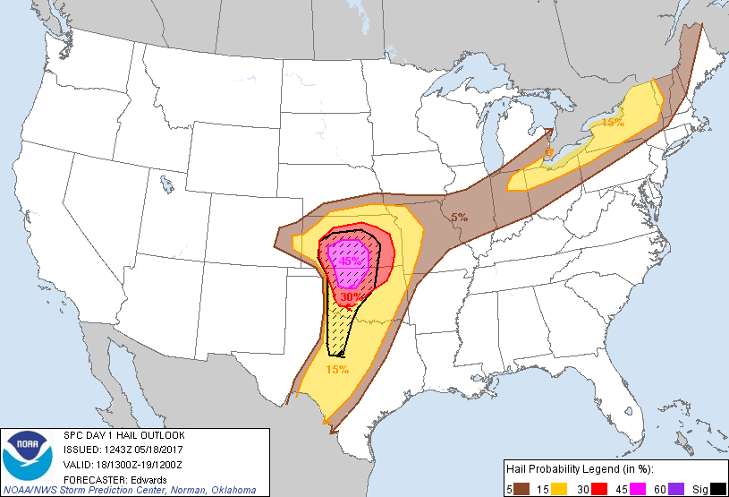
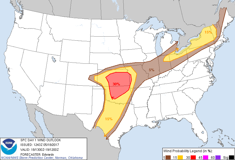
The hatched area on the hail map indicated the chances of hail larger than 2
inches within 25 miles of a point, but today (again, like Tuesday) the chances
for "gigantic" hail, 4 inches or larger, will be somewhat enhanced. That's
indicative of the strength of the updraft of today's storms.
AN IMPORTANT CAVEAT! Regardless of where lines between High/Moderate/Enhanced/
Slight end up, consider those to be fuzzy boundaries. The storms today in any
of those areas have a chance to be dangerous with all modes of severe weather
possible.
CAVEAT #2: This will be an evolving situation as we go through the day. The
high resolution models are still in poor agreement about storm initiation,
extent, and how that will impact the widespread storm environment.
This hasn't been etched in stone yet. Even the SPC mentions some more favorable
(but not necessarily desirable) outcomes.
"Some uncertainties still exist, however, precluding any greater
probabilities at this time -- mainly involving density and timing
of convection. Initiation of too many cells in early/middle afternoon,
and/or too close to each other at once, is
possible in some parts of the current moderate/high risks. This
scenario, which some guidance suggests, would lend a greater wind
threat and somewhat suppressed hail/significant-tornado risk with
eastward extent, due to messier storm modes amidst strengthening
deep-layer flow. Evidence for such a quick transition still is
inconsistent in the bulk of numerical guidance, and of course
observationally. While not compelling enough to modify the high or
moderate risk-driving probabilities yet, this is a possibility to be
monitored for potential adjustments to the outlook during the day."
So we have that going for us. Your local NWS offices will be fine tuning the
broader SPC guidance throughout the day, so get on their webpages and keep
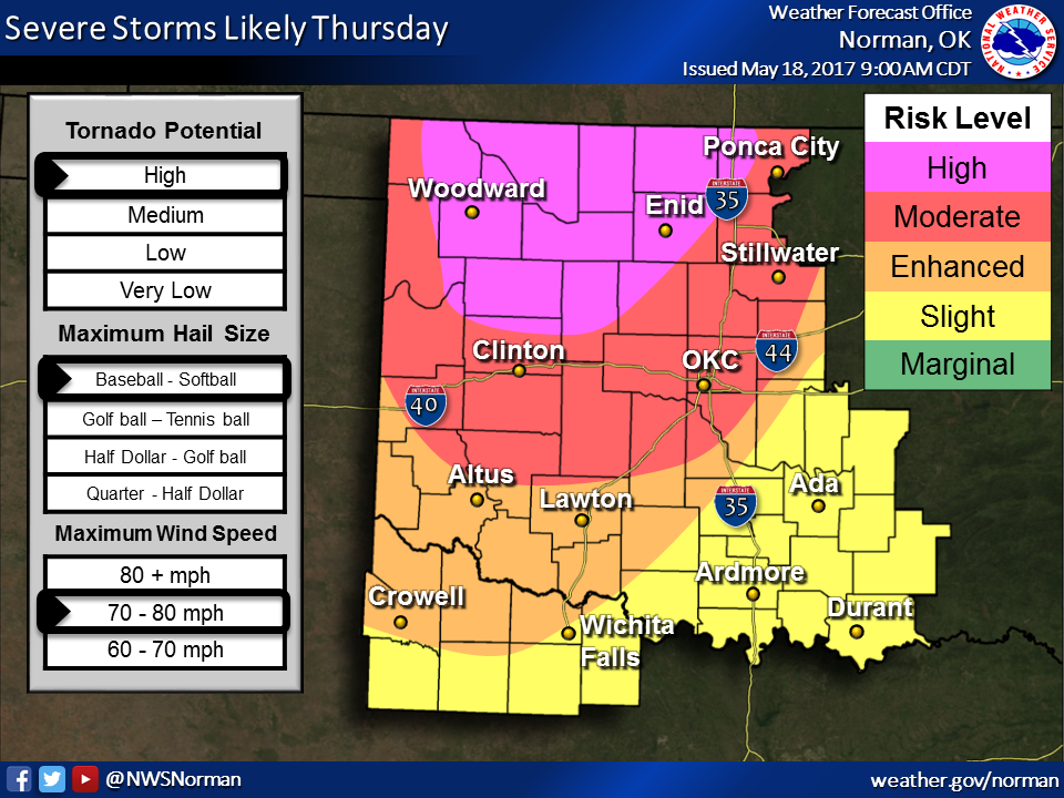
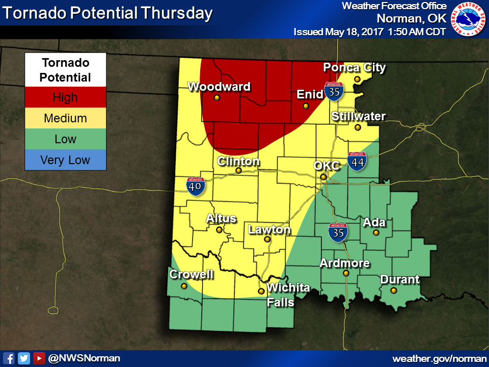
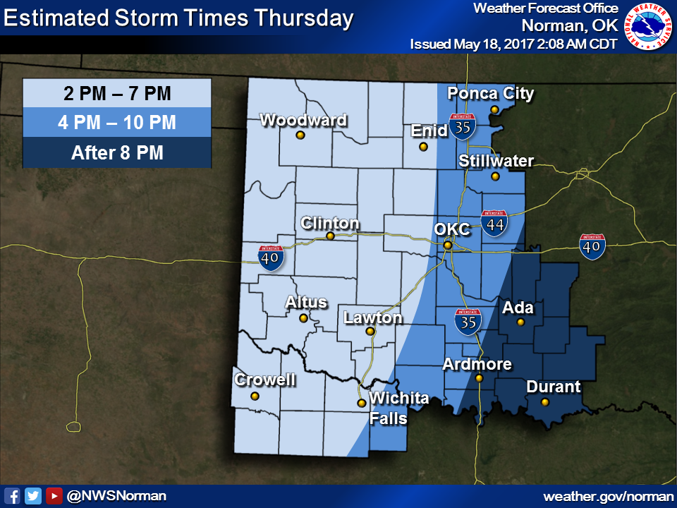
abreast of the changes. For instance, the Norman NWS office has extended the
MODERATE RISK category to cover much of the OKC metro area, which changes our
risk categories for tornadoes and hail and such. And keep in mind these tornado
potential and storm timing maps could definitely change as we go through the
day.
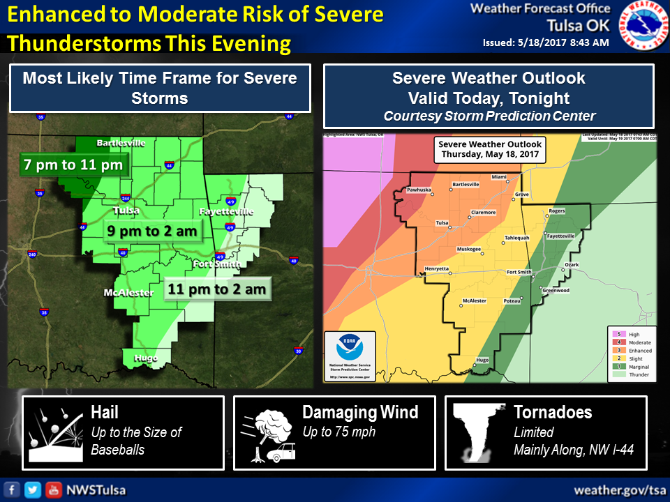
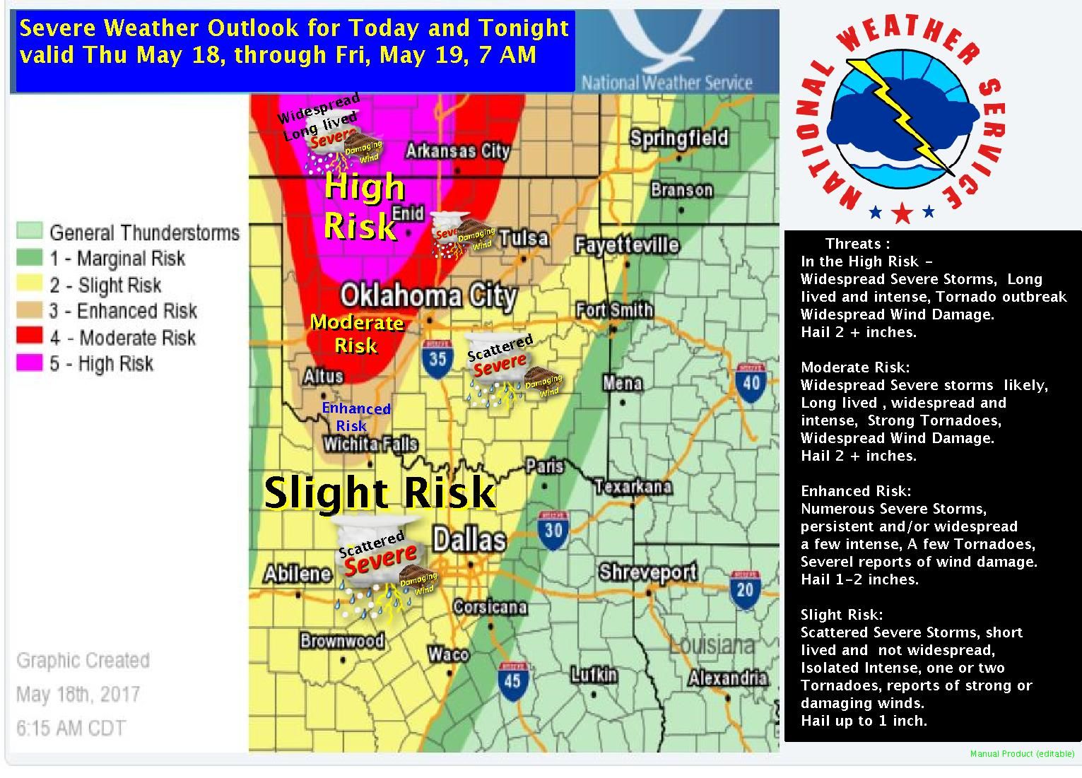
The Shreveport and Tulsa NWS offices have pretty informative graphics as well,
highlighting the categories and their possible impacts.
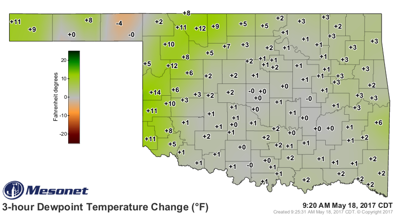
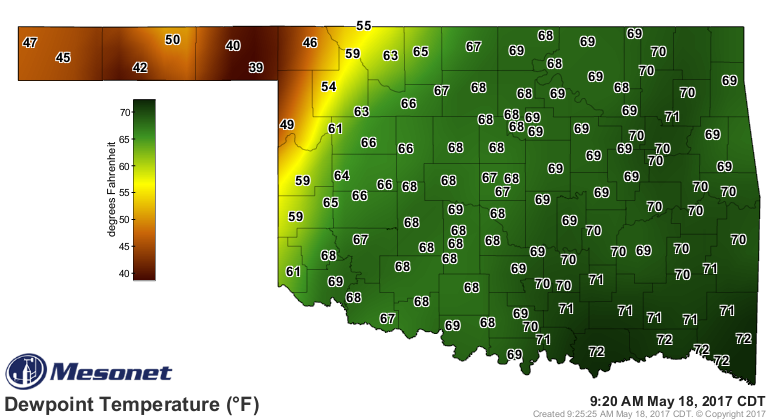
Mesonet data shows the dryline has backed up into far western Oklahoma, with
warm, juicy air overspreading most of the state.
What else is there to say? We have a bunch of uncertainty (storm timing,
evolution, discrete cells or not, early initiation interfering with later
storm evolution, etc.) surrounded by some certainty (severe storms today,
significant impacts, etc.).
What else is there to do? STAY WEATHER AWARE! Make your severe weather safety
plans YESTERDAY (or now unless you're a time traveler)! The individual killed
in Tuesday's storm was killed on the road fleeing his mobile home to escape the
oncoming tornado. DO NOT GET CAUGHT IN A SITUATION LIKE THAT! Get tuned into
your local NWS office and/or media source and be vigilant. They will do their
best to keep you informed, so you can keep YOURSELF safe.
Lots of capital letters today. Get used to it, because we get to do it all over
again tomorrow.
Gary McManus
State Climatologist
Oklahoma Mesonet
Oklahoma Climatological Survey
(405) 325-2253
gmcmanus@mesonet.org
May 18 in Mesonet History
| Record | Value | Station | Year |
|---|---|---|---|
| Maximum Temperature | 104°F | BEAV | 2013 |
| Minimum Temperature | 37°F | JAYX | 2002 |
| Maximum Rainfall | 5.06″ | REDR | 2001 |
Mesonet records begin in 1994.
Search by Date
If you're a bit off, don't worry, because just like horseshoes, “almost” counts on the Ticker website!