Ticker for May 16, 2017
MESONET TICKER ... MESONET TICKER ... MESONET TICKER ... MESONET TICKER ...
May 16, 2017 May 16, 2017 May 16, 2017 May 16, 2017
The shear is strong with this one
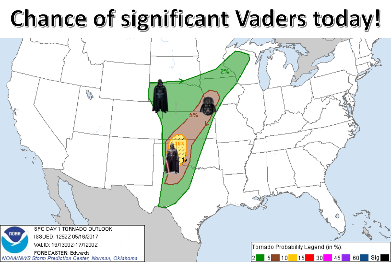
Now listen, it's not our fault that somebody at the office mumbled "chance of
significant 'naders today" and we thought they said "Vaders!" Because if they had
said significant Vaders, that would be something to REALLY worry about. But
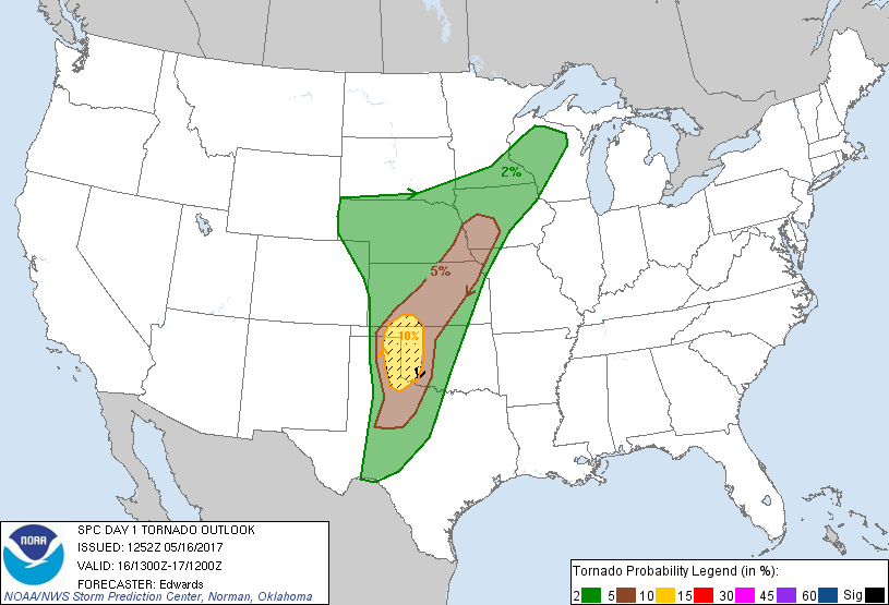
'naders are just as bad. As you can see from this un-besmirched tornado
probability map from SPC, there is a 10% chance of SIGNIFICANT (EF2 or higher)
tornadoes in that hatched yellow area across far western Oklahoma.
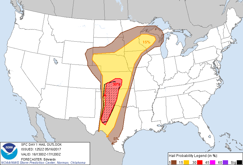
SPC also indicates the chance for other modes of severe weather, including a
30% chance of GIANT (think 3 inches or greater) hail, again across western
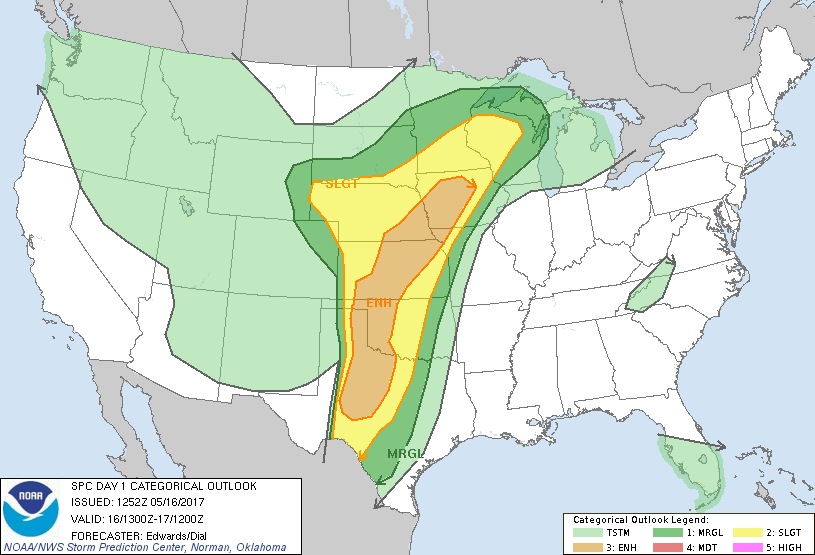
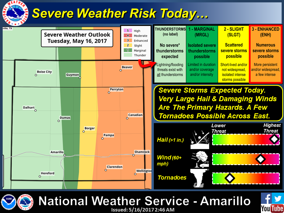
Oklahoma today and tonight. In the bigger picture, western OK is in an enhanced
risk of severe weather today and tonight with "slight" and "marginal" risks
extending to the east.
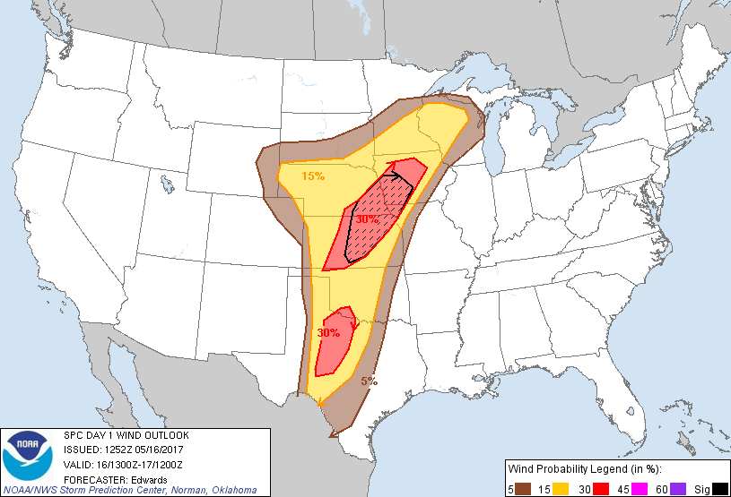
Here's a cheat sheet on what each SPC category means.
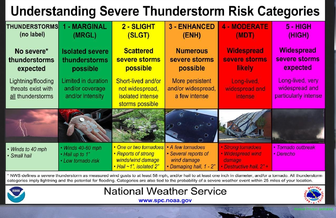
Doesn't mean there are going to be widespread tornadoes, doesn't even mean there
will be tornadoes. It means if storms do go up, and they most likely will, they
have a chance to become severe. And, if the conditions come together correctly,
those storms have a chance to rotate and become supercells. And, if the
conditions come together correctly, there could be a few tornadoes. And, if
the conditions come together correctly, some of those tornadoes could be of the
significant variety.
And...oh, never mind. You get the picture. One thing more certain will be
damaging hail and severe winds. Pick your poison. Maybe Vaders WOULD be better?
Classic setup here, powerful upper-level storm coming in from the west, dryline
if place, add moisture and daytime heating...POOF! There are actually a couple
of chances for severe weather out west, both early afternoon and then later
this evening. Here's the synopsis for both from SPC.
Early afternoon:
"Widely scattered to scattered thunderstorms should form during
early-mid afternoon near the dryline... This activity initially
will risk large/damaging hail, severe gusts and a few tornadoes."
Mid-afternoon/Evening:
"In mid/late afternoon, several discrete to semi-discrete supercells
are expected to develop and move northeastward...off the
dryline. As this activity crosses the eastern Panhandle region,
northwest TX, and parts of western OK, it will offer tornadoes, very
large/damaging hail and sporadic severe gusts. Some giant (3-inch
or more) hail is possible, along with potential for a couple of
strong, relatively long-lasting tornadoes, from the mature phases of
at least one or two cyclic supercells within convective arc."
As it progresses eastward, it could possibly form into a squall line of severe
storms. Tornadoes can't be ruled out, obviously (IT'S MAY!!), but a squall line
is certainly more favorable than tornadoes. Keep in mind, however, that a squall
line could bring a much larger area of damaging winds, and damaging hail will
still be possible.
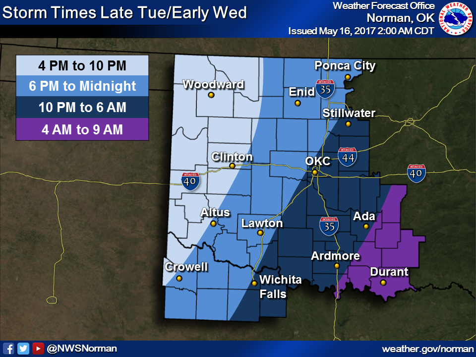
Storm timing is indicated by the Norman NWS office. Could be a late night for
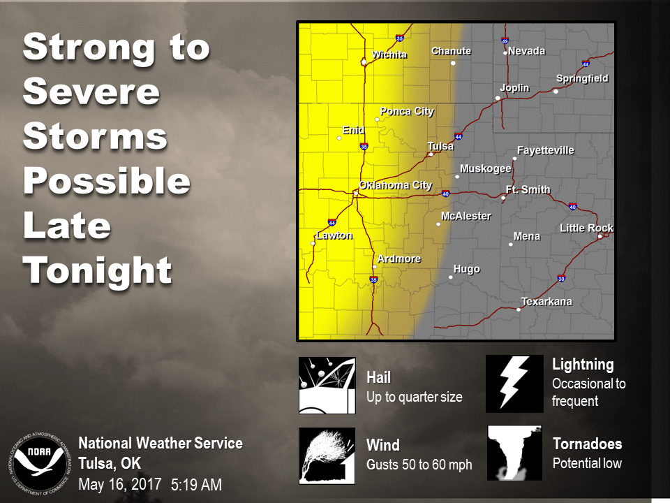
those of us east of I35. Other svr info provided by the Tulsa and Amarillo
offices.
Final advice...stay weather aware, especially you folks across western OK. Stay
tuned to your favorite media/NWS source (both preferably), and remember that the
severe weather setup can and probably will change throughout the day. The
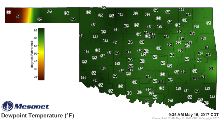
dryline is beginning to mix to the east already, as shown by the Mesonet
dewpoint map, so the time to prepare across western OK is NOW!
Oh yeah, don't let your guard down...we get to do this all over again on
Thursday.
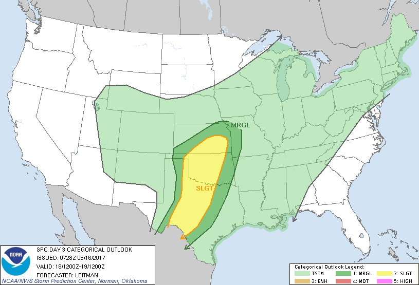
"...expect isolated to scattered thunderstorms to develop
along the sharp dryline by late afternoon as strong heating of a
moisture-rich boundary layer leads to strong instability. Impressive
midlevel lapse rates near 8-8.5 deg C/km and supercell-favoring
kinematic profiles will lead to a large, potentially significant,
hail threat. Additionally, strong winds and a few tornadoes will be
possible. The wind threat may increase during the overnight hours as
the cold front surges southeast and upscale growth becomes more
likely with eastward extent."
Gary McManus
State Climatologist
Oklahoma Mesonet
Oklahoma Climatological Survey
(405) 325-2253
gmcmanus@mesonet.org
May 16 in Mesonet History
| Record | Value | Station | Year |
|---|---|---|---|
| Maximum Temperature | 101°F | ALTU | 2000 |
| Minimum Temperature | 31°F | BOIS | 2011 |
| Maximum Rainfall | 4.55 inches | WYNO | 2021 |
Mesonet records begin in 1994.
Search by Date
If you're a bit off, don't worry, because just like horseshoes, “almost” counts on the Ticker website!