Ticker for May 11, 2017
MESONET TICKER ... MESONET TICKER ... MESONET TICKER ... MESONET TICKER ...
May 11, 2017 May 11, 2017 May 11, 2017 May 11, 2017
Southern Discomfort
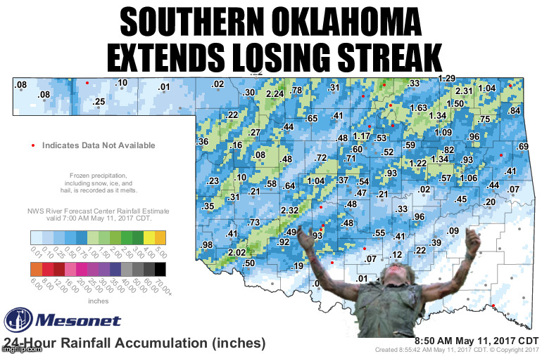
Using a "Platoon" meme? That's what we've come to? Well, southern Oklahoma, much
like Sgt. Elias there, must feel shot in the back, again. And Mother Nature
has the bullets. You see that nice rainfall pattern there, with the streaks of
those major cells showing up in green, signifying an inch or more of rain? Well,
those aren't the areas we're most concerned about. Yeah, they could use the rain.
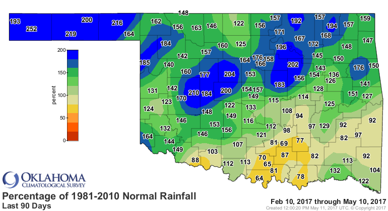
But the driest area of the state, southern Oklahoma, missed out on the best
moisture, as did the entire SE quarter of the state. Here's the map again, a
little less graphic (although still pretty graphic for southern Oklahoma).
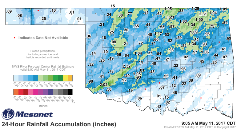
We're concerned because of this, this and this. {And what do you think of our
new maps? Pretty fancy-schmancy, eh?}
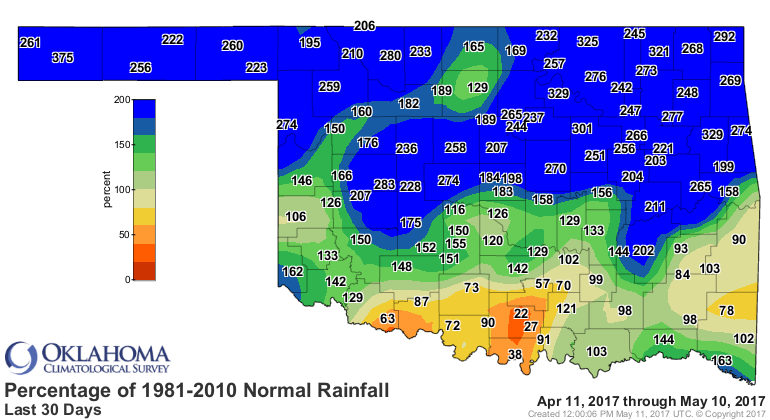
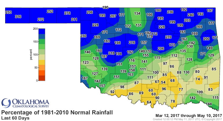
Which leads to this.
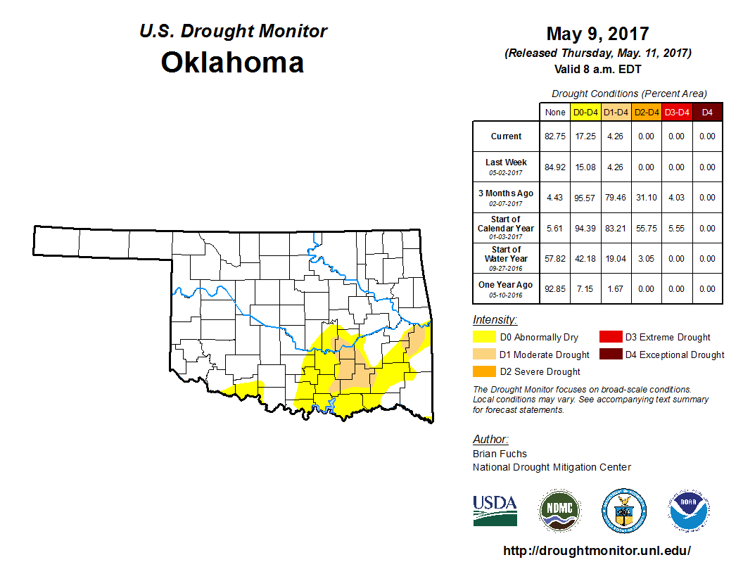
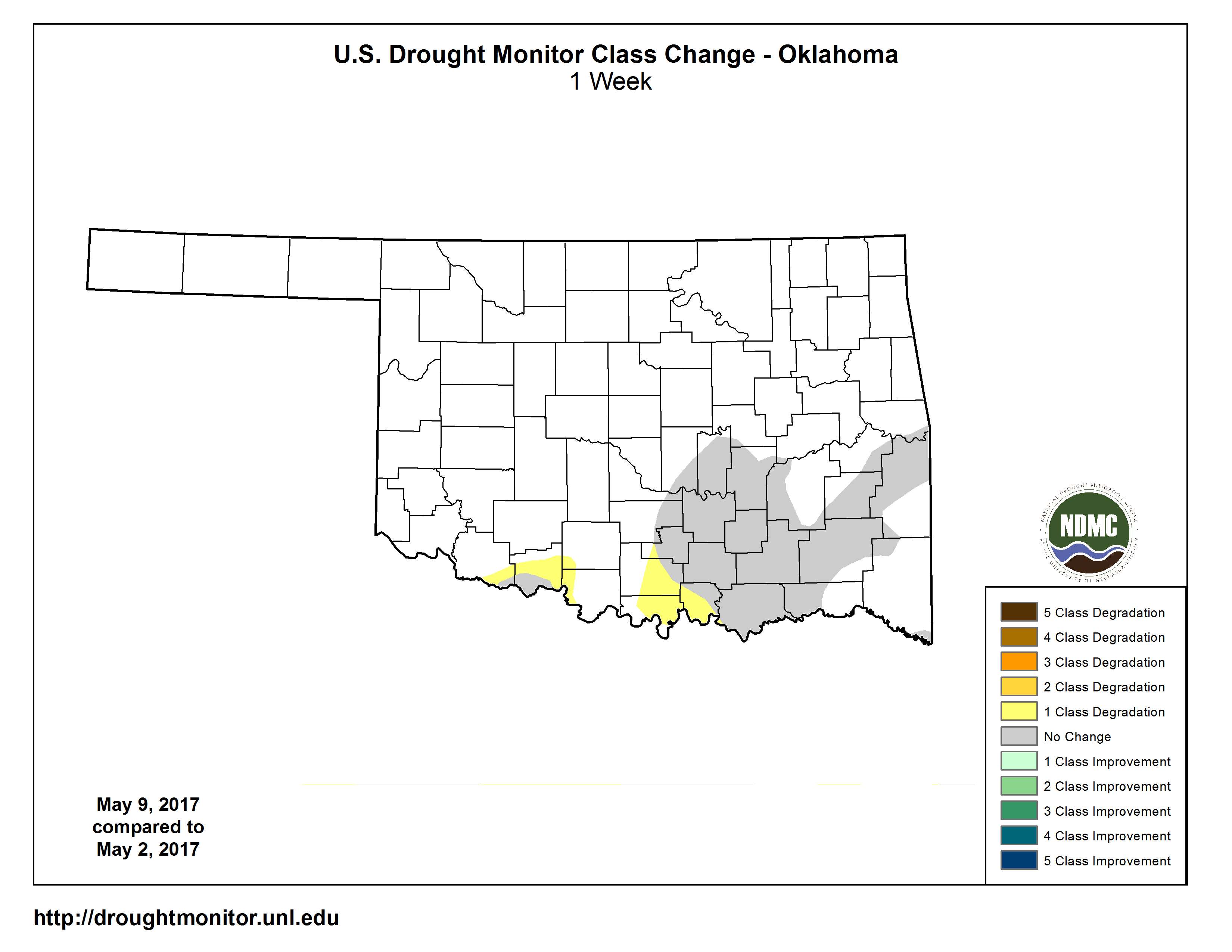
Heck, not only are the abnormally dry and drought conditions hanging on down
across southern OK, they've actually increased just a bit while the rest of the
state is greening up and droughting out! ("Droughting"...new word, feel free to
use it.)
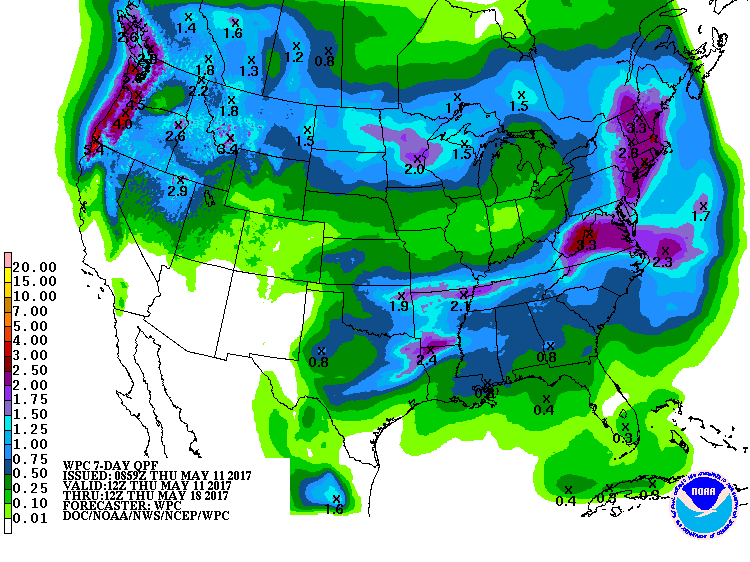
Luckily, there's a chance for more rain today. Unluckily, it doesn't extend
west enough.
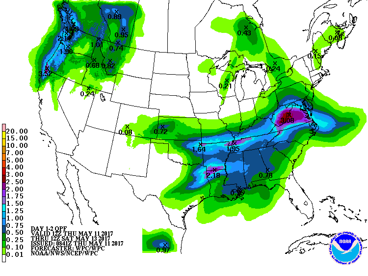
Maybe a *little* more help next week, but still, not too optimistic.
Southern OK needs Sgt. Elias. They're getting Sgt. Barnes.
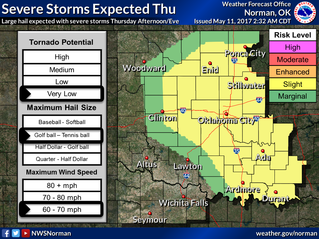
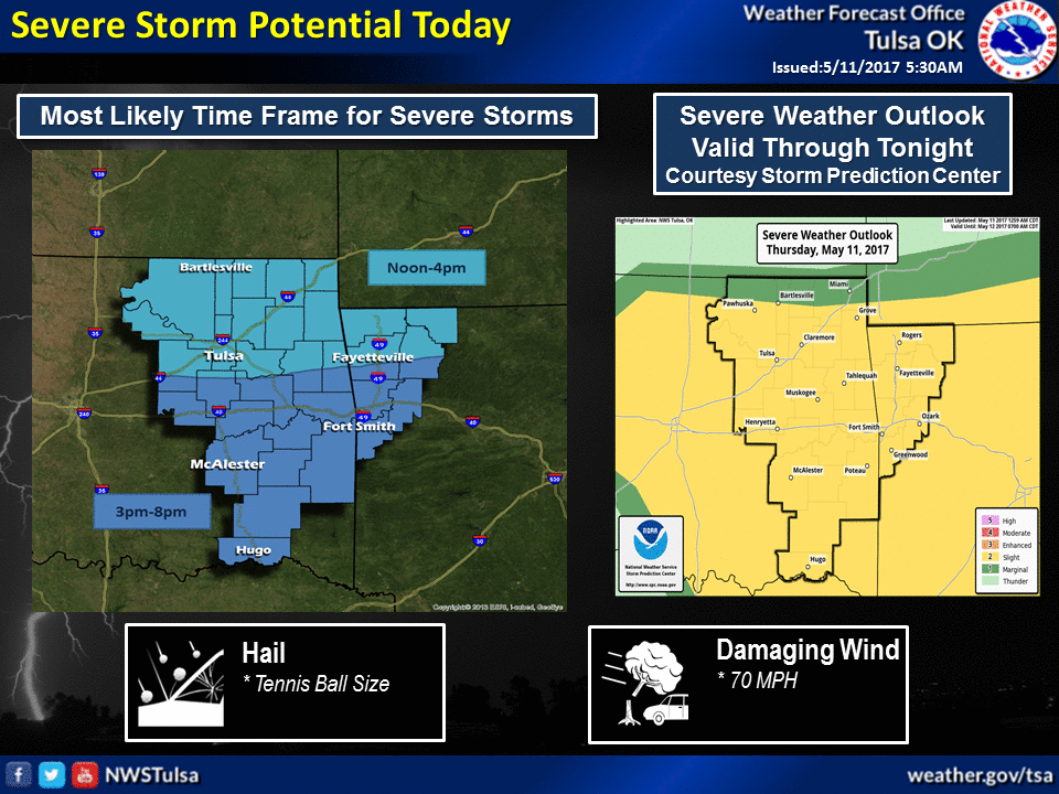
Stay weather aware today.
Gary McManus
State Climatologist
Oklahoma Mesonet
Oklahoma Climatological Survey
(405) 325-2253
gmcmanus@mesonet.org
May 11 in Mesonet History
| Record | Value | Station | Year |
|---|---|---|---|
| Maximum Temperature | 106°F | ALTU | 2000 |
| Minimum Temperature | 30°F | BOIS | 2008 |
| Maximum Rainfall | 5.87″ | HUGO | 1999 |
Mesonet records begin in 1994.
Search by Date
If you're a bit off, don't worry, because just like horseshoes, “almost” counts on the Ticker website!