Ticker for May 10, 2017
MESONET TICKER ... MESONET TICKER ... MESONET TICKER ... MESONET TICKER ...
May 10, 2017 May 10, 2017 May 10, 2017 May 10, 2017
It didn't work
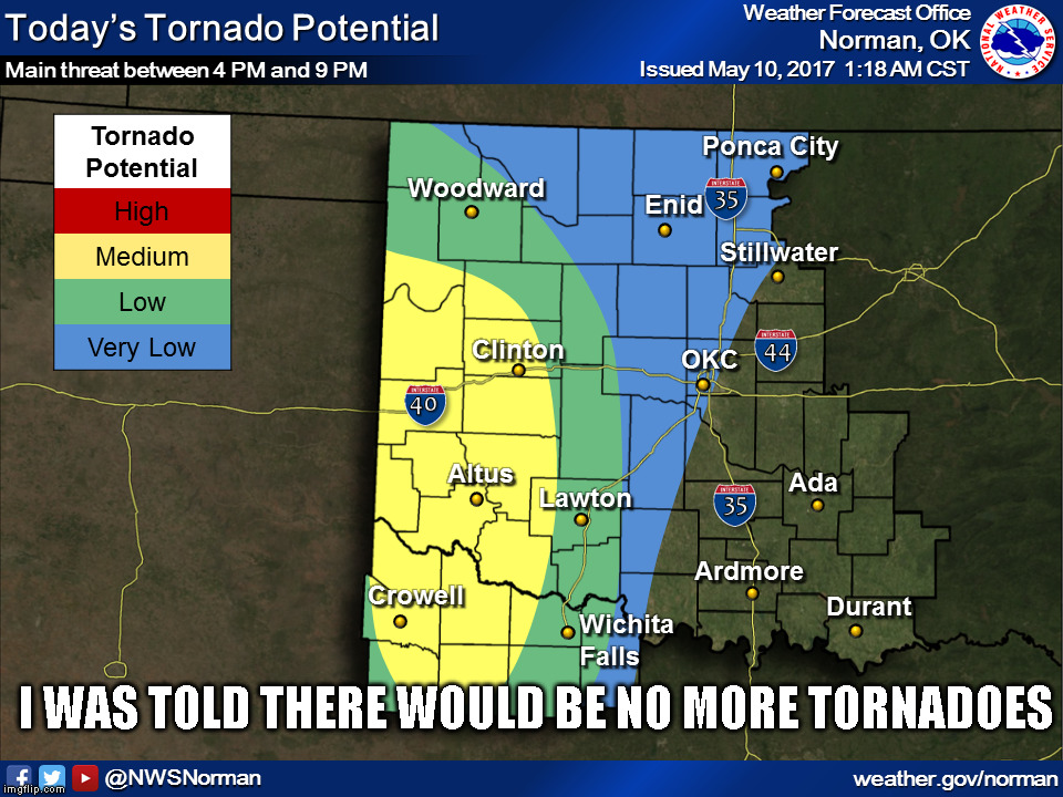
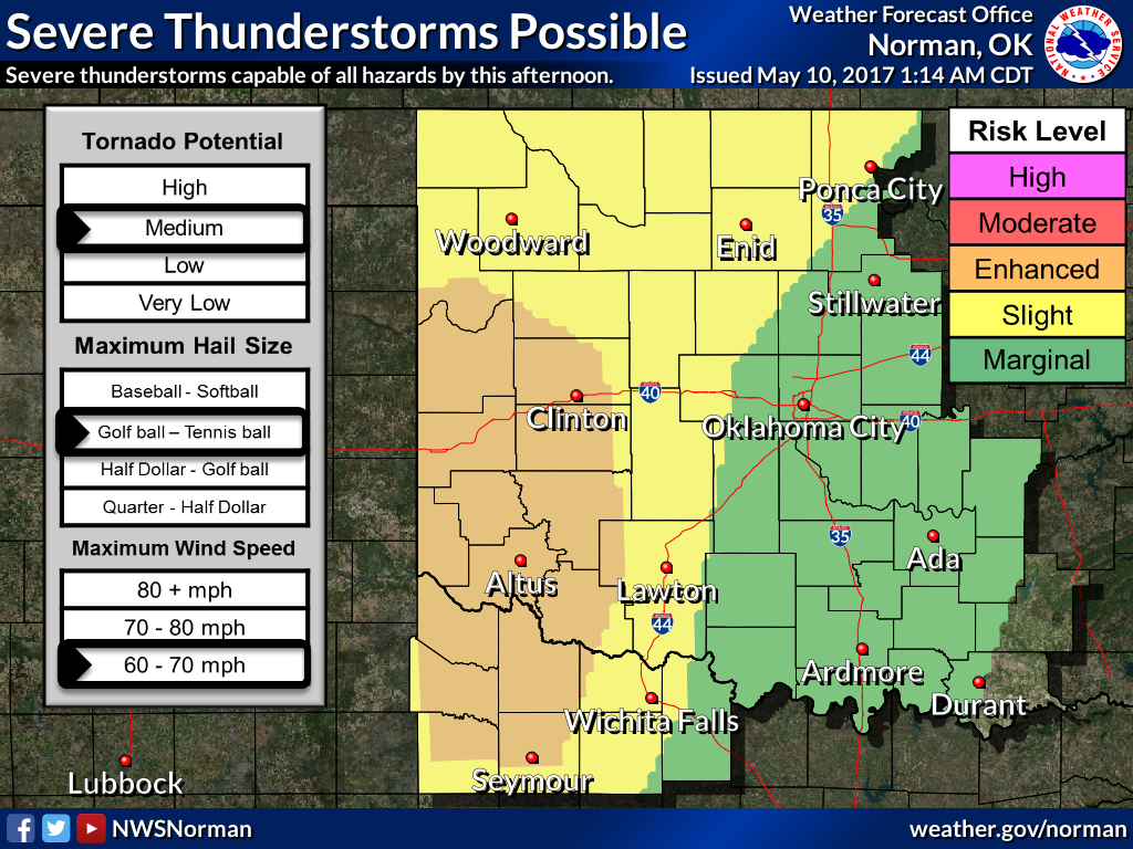
MEDIUM RISK?!? Well obviously my attempt to "jinx" the rest of tornado season
YESTERDAY failed miserably. Of course, a medium risk of tornadoes doesn't mean
there will definitely be tornadoes, but it would look better if that map said
"very low" across western Oklahoma. Classic setup today, storm system with a
dryline, outflow boundaries, plenty of moisture available.
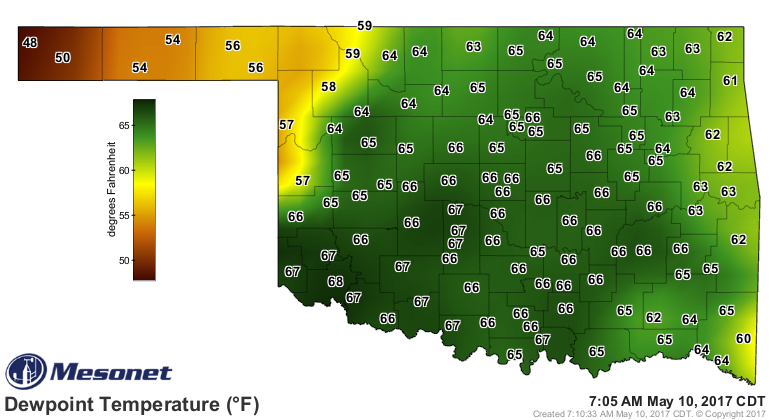
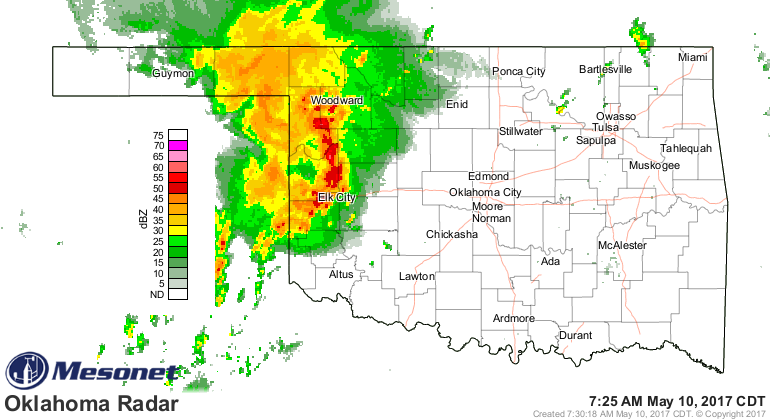
And while we have heavy storms going on as we Tick...
It's later today, when things heat up and get really juicy, when the big bad
storms are expected to arrive.
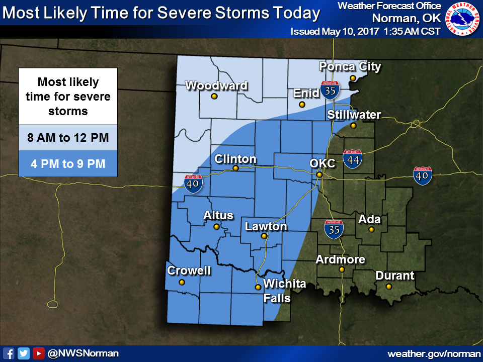
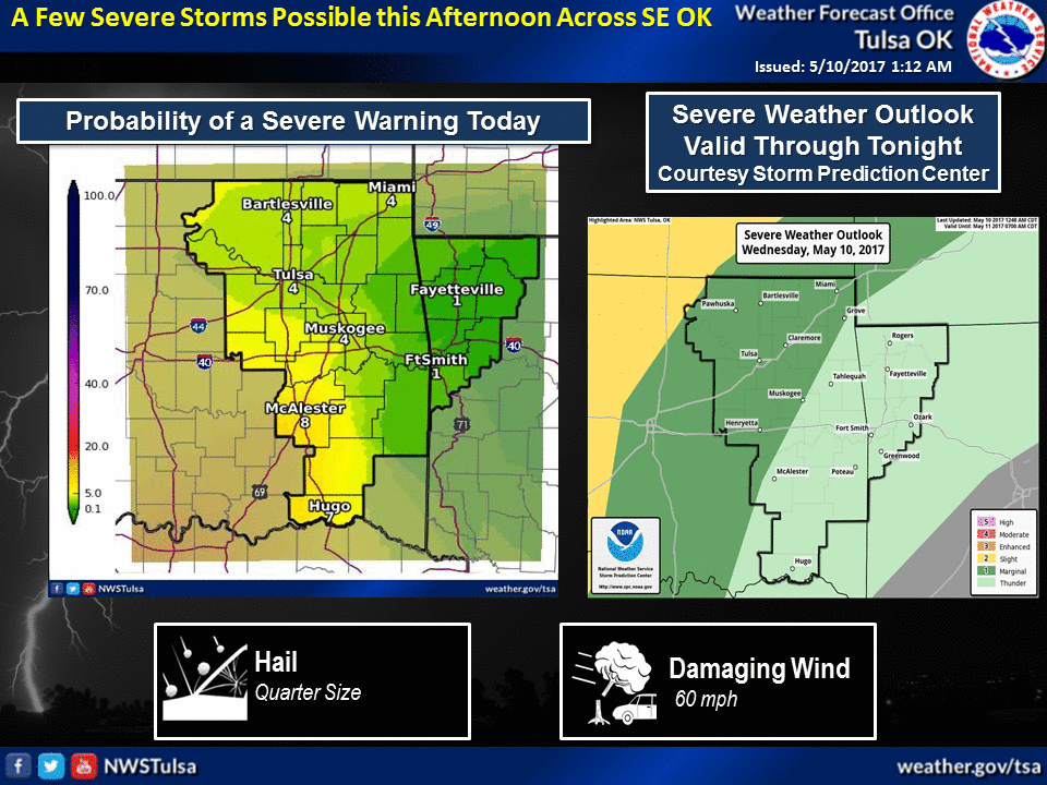
Here's a bit more of the scenario for today from your local NWS offices.
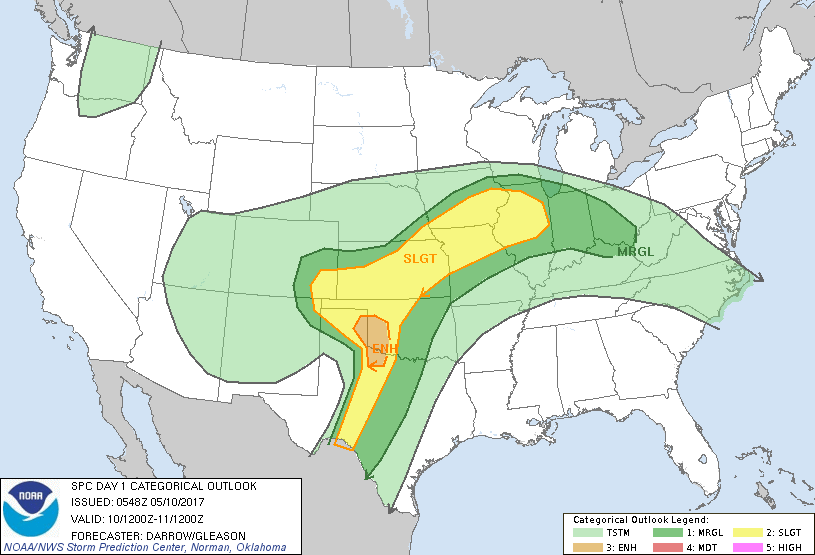
And the risk maps from the Storm Prediction Center.
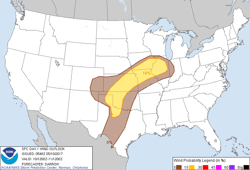
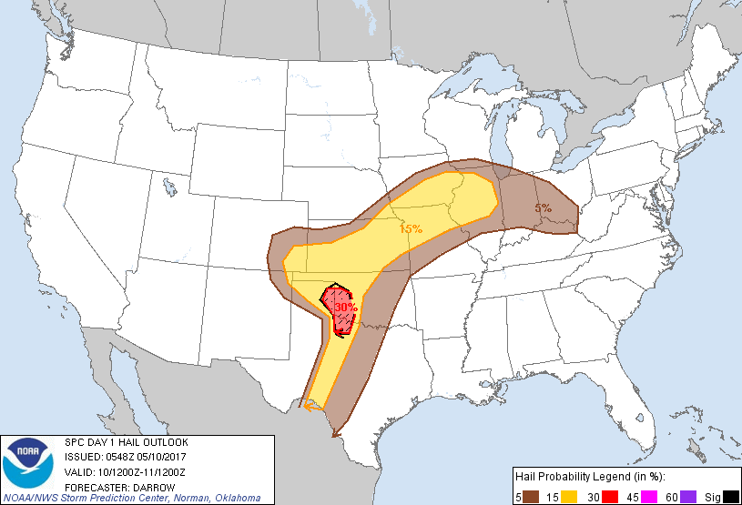
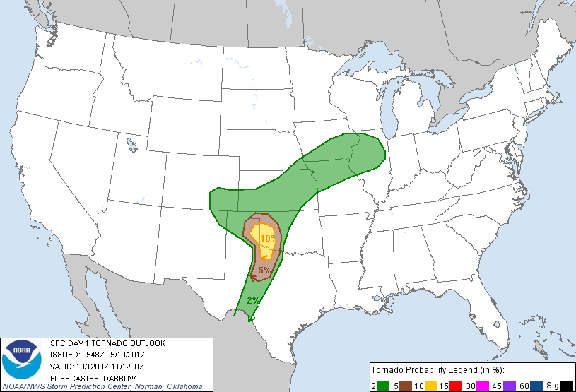
Remember, the chances of a tornado hitting your location are minute, and that's
even an inflation. The footprints for large hail and high winds are much larger.
All modes of severe weather need to be prepared for, regardless.
Let the games (the non-fun kind) begin.
Gary McManus
State Climatologist
Oklahoma Mesonet
Oklahoma Climatological Survey
(405) 325-2253
gmcmanus@mesonet.org
May 10 in Mesonet History
| Record | Value | Station | Year |
|---|---|---|---|
| Maximum Temperature | 102°F | ERIC | 2022 |
| Minimum Temperature | 31°F | EVAX | 2019 |
| Maximum Rainfall | 5.62″ | IDAB | 2009 |
Mesonet records begin in 1994.
Search by Date
If you're a bit off, don't worry, because just like horseshoes, “almost” counts on the Ticker website!