Ticker for April 28, 2017
MESONET TICKER ... MESONET TICKER ... MESONET TICKER ... MESONET TICKER ...
April 28, 2017 April 28, 2017 April 28, 2017 April 28, 2017
Betcha didn't see THIS coming
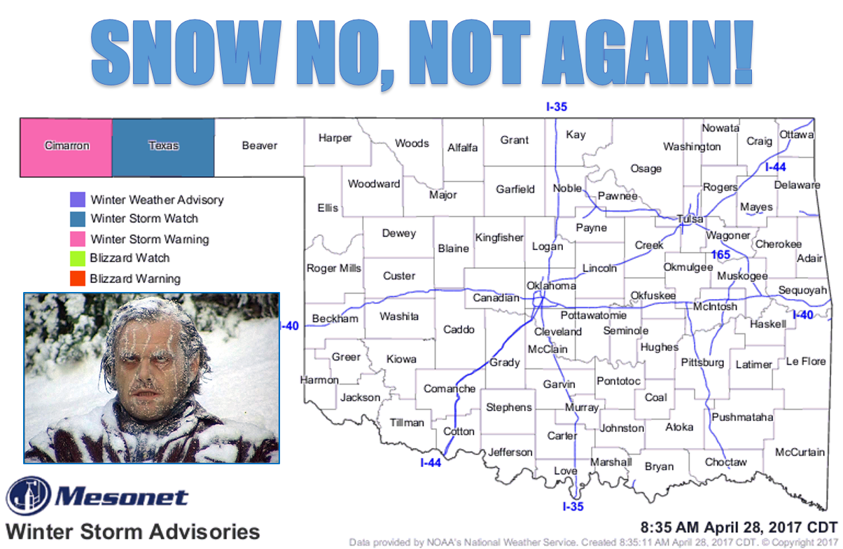
SAY IT AIN'T SO, JACK! Or better yet, say it again (Sam?).
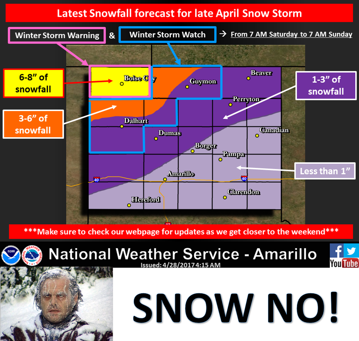
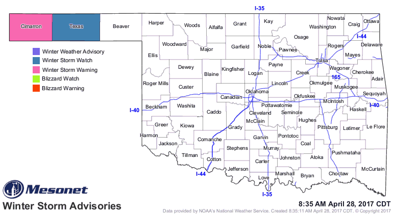
Oklahoma is about to be buried in snow, as you can see in the graphic above. And
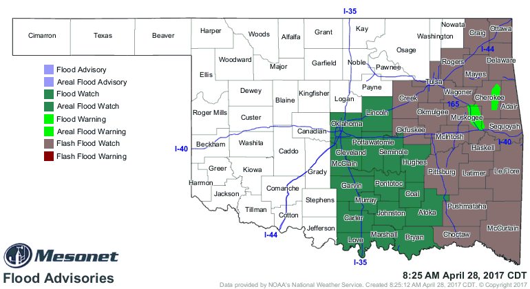
the Oklahoma Pan is about to be flooded. (See what I did there?)We've covered
the chance for severe weather at length this week, and not much has changed. The
biggest threats, at least at this time, still point to flooding as the biggest
threat. The chance of large hail is more predominant than winds or tornadoes
(tornado threat is still pretty low).
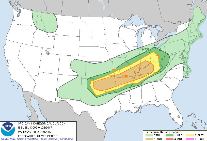
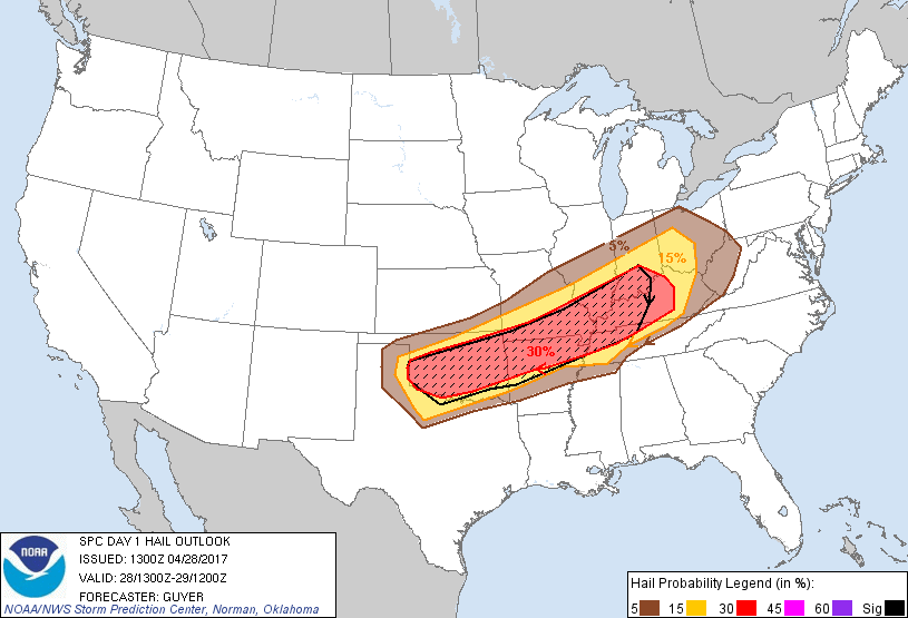
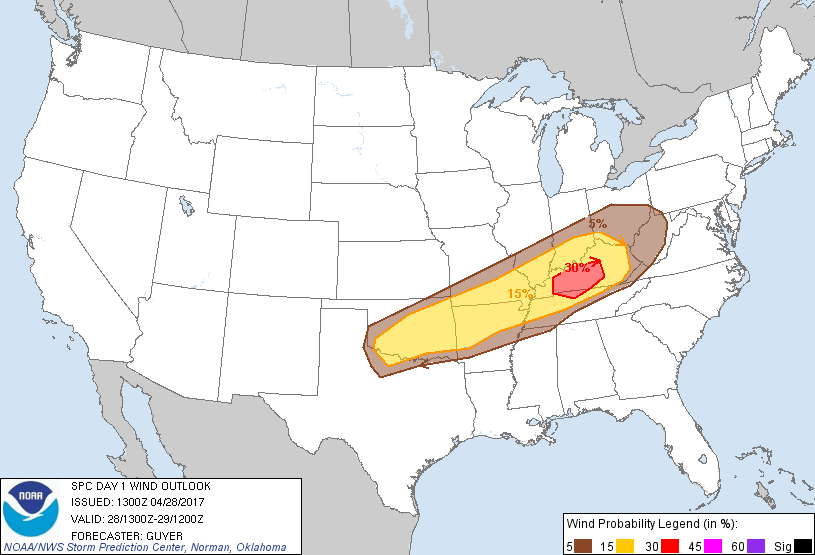
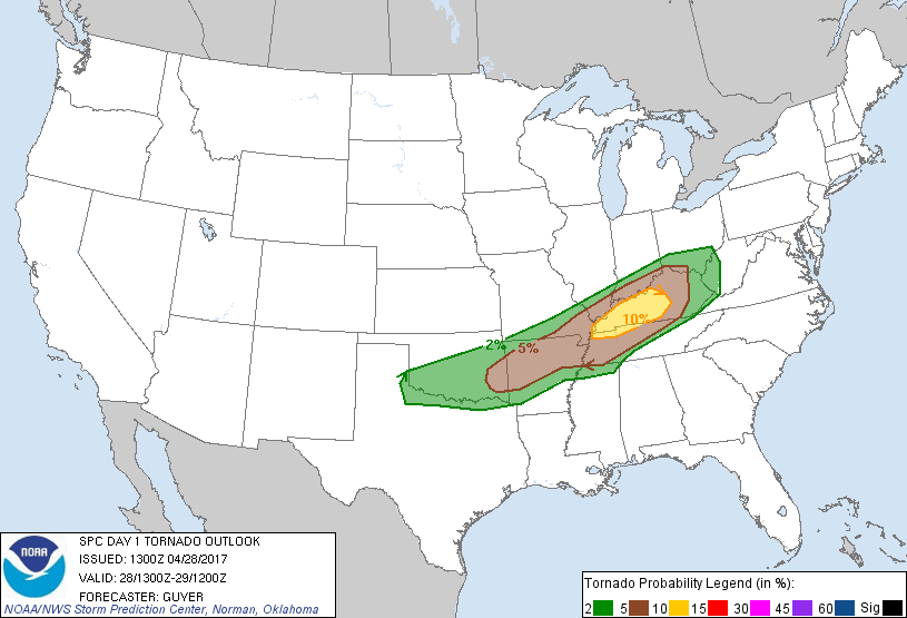
Gobs and gobs of moisture are available for this storm system, and it don't look
pretty for eastern Oklahoma.
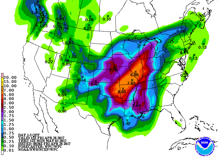
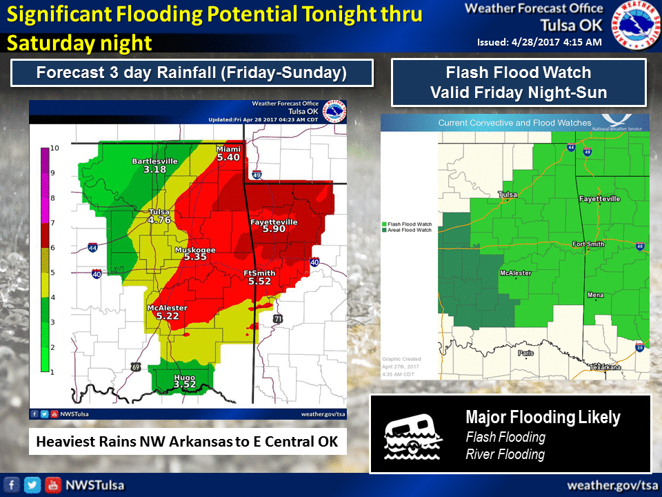
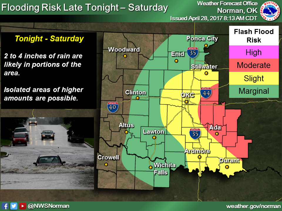
Up northwest, they'll be dealing with a much colder air mass than what we see
here in the Pan.
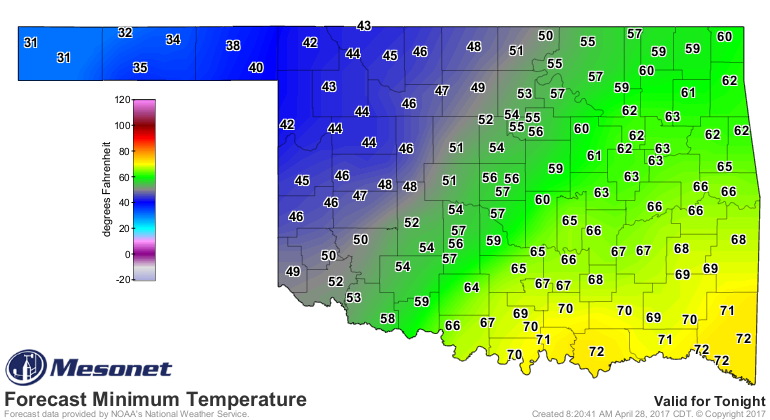
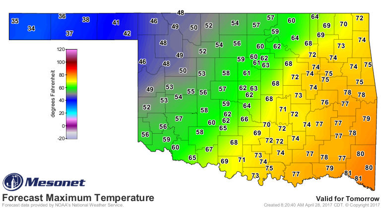
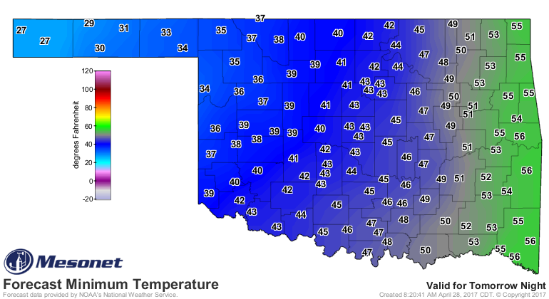
WINTER IS UPON US...two months late!
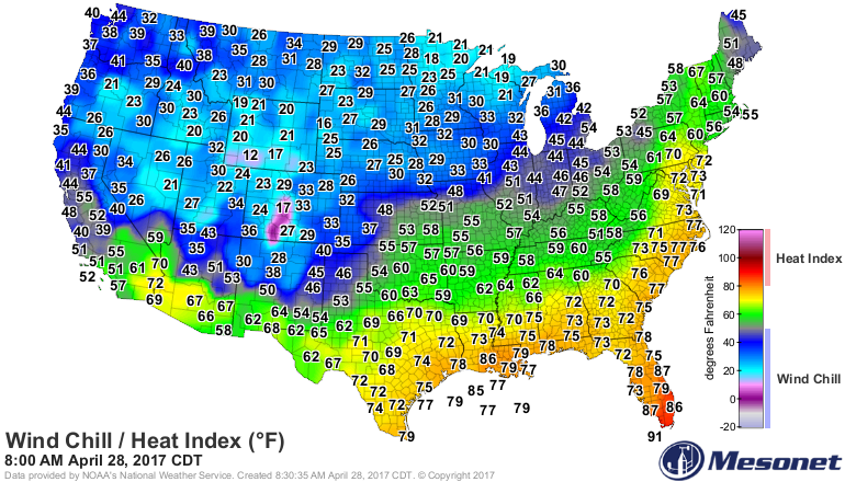
So remember, TURN AROUND DON'T DROWN!
Unless you're up northwest in the snow. Then don't turn around...just keep it
straight, nice and steady.
Gary McManus
State Climatologist
Oklahoma Mesonet
Oklahoma Climatological Survey
(405) 325-2253
gmcmanus@mesonet.org
April 28 in Mesonet History
| Record | Value | Station | Year |
|---|---|---|---|
| Maximum Temperature | 98°F | ALTU | 2020 |
| Minimum Temperature | 27°F | BOIS | 2008 |
| Maximum Rainfall | 6.80″ | MADI | 2006 |
Mesonet records begin in 1994.
Search by Date
If you're a bit off, don't worry, because just like horseshoes, “almost” counts on the Ticker website!