Ticker for April 27, 2017
MESONET TICKER ... MESONET TICKER ... MESONET TICKER ... MESONET TICKER ...
April 27, 2017 April 27, 2017 April 27, 2017 April 27, 2017
R.I.P.
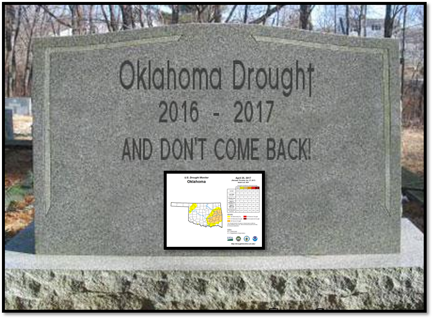
So long, farewell...you know the rest. A premature sendoff? I don't think so!
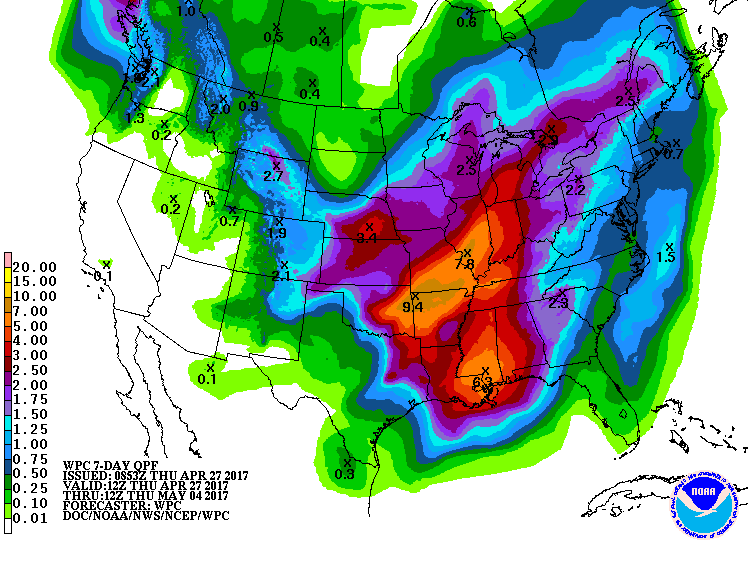
Just look at the latest U.S. Drought Monitor report AND the rainfall forecast for
this weekend's storm and then you tell me.
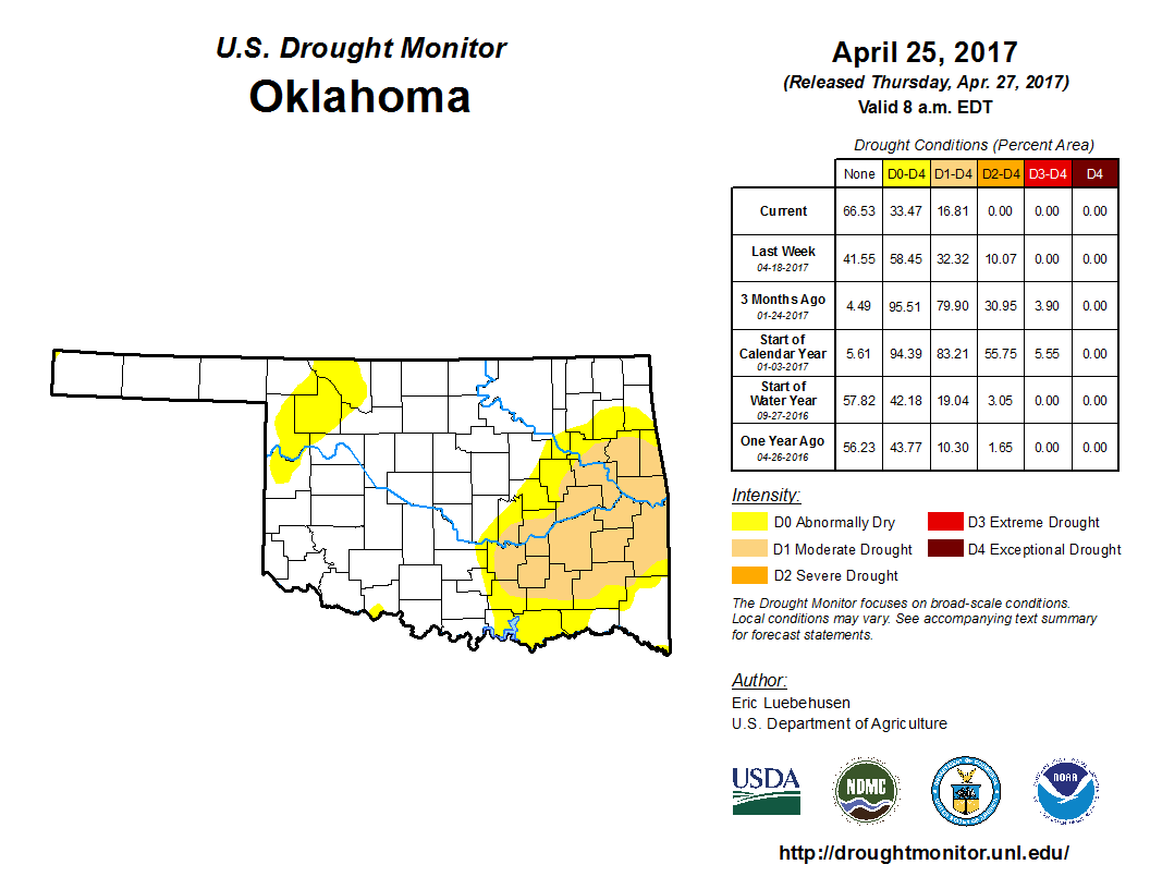
The drought is on life support, and Mother Nature is about to pull the proverbial
plug with another weekend-ruining-but-drought-killing storm system. We now have a
mere 17% of the state in drought, a level we haven't seen that low since OCTOBER
11, 2016! This has been a long time coming, having suffered through a horrible
wildfire season and stressed/damaged/destroyed wheat crop (in some areas).
Having that 5-9 inch bullseye directly over the remaining drought area in Oklahoma
is both fortuitous (for drought killing) and unfortunate (for flooding risk). The
NWS folks have already put out flood warnings and risk assessments for the type
of rainfall we're likely to see over the weekend.
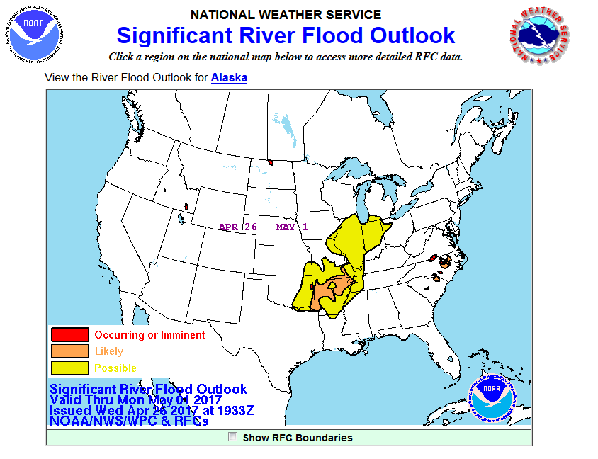
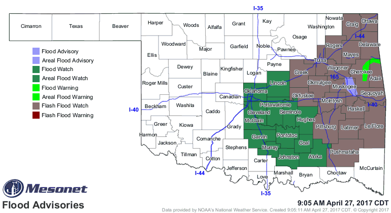
Here's the verbiage from the Flash Flood Watch for eastern Oklahoma. It's a
doozy.
"A potent upper level storm system will move into the area Friday
with strong to severe thunderstorms developing by early evening
across portions of eastern Oklahoma and northwest Arkansas.
Thunderstorms will continue Friday night through Saturday evening
with locally heavy rainfall as a frontal boundary slowly pushes
southeast. 8 to 10 inches of rainfall is expected across east-central
Oklahoma and northwest Arkansas with locally higher amounts
approaching 15 inches."
ZOUNDS! Not quite as bad for points west under the flood watch:
"Widespread 2 to 5 inches of rain are forecast with locally
higher amounts possible."
We still have the threat of severe weather (hail, high winds) and the VERY
CONDITIONAL threat of SEVERE severe weather (big honking supercells with even
bigger hail and a few tornadoes). Much like last week, it again depends on many
factors, such as where the warm front is located, where will storm initiation
occur and at what time, etc. Reading the forecast discussions and SPC discussion
for their day 2 outlook
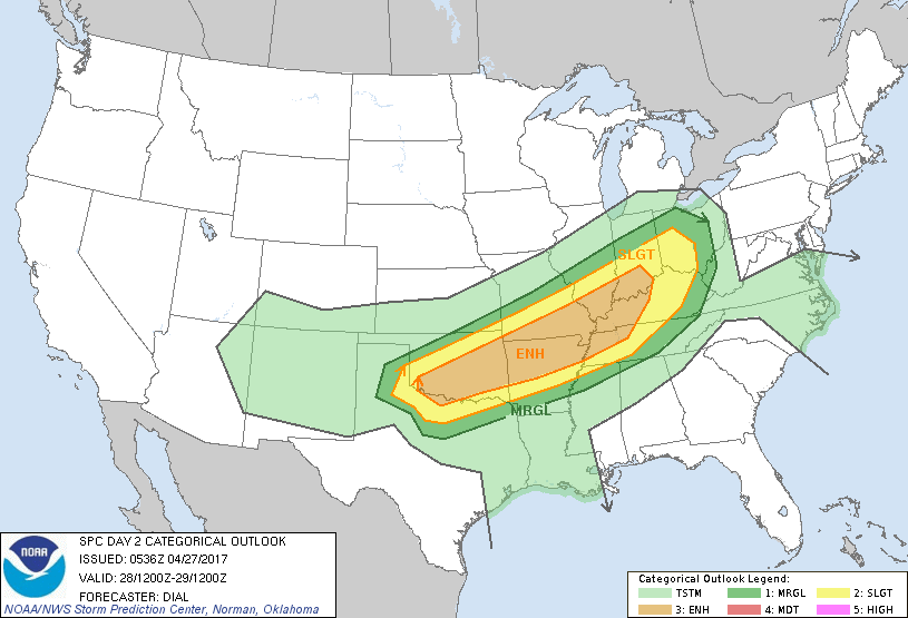
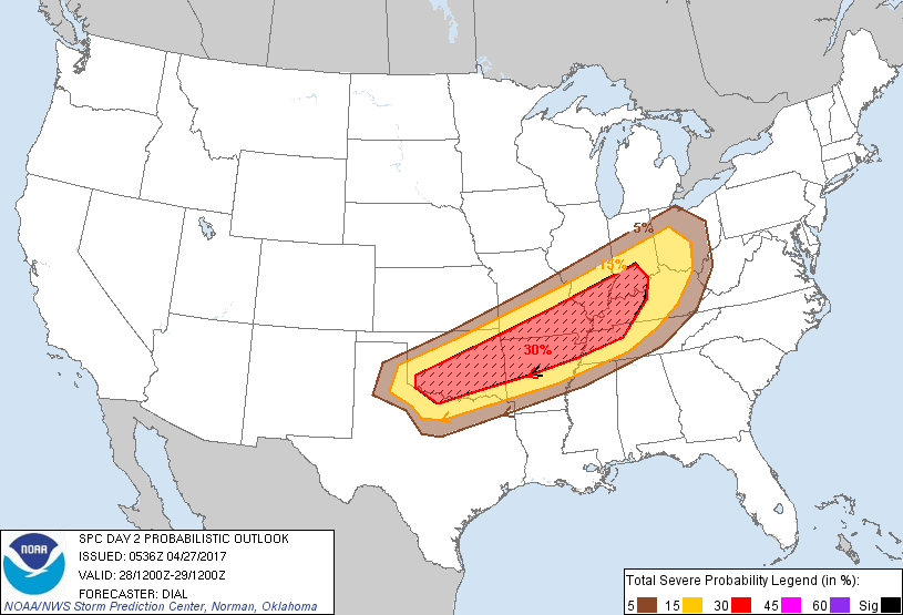
it's pretty apparent that this is another case of "check with us as it gets
closer when things start to solidify, but flooding is your primary risk at this
time."
Hey, you're not gaining a flood, you're losing a drought!
Silver linings and whatnot. And remember, nearly all flash flooding deaths are
avoidable...TURN AROUND, DON'T DROWN!
Gary McManus
State Climatologist
Oklahoma Mesonet
Oklahoma Climatological Survey
(405) 325-2253
gmcmanus@mesonet.org
"
April 27 in Mesonet History
| Record | Value | Station | Year |
|---|---|---|---|
| Maximum Temperature | 96°F | GRA2 | 2012 |
| Minimum Temperature | 24°F | BOIS | 2008 |
| Maximum Rainfall | 5.85″ | BLAC | 2024 |
Mesonet records begin in 1994.
Search by Date
If you're a bit off, don't worry, because just like horseshoes, “almost” counts on the Ticker website!