Ticker for April 26, 2017
MESONET TICKER ... MESONET TICKER ... MESONET TICKER ... MESONET TICKER ...
April 26, 2017 April 26, 2017 April 26, 2017 April 26, 2017
Pick a topic
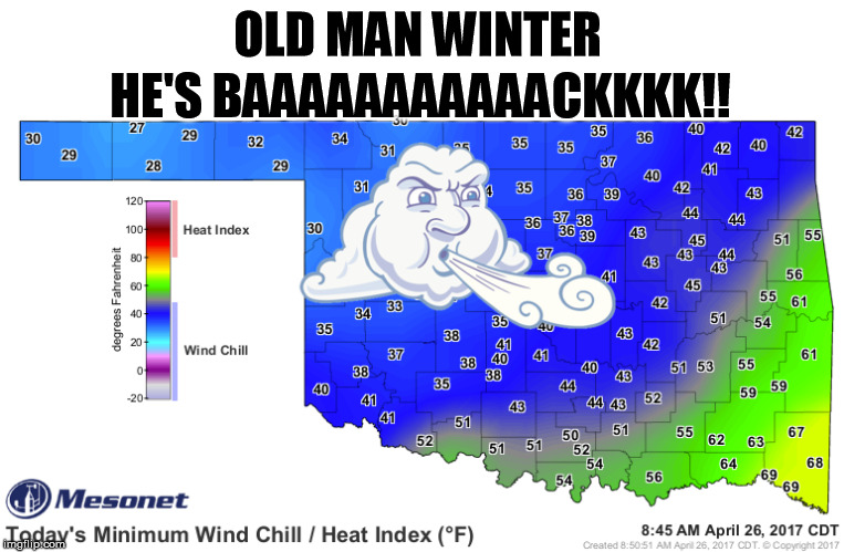
What do you mean "He's back"??? It wasn't this cold during winter! Lots to talk
about today, but we had lots of rain action last night, and it's still going on
as we Tick!
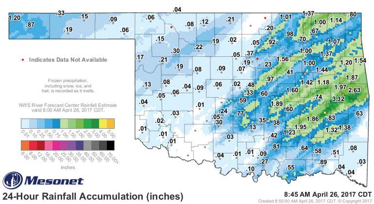
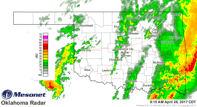
That heavy rain last night finally blasted the last remaining holdout of drought
impacts in east central Oklahoma, so the current drought's days are numbered
(think next Thursday's Drought Monitor map, since it came after the 6am cutoff).
Last night's front generated lots of storms and the associated rainfall, and
today's winter-like wind chills. But as is usually the case during spring in
Oklahoma, the next act could be as bad (or worse) than the first. We now await
the arrival of another big storm system for this weekend that could bring really
REALLY heavy rainfall. Let's let our friend Wyatt Earp show ya.
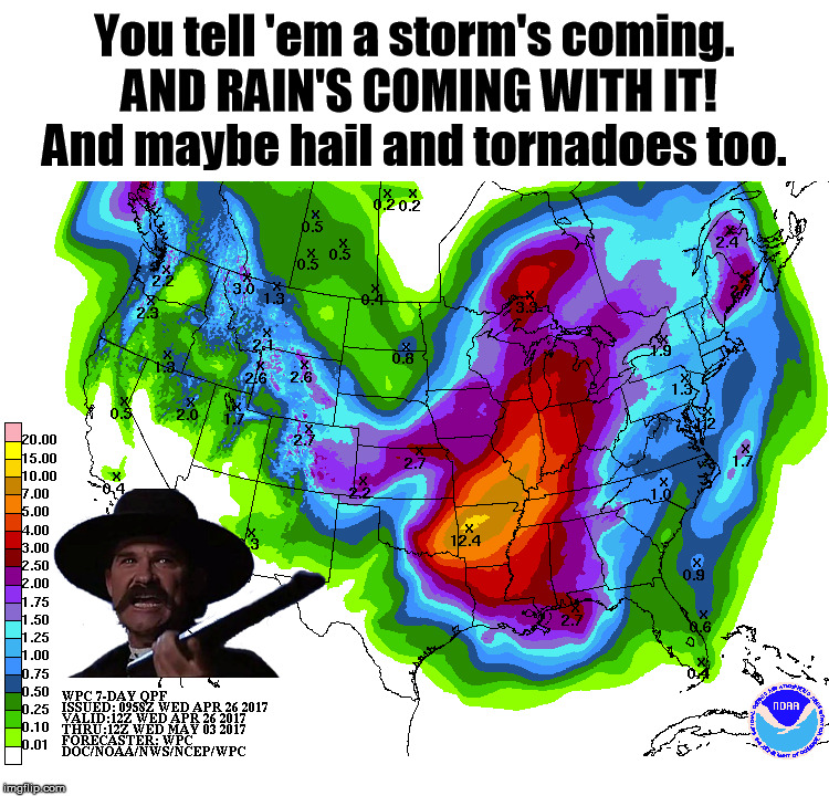
Yep, that's heavy rain alri...wait, did he say hail and tornadoes? Afraid so.
The storm scheduled to arrive Friday is much like last Friday's storm in that
it is VERY CONDITIONALLY packed with severe weather, meaning that the
ingredients are there, but Mother Nature has to provide them in the right order.
She can't add the flour and sugar, bake the cake and THEN try to add the eggs.
That would be one soggy egg-soaked mess. That's how last Friday's storm ended
up, and we have to hope this one is fouled up the same way. Nevertheless, the
rain looks to be nearly certain (again, like last Friday) and flooding will
be an issue. Here's the latest from our weather partners.
SPC's Day 3 Outlook, showing a broad area of enhanced/slight severe weather risk
from OK up into the northeast.
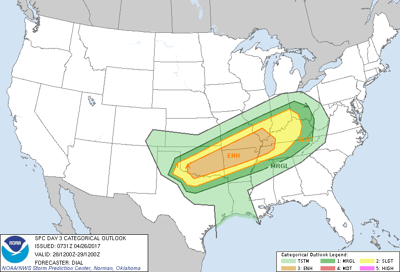
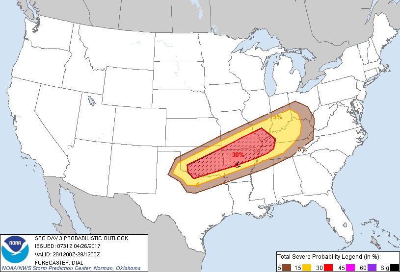
Graphics of the possible impending storm impacts from our local NWS offices.
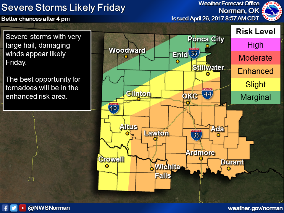
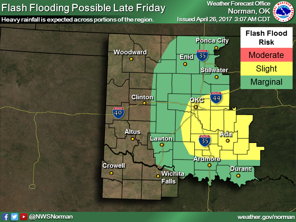
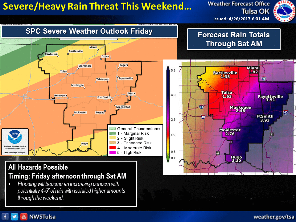
A bit of an explanation by the Tulsa NWS office:
"There is a potential for severe storms and heavy rain/flooding on
Friday. An upper level storm system will approach the area from
the west, with a warm front lifting north across Oklahoma during
the day Friday. The best potential for severe weather and flooding
will come late Friday afternoon into evening. Forecast rain amounts
of 4 to 6 inches are possible with locally higher amounts. This
will result in flash flooding and river flooding for portions of
the area."
And the weekend looks partly- to mostly-miserable.
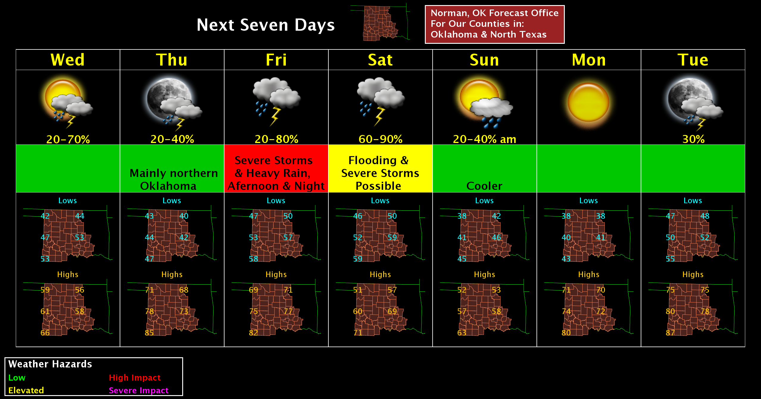
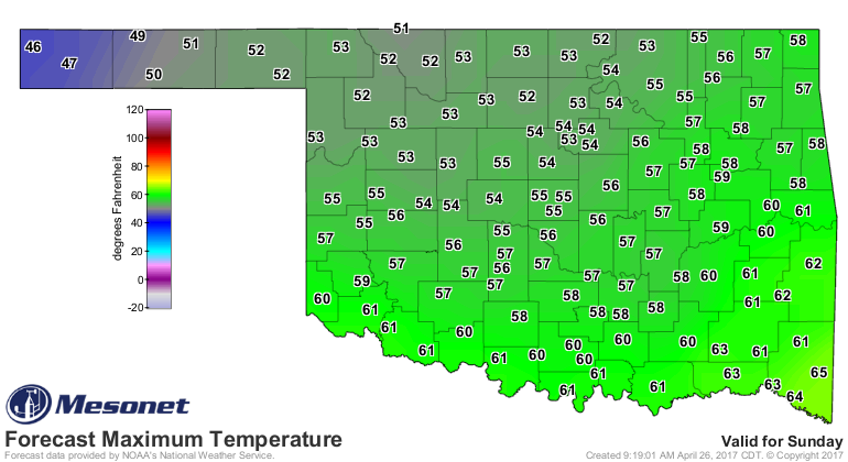
That's it! I'm cancelling all future weekends until further notice!
Gary McManus
State Climatologist
Oklahoma Mesonet
Oklahoma Climatological Survey
(405) 325-2253
gmcmanus@mesonet.org
April 26 in Mesonet History
| Record | Value | Station | Year |
|---|---|---|---|
| Maximum Temperature | 95°F | ALTU | 2014 |
| Minimum Temperature | 25°F | BOIS | 2006 |
| Maximum Rainfall | 5.51 inches | BOWL | 1998 |
Mesonet records begin in 1994.
Search by Date
If you're a bit off, don't worry, because just like horseshoes, “almost” counts on the Ticker website!