Ticker for April 24, 2017
MESONET TICKER ... MESONET TICKER ... MESONET TICKER ... MESONET TICKER ...
April 24, 2017 April 24, 2017 April 24, 2017 April 24, 2017
Here we go again
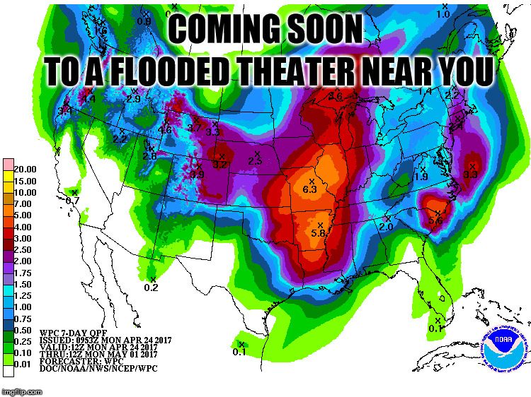
As Jack Nicholson said in "One Flew Over the Cuckoo's Nest"...a little dab will
do ya. However, the "little dab" of rain we're expecting this week, coupled with
what we saw last week, will not do us well at all.
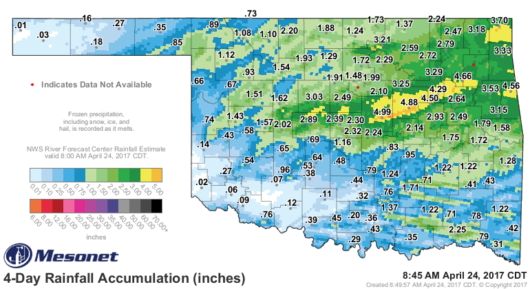
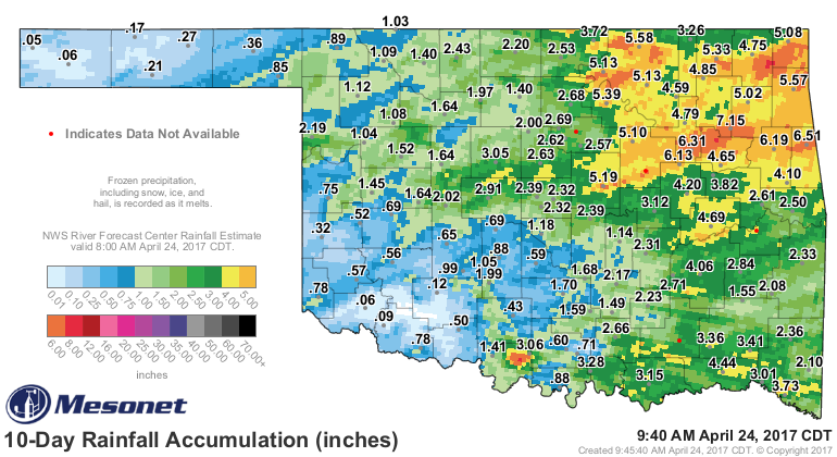
We see the forecast there for another 3-6 inches across the eastern half of the
state, and then we see that area just had 4-6 inches Friday and Saturday, and
6-8 inches over the last 10 days.
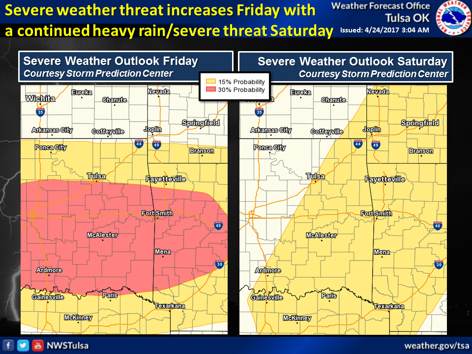
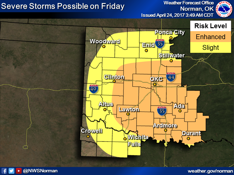
There's ending droughts, and then there's ENDING DROUGHTS! The setup is somewhat
similar to last week's, with Friday again being the big day. And all modes of
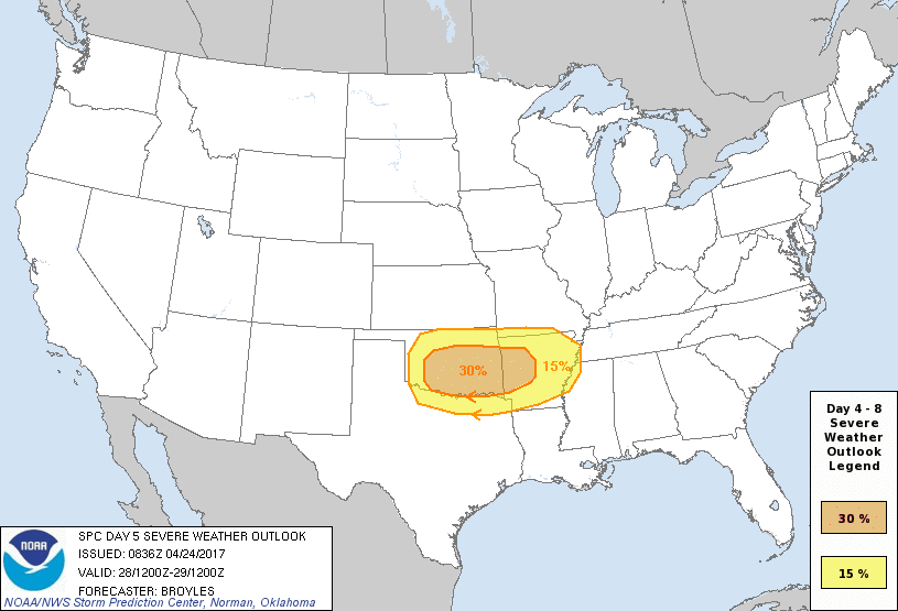
severe weather MIGHT be possible if the forecast continues to solidify. And again,
flooding will be a significant concern. The Storm Prediction Center has already
added an "area of color" on their day-5 outlook map, signifying an increased risk
of severe weather that day.
Here's a better description of the scenario for late this week from the NWS
office in Tulsa:
"A stronger storm system is expected to move into the Four Corners
region by late week, with the threat for more widespread and
significant severe weather Friday and Saturday. A few elevated
storms will be possible as early as late Thursday night and into
Friday morning as a warm front begins to lift north. Multiple rounds
of severe weather will be possible Friday and Saturday before a
Pacific front moves through Sunday morning. Large hail and damaging
winds will be likely, especially on Friday, including the threat for
tornadoes. In addition, locally heavy rainfall is expected which
could lead to flash flooding and additional rises on area rivers."
There's another chance for severe weather on Tuesday, but it's sort of dwarfed
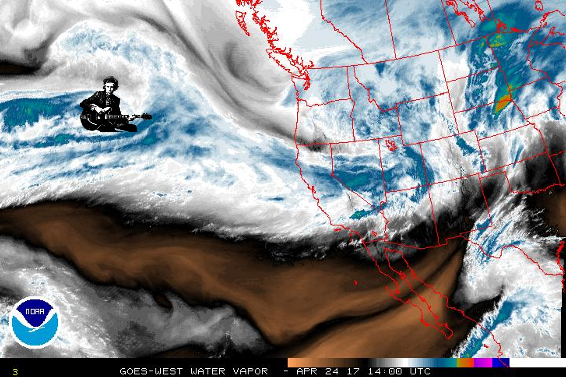
by Friday right now. And the usual caveats apply to Friday's scare-cast...the
storm is still out over the pacific, depicted on this water vapor satellite
image by decrepit rock star Keith Richards of the Rolling Stones.
Why, you ask? Why not?
So still a long way out, lots of time for forecast models to change their
area of focus, but it does appear that Friday, SOMEWHERE in the Southern Plains,
it's gonna be an exciting day.
Gary McManus
State Climatologist
Oklahoma Mesonet
Oklahoma Climatological Survey
(405) 325-2253
gmcmanus@mesonet.org
April 24 in Mesonet History
| Record | Value | Station | Year |
|---|---|---|---|
| Maximum Temperature | 97°F | BEAV | 2012 |
| Minimum Temperature | 15°F | BOIS | 2013 |
| Maximum Rainfall | 6.77″ | HASK | 2011 |
Mesonet records begin in 1994.
Search by Date
If you're a bit off, don't worry, because just like horseshoes, “almost” counts on the Ticker website!