Ticker for April 20, 2017
MESONET TICKER ... MESONET TICKER ... MESONET TICKER ... MESONET TICKER ...
April 20, 2017 April 20, 2017 April 20, 2017 April 20, 2017
Drought in the crosshairs
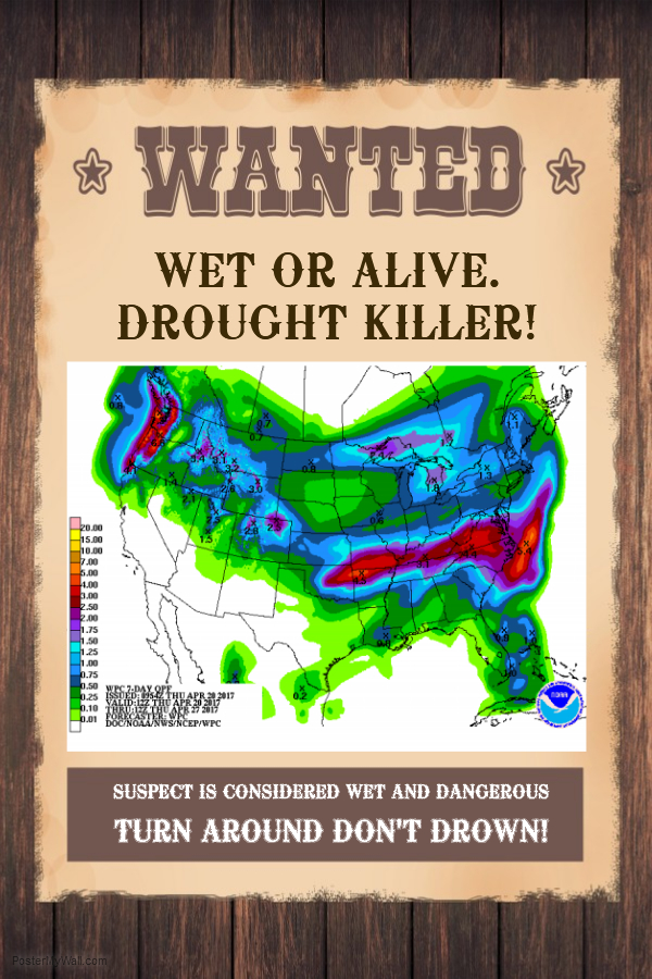
I've been promising you big changes on the Drought Monitor map, and Mother Nature
hasn't made a fool of me yet. This week at least. And the drought that has plagued
Oklahoma since last fall might be headed to the gallows if the storm just now
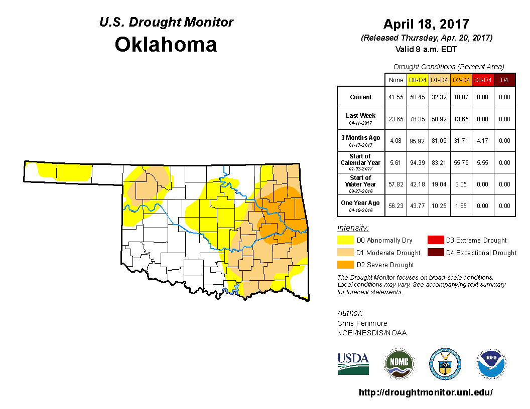
impacting the state has a say in it. The latest Drought Monitor map shows a huge
reduction in drought from 51% last week to 32% this week, and that's down from
81% just about a month ago on March 21.
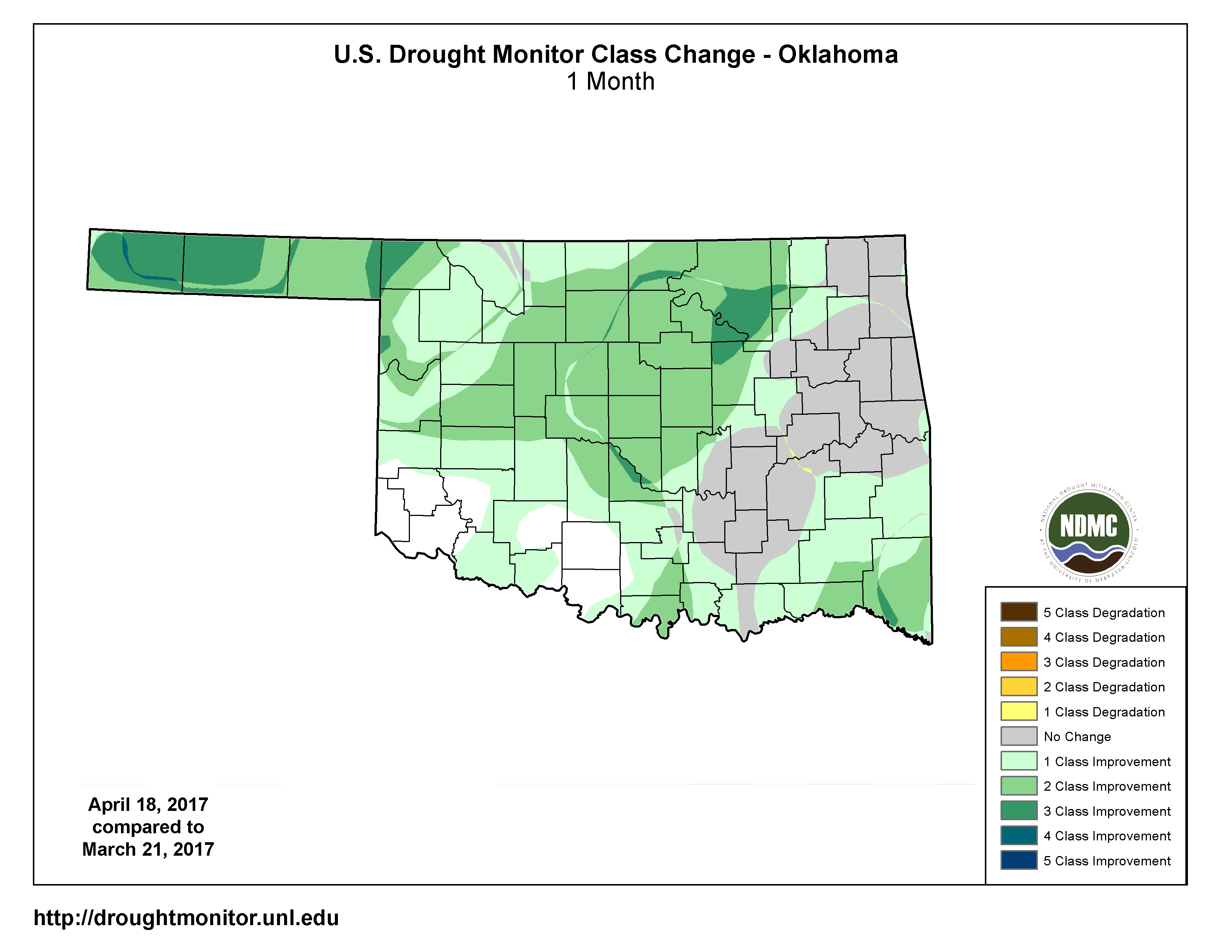
You can see the big changes over that 1-month time frame in this map.
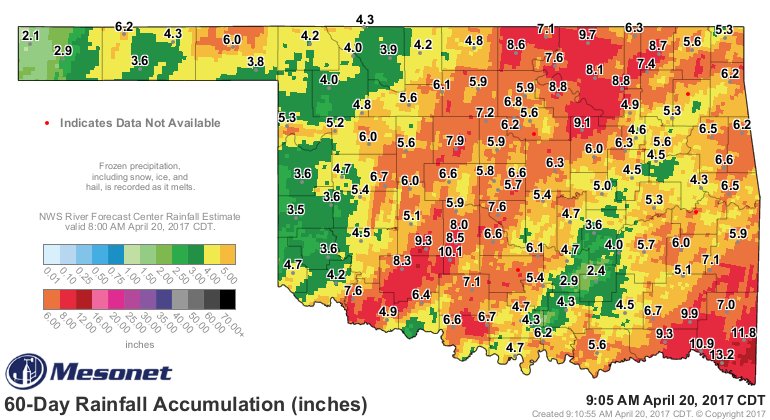
We have this type of rainfall to thank for that, providing moisture that eliminated
some of the most concerning impacts (fire danger, depleted soil moisture, delayed
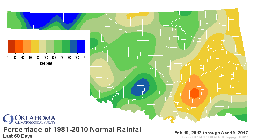
green up, etc.). Although we can still see those places still suffering from
moderate to severe drought showing up quite well on the 60-day percent of normal
map.
Now to that storm system. We have a front moving through the state as we speak,
and that also shows up quite well on the Mesonet maps. It's not a strong front,
but it's there nevertheless.
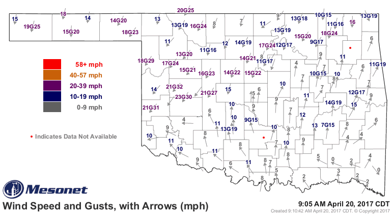
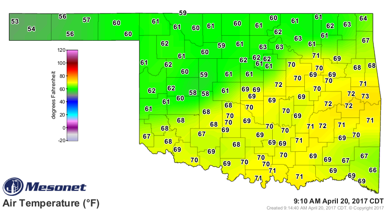
Without going all meteorological on you, here's the scenario. That front will
head south to the Red River and stall out. A smaller system will travel through
the broader system and help to set off a round of heavy showers and storms later
this evening through the morning, some possibly severe. Tornado threat very low.
But the Gulf of Mexico is sending tons of moisture up our way so expect very
heavy rains just to the north of the stalled front, which should start to move
back north as a warm front overnight. Then there is a chance, if conditions come
together just right tomorrow afternoon and the ongoing showers and storms don't
gum up the works, there will be a very conditional chance for severe weather
with all modes of hazards possible. The window for this upgraded severe weather
risk, from central through southern OK, will be very short and again VERY
CONDITIONAL.
In a nutshell, we don't want to see discrete supercells (big storms roaming
around all by themselves) in the warm air to the south of the front tomorrow
afternoon. There's a decent/good chance that won't happen. However, the Storm
Prediction Center has put us on notice for the chance with a slight risk from
central through southern OK tomorrow.
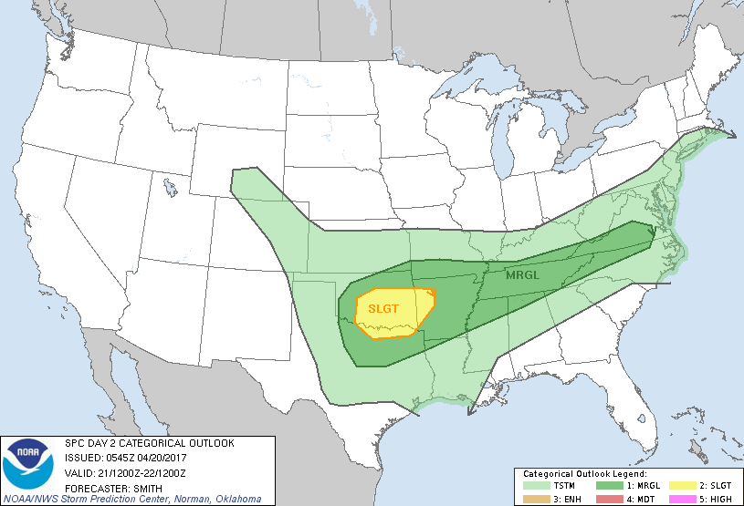
So the tornado threat is low, but SPC does mention them in their discussion for
tomorrow.
"Hail/wind and perhaps a couple of tornadoes are possible with the
severe threat maximizing during the late afternoon/early evening."
Doesn't that pretty much describe about every spring storm system we see, though?
So no need to panic. Just stay tuned to your favorite weather sources for
updated info. And that severe threat will exist later today through tomorrow
morning as well, but that will entail high winds and large hail mostly, which
can be just as damaging. One thing appears certain, however, and that is a bunch
of rain is expected to fall. The atmosphere is rich with moisture and it's just
going to get wetter. The NWS has already issued a flood watch for much of
central through NE OK.
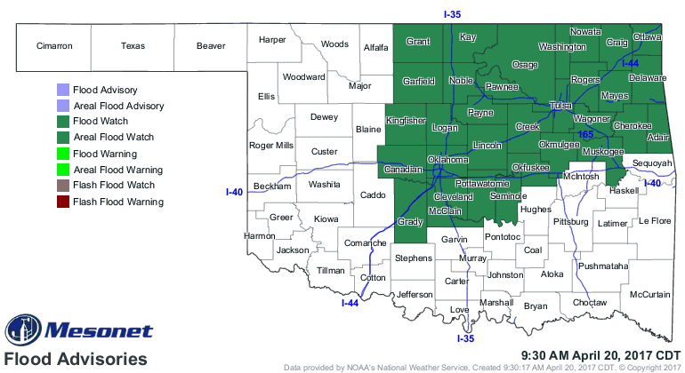
Widespread amounts of 1-3 inches, to as much as 5-6 inches in localized areas,
could be possible around that frontal boundary.
Springtime in Oklahoma...you gotta love it! Well, no you don't. Sometimes, you
just have to put up with it.
Gary McManus
State Climatologist
Oklahoma Mesonet
Oklahoma Climatological Survey
(405) 325-2253
gmcmanus@mesonet.org
April 20 in Mesonet History
| Record | Value | Station | Year |
|---|---|---|---|
| Maximum Temperature | 98°F | GRA2 | 2022 |
| Minimum Temperature | 24°F | BOIS | 2021 |
| Maximum Rainfall | 2.74″ | VINI | 2025 |
Mesonet records begin in 1994.
Search by Date
If you're a bit off, don't worry, because just like horseshoes, “almost” counts on the Ticker website!