Ticker for April 18, 2017
MESONET TICKER ... MESONET TICKER ... MESONET TICKER ... MESONET TICKER ...
April 18, 2017     April 18, 2017     April 18, 2017     April 18, 2017


TGbIF


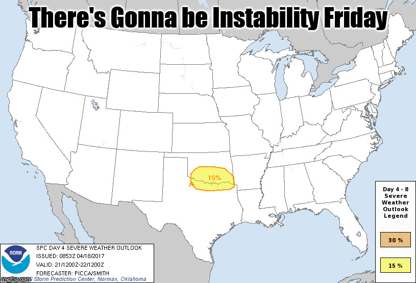
There's Gonna be Instability Friday? That's not the end of the week we asked for!
But yes, it does appear from four days out there might be a decent chance for
severe weather on Friday, and with that will come the customary dalliances with
large hail, high winds, flooding rainfall and possible tornadoes. Right now it
appears to be a southern/central OK type of a deal.


The storm is still over the pacific right now, so there are still a lot of
changes that could occur between now and then. One thing that probably won't
change, however, is the amount of return moisture awaiting this storm system as
if approaches Thursday night into Friday. It would appear there's gonna be a
lakefull of water falling here or there, and maybe just about everywhere. This
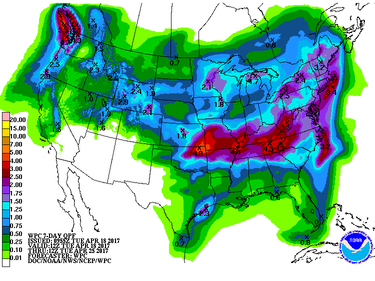
7-day rain forecast is somewhat polluted by other rain chances possible on
Wednesday


but the real action begins on Thursday along a stalled cold front. As the moist
air lifts up and over the frontal boundary, this could result in sustained
heavy rainfall Thursday into Friday morning. I have to be careful how to
explain that scenario...it's an easy way to explain this phenomenon known as
"isentropic lift," also incorrectly called "overrunning." I'll stop there before
I experience Grad Fluid Dynamics PTSD. Oh, back to the copious amounts of rain
and that 7-day rain forecast.


Man, that's a mess of rainfall across the northern half of the state. It does
decrease to the south, and that's something that's important for the risk of
severe weather. We all know by now that morning convection can disrupt the
chances for severe weather in the afternoon by reducing heating, making the
environment more stable, etc. So let's hope for that. But if the heavy rains
and convection stay farther north and allow for the proper conditions to evolve
in central and southern OK, that's when the risk of severe weather becomes
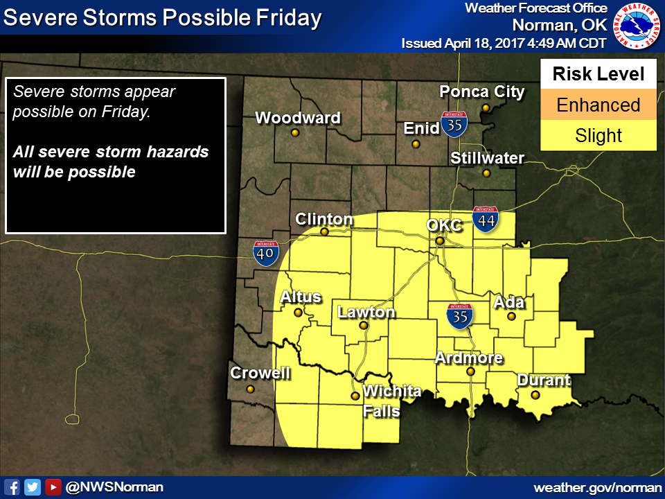
realized. Here's the Norman NWS' take on it, four days out.

"As for severe storms, Friday, the impact of the ongoing convection
through the morning hours will have an obvious impact on where, if
any, suitable warm sector will reside and the potential for severe
thunderstorms. At present, given the various solutions, it appears
some recovery may occur along and near the Red River Valley,
including far southern Oklahoma into north Texas, with storms
primarily developing along the front as it advances south/southeast
overnight into early Saturday."

Things for Friday are still a bit fuzzy. But you should be prepared not only
for severe weather but also for the chances of flooding rainfall. Don't limit
your preparations for one or the other because as said previously, we're still
four days out and things could change a bunch before then.

The bright side...the drought's days are numbered it would appear.

Gary McManus
State Climatologist
Oklahoma Mesonet
Oklahoma Climatological Survey
(405) 325-2253
gmcmanus@mesonet.org
April 18 in Mesonet History
| Record | Value | Station | Year |
|---|---|---|---|
| Maximum Temperature | 101°F | ALTU | 2011 |
| Minimum Temperature | 22°F | BOIS | 2013 |
| Maximum Rainfall | 3.17″ | TAHL | 2009 |
Mesonet records begin in 1994.
Search by Date
If you're a bit off, don't worry, because just like horseshoes, “almost” counts on the Ticker website!