Ticker for April 6, 2017
MESONET TICKER ... MESONET TICKER ... MESONET TICKER ... MESONET TICKER ...
April 6, 2017 April 6, 2017 April 6, 2017 April 6, 2017
Drought takes a whooping
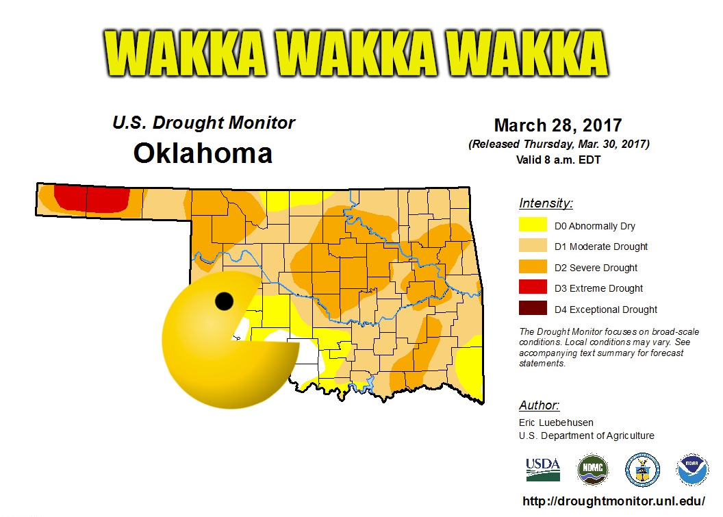
Sorry, I don't speak Pac Man. "Wakka Wakka Wakka" is how I hear him speak,
though. In this case, he's not eating dots, or ghosts, but drought. We did see
massive improvements on this week's map, thanks mostly to rains that occurred
last Tuesday (way back on March 28 and beyond) but missed the cutoff point for
consideration that morning.
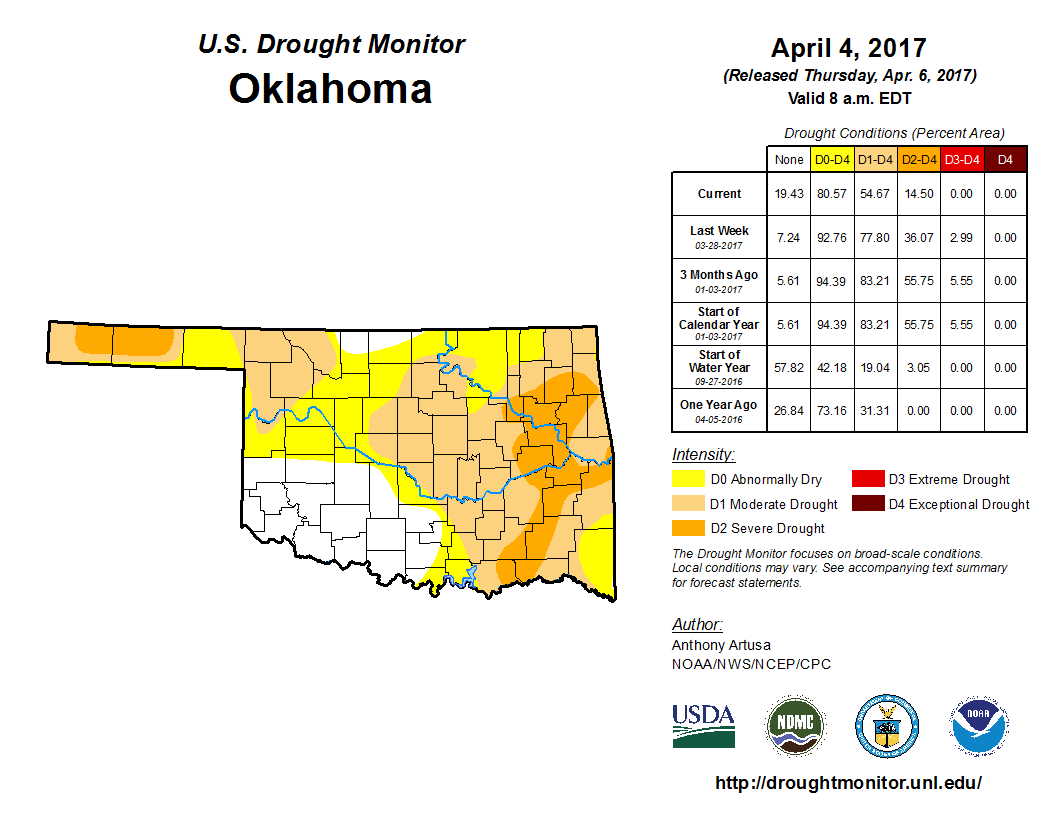
So in essence, we had 8 days worth of data to work with. We don't have an 8-day
rainfall map, but here's the 10-day that captures all that rain.
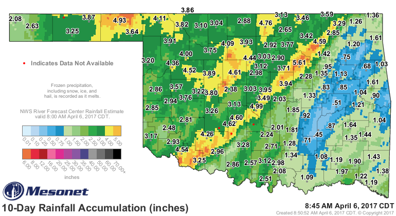
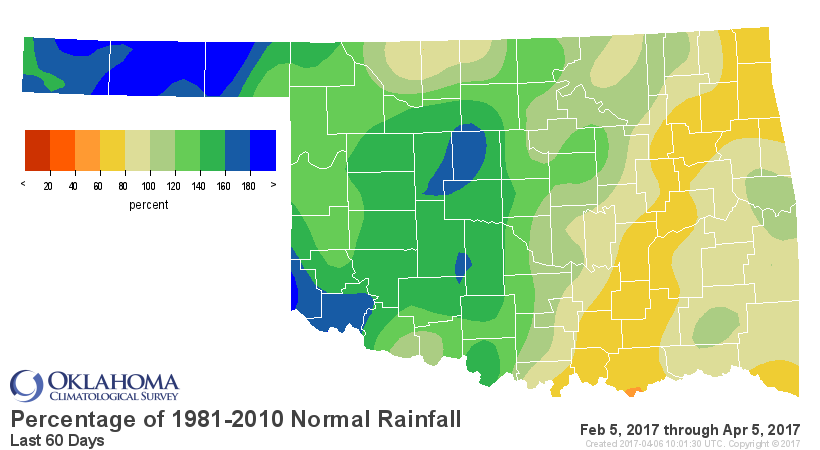
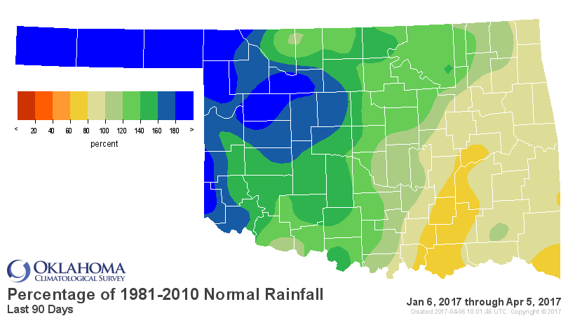
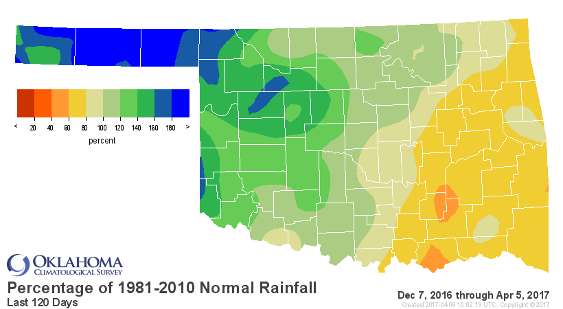
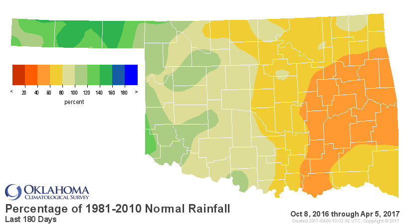
There is an obvious demarcation line between great rainfall totals, good rainfall
totals, and so-so rainfall totals. Kind of along the I44 corridor, just skewed a
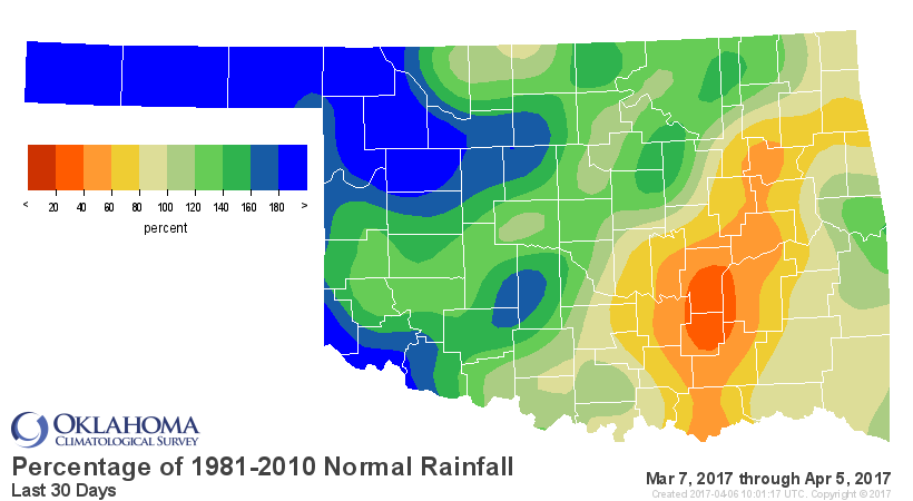
tad northwest and southeast. And this last 10 days of rainfall has transformed all
of our rainfall maps, from 30- to 180-days. Just take a look at the percent of
normal maps for those time periods and you can see those areas with a trajectory
out of drought...and those areas that need more help.
The cool weather that has dominated our region since the rains began has helped
tremendously, limiting evaporation to some degree at a time when the sun's
getting higher in the sky and the wind continues unabated (mostly).
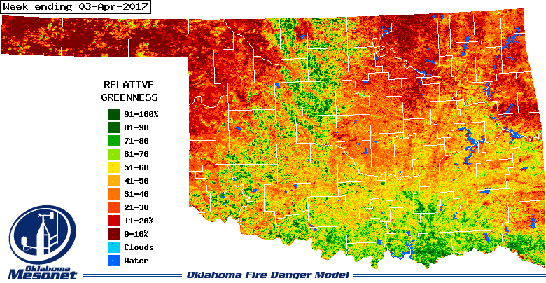
The Mesonet's OK-Fire program's relative greenness images show the wheat belt
finally starting to take off from SW through NC Oklahoma, and a green up along
the Red River as well. The rest of the state should soon follow thanks to the
moisture, higher sun and warmer weather (eventually??).
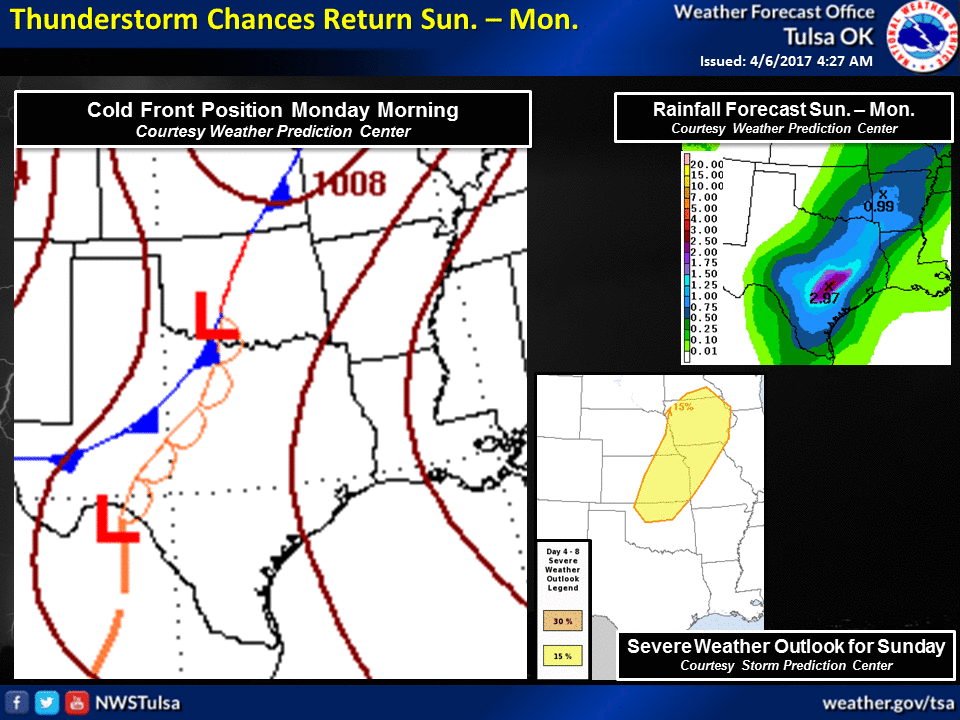
What's coming up? Well, another chance for storms Sunday and then farther into
next week with the approach of a storm system and cold front. Rain chances will
be stronger across SE OK and almost nil across the NW, but the SE is where it's
needed most this time.
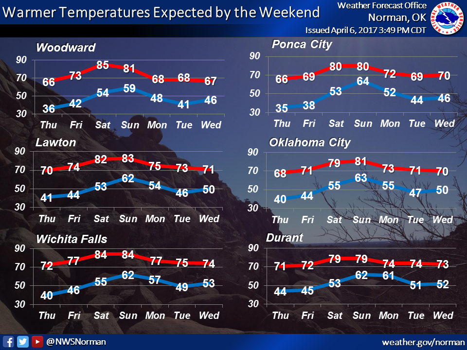
As per usual with fronts and such, expect a spike in temperatures as the storm
system approaches as the southerly wind machine kicks up, then a cool down
after the front passes.
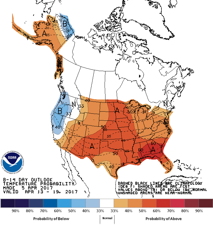
Farther out, looks like increased odds of above normal temps and a mixed
precip outlook.
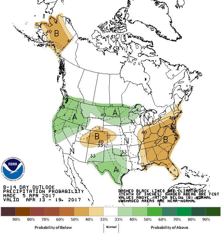
Farther out? I'm scared to look!
State Climatologists...bravery is not in our creed!
Gary McManus
State Climatologist
Oklahoma Mesonet
Oklahoma Climatological Survey
(405) 325-2253
gmcmanus@mesonet.org
April 6 in Mesonet History
| Record | Value | Station | Year |
|---|---|---|---|
| Maximum Temperature | 100°F | WALT | 2011 |
| Minimum Temperature | 14°F | EVAX | 2023 |
| Maximum Rainfall | 3.57″ | OKMU | 2018 |
Mesonet records begin in 1994.
Search by Date
If you're a bit off, don't worry, because just like horseshoes, “almost” counts on the Ticker website!