Ticker for April 11, 2017
MESONET TICKER ... MESONET TICKER ... MESONET TICKER ... MESONET TICKER ...
April 11, 2017 April 11, 2017 April 11, 2017 April 11, 2017
Why?
Let me describe the recent weather in one word: REALLY DISAPPOINTING!
Oh, that's two words? Well, what a DISAPPOINTMENT! Now you know how I feel. Windy,
very little rain, more wind, very little rain, more wind, now cold. But at least
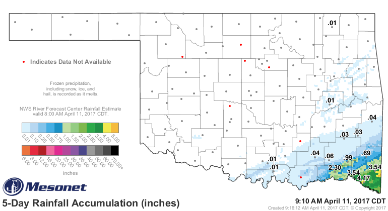
it WAS warm. The rainfall map shows where that rain did fall, with more than 4
inches showing up in McCurtain County over the last couple of days.
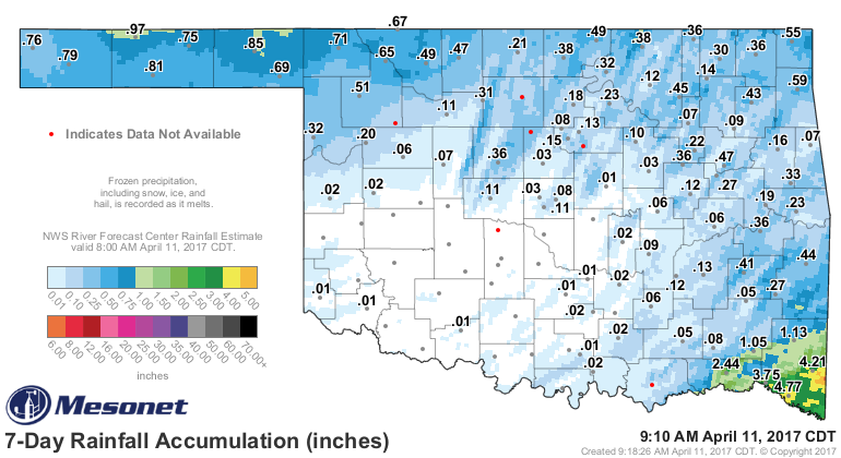
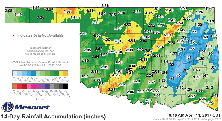
Other than that, you have to go back 7-14 days to capture the snow and rain
that fell across northwestern Oklahoma, and the tail end of that last big storm
system that dumped a ton (lots of tons, actually) across most of the state.
So last weekend's storm system was nothing but a big bag of wind (I HEARD THAT!!),
how about the series of small storm systems slated to move across the area
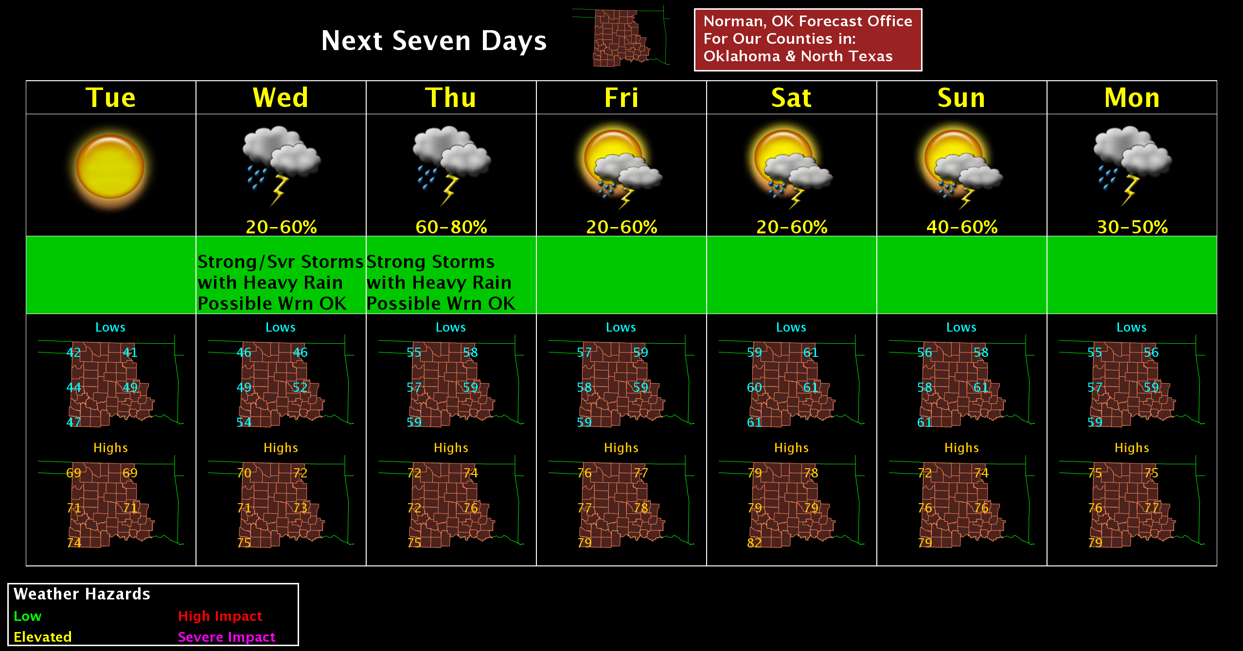
over the next week or so? Heck, take a look at the 7-day planner from NWS
Norman. They have showers/storms painted on every single day (other than today,
of course).
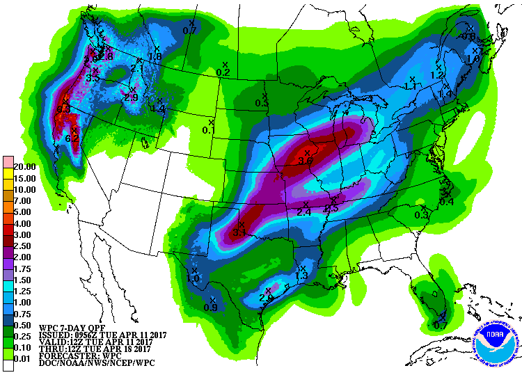
The rainfall amounts over that time period really add up to a nice springtime-
looking map.
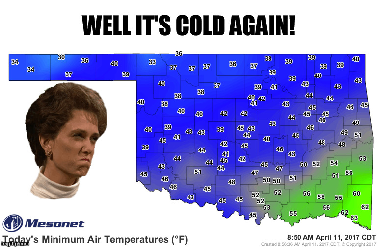
And now for the walk of shame. Eva had to go and hit freezing this morning.
It wasn't for long, apparently. Not even an hours worth as they dove to 30
degrees, but 'twas enough!
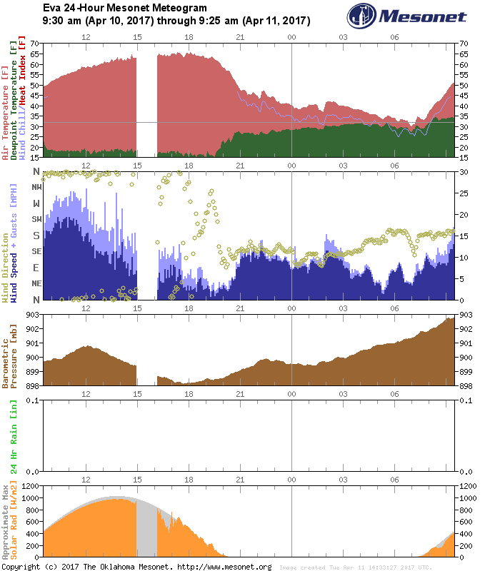
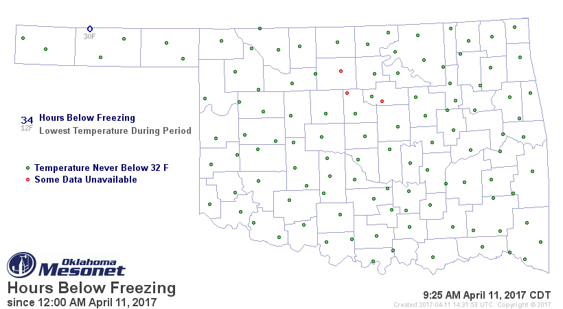
Come on, Eva. Get with the program.
Gary McManus
State Climatologist
Oklahoma Mesonet
Oklahoma Climatological Survey
(405) 325-2253
gmcmanus@mesonet.org
April 11 in Mesonet History
| Record | Value | Station | Year |
|---|---|---|---|
| Maximum Temperature | 96°F | ARNE | 2018 |
| Minimum Temperature | 15°F | BOIS | 2013 |
| Maximum Rainfall | 4.55″ | VINI | 1994 |
Mesonet records begin in 1994.
Search by Date
If you're a bit off, don't worry, because just like horseshoes, “almost” counts on the Ticker website!