Ticker for March 6, 2017
MESONET TICKER ... MESONET TICKER ... MESONET TICKER ... MESONET TICKER ...
March 6, 2017 March 6, 2017 March 6, 2017 March 6, 2017
Monday kicks off a
Get it, "fire" and "storm"? Firestorm? Okay, sometimes the Ticker has a way with
words. Sometimes, not way with words. But in case you've been living in a cave
for the last week or two (which would be lucky for you, since those are usually
fireproof), we've had this same basic weather pattern on and off throughout that
time frame. Lots of fire danger, especially when storm systems approach like
tonight. But at least there is a chance of rain across eastern Oklahoma.
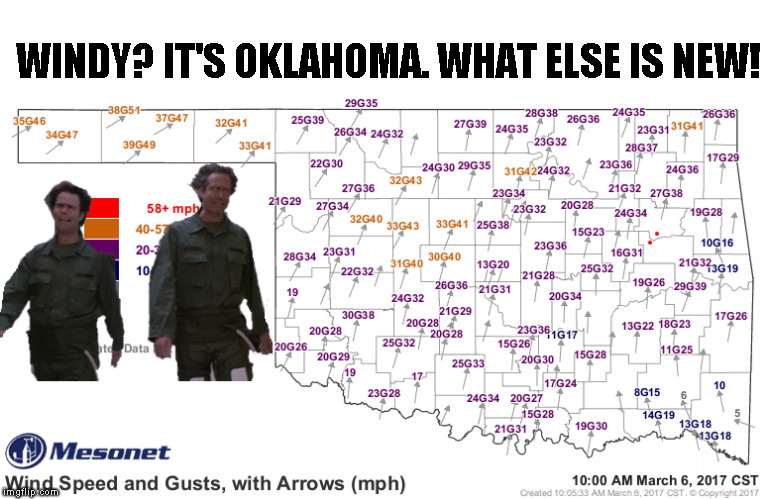
Let's start with the fire danger today. Looks fairly nasty out across the western
half of the state. Combine low humidity with some fierce winds in early March and
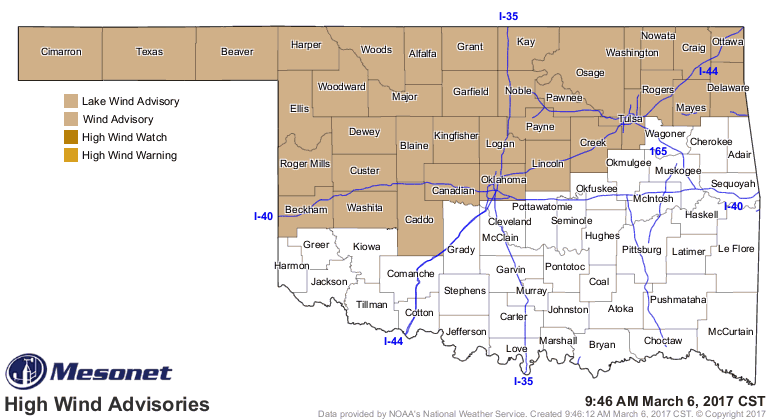
you will probably have fire danger, like today. And windy it will be, with a wind
advisory already issued for the northern half of the state, and then you have a
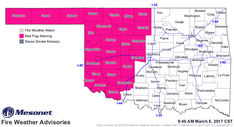
Red Flag Fire Warning for that western half or so.
From the Oklahoma Forestry Services:
"Red Flag Warning in effect from 11:00 AM through 8:00 PM for several
counties in western Oklahoma along and west of a line from Grant
County to Tillman County. Extreme fire weather conditions are
expected to develop this afternoon in areas where fuel loading and
fuel availability will result in very high potential for problematic
and extreme fire behavior. Respectable overnight moisture recovery will
dissipate as the dryline moves east followed with a cold front
impacting the Warned area late in the burning period. Post-frontal fire
weather on Tuesday and Wednesday will promote accelerated drying across
all of Oklahoma as relative humidity value again dive into the teens
across much of the state."
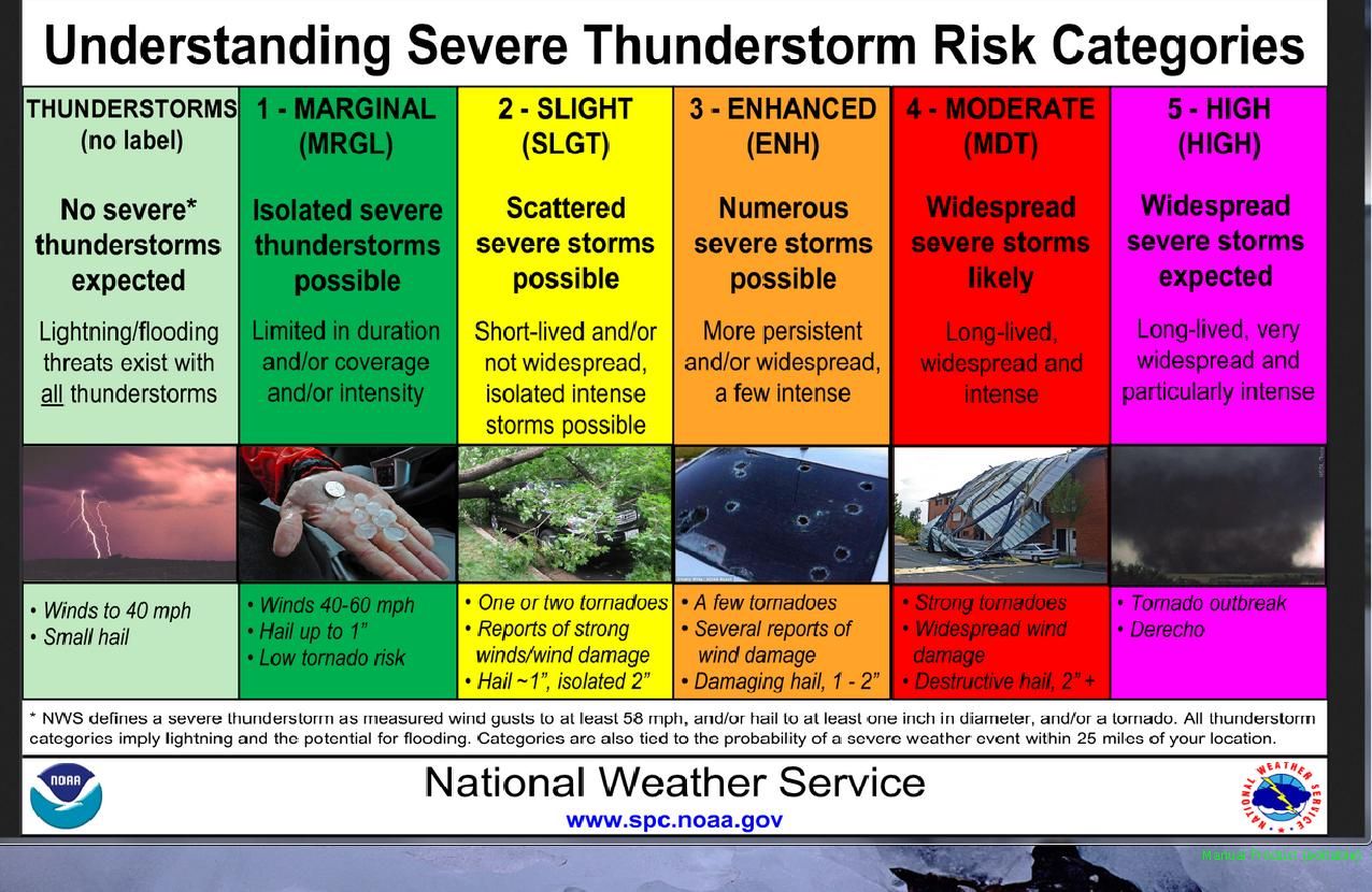
So that's the hazard across western Oklahoma. For eastern Oklahoma, theirs is
a chance of severe storms, with the Storm Prediction Center putting far
NE OK in the "Enhanced" risk for today. Slight and marginal risks extend west
into central OK from there. Here's a look at that map, and also a reminder of
what those risks detail.
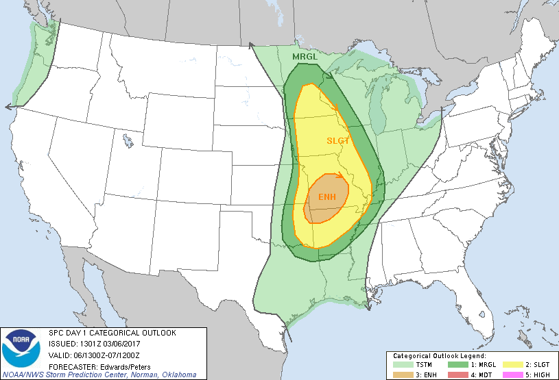
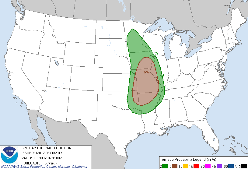
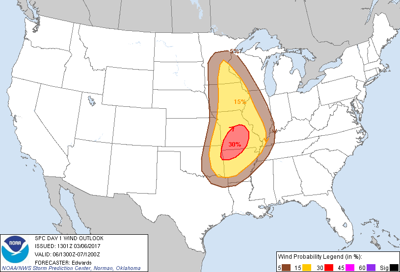
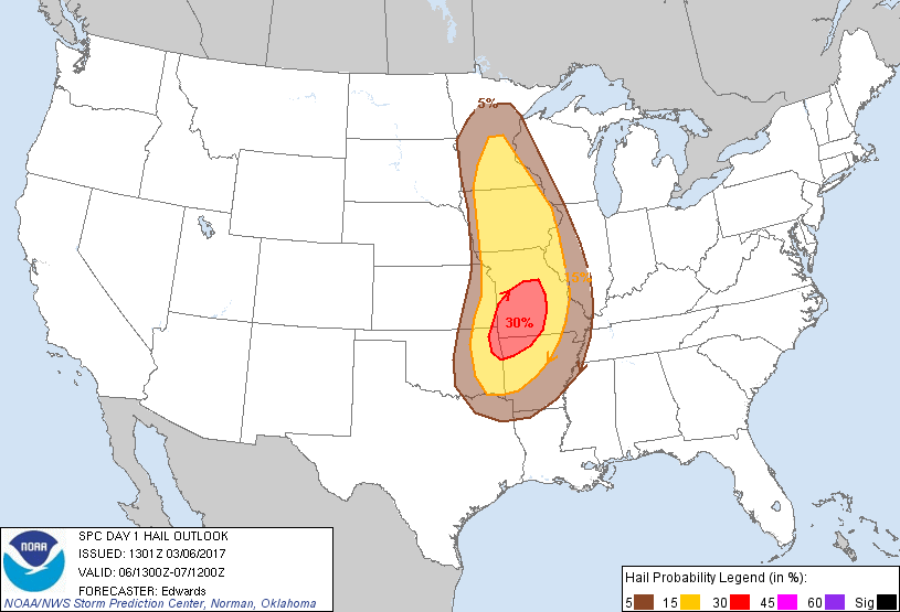
The main risk will be for wind and hail, but the tornado risk is not zero. Low,
but not zero (get used to that...you'll hear it a lot this spring).
Springtime in Oklahoma! You gotta take the good with the bad. Just be sure and
alert me when we get to the good.
Gary McManus
State Climatologist
Oklahoma Mesonet
Oklahoma Climatological Survey
(405) 325-2253
gmcmanus@mesonet.org
March 6 in Mesonet History
| Record | Value | Station | Year |
|---|---|---|---|
| Maximum Temperature | 87°F | ALV2 | 2017 |
| Minimum Temperature | 9°F | KENT | 2018 |
| Maximum Rainfall | 2.10″ | COOK | 1995 |
Mesonet records begin in 1994.
Search by Date
If you're a bit off, don't worry, because just like horseshoes, “almost” counts on the Ticker website!