Ticker for March 1, 2017
MESONET TICKER ... MESONET TICKER ... MESONET TICKER ... MESONET TICKER ...
March 1, 2017 March 1, 2017 March 1, 2017 March 1, 2017
Here comes sprummer!
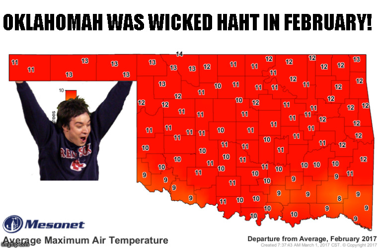
That map pretty much says it all for February, but for some strange reason I
felt the need to say much more. February is gone, and as detailed below, it
ended as the 4th warmest on record for Oklahoma since records began in 1895. Not
too shabby, again. Perhaps the most concerning thing is that there appears to
be no let up in sight for the warm, dry conditions that plagued the state over
the last 2 weeks. And that means more fire danger. I know spring has arrived
early...no doubt about that. But until we get that nice spring green up, fire
danger will continue to hang around.
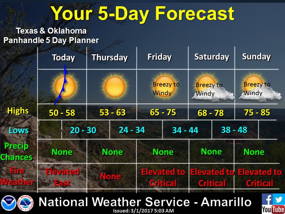
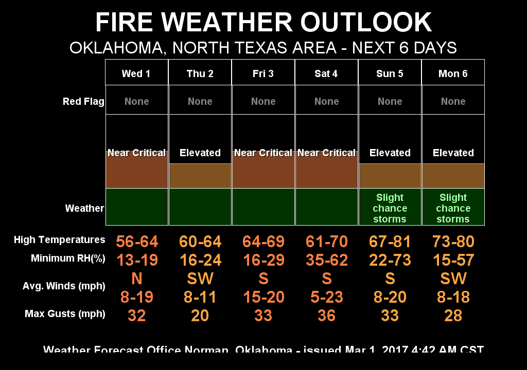
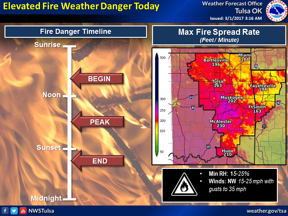
The medium-term outlooks are less than favorable
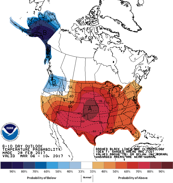
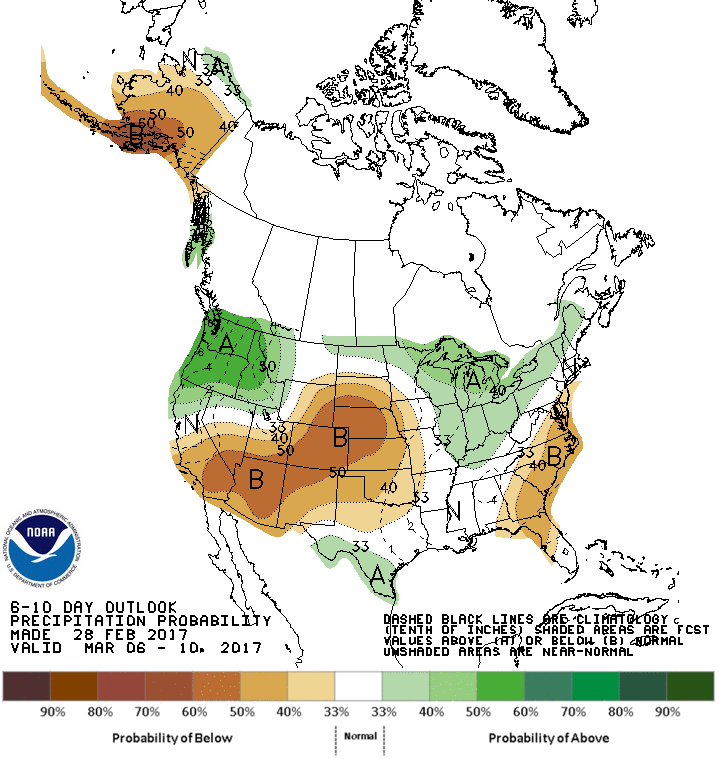
and the March monthly outlooks in the summary below are even less so. So check
out the February summary, hit the highlights of February and the not-so-great
outlook for March.
----------------------------------------------------------------------------------
February Brings Early Oklahoma Spring
March 1, 2017
While glimpses of winter were sporadic in December and January, they were
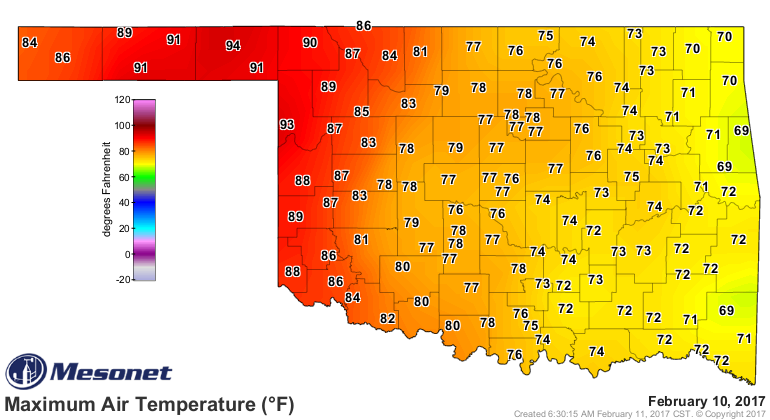
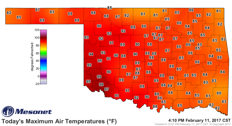
downright scarce during February. Temperatures often soared into the 70s and
80s, culminating with a maximum of 99 degrees at the Mangum Mesonet site on
February 11. That ties the mark for highest temperature ever recorded in
Oklahoma during not only February, but winter as well. That record was set
previously at Arapaho on Feb. 24, 1918. The previous day?s high temperature of
94 degrees at the Beaver Mesonet site broke the record for the highest
temperature ever recorded in the state for that early in the calendar year.
That previous mark was held by the cooperative observing stations at Cloud
Chief and Guthrie, reaching 93 degrees on Feb. 1, 1911.
The lack of substantial cold air was perhaps just as striking as the
predominance of the warm extremes. Several cold fronts dropped state
temperatures close to seasonal normals, but the truly frigid weather was mostly
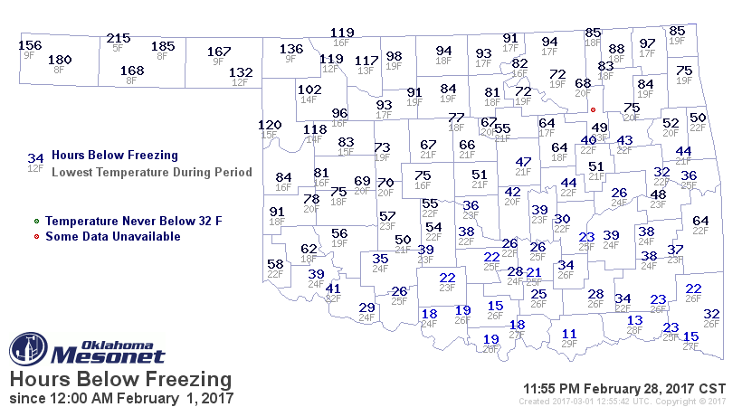
confined to the western Oklahoma Panhandle. The Mesonet site at Eva recorded a
statewide low for the month of 5 degrees on the 25th. The Durant Mesonet site
spent 11 hours at or below freezing during February, bottoming out at a
relatively mild 29 degrees. In contrast, Eva was below freezing for 215 hours.
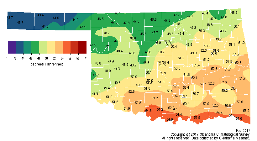
According to preliminary Mesonet data, the statewide average for February was
49.8 degrees, 7.7 degrees above normal to rank as the fourth warmest February
since records began in 1895.
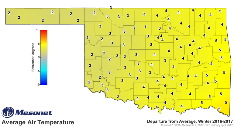
February also marks the end of the three-month climatological winter. The
December-February statewide average ended at 42.9 degrees, the ninth warmest
winter on record, 3.4 degrees above normal.
The lowest winter temperature recorded by the Mesonet was minus 19 degrees at
Kenton on January 7. The first two months of 2017 also broke the record for
the warmest January-February combined with a statewide average of 45.1 degrees,
5.3 degrees above normal, besting 1952?s 44.7 degrees.
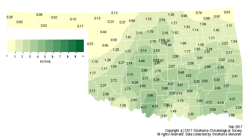
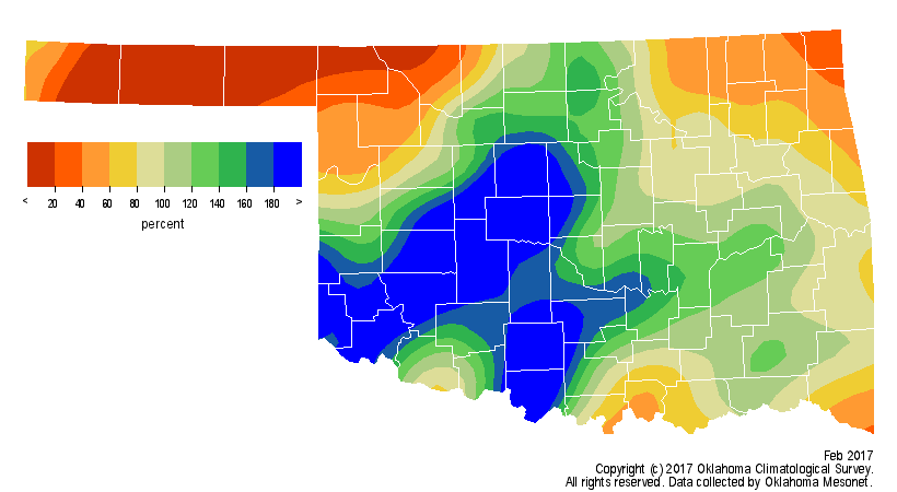
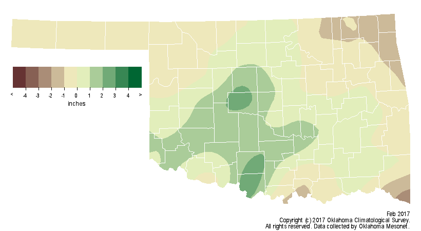
Two robust mid-month storm systems boosted the statewide average precipitation
total to 2.04 inches, 0.21 inches above normal, to rank as the 34th wettest
February on record. Southwestern through central Oklahoma enjoyed the best
rains with totals ranging from 2-4.5 inches. Southwestern and central Oklahoma
saw their 12th- and 15th-wettest Februaries on record, respectively. El Reno
led the state?s monthly total at 4.48 inches. Seven Mesonet sites recorded at
least 4 inches, and 69 garnered at least 2 inches. Parts of the state were
exceedingly dry, however. Kenton led the Panhandle with a paltry 0.28 inches
while Goodwell and Hooker tied for the lowest at 0.02 inches. In the northeast,
Miami came in about 1.5 inches below normal with 0.63 inches.
The winter ended as the 43rd wettest with a statewide average of 5.38 inches,
about a tenth of an inch above normal.
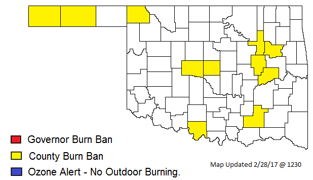
Although a bit of severe weather made its presence felt during February, fire
danger was the most frequent hazard. Weather conditions prompted Gov. Mary
Fallin to issue a burn ban for 53 counties on Feb. 10, although the ban was
lifted on Feb. 15 after the beneficial rains. Eleven county burn bans remained
in place on the month?s final day.
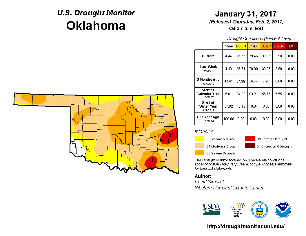
The two consecutive storm systems signaled a change in the general weather
pattern experienced by Oklahoma since early last fall. The state had been
seeing perhaps one good rain a month, allowing for drought intensification in
between those systems. The reinforcing moisture allowed for more sustained and
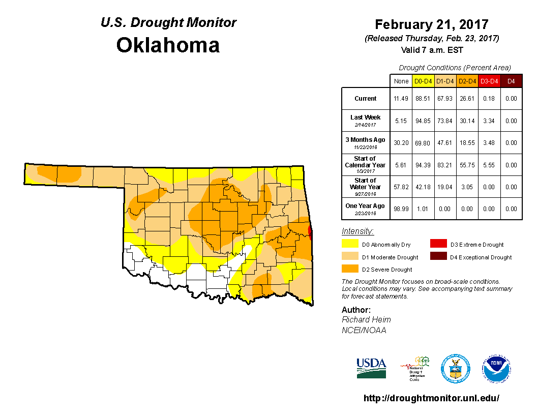
significant drought relief. Nearly 80 percent of the state was covered by
drought at the end of January according to the U.S. Drought Monitor. That
amount was reduced to 68 percent on the last report for the month.
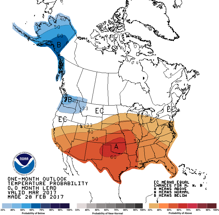
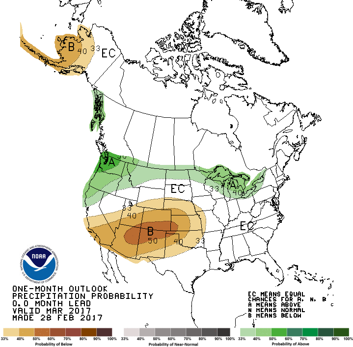
The March outlooks from the Climate Prediction Center (CPC) indicate warm, dry
weather is possible during March with increased odds of above normal
temperatures and below normal precipitation.
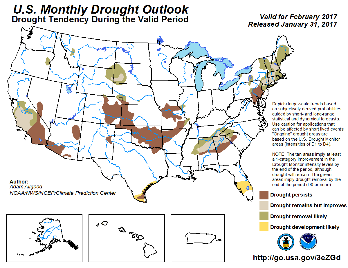
With those conditions favored, CPC?s U.S. Monthly Drought Outlook sees drought
persisting across the state where it currently exists. No drought development
is expected during March.
Gary McManus
State Climatologist
Oklahoma Mesonet
Oklahoma Climatological Survey
(405) 325-2253
gmcmanus@mesonet.org
March 1 in Mesonet History
| Record | Value | Station | Year |
|---|---|---|---|
| Maximum Temperature | 95°F | NEWP | 2006 |
| Minimum Temperature | 7°F | GOOD | 2001 |
| Maximum Rainfall | 1.86″ | HUGO | 1997 |
Mesonet records begin in 1994.
Search by Date
If you're a bit off, don't worry, because just like horseshoes, “almost” counts on the Ticker website!