Ticker for February 16, 2017
MESONET TICKER ... MESONET TICKER ... MESONET TICKER ... MESONET TICKER ...
February 16, 2017 February 16, 2017 February 16, 2017 February 16, 2017
Here we go again!
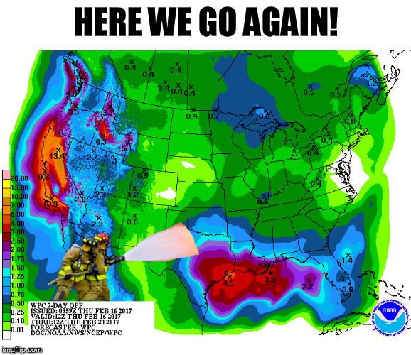
I've said many times that getting one big storm is not the way to end a drought.
You might fill up a pond, but you might not moisten the soil. You might moisten
the soil, but with no runoff ponds and reservoirs don't fill up. No, the best way
to kill a drought is to get TWO storms within two weeks of each other. We've been
getting a good storm about once a month. Now we see good chances for rain starting
to look more likely early next week, and this rainfall forecast looks eerily
similar to the one we had earlier this week...lots of rain in Texas with lessening
amounts as you go north into Oklahoma. Here's the forecast from last weekend, and
what it resulted in:
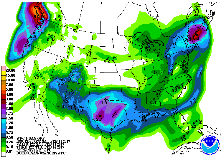
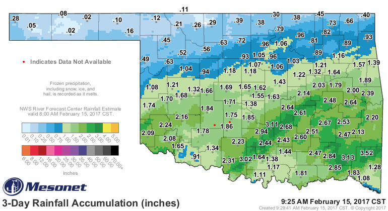
And at this point, the coming storm looks even more juicy. Also similar to the
mid-January storm, the amount of moisture flow from the Gulf of Mexico looks to
be quite high for this time of year, so things are looking good (at this time...
that could change, of course, as we get closer and the forecast models get a
better handle on things) for another drought-quencher.
Drought you say? Well, many of you probably expected a much more non-droughty
drought map. For any newbies, let me explain again that we cannot consider any
rainfall that occurred after 1200GMT (6am during CST, 7am during CDT) Tuesday.
That allows the National author to digest input from all 50 states and a couple
of territories. So here is your incomplete-relief U.S. Drought Monitor map for
this week, and the 1-week change map.
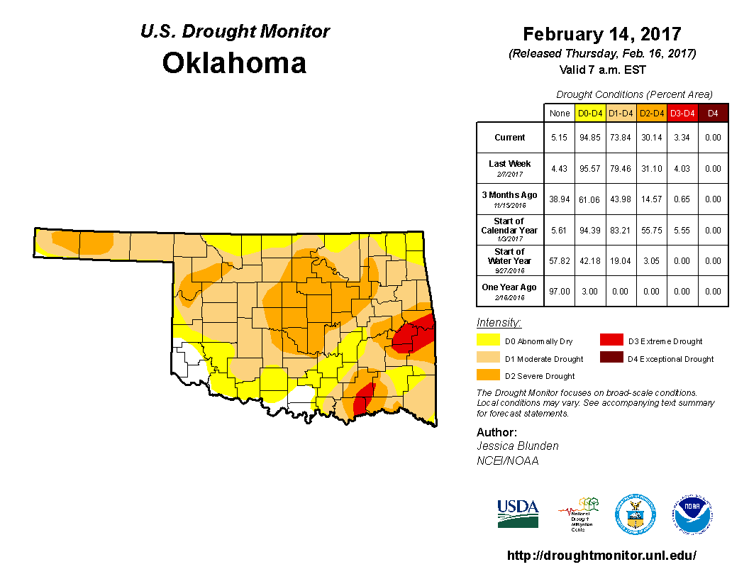
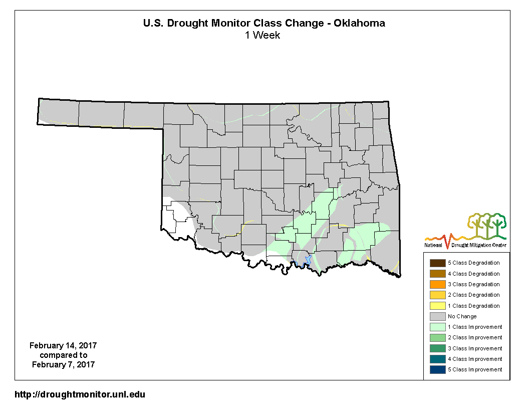
Reasoning: On Tuesday morning, we had two heavier bands of rain that had fallen
from SC up through EC OK, and also a bit farther SE. Another heavy area of rain
had fallen across SW OK, but that area wasn't in drought, so no worries there.
We tried to take into account the extreme temperatures and wind that we saw
the previous two weeks, and also the nearly month-long period with little
rainfall since the mid-January storm.
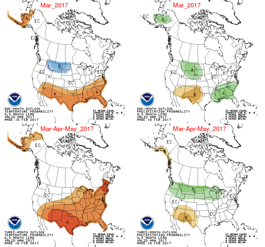
Now as we go out a bit further, the CPC outlook maps for March (the top two on
this figure) show increased odds for above normal temps and below normal precip
across southern and western OK, respectively. For March-May, greater increased
odds of above normal temps statewide, but no clear indication for precip.
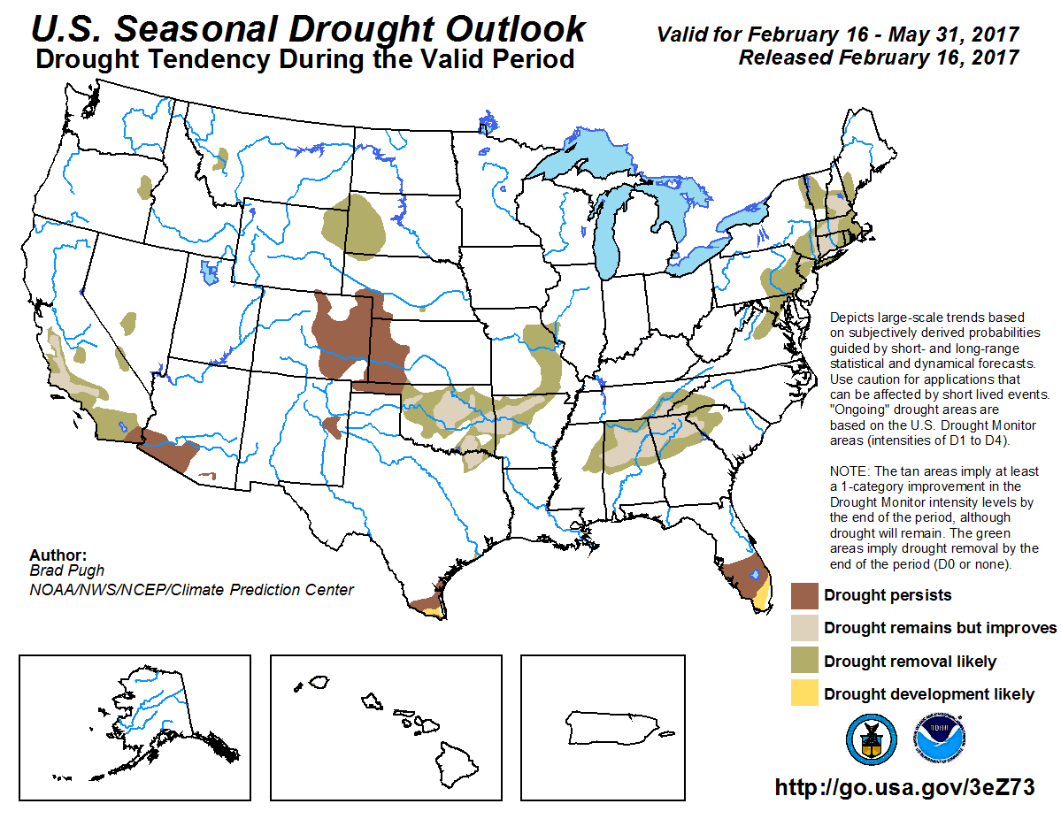
That means the Seasonal Drought Outlook has to go by climatology basically for
precip, so the resulting March-May drought outlook map shows drought (where it
exists now) either disappearing or improving across the main body of the state,
but persisting across the Panhandle.
So drought removal during spring would be just what the doctor ordered, as they
say. Keep in mind that above normal temperatures will require at LEAST normal
precip to keep up with vegetative/human/evaporative demands, so if we go into
a dry signal, drought could hang around longer than is wanted. However, the good
news is we might have a significant amount of this drought kicked out of here
after next week, if that storm performs well. NW OK is looking less fortunate
at this time, but that could definitely change.
Gary McManus
State Climatologist
Oklahoma Mesonet
Oklahoma Climatological Survey
(405) 325-2253
gmcmanus@mesonet.org
February 16 in Mesonet History
| Record | Value | Station | Year |
|---|---|---|---|
| Maximum Temperature | 85°F | HOLL | 2011 |
| Minimum Temperature | -22°F | NOWA | 2021 |
| Maximum Rainfall | 3.37″ | TALI | 2008 |
Mesonet records begin in 1994.
Search by Date
If you're a bit off, don't worry, because just like horseshoes, “almost” counts on the Ticker website!