Ticker for February 21, 2017
MESONET TICKER ... MESONET TICKER ... MESONET TICKER ... MESONET TICKER ...
February 21, 2017 February 21, 2017 February 21, 2017 February 21, 2017
Does something wicked this way come?
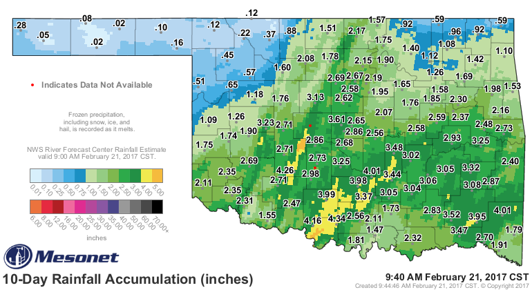
We could talk about many things, like the great rainfall the last two storms
over the last 10 days have given us (remember? reinforcing rainfall is the key
to ending drought, usually).
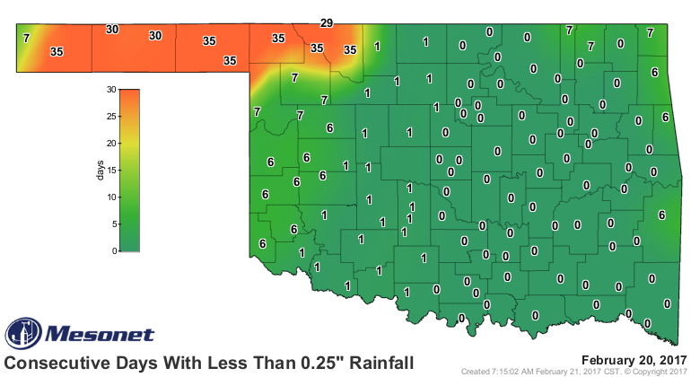
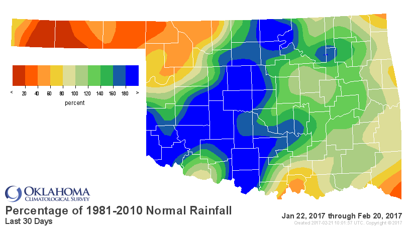
Or how northwestern OK has gotten hosed (or not hosed) by the fortunes of
moisture.
And even about the winter that other than a few days here and there, just hasn't
really materialized this year, and will remain absent for another week at least.
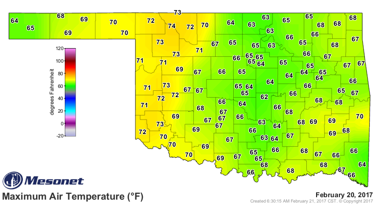
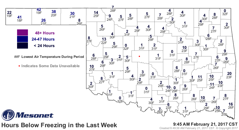
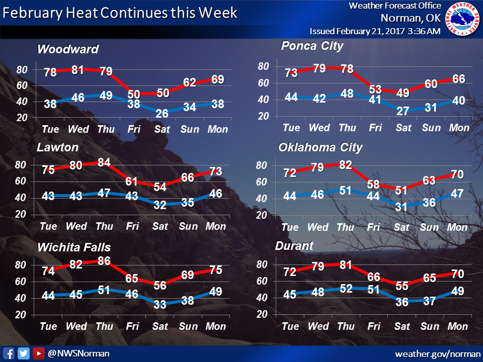
Don't believe it, just ask the rose bushes (as shown by this picture from
Buffalo resident Mark Lemons...things are blooming even in the GREAT northwest).

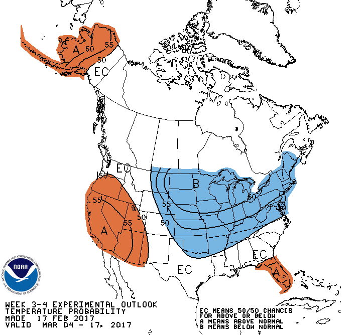
Is there a sinister evil lurking to our north (no, not Canada...come on, their
bacon gives them a permanent pass)? The long range temperature outlooks sort of
hint at it.
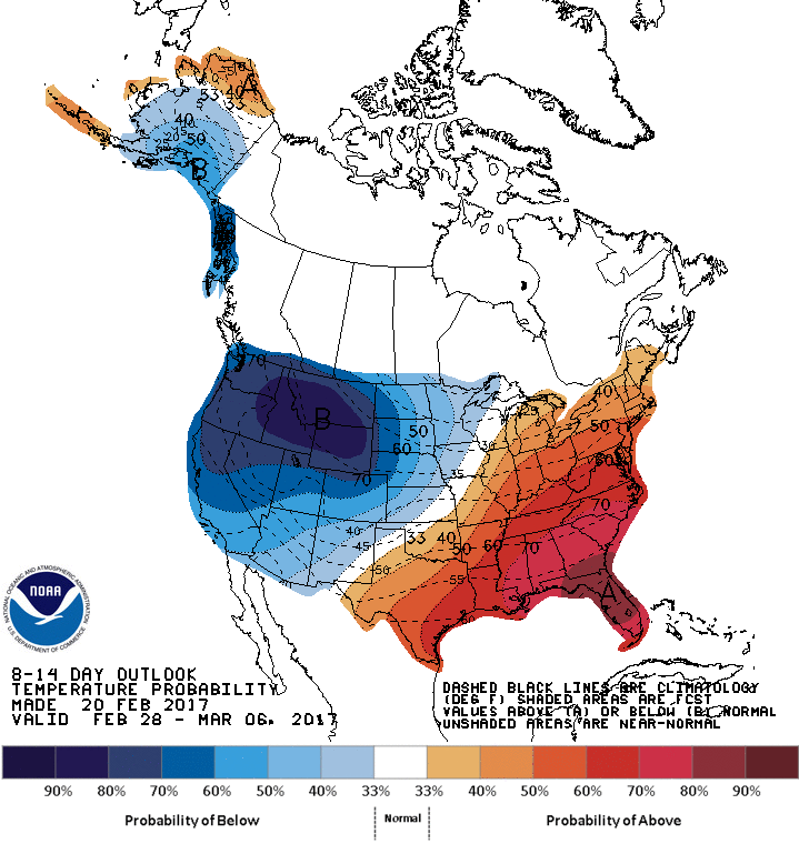
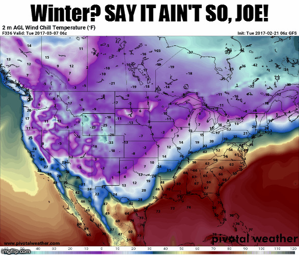
And the first map I showed, the 336 hour GFS modeled wind chill, valid for
midnight on March 7, gives us a really ugly look at a return to winter. But
here's the deal. A 368 hour forecast is basically a fantasy-cast (or in this
case, a nightmare-cast). Many many things can change before then, and they
probably will. In fact, that arctic air invasion from the north didn't even
show up on the model run previous to that...it skirts us to the north. However,
it is at least worth noting that it's hinted at in a long range model, and also
something of a hint in CPC's outlooks.
We've seen this scenario before. A lack of winter all through February, hit
March (spring break is a favorite attack period, so maybe early this year) and
BOOM, a return to winter, damaging plants that thought it was spring already, as
well as the mental health of state residents like myself that had moved on
from a cold weather state of mind. Heck, I'm not even sure I was ever there
this year. Next model run is coming out now. Let's hope it disappears.
Joe, Mary, Greg, Mother Nature...whomever is at the controls, SAY IT AIN'T SO!
Gary McManus
State Climatologist
Oklahoma Mesonet
Oklahoma Climatological Survey
(405) 325-2253
gmcmanus@mesonet.org
February 21 in Mesonet History
| Record | Value | Station | Year |
|---|---|---|---|
| Maximum Temperature | 87°F | BURN | 2023 |
| Minimum Temperature | 2°F | HOOK | 2013 |
| Maximum Rainfall | 2.90″ | BROK | 2018 |
Mesonet records begin in 1994.
Search by Date
If you're a bit off, don't worry, because just like horseshoes, “almost” counts on the Ticker website!