Ticker for January 11, 2017
MESONET TICKER ... MESONET TICKER ... MESONET TICKER ... MESONET TICKER ...
January 11, 2017 January 11, 2017 January 11, 2017 January 11, 2017
Paper, chips?
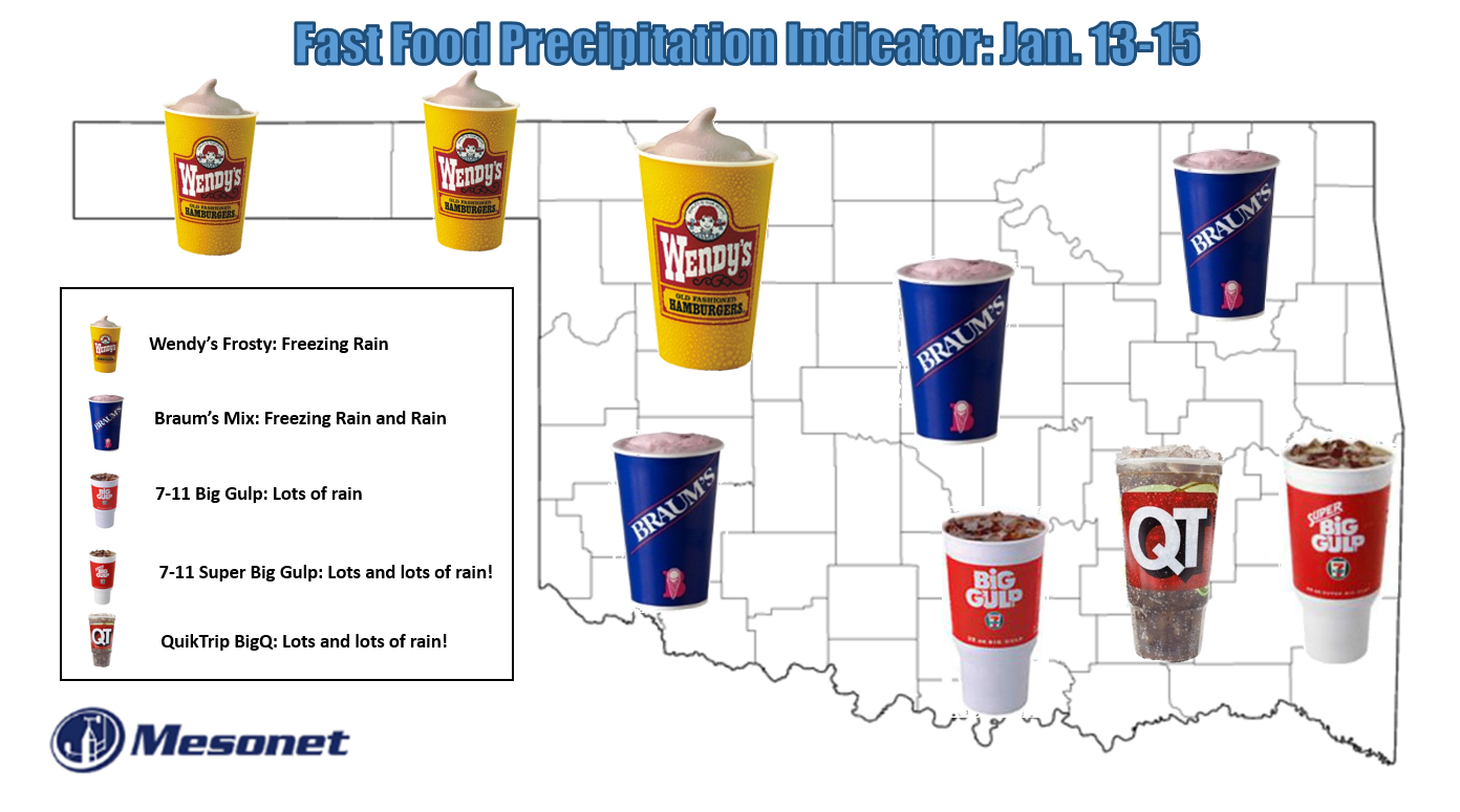
(I threw the BigQ in there for you Tulsa folks)
Hey, that's about the best we can do with the information we have, and remember...
that map is supposed to represent fuzzy (and very sticky) lines. The Oklahoma
Mesonet is going to once again play one of the more significant roles throughout
the weekend -- locating that pesky freezing line. Wherever it sets up, to the
northwest you have all sort of nasty trouble and to the southeast you have a whole
lotta watah. And where will that fuzzy boundary be? I44, of course, the frequent
Mason-Dixon line of weather in Oklahoma, famous thoroughfare for rushing tornadoes
into the OKC metro area as well as...well, dividing ice and rain. Therefore, THIS
map will be the one to watch as a key to what you can expect.
http://www.mesonet.org/index.php/weather/map/air_temperature
There will be a freezing line superimposed on that map so you can track it in
your county. Almost equally important to forecasters will be the wet-bulb
temperature map.
http://www.mesonet.org/index.php/weather/map/wet_bulb_temperature
As noted on the map:
"The Wet-Bulb Temperature map displays the temperature the air would have
if it cooled to saturation by evaporation...Wet bulb temperatures below
freezing in the winter indicate that temperatures could drop below
freezing during precipitation."
In other words, as the precipitation starts falling, it can evaporate. That's a
cooling process since it requires heat to evaporate moisture. If that wet-bulb
temperature is close to freezing in your area and it starts precipitating,
that's a sign you could be in the icy zone. So we'll do a dance on Friday
watching both of those lines as the moisture from the Gulf of Mexico rides up
and over the cold air due to a process called isentropic lift (ask me later).
Now I showed this the other day, but the vertical temperature profile of the
atmosphere is the key for what type of precipitation you receive.
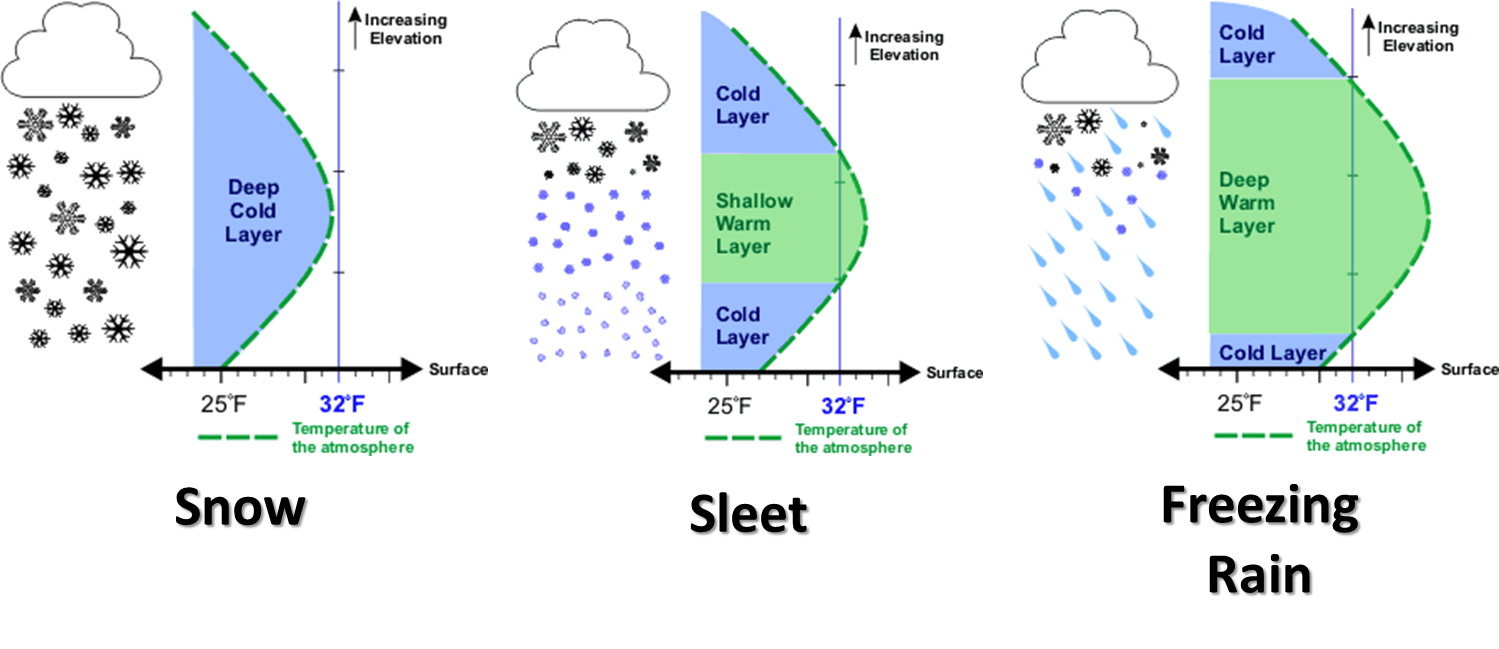
In this weather setup on Friday and Saturday, the last one of those scenarios
is what we're dealing with here. There will be a warm nose of air bulging into
Oklahoma from the south overlaying a very cold shallow air mass. Any frozen
precipitation falling through that warm layer will melt, then pass into the
freezing layer near the ground. The surfaces near the ground will drop to
freezing or below. When that cold precip, at times supercooled (ask me later),
hits those surfaces (overpasses and power lines first, then roads, then
erstwhile State Climatologists), you will have accumulating ice. So travel
problems and power outages become, and will be, the primary hazard come Friday
morning into Saturday.
That's a lot of semi-literate, quasi-scientific mumbo-jumbo. Here are two
pictures that can replace about all of that writing above.
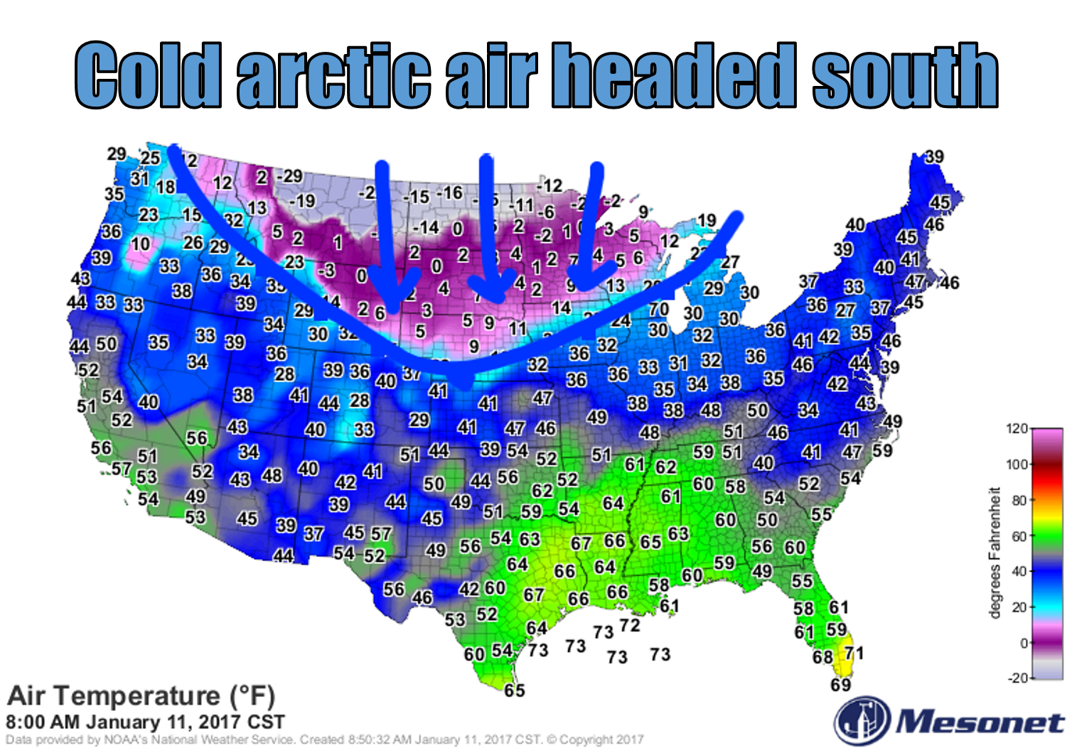
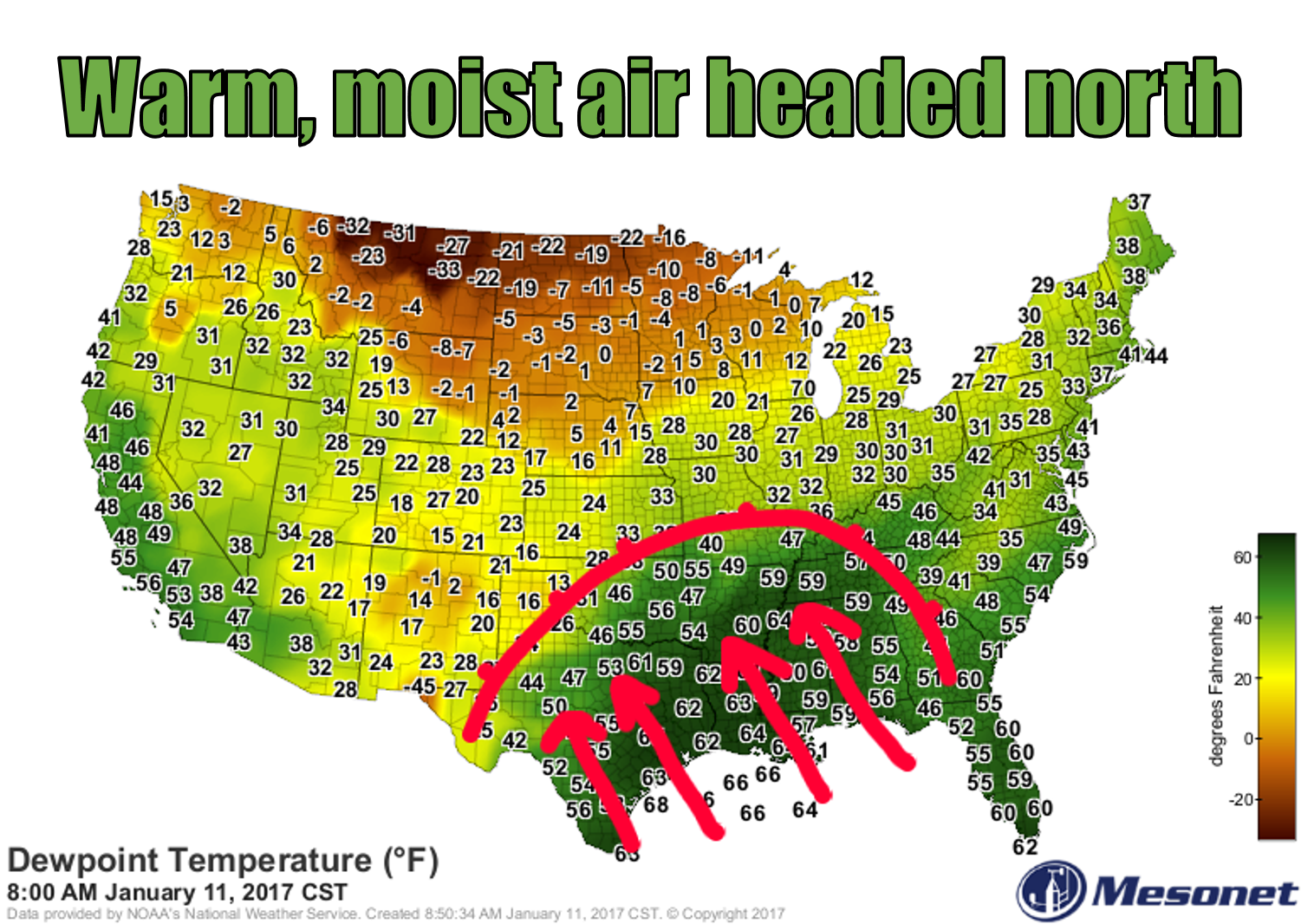
Cold arctic air headed south, warm moisture-rich Gulf air headed north. I wish
never the twain shall meet, but meet they shall, right over Oklahoma. There is
an unusual amount of moisture associated with this storm for January, and the
precipitation forecast bears that out.
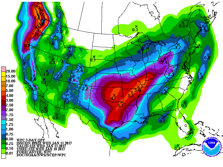
Now for the professionals and their take.
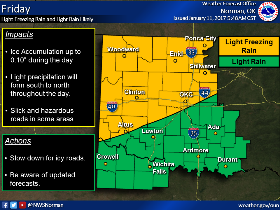
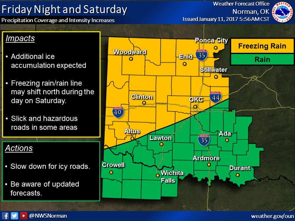
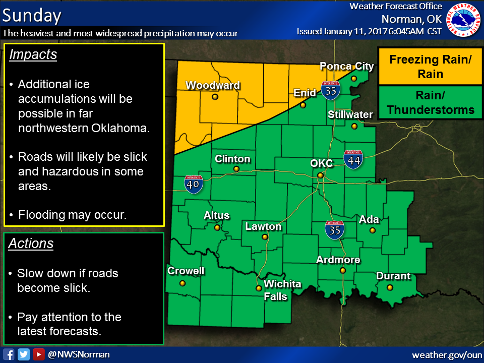
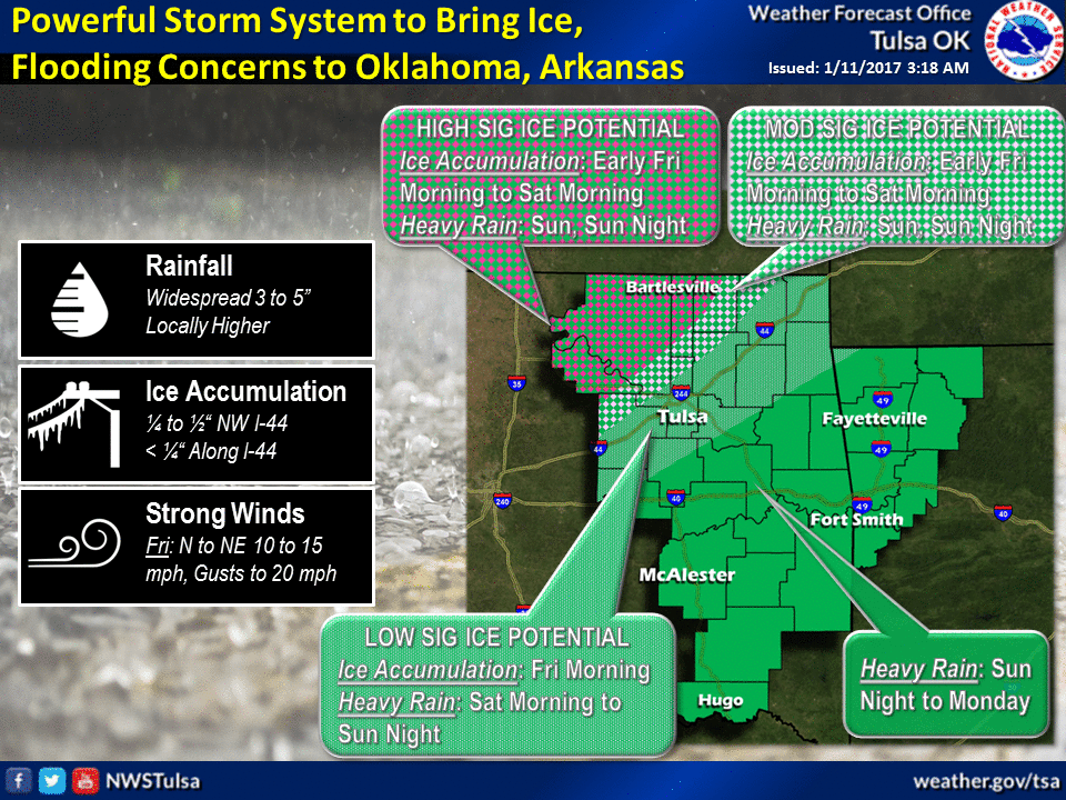
It's going to be very difficult to make ice accumulation forecasts with this
storm due to all the uncertainties, but here is an estimate from the Norman
NWS office based on the latest forecasts and data.

Now let me be frank, because I'm tired of being gary. If far NW OK sees a half-
inch to an inch of ice, well...that's not good. Even those areas to the south
seeing a quarter- to half-inch will have problems. My hope is that freezing
line oscillates back and forth enough that we will see melting, then small
accumulations, melting, them more small accumulations. I haven't seen any
forecasts of strong winds, so that will help limit utility infrastructure
damage, at least.
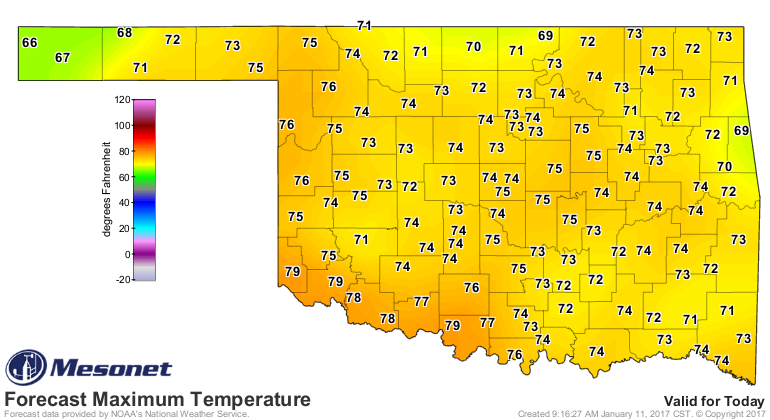
Another "at least" -- at least today we will have a bit of spring in our step,
and in our temperatures as well. We should get close to record highs across parts
of the state today. This is a good thing in that it will give us one good
soil temperature spike upwards, maybe help limit some travel problems later on
(NOT THOSE OVERPASSES AND BRIDGES, HOWEVER!!!).
Our final takeaway? There is just too much uncertainty about this complex
storm setup for this weekend to give anything other than fuzzy answers. Some
things are less uncertain even through they're shrouded in uncertainty. Let's
say they're accurate, but not precise.
* There will be problematic ice accumulations somewhere across northern OK.
* There will be a lot of precipitation with this system.
* The forecasts, while useful, will pale in comparison to "nowcasting."
In other words, watch the forecasts and pay attention to them, but to really
be safe, especially across those fuzzy boundaries like the I44 corridor, you
have to keep up with the hour-to-hour weather.
One final time, here are the two maps you want to pay attention to as you
nowcast (hour-to-hour weather)...the wet-bulb and air temperature maps.
http://www.mesonet.org/index.php/weather/map/wet_bulb_temperature
http://www.mesonet.org/index.php/weather/map/air_temperature
And as always, be prepared.
Frank McManus
State Climatologist
Oklahoma Mesonet
Oklahoma Climatological Survey
(405) 325-2253
gmcmanus@mesonet.org
January 11 in Mesonet History
| Record | Value | Station | Year |
|---|---|---|---|
| Maximum Temperature | 85°F | BURN | 2023 |
| Minimum Temperature | -8°F | HOOK | 2011 |
| Maximum Rainfall | 2.07″ | BBOW | 1998 |
Mesonet records begin in 1994.
Search by Date
If you're a bit off, don't worry, because just like horseshoes, “almost” counts on the Ticker website!